Day 3 :
- Dear Satellite 2016 attendees!
We would like to inform you that 3rd Day of the conference i.e., (July 23rd, 2016) is scheduled for Business to Business Meeting, Networking with Keynotes, speakers, moderator and lunch will be provided from 12:30 -13:30.
We are very much glad to anticipate your presentation at networking and lunch session on 3rd day of the conference.
Thanks and regards,
Valentina Esther
Satellite 2016
Session Introduction
Giovanni Laneve
Sapienza University of Rome
Italy
Title: Satellite images applications made by using automated procedures

Biography:
Giovanni Laneve received the laurea degree in aeronautic engineering from the Università di Napoli, Naples, Italy, in 1985, and the laurea degree in aerospace engineering from the Università di Roma “La Sapienza,†Rome, Italy, in 1988. Presently he is an Associate Professor of the Aerospace Engineering School of the Università di Roma “La Sapienza.†He has produced more than 130 scientific papers. Since 1988, he has been teaching the course of 'Aerospace systems for Remote Sensing'. Currently, his main research interest concerns new algorithms for the exploitation of satellite images, satellite remote sensing applications for fire management, applications of satellite data for the African regions, and studies on environmental and disaster monitoring.
Abstract:
The effective exploitation of the increasing number of Earth Observation (EO) satellite images presently available requests the development of automatic processing procedures. The present paper is devote to illustrate some 'real-time' monitoring applications of remote sensing satellite images. The applications have been developed at the Earth Observation Satellite Images Applications Lab (EOSIAL). The EOSIAL Lab of the University of Rome 'La Sapienza' is dedicated to develop innovative application through the use of optical remote sensing data (multi- and hyper-spectral) and SAR, integrated with GIS analysis. The areas of interest include: the monitoring of fires, monitoring of volcanic eruptions, the study of oil spills, monitoring of agricultural areas and precision agriculture, the development of applications related to safety issues (borders permeability, monitoring of refugee camps) and disaster management (dust storm, damage assessment, early warning, etc.). The automated procedures developed at the Lab involves the use of geostationary and polar orbit satellites sensor at low, medium and high spatial resolution. In particular, some applications concerning: - The early detection and monitoring of forest fires based on geostationary satellite (MSG/SEVIRI); - The generation of fire hazard maps based on polar orbit satellites; - The continuous monitoring of areas impacted by dust storm; - The periodic update of agricultural area maps for developing countries.
Yu V Tokarev
Radiophysical Research Institute
Russia
Title: Power Losses of HF Emission at the Earth - Remote Spacecraft Path

Biography:
Yuri V. Tokarev was born in 1941. After education in State University he was sent to Radiophysical Research institute (Gorky, Russia) where he works so far. In 1972 Yu.Tokarev has completed his PhD thesis on synchrotron mechanism of nonthermal radio emission of the Galaxy. In 1974-1979 years he was appointed the head of the RRI laboratory at Vasil’sursk, Gorky region where at this time a powerful HF transmitting system named later the SURA facility was created. The main mission of the SURA facility is studying of the nonlinear phenomena of a powerful radio wave in ionosphere plasma. At the same time its 144-element antenna with the size 300 m x 300 m can work in reception mode too. Since 1980 Yu.Tokarev headed works at the facility on using of its antenna as radio astronomical tool in a poorly studied range at frequencies lower than 10 MHz and also as radar for investigation of near space objects (plasmasphere, Earth bow shock, Moon, solar wind) by radio sounding technique. He has published more than 30 papers in these areas in reviewed journals.
Abstract:
Attenuation of the HF emission during crossing the Earth ionosphere is of interest as for a problem of their transport to near-earth space, and for the ground-based long-wave radio astronomy. Experiments on reception of radiation of the Russian SURA facility in the working range of 4.3-9.5 MHz onboard of the ESA-NASA WIND spacecraft give favorable opportunity to promote in this direction. Some results of these experiments in 1996…2001 years when the sp/c moved on the elliptic orbits extended in the solar direction with apogee up to one million kilometers are discussed in the report. The technique of absolute calibration of the SURA signals based on using of the cosmic background spectrum as a secondary standard is presented. The most studied mechanism of transionospheric attenuation of short waves is their absorption due to ohmic losses. At the same time, the preliminary analysis shows that the observed picture of weakening of the SURA radiation doesn't fit into the ionosphere absorption model. Evidently, the wave scattering by the ionosphere inhomogeneities as well as some phenomena of nonlinear interaction of powerful HF emission with ionosphere plasma (the SURA effective power was of 15 MW) also take part here. Noted mechanisms have various impacts to the passing radiation at frequencies above the ionosphere critical frequencies and have to be shown differently in observed signal characteristics. For solution of the question the analysis of observed features of the received signals, including transition curve, scintillation spectrum, polarization parameters and power distribution function is considered in the report.

Biography:
Sipho Mkhabela has completed Foundation degree Aeronautical Engineering from Farnborough College of Technology (Degree awarded by Surrey University) United Kingdom, best student in Mathematics, Worked as an engineer at Cennox Plc. Also a member of the Royal Aeronautical Society, London UK.
Abstract:
This research and presentation is about Aerospace Engineering and Technology, Aerospace Engineering is the primary field of engineering concerned with the development of aircraft and spacecraft. It is divided into two major and overlapping branches: aeronautical engineering and astronautical engineering. A Spacecraft is a vehicle or machine designed to fly in outer space. They are used for a variety of purposes, including communication, Earth Observation, Meteorology, navigation, space colonization, Planetary exploration and transportation of humans and cargo. Aerospace Engineering and technology focuses on communication between earth communication stations and space based communication satellites. In this presentation I will be covering lots of topics, all in relation or under the topic: Aerospace Engineering and Technology, for example: Material science, Aircraft Structures, Orbital maneuver, Fluid mechanics, Space Propulsion, etc
Shengcheng Cui
Chinese Academy of Sciences
China
Title: A new land surface albedo model for better characterizing surface reflective properties

Biography:
Shengcheng Cui has completed his PhD in June, 2011 from the Graduate School of Chinese Academy of Sciences (and now is University of Chinese Academy of Sciences). His major research interests include the study of the surface reflective properties (SRP) model and retrieval algorithm, global statistical analysis and applications of satellite measured SRP data. At present, he is the Principal Investigators (PIs) of the AHNSF (Anhui Provincial Natural Science Foundation) and NSFC (National Natural Science Foundation of China) projects. He has published more than 20 papers in reputed journals
Abstract:
Land surface albedo (LSA) provides a unique interface for the coupled surface-atmosphere system (CSAS). It serves as an essential analysis tool for the surface energy balance and plays an important role in various aspects involving the state and evolution of CSAS. A new LSA model was constructed to improve the characterization of the surface reflectivity properties. This model took the real angular distribution of diffuse sky irradiance field and the multiple-reflecting effect between the surface and the atmosphere into account. The model has advantage in accuracy when the sun is located higher than 50 degrees. Satellite observed surface reflectance anisotropy and albedo is strongly affected by solar illumination angles and atmospheric conditions. A parameterization of LSA was conducted and tabulated into lookup tables (LUT) with respect to two variables – solar zenith angle (SZA) and aerosol optical depth (AOD). With the developed LSA model and the parameterized LSA LUTs, it is expected that users can easily make a fast yet accurate albedo calculations after successfully inverting surface bidirectional reflectance distribution function (BRDF) model. It is promising for in-situ truth validation against satellite-derived land surface parameters products and also useful for any radiative transfer problems in the CSAS.
Yao Yao
Sun Yat-sen University
China
Title: Extracting urban impervious surface from GF-1 imagery based on one-class classifiers

Biography:
Yao Yao is a PhD candidate at the age of 28 years from Sun Yat-sen University and He has worked for China Academy of Space Technology (CAST) from 2012 to 2014. His area of interests includes Remote Sensing, Geoinformatics, Geodesy and Surveying. He published various artlicles in national and international journals.
Abstract:
Impervious surface area is a direct consequence of the urbanization, which also plays an important role in urban planning and environmental management. With rapid technique development of remote sensing, Monitoring urban impervious surface via high spatial resolution (HSR) images has attracted unprecedented attention recently. Traditional multi-classes models are inefficient for impervious surface extraction because it requires labeling all known and unknown classes that occur in the image exhaustively, so we need to find a reliable one-class model to classify one specific land cover type without labeling other classes. In this study, we investigate several one-class classifiers, such as Presence and Background Learning (PBL), Positive Unlabeled Learning (PUL), OCSVM, BSVM and MAXENT, to extract urban impervious surface area using high spatial resolution imagery of GF-1, China’s new generation of high spatial remote sensing satellite, and evaluate the classification accuracy based on artificial interpretation results. Compared to traditional multi-classes classifiers (ANN and SVM), the experimental results indicate that PBL and PUL provide highest classification accuracy, which is similar to the accuracy provided by ANN model. More surprisingly, it outperforms OCSVM, BSVM, MAXENT and SVM models. Hence, the one-class classifiers only need a small set of specific samples to train models without losing predictive accuracy.
Ayobami T Salami
Obafemi Awolowo University
Nigeria
Title: Updating Land use map of Obafemi Awolowo University campus using Low-Cost unmanned aerial vehicle image
Biography:
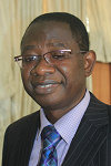
Ayobami T Salami is the Head, Space Applications & Environmental Science Laboratory at the Obafemi Awolowo University (OAU), Nigeria where he is currently the Deputy Vice-Chancellor (Academic). He is also the Centre Leader, World Bank sponsored African Centre of Excellence on ICT-Driven Knowledge Park. He has coordinated many multi-disciplinary and multi-country projects for several national, regional and international organizations. He has also had teaching and research experience in the University of the Gambia; University of Dar es Salaam, Tanzania and International Institute for Geo-information Science and Earth Observation (ITC), The Netherlands. He has been an Eisenhower Fellow (USA) since 2009.
Abstract:
This study uses a high resolution digital orthophoto derived from an Unmanned Aerial Vehicle (UAV) aerial photograph to update the land use map of the Obafemi Awolowo University Campus while focusing on the built up environment. An aerial survey was conducted in the study area using commercially available low-cost Phantom II Vision Quad copter. Sets of overlapping aerial photographs captured with optical camera on-board the UAV were used to produce 8 cm orthophoto. A digital copy of 1987 land use paper map of the campus was obtained by heads-up digitizing, the digital map was then overlaid on the orthophoto from which new buildings and features were extracted and populated with relevant attributes. These features were used to compose an up-to-date map. An updated land use map of the Obafemi Awolowo University campus produced shows an addition of 187 building structures, with sizes ranging from small service centers to large administrative blocks. The major changes which took place in the study area included the removal of the old bukateria, and the construction of new market and the swimming pool (which is at the sport complex of the campus). Most of the buildings are created around the existing ones with some gradual build-up of structures at the eastern part of the campus. This may cause congestion on some facilities such as roads network. The study was able to show that the use of micro UAV is a cost effective way to derive high resolution spatial datasets which could be used for monitoring land use changes in the developing countries.
Reuben Jikeme Umunna
National Space Research & Development Agency (NASRDA)
Nigeria
Title: Design of a 25watts Resist-o-jet cold gas thruster

Biography:
Reuben Jikeme is currently a PhD candidate at Kyushu Institute of Technology, Kitakyushu, Japan. He completed a Masters in Aerospace Engineering at University of Salford, Manchester, England. He joined National Space Research and Development Agency, Abuja, Nigeria, 2007 and was part of the team that successfully assembled and tested Nigeriasat-2 and Nigeriasat-X Earth Observation satellites. Reuben’s areas of research include: Spacecraft propulsion; aerodynamics; guidance and control of Unmanned Aerial Vehicles – fixed and rotary.
Abstract:
A resist-o-jet is an electrically heated thruster wherein electric energy is converted to thermal energy by Joule-heating for the purpose of raising propellant temperature. Resist-o-jet thrusters have been extensively studied since the 1960’s as a cheap and reliable performance enhancement for spacecraft translations. This work aimed to design a low power heat exchange to be used in a cold gas or liquefied gas satellite propulsion system. The design ensures complete vaporization of the propellant (if liquid) within the thruster chamber and improves the specific impulse of the thruster. To maximize heat transfer, various heat exchanger configurations were studied in detail. These studies revealed that two different heating methods exist - indirect and direct heating. The indirect heating method requires a heater and an exchanger thus, making it difficult to isolate the propellant from having direct contact with the heater. The direct method on the other hand combines both functions in a single element where the propellant makes direct contact with the heater, allowing for a relatively simple and more reliable design. This work outlines the design process of a 50watts direct contact heating resist-o-jet thruster.

Biography:
Pradeep K Rawat is a renowned hydrologist from the department of Geography, Kumaun University, Nainital, India. Beside that he has been a visiting consultant scientist in International Centre for Integrated Mountain Development (ICIMOD) Kathmandu, Nepal. He published more than 25 research papers in reputed peer reviewing international journals. His primary area of research and teaching interest is applications and development of new geo techniques (remote sensing data, GIS, mathematical modeling etc.) in environmental geomorphology, hydrology and natural hazards in view of climate change. Consequently at present time he particularly engaged to examine the impacts of climate change and environmental degradation on geohydrology to evolve a geotechnical integrated management plan (GIMP). Beside that he has established himself as an active reviewer for several international journals published by Springer and Elsevier.
Abstract:
Himalaya foothill geo-environment is highly vulnerable for flood disaster due to dynamic upstream hydrological process and its associated reshaped downstream geomorphology. Rapid urbanization resultant to high rate of land use change and natural resource degradation which has been accumulating the vulnerability and socioeconomic risks of flood disaster in the region. The Ramnagar Himalayan Foothill area (RHFA) in district Nainital, Uttarakhand (India) has been selected for the case illustration. Key objective of the study was to investigate emerging flood disaster risk in the region through development and integration of multiple GIS modules. Results advocates that the fast urbanization and development of new colonies has caused increase in built up area (with 1.25% annually) and population density (with 87 persons/km2 annually) under different flood hazard zones during last two decades period (1995-2015). Consequently 29% area of very low flood disaster risk zone converted into moderate (6 %), high (8 %) and very high flood disaster risk zone (15 %) with 0.31 %, 0.40 %, and 0.77 % annual rates respectively. This emerging spatial variability of flood disaster risk shows increasing rates in very low to very high hazard zones. Unfortuenelly, the densely populated (2610-9440 persons/km2) hazard areas still have been growing with their rich socioeconomic and infrastural development which needs to be stopped now without being too late and to implement an effective disaster risks reduction (DRR) plan to manage such hydrological events.
Sisir Kanti Nag
Jadavpur University
India
Title: Assessment of potential zones for groundwater in Kashipur block, Purulia district, West Bengal, India

Biography:
S K Nag has completed his PhD from Jadavpur University. He joined the department as faculty in the year 1990. He became the Head of the Department in 2007 and continued till 2009. A laboratory for Remote Sensing and GIS studies has been set up in the Department and the class-rooms and laboratories were upgraded into smart category with modern equipment and technologies for teaching facilities. He has published more than 40 papers in reputed journals and has been serving as an Editorial Board Member of repute.
Abstract:
The rapidly increasing need for water has put tremendous pressure on groundwater resources in areas where it is the prime source of water. The objective of this study is to delineate groundwater potential zone in Kashipur Block, Purulia district, West Bengal, India with dry climate and hard rock terrain. In the present study, groundwater potential zones for the assessment of groundwater availability in Kashipur Block of Purilia District, West Bengal, has been delineated using remote sensing and GIS techniques. Survey of India toposheets and IRS-1C—LISS III satellite imagery. The raster maps of these factors are allocated to a fixed score and weight computed from multi-influencing factor technique. Each weighted layer is statistically computed to get the groundwater potential zones. Weighted Index Overlay modeling technique was used to develop a groundwater potential zone map with three weighted and scored parameters. Although the area is characterized by hard rock, it has groundwater prospective zones due to fracturing, weathering and the presence of valley fills overlying a planation surface. The results reveal that the modeling assessment method proposed in this study is an effective tool for deciphering groundwater potential zones for proper planning and management of groundwater resources in diverse hydrogeological terrains.
Mariappan Ramasamy
Jawharlal Nehru Technological University
India
Title: LTE based Satellite networks using IP-Over-WDM optical links

Biography:
Mariappan Ramasamy is Dean of Research & Development in Sri Venkateswara College of Eng., Tirupati, affiliated to Jawaharlal Nehru Technological University, Andhra Pradesh, INDIA. He is Masters in Electronics & Communication Eng. with specialization in Optical Communication and Doctorate in Information & Communication Engineering with specialized in Wireless & Optical Communication Networks. His field of interests includes - Wireless networks, Cognitive networks, sensor networks, Optical networks, Satellite Networks and Network security. He has more than 22 years of Experience in Academic & Research & Development Projects. He has published about 48 research papers in reputed Journals and Conference Proceedings. e has been serving as an editorial board member of reputed Journals including IEEE/OSA Journal of Light wave Technology. He is the Fellow of IE and UWAI. He is also an active member of the Professional Societies: IEEE, CSI, ISTE, ACEEE and IAENG. His current nature of work includes Project development, researching the new technology development to implement in various research projects in linked with the Industry and Society. He has received ISTE National award for the Best National Projects, Innovation for Entrepreneurship Development Centre (IEDC) Project award, Accenture innovation award, Techknow award, etc. Also he has received research grants from DST, DRDO, CSIR, TNSCST, etc for Research Projects and allied activities.
Abstract:
Optical Communication plays a vital role in many applications which require high data rate links with low latency and wide channel capacity. IP-over-WDM is the future Optical Internet technology which replaces the bottleneck of electronic routers and switches available in the current generation Internets. One such challenging technology is the LTE based Satellite networks using IP-over-WDM Optical links from satellite to ground stations ie for Satellite downlinks. Due to the inherent properties of Optical domain, it reduces the downlink latency to a great extent while increasing more number of satellite users with its enormous bandwidth. As the channel space per user will be wide enough, the becoming probability of the downlink will be almost zero. In addition, the Optical links have no electromagnetic interference or noise like RF links in the traditional RF based satellite networks. Also, the RF links need complex design of ground station receiver, while the proposed optical domain receiver will have simpler design by using an efficient photo detector without any external noise or EM interference. This new technology may have few challenging problems due to bad weather and environmental conditions, which can be solved by re-routing satellite links through cross optical links where good optical beams are received perfectly. The most important aspect of this next generation LTE based Optical domain satellite link is reconfigurability, the logical link topology will be reconfigured and optimized based on the traffic load, link cost, etc and hence the ultimate QoS parameters for the Optical domain satellite link network will be enhanced much.
Vinay Vishwanath Godse
Manipal Institute of Technology
India
Title: Identifying ground station locations to receive data optimally
Biography:
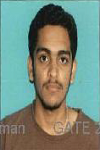
Vinay Vishwanath Godse has completed his B. tech at the age of 21 years from B.A.T.U University, Mangaon, India. He has worked in Accusonic controls Pvt. Ltd. For 2 years as executive engineer. Now, He is pursuing M.tech in Manipal University, Karnataka, India and doing his M.tech project in DSST (Department of space science technology), Research Center Imarat (RCI), Hyderabad, India.
Abstract:
Earth observation satellites play significant role for global situation awareness. The earth observation satellites use imaging payloads in RF and IR bands, which carry huge amount of data, needs to be transfer during visibility of satellite over the ground station. Location of ground station plays very important role in communication with LEO satellites, as orbital speed of LEO satellite is much higher than earth rotation speed. It will be accessible for particular ground station for very short duration. In this project we want to develop an effective way of data transfer by situating ground stations to collect the data from maximum passes per day. Our approach is to compute and simulate sub satellite points (SSP) for ground stations to receive data for given earth observation LEO satellite with low free space loss (FSL) and accordingly situating ground stations over Indian terrain for real time data transfer. Cartosat-2B LEO earth observation satellite is taken for the case study. Cartosat-2B will complete around 14 passes over equator in a day. In those 14 passes only 4 to 5 times it will pass Indian Terrain. Our aim is to receive data at multiple ground stations and increase number of accessible passes criteria of low free space loss (FSL) has been set while selecting ground stations.
