Day 3 :
- New Satellite Technologies For Cleaner Low Orbits
Applications of Satellite Technology
Satellite Challenges and Solutions
Integral Manoeuvres for the Future

Chair
Ruisong Xu
Chinese Academy of Sciences, China

Co-Chair
Antonio G Accettura
OHB System AG, Germany
Session Introduction
Atri Dutta
Wichita State University
USA
Title: Algorithms for optimal scheduling of multiple spacecraft maneuvers
Time : 10:00-10:25
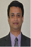
Biography:
Atri Dutta is an Assistant Professor in Aerospace Engineering at Wichita State University. Prior to his joining in WSU, he was a Post-doctoral Research Associate at Princeton University and a Research Engineer at Georgia Institute of Technology. All his degrees are in aerospace engineering which includes; Doctor of Philosophy, Master of Science from Georgia Institute of Technology and Bachelor of Technology from Indian Institute of Technology, Kharagpur, India. His research interests are optimal control, space dynamics, optimization and spacecraft design.
Abstract:
Future space missions like on-orbit refueling of satellite constellations or on-orbit debris removal will require the optimization of multiple spacecraft maneuvers. Usually, such a mission requires the determination of an optimal sequence of targets visited by the servicing spacecraft, along with the computation of the optimal trajectory for each orbital transfer. Some problems, such as Peer-to-Peer (P2P) refueling, requires the determination of satellites that make the maneuvers and the optimal trajectory for each maneuvering satellite. Both classes of problems are challenging, which involve a mixture of continuous and discrete decision variables, and belong to the NP-hard class of optimization problems that are difficult to solve. Recently, novel algorithms inspired by the Greedy Random Adaptive Search Procedures (GRASP) have been developed to solve mixed integer nonlinear programming problems that form the crux of both classes of spacecraft maneuver planning problems. GRASP methodology has been widely studied in the field of combinatorial optimization, and have been demonstrated to efficiently compute good-quality sub-optimal solutions for NP-hard assignment problems; these procedures also provide the benefit of parallelization. These algorithms use a two-step methodology: The first step involves creation of basic feasible solutions to the problem using a greedy, random and adaptive methodology, while the second step involves performing local search about the generated basic feasible solution. The solutions generated by the GRASP based algorithms are sub-optimal; however, for P2P refueling problems, they have already shown to compute optimal or near-optimal set of satellite, which pairs with the minimum fuel expenditure during the mission.
Antonio G Accettura
OHB System AG
Germany
Title: Future telecomsats as a new paradigm for satellite industries and operators
Time : 10:25-10:50

Biography:
Antonio G Accettura has a MS in Aerospace Engineering from University of Rome “La Sapienza”. He is Project Procurement Manager for Galileo in OHB, a premier satellite manufacturer. Previously he worked in AVIO, Arianespace, ELV and Alenia covering several positions from technical to business development domains. He has published more than 40 papers in reputed journals and conferences and has published a book in the frame of advanced space propulsion technologies.
Abstract:
In Europe OHB is the third large satellite manufacturer. There are currently 33 satellites under manufacturing, and 10 companies are part of the OHB Group. There is not a single growth factor that contributed OHB becoming one of the most successful space industries present in Europe and one of the most interesting to work with: a lean organization, a focused long-term vision, a system-oriented team, and an international mindset. After this phase that leads OHB among the satellite manufacturer leaders, the revolution currently ongoing is related to the telecommunication satellites. What we are trying to implement, and we are well on track, is a new paradigm based on few strategic lines that can be summarized as follows: 1. Standard platforms for all telecom sats 2. Use of COTS available on the market 3. Electric propulsion as a basic configuration for future satellites 4. Development of Electrasatellite, taking benefit from equipment developed on last projects What is currently under development with Electra is a brand new concept, not paper based but exactly substantiated with a strong technical background and will be shown in the present paper. The telecom sats fleet currently under development at OHB will be also presented, as well as the roadmap for a unified satellite platform that could match satellite capabilities and operator needs. This mutual growth will provide an exceptional added value to the market, including disclosing new opportunities for both governmental and commercial customers.
Claudio Maccone
International Academy of Astronautics (IAA)
Italy
Title: Protected Antipode Circle (PAC) on the Farside of the Moon
Time : 11:10-11:35
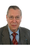
Biography:
Claudio Maccone is an Italian SETI astronomer, space scientist and mathematician. In 2002 he was awarded the “Giordano Bruno Award” by the SETI League, for his efforts to establish a radio observatory on the farside of the Moon. In 2010 he was appointed Technical Director for Scientific Space exploration by the International Academy of Astronautics. Since 2012, he has chaired the SETI Permanent Committee of the International Academy of Astronautics, succeeding Seth Shostak of the SETI Institute, who held that position from 2002 to 2012. He obtained his PhD at the Department of Mathematics of King's College London in 1980. He then joined the Space Systems Group of Aeritalia in Turin as a technical expert for the design of artificial satellites, and got involved in the design of space missions. In 2000 he was elected as Co-Vice Chair of the SETI Committee of the IAA. He has published over 100 scientific and technical papers, most of them in “Acta Astronautica.” In 2010, he was appointed Technical Director of Scientific Space Missions for the International Academy of Astronautics. In 2012, he became a founding member of the Advisory Council of the Institute for Interstellar Studies.
Abstract:
The international scientific community and especially the IAA (International Academy of Astronautics) have long been discussing the need to keep the Farside of the Moon free from man-made RFI (radio frequency interference). In fact, the center of the Farside, specifically crater Daedalus, is ideal to set up a future radio telescope (or phased array) to detect radio waves of all kinds that are impossible to detect on Earth because of the ever-growing RFI. Nobody, however, seems to have established a precise border for the circular region around the antipode of the Earth (i.e. zero latitude and 180° longitude both East and West) that should be Protected from wild human exploitation when several nations will have reached the capability of easy travel to the Moon. In this presentation we propose of PAC, the Protected Antipode Circle, centered around the antipode on the Farside and spanning an angle of 30° in longitude, in latitude, and in all radial direction from the antipode. There are sound scientific reasons for this: 1) PAC is the only area on the Farside that will never be reached by radiation emitted by future human space bases located at the L4 and L5 Lagrangian points of the Earth-Moon system; 2) PAC is the most shielded area of the Farside, with an expected attenuation of man-made RFI of 100 dB or higher; 3) PAC does not overlap with other areas of interest to human activity except for a minor common area with the Aitken Basin, the southern depression supposed to have been created 3.8 billion years ago during the “big wham” between the Earth and the Moon. In view of the unique features, we propose PAC to be officially recognized by the United Nations an International Protected Area, where no radio contamination by humans will possibly take place now and in the future for the benefit of all humankind.
Ruisong Xu
Chinese Academy of Sciences
China
Title: Remote sensing monitoring and driving force analysis of urban expansion in Guangzhou City, China
Time : 11:35-12:00
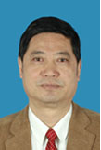
Biography:
Ruisong Xu is born in China on Autumn Provence, 1950. He is graduated in space and earth sciences department from Chinese Sciences and Technology University in 1976. He is a Dr. in geochemistry and a senior scientist in biogeochemical remote sensing in Guangzhou Institute of Geochemistry, Chinese Academy of Sciences between 1977 to now. There are more than 150 research papers of him has been published in SCI academy journal. His 7 research monographic has been published. He has been finished more than 30 national research programs in remote sensing application, geochemistry, nature resources, environment and ocean. He is a member of World ESCH expert group and a national scientist. He got a Denying Scientist award in 1993. He got 15 Chinese, USA, Japanese, Russia, Australia, European etc. patents. He has been awarded 16 Sciences and Technology awards from national of China.
Abstract:
Based on Land-satellite remote sensing data and by means of specific extraction and supervised classification of remote sensing information, a dynamic study was carried out on urban expansion of the built-up area of Guangzhou City, China in different periods. A detailed analysis was made of the area, orientation and rate of variation of urban expansion of Guangzhou City, China in the period of 23 years lasting from 1979 to 2002, and a model for urban expansion was proposed in this paper. As demonstrated by our research results, urban expansion of Guangzhou City, China is very fast with high speed development of the economy. In the 23 years period, the built-up area of Guangzhou City, China attains a net increase of 325.5 km2, and reaches 397.4 km2 in 2002, which is nearly 4.5 times of that in 1979 and means an annual average expansion of 14.2 km2 and an annual growth rate of 19.7%. The model of urban expansion in Guangzhou City, China is basically characterized by radial expansion centered on the old city town, which takes the form of expansion in rings, in layers and along major traffic routes. Here the rate of urban expansion varies in different periods, and is the most outstanding in various periods in the east of the city. The built-up area of Guangzhou City, China is highly correlated with the gross domestic product (GDP), total population, urban resident income and urban traffic of the city, which are the dominating driving factors for expansion of the built-up urban area of Guangzhou City, China.
Vladislav V Demyanov
Irkutsk State Transport University
Russia
Title: GNSS positioning availability control under space weather hazards
Time : 12:00-12:25

Biography:
Demyanov V V completed his PhD in Radio-physics at the age of 28 from Irkutsk State University and was graduated as a Doctor of Science in Radio-navigation at the age of 40 from Siberian Federal University. He is a Professor of Irkutsk State Transport University and Senior Researcher of Institute of Solar and Terrestrial Physics (Siberian Branch of Russian Academy of Science). He worked as Invited Researcher in Shanghai Astronomic Observatory. He has published more than 50 papers in reputed journals, prepared 3 monographs and 2 chapters of monographs. The main research interests are GNSS performance under Space Weather hazards, GNSS remote sensing and GNSS for transport applications.
Abstract:
A problem of real-time GNSS user positioning availability control under geomagnetic storms, solar radio flares and other irregular impacts is considered. A new methodology of positioning availability control under irregular external impacts is offered. The positioning availability value is defined as a full probability of event when we get a personal GNSS user’s required navigation parameters (RNP) taking in account the current Positioning Delusion of Precision (PDOP), ranging errors and positioning errors. On a basis of GNSS/LAAS network dataset we get current GNSS performance statistics, such as positioning error standard mean and standard deviation and a number of positioning failures within the observation period. The PDOP values are used in order to compute an ancillary alarm index of a probable sudden positioning deterioration under poor GNSS satellite vehicles (SV) geometry. The method can be recommended for some transportation applications which have strong RNP, such as aviation landing systems and automatic railroad traffic control.
Wael Ahmed Abonema
Helwan University
Egypt
Title: Enhancing LEED as a sustainable rating system by applying its regional priority for all environmental regions
Time : 12:25-12:50
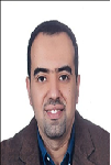
Biography:
Wael Abonema has completed his PhD in 2009 at the age of 35 years from Polytechnic of Athens and Helwan University. His master studies from Helwan University, Faculty of Fine Arts, and Architecture department. He is the Design director of Engineering Consultant Group. He has published more than 11 papers in reputed international conferences and journals. All his researches focused on sustainable design and enhancing architectural design tool using the artificial intelligence. In 2013, He got his Master of Business Administration (MBA) from International school of Scandinavia, Denmark. He has a European consultancy and membership in Technical Chamber of Greece (TEE)
Abstract:
Sustainable design nowadays is not an option for the construction industry all over the world; it becomes a mandatory because of environmental requirements. Big Countries all over the world have started in last decade of the twentieth century to create sustainable rating systems based on their environmental needs. The three pillars of sustainability which is environment, people and economy composite certain categories for each rating system. Those rating systems categories cover the project site, water consumption, Energy efficiency, planet atmosphere, construction regional material, and indoor quality. LEED as a rating system for sustainable design has started to be applied not just in the US but also in many countries in the Middle East and Egypt. LEED as sustainable rating system has a rigid category weights. The impact of this rigidity leads to unpractical situation, which is every part of the world suffers from certain lack of resources by the same amount, and it is not true. Countries are not the same in everything. For example in the Middle East, they have big area of desert and suffer from lack of potable water resources, but they have plenty of energy resources. Country like Japan lives on the opposite side. It means that each part of the world should have different category weights. That is the reason of creating many rating systems, but Regional priority as a category can make the balance for LEED to can modify all weights based on the region.
Tamer Mekky Ahmed Habib
National Authority for Remote Sensing and Space Sciences
Egypt
Title: Reliability and cost effectiveness of spacecraft attitude and orbit monitoring
Time : 13:40-14:05
Biography:
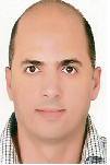
Tamer Mekky Ahmed Habib has completed his PhD, MSc and BSc from Cairo University, Faculty of Engineering, Aerospace Department. He is the Head of Spacecraft Dynamics and Control Department. He has published 14 journal and conference papers in the field of spacecraft guidance, navigation, and control. He is currently a Researcher at the National Authority for Remote Sensing and Space Sciences. He is a Reviewer for the Aerospace science and Technology Journal, in addition to four journals.
Abstract:
This article reviews current state of the art reliability and cost effectiveness of spacecraft attitude and orbit monitoring. Failure analysis showed that more than 30% of spacecraft failures are due to attitude, orbit monitoring and control subsystem. Sometimes, the whole mission life time depends solely on this subsystem. Thus, spacecraft attitude and orbit monitoring subsystem design is considered to be challenge due to the high cost, high reliability requirements, limited power budget, processing budget and mass budgets usually associated with space missions. The monitoring system of spacecraft attitude and orbit consists of hardware and software components. This complicates the process of reliability calculation and implies the need for effective cost estimation methods.
Leshan Uggalla
University of South Wales
United Kingdom
Title: Mitigating the effects of rain-induced fading in Ka-band satellite video broadcast system using time diversity in concert with maximal ratio combining
Time : 14:05-14:30
Biography:
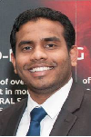
Leshan Uggalla is a Doctoral Researcher in the area of satellite communications at University of South Wales, UK. His research interest focused on characterisation and prediction of propagation impairments on earth-space paths, design of Fade Mitigation Techniques for EHF satellite communication systems, design of satellite-integrated networks and similar areas. Also he is a qualified engineer with over 10 years of working experience in the telecommunication sector. This includes planning, installing and managing of a wide range of advanced telecom equipment's.
Abstract:
Steadily-increasing user demand for a wide range of high-quality video services delivered via satellite has driven broadcasters to move into the higher frequency bands in order to accommodate the necessary data rates. However, a major issue at these frequencies is the effect of severe rain-induced fading on link reliability, which requires that the system must be designed to implement mitigation techniques in order to achieve an acceptable quality-of-service. These techniques generally involve the use of adaptive modulation and data rates, together with various forms of diversity, switching or combining. During the presentation, we analyse and quantify the benefits of adding i) time diversity (TD) and ii) maximal ratio combining (MRC) to the widely used DVB-S2 standard. Our results, which are based on combining a) 3 years of satellite beacon propagation measurements from 2 UK sites; b) high-fidelity computer simulations of the DVB-S2 standard for a typical satellite-broadcast communications link; and c) our new TD / MRC technology, indicate that substantial improvements in data throughput and significant reductions in outage time are readily achievable.
Essayas Kaba Ayana
Columbia University
Columbia
Title: Estimating total suspended sediment (TSS) budget of a freshwater lake using remote sensing
Time : 14:30-14:55

Biography:
Essayas Kaba Ayana was born in 1971 and grew up in Addis Ababa, Ethiopia. After he completed high school at Entoto Academic, Technical and Vocational Secondary School, he joined the then Arba Minch Water Technology Institute in 1998. During his four year stay at the institute, he became interested in GIS and remote sensing supported hydrologic modeling. He got his Bachelor of Science degree in Hydraulic Engineering in 2002. He then became a faculty member at Bahir Dar University, Engineering Faculty. After working for three years he was awarded a Dutch scholarship to study GIS and remote sensing at the International Institute for Geo – Information Science and Earth Observation (ITC) in Enschede, the Netherlands and earned a master’s degree in integrated catchment and water resources management. In his MSc. research he evaluated the performance of radar altimetry data over Lake Tana, a source to the Blue Nile River. Up on return he served as chair of the Department of Water Resources Engineering at Bahir Dar University. In addition, he taught courses in the area of GIS and remote sensing. He then became a vice dean for the Engineering Faculty in 2009. He joined Cornell University in fall 2009 to start his Ph.D. in the Biological and Environmental Engineering Department.
Abstract:
Sediment plumes to freshwater lakes and reservoirs decreases storage volume, reduces sunlight penetration in lake water and degrade the productivity of the whole food web in the aquatic system, reduces zooplankton growth and makes water supply disinfection costly. Intensive sampling of either sediment concentration or turbidity on many locations is prohibitively expensive. Techniques using remotely sensed images have become increasingly effective in estimating total suspended solid and turbidity in open water bodies. Nevertheless these techniques use relationships of remotely sensed reflectance and sediment concentration which are site specific. In this study calibrated coefficients from literature are used to establish a global relationship that relates TSS and reflectance measured by MODIS in one of the stream flowing into a fresh water lake. Site correction is applied to the established relationship and TSS time series is constructed for other four inflowing streams flowing and a major outflowing river, the Blue Nile. Out flowing TSS from remote sensing is validated using TSS samples taken at outlet of the lake. The TSS budget of the lake indicated that in a given season nearly 64% of the TSS accumulates in the lake.
Yoshinari Minami
Advanced Science-Technology Research Organization
Japan
Title: Conceptual Design of Manned Space Transportation Vehicle Using Laser Thruster in Combination with H-II Rocket
Time : 14:55-15:20

Biography:
Yoshinari Minami received his BS Degree in Electrical Engineering from Ritsumeican University and eventually joined NEC Corporation after that. He has been engaged in the design and development of TT&C Sub-system and data handling system of many Japanese satellites in the space development division. After that, he has been engaged in the design and development of Japanese Experimental Module (JEM) in the Space Station Systems Division. He is now designated as an Administrative Director of Advanced Science-Technology Research Organization. He is a Member of the Institute of Japan Society for Aeronautical and Space Sciences and a Member of the Institute of the Physical Society of Japan. Furthermore, he is a Member of IAA Scientific Committee on the future of space exploration.
Abstract:
This paper describes the conceptual design of Manned Space Transportation Vehicle (MSTV) using laser thruster in combination with H-II rocket. By combined use of laser thruster and H-II rocket, space trip to International Space Station (ISS) or round trip around the moon can be performed. Once MSTV with one crew boarding is put into circular orbit in an altitude of 200 km around the Earth, parking orbit by H-II rocket, MSTV is put into circular orbit in an altitude of 400 km, ISS orbit from 200 km circular orbit by laser thruster. Laser thruster using water propellant, power source for laser, orbital transfer calculations to ISS or moon and so on was examined. MSTV using laser thruster that carries laser source and power supply was investigated. Due to the latest developments of high power Laser Diode (LD) and fuel cell, a laser space vehicle that carries both laser device and power supply on board is found to be feasible. Laser vehicle is no longer constrained by a ground-based laser system. MSTV is launched with H-II rocket and put into circular orbit in an altitude of 200 km. After then, MSTV is put into circular orbit in an altitude of 400 km, ISS orbit from 200 km circular orbit by laser thruster. MSTV equipped with the above-mentioned laser engine system will fly from the space platform, ISS and the space hotel on the Earth orbit to the moon.
Alexander G. Yushchenko
National Technical University
Ukraine
Title: Electrodynamics of new submillimeter transmission lines based on flat waveguide splitters
Time : 15:20-15:45
Biography:
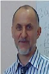
Alexander G. Yushchenko is a multi-science investigator at National Technical University “Kharkiv Polytechnic Institute”, Ukraine. His research interests cover electrodynamics of new types of dielectric waveguide structures, expert systems, evolutionary modeling, theory of creative processes, neural networks, etc. For a long time he worked in Microwave Devices Laboratory of a Karazin State University, Kharkiv, Ukraine, where he made a career from an engineer to a chief designer of filter development for defense industry of the former USSR (S-300 and Buk-M2 missiles, etc.). He led the competitive research of the Ministry of Science and Education of Ukraine that was devoted to the development of satellite and cable communications and television in Ukraine. He has published about 150 scientific papers, has 12 patents of the USSR, Russia and Ukraine. His principal scientific achievements and CV have been listed in international directories.
Abstract:
Submillimeter waves become even more widely used in satellite technologies. The evolution of the circuit technology of send/receive devices is largely determined by the quality of transmission lines. The advanced circuit technologies are used not only in power transmission but also as a basis for construction of filters, antennae, mixers, splitters, polarizers, etc. We provide an overview of new types of transmission lines based on planar cut-off waveguides with or without dielectric filling. The idea for the new class of transmission lines was inspired be a discovery made in Microwave Devices Laboratory, Karazin State University, Kharkiv, Ukraine. The laboratory found that cut-off waveguides are able to maintain eigen-oscillation mode in their branching areas acting as semi-open resonators. Using an original method of partial areas, we obtained and calculated dispersion relations that describe the spectrum dynamics of normal modes. The characteristic feature of the method used consists in term by term satisfaction of the boundary conditions for the electric component of a mode; that technique ensures a high convergence rate of the calculations. We provide calculated losses for the most promising transmission lines. The calculation results demonstrate the advantages of these lines over the known line types.
Alexander G. Yushchenko
National Technical University
Ukraine
Title: WDR-based bandpass filters and an intelligent system for their optimal design
Time : 15:20-15:45
Biography:
Alexander G Yushchenko is a multi-science Investigator at National Technical University, Ukraine. His research interests cover electrodynamics of new types of dielectric waveguide structures, expert systems, evolutionary modeling, theory of creative processes, neural networks, etc. He worked in Microwave Devices Laboratory of a Karazin State University, Ukraine, where he made a career from an Engineer to a Chief Designer of filter development for defense industry of the former USSR (S-300 and Buk-M2 missiles, etc.). He has led to the competitive research of the Ministry of Science and Education of Ukraine that was devoted to the development of satellite and cable communications and television in Ukraine. He has published 150 scientific papers, has 12 patents of the USSR, Russia and Ukraine. His scientific achievements have been listed in international directories
Abstract:
Bandpass filters in send/receive systems, protect the receivers from spurious emissions, split broadband signals to separate channels for better handling, stabilize local oscillator frequencies, etc. Among the known filter designs, the original filters based on partially-filled WDRs are distinguished for their high quality and sparse spectrum of spurious modes; they can be a basis for creation of ultra-wideband, millimeter and sub-millimeter devices. Being constructed with superconducting materials in combination with quartz and leucosapphire, they have no competitors in terms of overall quality indices. We show that the advantage of WDR filters consist in selective properties and discuss the ways of their adaptation to planar technologies. It was demonstrated that electrodynamic properties of WDR filters allow creating devices ranging from narrow to ultra wide passbands. But development of high quality filters largely depends on how much the CAD systems are able to optimize the filter construction basing on such criteria as steepness of the frequency response curve, out-of-band suppression value and maximum achievable bandwidth. Since the known CAD systems lack such functions, we propose an original knowledge-based CAD program implementing the strict electrodynamic models of coupled resonators obtained using generalized scattering matrix method.
Yehia Abdel-Aziz
National Research Institute of Astronomy and Geophysics
Egypt
Title: Spacecraft formation flying control subject to Lorentz force perturbations

Biography:
Yehia Abdel-Aziz is Full Professor of Space Flight Dynamics and Control at Solar and Space Research Department, NRIAG, Egypt. He is the Secretary General of the National Egyptian Committee of Space Research for COSPAR since February 2005 up to 2014. He is the founder of the Spacecraft Charging Laboratory at NRIAG. He is leading two different teams working in orbital and attitude control, and spacecraft charging. He received the BSc Degree in Applied Mathematics (1991) and MSc in Attitude Dynamics of spacecraft (1998) from Mansoura University, Egypt. In December 2002 he received his PhD in Orbital Mechanics from Adam Mickiewicz University, Poland. He is also a Visiting Scholar at UNESP, Brazil and CETP, Paris- France. He published more than 32 papers in reputable journals. His area of interest: Attitude dynamics and control of spacecraft, orbital mechanics, formation flying satellite, and space debris. He is the PI for three projects and member of other four projects.
Abstract:
A spacecraft that generates an electrostatic charge on its surface in the Earth magnetic field will be subject to a perturbative Lorentz force in Low Earth orbit (LEO). The Lorentz force acting on an electrostatically charged spacecraft may provide a useful thrust for controlling a spacecraft’s orbit. In this work, the Lorentz force will be developed as a function of the orbital elements. The orbital perturbations of a charged spacecraft due to Lorentz force in the Earth’s magnetic field, which is modeled as a titled dipole is investigated using the Gauss variation of the Lagrange Planetary Equations. The dynamical models of the relative motion will develop what leads to approximate analytical solutions for the motion of a charged spacecraft, subject to Lorentz force. The innovative concepts of this work is replacing the usual control like propellent or thruster by electrostatic force. The model is derived when the chief spacecraft’s reference orbit is either circular or elliptical and the deputy spacecraft is capable of established electrostatic charge. The expected results will focus on how to control and correct the in track position or/and plane orbit of the charged spacecraft using the Lorentz force. The trajectories of the both spacecraft (chief and deputy) will be estimated for short time intervals with different charge to mass ration (q/m) for different orbits in LEO.
Yizhou He
Beijing University of Posts and Telecommunications
China
Title: Random access preamble design based on time pre-compensation for LTE-satellite system

Biography:
He Yizhou is a PhD final year student. He will get his PhD degree in this year in the Information and Electronics Technology Laboratory, Beijing University of Posts and Telecommunications, China. His current research interests include mobile satellite communications and physical layer technology.
Abstract:
Because of the integration of Long Term Evolution (LTE) technology and mobile satellite communication systems, uplink access technology for LTE-based GEO satellite has become a popular research topic for satellite system. In order to solve the problem of unreasonable design for PRACH signal structure and reduce the effect of time uncertainty, this paper proposes a novel random access preamble based on Time Pre-Compensation (TPC) for LTE-Satellite System. In this scheme, by applying the method of non-linear least squares, the user terminal (UT) can use the receiving power to estimate the communication round trip delay (RTD) and based on the transmission delay of the beam center and the satellite, RTD can be compensated before transmission. Therefore, the preamble length and duration can be reduced without related to the maximum of RTD. In order to verify the performance of the scheme, the Mat lab is used to build a test system. The simulation results show that the proposed preamble satisfies the requirements of LTE-Satellite System, and the better performance than previous researches is obtained.
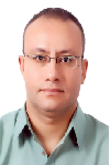
Biography:
Mohamed H Khalil has completed his PhD from Cairo University. He is a Professor in the geophysics department, Cairo University and senior advisor in the Center of Environmental Hazard Mitigation (CEHM), Cairo University. He has published more than 40 papers in reputed journals and has been serving as an Editorial Board Member of repute.
Abstract:
A detailed ground magnetic survey, geoelectric vertical electric sounding (VES), and groundwater & soil quality analysis were conducted in the area of the abandoned landfill of the Awadallah lead (Pb) smelter, Cairo, Egypt. The integration between the applied techniques located successfully the buried solid waste, demarcated the groundwater and its possible contamination, and determined the lead level in soil. Magnetic survey comprised 50 magnetic profiles each 190 m length. Vertical derivatives, wavelength filters, and continuation filters characterized the eastern and central parts of the landfill by high intense magnetic anomalies reflecting metal and lead wastes. The geoelectric survey comprised 16 VES with maximum AB/2 of 100 m. The inverted data demarcated effectively the groundwater aquifer with depth ranged from 11 to 18 m and true resistivities ranged from 96 to 118 Ohm.m. The second layer (Holocene-Q3) of semi-permeable silty and sandy clay cap (true resistivities 29 ~ 51 Ohm.m and thickness 9 ~ 17 m) constituted a considerable role in limiting the possible contamination from the landfill. The analyzed groundwater parameters pH, Eh, TDS, SEC, and DO indicated a good water quality with homogenous aquifer characteristics. Whereas, the lead concentration in groundwater (0.033~0.036 mg/L) was slightly exceeding the safe limits identified by the U.S.EPA (≤ 0.015 mg/L). Lead in soil samples revealed elevated concentrations (3130 mg/Lit/kg at VES-3) around the Awadallah smelter. Whereas, a gradual decrease in concentrations recorded in the northwestern direction.
S. Savin
Space Research Institute
Russia
Title: Magnetospheric studies: from PROGNOZ-8 till ROY experiments
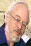
Biography:
S. Savin is a Leading Research Staff of the Laboratory of Electromagnetic Radiation Investigation at Space Research Institute, Russian Academy of Sciences. He has completed his Ph.D. in Moscow Physical-Technical Institute in the year of 1988 and Doctor Physics/Math. Sciences in the year of 2005. From 1978-1990, he is working as a Research Staff, Senior/ Leading Research Staff of the Laboratory of Electromagnetic Radiation Investigation, Co-I of the Combined Wave Diagnostic Experiments onboard the Prognoz-8 and -10 spacecraft in 1980 and 1985. He worked as a Project Scientist of the APV-N VEGA-1, 2 and APV-F Phobos-1, 2 plasma wave experiments in 1984-1989 and that of the Regatta-Cluster Project. Co-PI of wave instruments on board Interball-1 (1995-2000). Project Scientist of STRANNIK (PILGRIM) Project, Project Scientist of ROY Project
Abstract:
Multi-spacecraft measurements in the magnetosheath and in the solar wind by PROGNOZ-8, 10, Interball-1, Cluster and Polar, DOUBLE STAR, GEOTAIL, ACE/ WIND, SPECTR-R are presented. Wev show that coherent structures with magneto sonic Mach number up to 3 – Super magneto sonic Plasma Streams – generate transient and anomalous boundary dynamics, which may cause substantial displacements of the magneto spheric boundaries and the riddling of peripheral boundary layers. We describe a direct plasma penetration into the flank boundary layers, which is a candidate for being the dominant transport mechanism for disturbed magnetosheath periods. We present the data confirming the magnetopause charging and compare the data with recent theoretical models. We discuss the future projects, such as STRANNIK and ROY, which could in a cooperative manner proceeds the past results.
You Cheng Tang
National Changhua University of Education
Taiwan
Title: The relationship between intellectual capital and knowledge management

Biography:
Lois Tang has completed her PhD in the field of Accounting from Cardiff Business School (Cardiff University) in 2004. She was head of the Dept. of Curriculum Coordination of National Changhua University of Education (NCUE) and is Associate Professor of the Accounting Department of NCUE. She has participated in various research projects to improve the methods by which capital budgeting investment can be applied to enterprises. Among her recent research interests are innovation capital, intellectual capital, behavior theory and performance evaluation and management.
Abstract:
Innovation is a crucial key for business survival. A business wants to create innovation as much as it can, however, it must have enough and effective intellectual capital within its organization. How can a business retain intellectual capital? This relies on how it manages its knowledge data base. Therefore the relationship between intellectual capital and knowledge management becomes very important. This talk will outline the links from the knowledge base to intellectual capital and then to the creation of innovation.
Boris A Voronin
V.E. Zuev Institute of Atmospheric Optics SB RAS
Russia
Title: Time of weak lines and poor parameters

Biography:
Boris A Voronin is a Senior Staff scientist in V.E. Zuev Institute of Atmospheric Optics of Siberian Branch of the Russian Academy of Science (IAO SB RAS). He has published more than 60 papers in reputed journals. He also received the award of Academician VE Zuev (SB RAS).
Abstract:
A lot of high quality information, both experimental and theoretical, about spectra of molecular gases has been obtained in the last time for the purpose of atmospheric and astronomic applications. For example, very detailed linelists were calculated for: water vapor H216O - BT2 (Barber-Tennyson containing about 500,000,000 transitions), HD16O–VTT (Voronin, Tennyson, Tolchenov~700,000,000 transitions), some other gases–NH3 BYTe (~1.1 billion transitions), SO2 (4,000,000), CH4 (~1 billion transitions). All these linelists involve huge number of strong and weak lines, which possess accurate line position and strength. But other spectroscopic parameters, such as air-broadening, self-broadening, temperature exponents are absent. So, there is a need to determine these parameters for different applications. This present work is aimed at developing of simple methods of estimation of needed line parameters for HD16O. Also similar data will be presented for H216O, NH3, CO, SO2.

Biography:
Omotara Olayinka Theophilus was born on March 26. He was appointed as a Professor on June 8, 2012. He is an alumnus of the University of Kuwait and University of Ibadan. His appointment as Dean, Faculty of Education took effect from August 1, 2010 to July 31, 2012 in accordance with the provision of Article 8 of the University of Lagos Statute. He has started his academic career with the University of Lagos as a Lecturer II from 2009 after a brief spell in part-time Lectureship at the University of Ibadan for a year. By a dint of hard work and dedication, he was rose steadily through the rank to the chair of Christian studies in 2010 the renowned Christian scholar has held various administrative positions in the University.
Abstract:
In the near future due to extensive use of energy, limited supply of resources and the pollution in environment from present resources e.g. (wood, coal, fossil fuel) etc., alternative sources of energy and new ways to generate energy which are efficient, cost effective and produce minimum losses are of great concern. Wireless electricity (Power) transmission (WET) has become a focal point as research point of view and nowadays lies at top 10 future hot burning technologies that are under research these days. In this paper, we present the concept of transmitting power wirelessly to reduce transmission and distribution losses. The wired distribution losses are 70 – 75% efficient. We cannot imagine the world without electric power which is efficient, cost effective and produce minimum losses is of great concern. This paper tells us the benefits of using WET technology specially by using Solar based Power satellites (SBPS) and also focuses that how we make electric system cost effective, optimized and well organized. Moreover, attempts are made to highlight future issues so as to index some emerging
Hang Guo
Nanchang University
China
Title: Kalman filtering for the GPS/Magnetometer Navigation system
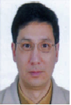
Biography:
Hang Guo has completed his Ph.D. in Geomatics and Geodesy with emphasis on navigation from Wuhan University, China in 2003, and now he is a Professor of Academy of Space Technology at Nanchang University, ION member, and was a visiting scholar at the Ohio State University, USA, University of FAF, Munich, Germany, University of New Brunswick, and University of Calgary, Canada. He has published more than 50 papers in reputed journals,Proceedings, and has been serving as an editorial board member of repute.
Abstract:
This paper investigated the data processing method of Kalman filtering for a GPS/ magnetometer integrated system. The practical field test was performed near UNB, Canada. GPS receiver and magnetometers were installed on the car. Two GPS receive lined as a baseline on the top of car to measure the car orientation as the reference, while the magnetometers were put into the car, which measure the car orientation as well. The observation is the difference between GPS azimuth and the magnetic azimuth with the magnetic declination reduction. The observation equation was derived and composed of the car velocity components. And the observation noise was derived by both GPS and magnetic measurement errors. The dynamical equation used the constant acceleration model with the rate of the acceleration as the model error. The results shown that the averages of the east, north, and up RMS are 0.013, 0.014, and 0.013 m; the averages of the east, north, and up velocity RMS are 0.019, 0.020, and 0.016 m/s; the averages of the east, north, and up acceleration RMS are 0.032, 0.032, and 0.026 m/s2. The further purpose of the paper is to study the possibility of the magnetic azimuth bridging the GPS azimuth gap with the help of Kalman filtering.
V K Srivastava
Maharashtra Forest Department
India
Title: Agent based model for land use/land cover dynamics
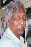
Biography:
Srivastava V K obtained PhD in Ecology in 1979 from Saurashtra University, Rajkot, but started carrier as Research Officer at Forest Research Institute and Colleges, Dehra Dun, India in 1977. Thereafter, he joined Space Applications Centre, Ahmadabad, as a Subject Matter Specialist (Forestry) in 1983 and continued till June 2006. Here, he developed remote sensing methodologies for Forestry. Subsequently, he joined National Remote Sensing Centre, Hyderabad and continued till superannuation in March 2012. Here, he worked on Land use/cover dynamics in Indian River basins. He has published 70 research papers in various journals, seminars and symposia, scientific and technical reports.
Abstract:
The changes in land use/cover, coupled with human dimensions, climate change and variability, affect the natural resources and ecosystem in a complex way. These changes have important implications for future changes in the earth’s climate and for subsequent land-use change. Many forces affect the human activity including local culture, economics, environmental conditions, land policy and development program which drive the land use/cover change. Models which are abstraction of complex interaction between various drivers can be used to describe the spatial and temporal relationships between drivers and the resulting patterns of land use and their changes. Models are also used to predict future configurations of land use patterns under various scenarios of bio-physical and socio-economic change. Though many LULCC models are available in literature, but all are case and region specific. No model can be adopted for a different place other than the place for which it was developed. In India where population density is high along with high cultural, social, climatic and physiographic diversity, none of the exiting LULCC model performs to the satisfaction. Therefore, an agent based statistical model was developed to meet the requirement in Indian River basins. The spatial and temporal integrity in view of significant available drivers have been maintained using statistical tools. The model predicts the future land use/land cover scenarios with respect to the past changes in the two time frames. This model though was developed and evaluated for Goa, India and used in all the river basins of the country.
Ali Said
Tripoli university
Libya
Title: Data enhancement for mineral resources using GIS and remote sensing

Biography:
Ali Said is an Associate Professor at civil engineering department, faculty of engineering, Tripoli University. He got his B.Sc. in civil engineering 1986 from Tripoli University. His M. Phil. In surveying and GIS 1996 from Newcastle University, UK. His area of interests are; Remote sensing applications for monitoring environment changes, mapping from satellite images, GIS applications in mining, map projection systems. He has a lot publication in these areas.
Abstract:
The northeast Libya area acquired great interest by the Libyan Industrial Research Center (LIRC), so they contracted with a number of companies to produce 1:250,000 scale geological survey maps for the area. Those companies were of different scientific references and different nationalities, which led to the production of metal maps differ in their mineral classifications, and the symbols used in identifying the mineral, which caused a lack of clarity of the information when producing unified map of the area. This paper aims to improve the mineral information available from these maps using Geographic Information Systems (GIS) and remotely sensed data (e.g. satellite images). The unification of the map projection system for the whole area was done. A data-base was designed representing the mineral resources located in the northeast Libya area. A unified classification of mineral resources was established based on the existing geological maps and the satellite images interpretation. Also general mineral map was produced and good results were achieved.
Hina Fathima. A.
VIT University
India
Title: Optimization in Microgrids integrating Battery Energy Storage Systems - A Review
Biography:
Hina Fathima A completed her Undergraduate in Electrical Engineering in 2006. After serving as a Lecturer at an engineering institute she completed her Post graduate studies in 2011. She is currently pursuing her PhD and is serving as a Research Associate in the School of Electrical Engineering, VIT University. Her areas of expertise include optimization in renewable energy and energy storage systems and power management. Her PhD work involves optimized integration of energy storage systems into grid-connected renewable systems in India. She has published three papers in various international conferences and journals.
Abstract:
Fast depleting fossil fuels and the growing awareness for environmental protection have led us to an energy crisis. Hence, efforts are being made by researchers to investigate new ways to extract energy from renewable sources. ‘Microgrids’ with Distributed Generators (DG) are being implemented with renewable energy systems. Growing penetration of renewable sources in the power scenario has also led to a bilateral increase for the need of storage systems. Unpredictability and high intermittence in the power generated from renewable systems like wind have driven the need for adequate back up energy reserves and power quality improvement according to grid standards. Optimization methods justify the cost of investment of a microgrid by enabling economic and reliable utilization of the resources. Thus the concept of Hybrid Renewable Energy Systems (HRES) with state of art application of optimization tools and techniques to microgrids has gained prominence. An extensive literature survey on HRES reveals a framework of diverse objectives for which optimization approaches could be applied to empower the microgrid. Battery Energy Storage Systems (BESS) have been the most popular and mature technology for grid applications from a long time. Lot of research is pursued in BESS to develop its volumetric capacity, specific discharge rates and efficiency by improving the material properties, integration topologies and control mechanisms. A brief overview of the future scope of development in BESS by exploring their developments, properties as well as the applications in wind power grids is outlined.
SANJAY K. JAIN
National Institute of Hydrology
India
Title: Glacier variations in response to climate change in the baspa basin, western Himalaya
Biography:
SANJAY K. JAIN is a Scientist at the National Institute of Hydrology. He got his Ph.D. degree in Snowmelt runoff modeling and sediment studies in Satluj basin using remote sensing and GIS from Indian Institute of Technology in 2001. He is the member of Editorial Board at Water Resources Management of International Journal. He has published more than 119 papers in International Journals, National Journals, International /National Conferences.
Abstract:
Himalayan glaciers are generally difficult to monitor by field observation due to the highly rugged and extremely inaccessible mountainous terrain. Thus, in this study, changes in glacial area, perimeter, length, ELA, snout and debris cover were examined based on MSS (1976), ETM+ (2000 & 2006) and TM (2011) in the Baspa river basin, a major tributary of Satluj River, located in western Himalayan region. Additionally, the Survey of India (SOI) topographical maps (1962) and LISS III (2007) Satellite data were used for the collection of additional information to attain higher accuracy in glacier mapping. The investigations have generated a new inventory of 80 glaciers for the year 2011. Over a period of 36 years from 1976 to 2011, the glacier area has changed from 253.4 km2 to 195.7 km2 i.e., 57.7 (22.8%) at a rate of 1.6 ma-1, where as the perimeter changed from 900 to 799 km i.e., 101.0 (11.2%) at rate 2.8 ma-1, and the length changed from 266.1 to 217.2 km i.e., 48.8 (18.4%) at a rate 1.4 ma-1. Moreover, the equilibrium line of altitude (ELA) had gone up from 5126 m asl to 5235 m asl i.e., 109m (2.1%) upward rise at a rate of 3 ma-1 where as the snout has retreated from 4740 m asl to 4812 m asl i.e., 72.1 m (1.5%) at a rate of 2 ma-1 recession. The glacier changes are significantly controlled by the size, altitude, aspect, slope and debris cover in the basin. Generally, the clean, small sized, low altitude glaciers with south to southwest aspect and steep slope have lost large area and vice versa. Furthermore, the glacier changes in the region are a response to temperature (Tmax & Tmin) increase particularly Tmin along with rainfall and snowfall decrease from 1985 to 2008.
