Day 1 :
Keynote Forum
Yi Lung Mo
University of Houston, USA
Keynote: Satellite-based big data for resilience of critical infrastructures subjected to natural and Man-made Disasters
Time : 10:10-10:45

Biography:
Yi Lung Mo is a PhD and PE holder. He is a Professor of Civil Engineering and Director of Thomas TC Hsu Structural Laboratory at the University of Houston, Houston. He has done his PhD in Structural Engineering from University of Hannover, Germany. He has 5 awards and 2 pending patents and has written eight books and book chapters and has had 149 technical papers published in international journals, also 152 conference papers and 51 technical reports. Based on his research performance, he has received the Alexander von Humboldt Research Fellow Award from Germany, the Distinguished Research Award from the National Science Council of Taiwan.
Abstract:
The potential impacts of natural and man-made disasters, such as earthquakes, tornados, tsunamis, blasting, missile attacks, increase significantly to critical infrastructures. The resilience of such infrastructures is highly desired to reduce the economic loss to a minimum. Space borne satellites acquiring information on the earth surface routinely will provide rich data. Combining together with the finite element analysis results for the targeted critical infrastructures will produce large and complex data sets including analysis, capture, data duration, search, sharing, storage, transfer, visualization, and information privacy that can be stored in big data. The critical infrastructures can be visualized as assemblies of various elements. The behavior of a whole structure can be predicted if the behavior of each element is thoroughly understood. As part of this lecture, the development of a finite element analysis (FEA) program to predict the nonlinear behavior of infrastructures will be presented. In the formulation, we develop the constitutive relation and various element modules with a model-based simulation approach by taking into account the Cyclic Softened Membrane Model developed at the University of Houston. To form a FEA program, the constitutive relation modules and the analysis procedure were implemented into a finite element program development framework, Open Sees developed at UC Berkeley. By analyzing the data collected by satellite after impact and the analytical outcomes of the targeted infrastructures, a resilience methodology can be quickly developed that will be very helpful for the decision makers.
Keynote Forum
David Olowokere
Texas Southern University, USA
Keynote: Surveying the historical development of new wave of Satellite Technology Systems
Time : 11:05-11:40
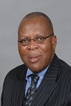
Biography:
David Olowokere has received his PhD degree from the State University of New York in Buffalo NY and he currently heads the engineering programs at Texas Southern University, Houston, Texas (TSU). He has served as Principal Investigator for research grants from several organizations including US National Science Foundation, NASA, US Department of Energy and the US Department of Defense. His publications have appeared in several peer-reviewed journals, and he has made presentations in numerous conferences, workshops and symposia worldwide in the general area of engineering education, engineering management and information technology.
Abstract:
The use of satellites to move information is not a new technology. The launch of Sputnik I in October 1957 by the Soviet Union led directly to many new developments in scientific and military fields, including the foundations of NASA and The Space Act. Ever since its early stages of development, the satellite has now become an increasingly important and heavily relied-on technology in our society today. They provide direct communication over large distances anywhere around the world. Satellites can deliver bandwidth speeds up to 155 megabits per second, thus allowing companies to use high bandwidth applications such as streaming data or video and web casting. And because there are no cables between links, information can be shared with the most remote, hard to reach areas of the world. There are many different kinds of satellites that are used every day. One type of satellite is weather satellite. Tiros1 was the first weather satellite which was able to send pictures of clouds to the earth. Another kind of satellite is a navigation satellite. Telstar 1, launched on July 10, 1962, by the American Telephone and Telegraph Company, was the first active satellite capable of transmitting telephone conversations, television pictures, and telephoto microwaves. Syncom 2, launched by NASA in 1963, was the first synchronous communication satellite, while Syncom 3, launched a year later, relayed the first trans-Pacific television pictures. The presentation will focus on the trend of development and emergence of man-made satellite system from inception until now; and its thrust into being an integral part of everyday life.
Keynote Forum
Guoquan (Bob) Wang
University of Houston, USA
Keynote: Large GPS networks for natural hazards study in North America and Caribbean
Time : 09:35-10:10
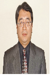
Biography:
Guoquan Wang is an Associate Professor at the University of Houston. He got his Ph.D. degree in Solid Earth Geophysics from the Institute of Geology, China Earthquake Administration in 2001. He is the director of the Houston GPS Network. His current research interests lie on high-accuracy GPS and its applications in natural hazards study.
Abstract:
- Satellite Engineering & Technology
Vibration Design and Satellite Remote Sensing
Integral Manoeuvres for the Future

Chair
Yi Lung Mo
University of Houston, USA

Co-Chair
Hyongki Lee
University of Houston, USA
Session Introduction
Yi Lung Mo
University of Houston
USA
Title: Periodic material-Based vibration isolation for satellites
Time : 11:40-12:05

Biography:
Y L Mo is a PhD and PE holder. He is a Professor of Civil Engineering and Director of Thomas TC Hsu Structural Laboratory at the University of Houston, Houston. He has done his PhD in Structural Engineering from University of Hannover, Germany. He has 5 awards and 2 pending patents and has written eight books and book chapters and has had 149 technical papers published in international journals, also 152 conference papers and 51 technical reports. Based on his research performance, he has received the Alexander von Humboldt Research Fellow Award from Germany, the Distinguished Research Award from the National Science Council of Taiwan.
Abstract:
The vibration environment of a satellite is very severe during launch. Isolating the satellite vibrations during launch will significantly enhance reliability and life-span, and reduce the weight of satellite structure and manufacturing cost. Guided by the recent advances in solid-state physics research, a new type of satellite vibration isolator is proposed by using periodic material that is hence called periodic isolator. The periodic isolator possesses a unique dynamic property, i.e., frequency band gaps. External vibrations with frequencies falling in the frequency band gaps of the periodic material-based satellite system were to be mitigated. Using the elastodynamics and the Bloch-Floquet theorem, the frequency band gaps of periodic isolators were determined. A parametric study was conducted to provide guidelines for the design of periodic isolators. Based on these analytical results, a finite element model of a micro-satellite with a set of designed periodic isolators was built to show the feasibility of vibration isolation. The periodic isolator was found to be a multi-directional isolator that provides vibration isolation in the three directions.
Hyongki Lee
University of Houston
USA
Title: Applications of satellite remote sensing for hydrologic studies
Time : 12:05-12:30

Biography:
Hyongki Lee from civil and environmental engineering is specialized in hydrologic remote sensing. His research interest spans from tackling fundamental science questions to implementing practical applications, including quantifying terrestrial water stores in large river basins and predicting floods in trans boundary river basins using satellite data. He has published 15 peer-reviewed articles as worked as a Co-Author at top-ranked journals. He has been a recipient of NASA’s new investigator award.
Abstract:
Various satellite geodetic instruments have been used with their own advantages and disadvantages to quantify terrestrial water dynamics. For example, satellite radar altimeter, which was originally developed for ocean circulation studies, has also been successfully used to observe water height changes over rivers, lakes, and wet-lands. However, it is a nadir-looking one-dimensional profiling instrument, and thus the satellite ground track must intersect with the water bodies. On the other hand, Inter-ferometric Synthetic Aperture Radar (InSAR) has been a unique technique to map two-dimensional water height changes beneath flooded forests between SAR acquisition dates with high spatial resolution (~40 m). However, InSAR can provide only spatially relative water height changes, and thus it requires a vertical reference to retrieve absolute water height changes. The Gravity Recovery and Climate Experiment (GRACE) mission has also been extensively used in many areas of hydrologic studies. GRACE has been successfully used to reveal Terrestrial Water Storage (TWS) changes, in terms of total changes in water stored in surface, soil, and ground water reservoirs, over large river basins. However, GRACE also has its own limitations, including its coarse spatial resolution (>300 km half wavelength) and its inability to separate a vertical structure of a TWS change into individual components. In this paper, we have discussed how we can integrate different types of satellite remote sensing observations to characterize and quantify terrestrial water dynamics in large river basins.
Guoquan Wang
University of Houston
USA
Title: Introduction to GPS geodesy infrastructure in the houston metropolitan area for urban geological hazards study
Time : 12:30-12:55
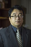
Biography:
Guoquan Wang is an Associate Professor at the University of Houston. He got his Ph.D. degree in Solid Earth Geophysics from the Institute of Geology, China Earthquake Administration in 2001. He is the director of the Houston GPS Network. His current research interests lie on high-accuracy GPS and its applications in natural hazards study.
Abstract:
High-accuracy GPS technology has been frequently applied to study geological hazards, such as earthquakes, volcanos, faulting, and subsidence, during the past two decades. Currently, there are over 200 permanent GPS stations in the Houston metropolitan area. Data from these stations are available to the public through the Harris-Galveston Subsidence District and public data archive facilities at UNAVCO and the National Geographic Survey (NGS). A sophisticated local GPS geodetic infrastructure should comprise three components: a dense GPS network (hardware), a stable local reference frame (firmware), and software packages for real-time and post-processing positioning (software). The U.S. GPS employs the World Geodetic System (WGS-84) developed by the U.S. Department of Defense as its reference frame (datum) for defining the orbits and positioning its satellites. As a result, GPS positions are initially referred to a global reference. GPS positions within a global reference frame (e.g., IGS08) are not sufficient by themselves to precisely measure local-scale ground deformation. Slow local ground deformation could be overlooked or biased within a large-scale reference frame. This presentation will introduce the Houston GPS geodesy infrastructure with the newly established Stable Houston Reference Frame (SHRF). Current faulting and subsidence activities derived from GPS observations within the Houston metropolitan area will also be discussed.
David Olowokere
Texas Southern University
USA
Title: Case Study of Satellite-Based AIS system for continuous tracking at sea of global movement of Nigerian liquefied natural gas.
Time : 13:45-14:10
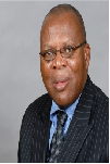
Biography:
Olowokere received his PhD degree from the State University of New York in Buffalo NY, and he currently heads the engineering programs at Texas Southern University, Houston, Texas (TSU). He has served as principal investigator for research grants from several organizations including U.S. National Science Foundation, NASA, U.S. Department of Energy and the U.S. Department of Defense. He has been actively involved in the development of front-office geospatial software application that tracks vessel positions and other critical data in real time for hydrocarbon-carrying sea vessels. His publications have appeared in several peer-reviewed journals, and he has made presentations in numerous conferences, workshops and symposia worldwide in the general area of engineering education, engineering management and information technology.
Abstract:
All international ships of more than 300 tons and all passenger vessels, irrespective of size, are mandated by the International Convention for the Safety of Life at Sea (SOLA) to carry a transponder that broadcasts their position, course and speed. This tracking system, called the automatic identification system (AIS), sends information to other nearby vessels so it can be displayed and utilized in conjunction with radar. Satellite AIS data are transmitted through very high frequency (VHF) radio waves, so its horizontal range has generally been limited to approximately 50 nautical miles or less. Maritime authorities, recognizing the benefits of tracking a ship's identification, location, heading, speed and cargo, have installed AIS receivers on shore that capture relevant real-time ship information, allowing tracking of ships. The use of AIS information in congested shipping areas has indeed become standard practice for many nations. This paper is a case study of the tracking of movements of selected shipments of LNG from the Bonny terminal in Nigeria to selected global destinations. Real-time movement along certain paths which are considered off-course will be demonstrated. Explanations of motives and intentions of the displayed errant movement will be put forth, and conclusions postulated.
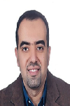
Wael Ahmed Aboneama
Helwan University
Egypt
Title: Improving BIM as an architectural design tool towards sustainability through applying LEED categories on its database
Time : 14:10-14:35
Biography:
Wael Ahmed Abonema completed his PhD in 2009 from Polytechnic of Athens and Helwan University and Master Studies from Helwan University, Faculty of Fine Arts and Architecture department. He is the Design Director of Engineering Consultant Group. He has published more than 11 papers in reputed international conferences and journals. All his researches focused on sustainable design and enhancing architectural design tool using the artificial intelligence. In 2013, he got his Master of Business Administration (MBA) from International school of Scandinavia, Denmark. He has a European consultancy and membership in Technical Chamber of Greece (TEE).
Abstract:
Architectural design was influenced through the last century by several high-tech design tools. Last decade Building Information Model "BIM" has proved its capabilities as an effective production tool for construction industry. It helps the architect to go through the construction documents accurately and faster for building calculations, coordination between all disciplines, and to carry out the architectural drawings faster with minimum problems. Architectural design tools development is running in two directions: First, one depends on developing a helpful tool for the architect to facilitate producing complicated forms and construction problems; the second one is the implementation of artificial intelligence to solve design problems and to lead towards better building performance. This research is oriented to the second direction. In case of applying LEED categories, which describes sustainability principals into the BIM database, we will ensure that the outcome of this design tool will meet sustainability guidelines. One of the best direction of enhancing BIM as an architectural design and documentation tool is to enlarge the scope and hierarchy of its database to include LEED categories as one of the most important rating system in the world and applied in many regions. It will push architects forward towards sustainable designs and saving environmental resources based on up to date information.
William Walker
National Aeronautics and Space Administration
USA
Title: Thermo-electrochemical testing and simulation of lithium-ion batteries operating in radiation driven space environments
Time : 14:35-15:00

Biography:
W Walker graduated from West Texas A&M University with a BS in Mechanical Engineering and began his career with the National Aeronautics and Space Administration (NASA) Johnson Space Center (JSC). He is currently pursuing PhD in Materials Science and Engineering from the University of Houston with a research focused on thermo-electrochemical testing and analysis of lithium-ion batteries designed for space applications. He is the Recipient of a 2015-2016 NASA JSC Academic Fellowship offer to focus on lithium-ion battery thermal runaway and propagation research. His publication center is around the use of Li-ion batteries in thermal radiation driven space environments, the passive thermal design of batteries for spacecraft, thermo-electrochemical test and analysis techniques and the general use of Li-ion batteries in the aerospace industry.
Abstract:
Advanced energy storage and power management systems designed through rigorous materials selection, testing and analysis process are essential for ensuring mission longevity and success for space exploration applications. Comprehensive testing of Boston Power Swing 5300 lithium-ion (Li-ion) cells utilized by the National Aeronautics and Space Administration (NASA) to power humanoid robot Robonaut 2 (R2) is conducted to support the development of a test-correlated Thermal Desktop (TD) Systems Improved Numerical Differencing Analyzer (SINDA) (TD-S) model for evaluation of power system thermal performance. The temperature, current, working voltage and open circuit voltage measurements are taken during nominal charge-discharge operations to provide necessary characterization of the Swing 5300 cells for TD-S model correlation. Building from test data, embedded FORTRAN statements directly simulate Ohmic heat generation of the cells during charge-discharge as a function of surrounding temperature, local cell temperature and state of charge. The unique capability gained by using TD-S is demonstrated by simulating R2 battery thermal performance in example orbital environments for hypothetical Extra-Vehicular Activities (EVA) exterior to a small satellite. Results provide necessary demonstration of this TD-S technique for thermo-electrochemical analysis of Li-ion cells operating in space environments.
Robert P. Whearty
Marsh Space Projects
USA
Title: Satellite launch and In-orbit insurance
Time : 15:00-15:25
Biography:
Robert P. Whearty is Senior Vice President at Marsh Space Projects. He has completed his BSEE in the year of 1984. He did his MSEE in Electro physics from the University of Southern California in the year 1987 and MBA in finance/international business concentration from the University of Maryland. Presently he is working on new business development, risk management consulting, policy design, loss formula development and satellite and launch vehicle contract review, in support of insurance placement, and claims settlement. Major accounts supported include, Iridium, Aireon, SES, O3b, Lockheed Martin, Blue Origin and Sierra Nevada.
Abstract:
Despite the reliability of launch vehicles and the mature nature of many commercial satellites, getting a satellite to its intended orbit remains a risky proposition. The recent Proton failure of the Mexsat-1 satellite has already had a negative impact on other service providers due to the likely delay in the Proton return to flight following a failure review board. Commercial satellite operators such as SES, Iridium and Eutlesat, to name a few, typically manage this risk through risk transfer (insurance) contracts. As there is no “standard satellite” each policy is bespoke and each risk must be marketed to the approximately 40 underwriters globally who underwrite such risks. To help them in the development of a suitable insurance program based on the company’s risk tolerance, they typically hire a broker. The broker as a go between to commercial operator and the insurance underwriting community works to develop a coverage design tailored to the specific company and then translate that design into an insurance policy wording. As can be expected, the marketing and underwriting of these risks tends to be very technical in nature with most underwriters and brokers employing former satellite engineers.
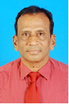
Narayanasetti Venkata Vighnesam
Visvesvaraya Technological University
India
Title: India’s first Moon and Mars missions orbit determination
Time : 15:45-16:10
Biography:
N.V.Vighnesam is currently working as Professor at Dayanandasagar College of Engineering, Bangalore, India. He holds his M.Sc. from Andhra University and Ph.D. from Indian Institute of Technology, Bombay, India. He worked as Head, Orbit Dynamics Division, Flight Dynamics Group, ISRO Satellite Centre. He was responsible for design and development of orbit determination system for all ISRO Satellites. He has published more than 65 technical papers.
Abstract:
India’s first Moon mission (Chandrayaan-1) and Mars Orbiter Mission (MOM) carrying several scientific instruments for the purpose of expanding scientific knowledge about the Moon and Mars were launched in October 2008 and November 2013 respectively. The spacecrafts were put into their target orbits by carrying out sequence of orbit maneuvers. Precise orbit determinations are carried out during each phase of the mission using tracking data from network of tracking stations configured for the mission. The determined orbital solutions are used for spacecraft navigation, mission planning, and science data processing. ISRO’s operational orbit determination program (ODP) used for low earth missions was suitably updated and validated before the launch of these missions. Orbit Determination methodology and the performance of Chandrayaan-1 and MOM orbit determination systems during initial phase of the mission along with achieved orbit determination accuracy in the early normal phase is presented.
Ning Cao
University of Houston
USA
Title: A time domain along-Track SAR interferometry method
Time : 16:10-16:35

Biography:
Ning Cao received the B.S. and M.S. degrees in electronic engineering from Harbin Institute of Technology, Harbin, China, in 2011 and 2013, respectively. He is currently at his second year working toward the Ph.D. degree in Geosensing Systems Engineering in the Department of Civil & Environmental Engineering, University of Houston. His main research interests focus on multitemporal interferometric SAR techniques, and airborne SAR image processing.
Abstract:
Differential interferrometric synthetic aperture radar (DInSAR) has already been proven to be a useful technique for measuring ground displacement at millimeter level. One major drawback of traditional DInSAR technique is that only the 1-D deformation in the slant range direction can be detected. In this study, a time domain along-track SAR interferometry method is proposed to extract the terrain deformation in the azimuth direction. Therefore, 2-D terrain deformation map can be obtained from one InSAR pair. Using traditional time domain backprojection, the phase component corresponding to slant range direction offset can be estimated and removed from the range compressed signal. Then an along-track phase compensation is implemented to align the phase of the signal in the specified azimuth direction. Finally, the phase component in the along-track direction can be obtained by time domain coherent summation process. Comparing with the recently developed multiple-aperture interferometry (MAI), it has been found that the proposed method can utilize much larger aperture than the MAI process, which indicates that finer resolution and SNR can be acquired.
Ting Yuan
University of Houston
USA
Title: Diffusion modeling of water flow in the congo floodplains using geodetic and remote sensing measurements
Time : 16:35-17:00

Biography:
Ting Yuan received the B.S degree in Geomatics engineering and M.S degree in Geomatics and Geodesy both from Wuhan University, China in 2009 and 2011. She is now pursuing the PhD degree in Geosensing Engineering and Science at University of Houston. Her research includes SAR, InSAR and other remote sensing data processing for hydrologic applications.
Abstract:
The Congo Basin is the third largest in size (~3.7 million km2) and second only to Amazon in terms of discharge (~40, 200m3s-1 annual average). Hydrological flux in the Congo Basin is of great importance to local and global climate, biogeochemical cycling. Whether water in wetlands comes from upland runoff or fluvial exchange could make a difference in the sediment supplies, carbon and nutrient exchange. The remote location and vast size of the Congo Basin leaves remote sensing tool the only viable and effective tool to investigate its hydrology. In this study, we utilized water surface height from Envisat altimeter, precipitation from TRMM products and Hillslope River Routing (HRR) model derived upland runoff to estimate hydrological parameters including manning’s coefficient n in 1-D diffusion model. Based on this 1-D diffusion model and multiple repeated Envisat altimetry measurements, we will quantify the temporal change in volume of water in Congo’s floodplains received from and drained to its mainstem along the Envisat ground passes.
Shin-Young Kim
Korea University
Korea
Title: Comparison analysis of global horizontal irradiance between Korea institute of energy research and NASA
Time : 17:00-17:25

Biography:
Shin Young Kim has completed her Master’s from Department of Electrical, Information and Control Engineering in Hongik University and PhD studies from Department of Electricity and Electronic Engineering in Korea University. She is a Student Researcher of KIER, a government-contributed research institute of energy technology field.
Abstract:
Solar energy is one of the typical energy of new and renewable energy. Research and development about photovoltaic power generation, solar heat power generation, and solar heat directly use solar energy which has been proceeding consistently. Insolation is the total amount of solar radiation energy received on a given surface area during a given time. It generally classifies 3 sorts. Global Horizontal Irradiance (GHI) which includes both Direct Normal Irradiance (DNI) and Diffuse Horizontal Irradiance (DIF). It has a significant effect on installation and analysis of photovoltaic system. Korea Institute of Energy Research (KIER) had measured GHI in 15 cities from 1982. By 1990s, GHI and DNI had been measured in 16 cities. Measurement area had been decreased from 2008 to 2009. But the area has been increased recently. In this paper, the GHI measurement value of KIER and satellite data of NASA SSE were compared for verifying reliability of the measurement value. Daejeon was selected for comparison area and daily GHI data was compared based on long term database from 1992 to 2005.
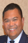
Clarence Eder
George Washington University
USA
Title: Beyond Integration Readiness Level (IRL): A multi-Dimensional framework to facilitate integration of system of systems
Biography:
Clarence Eder works as a Principal Acquisitions Associate for Quantech Services Inc. supporting the United States Air Force Space and Missiles Systems Center in El Segundo, CA. Clarence retired as an active duty Air Force officer with over 18 years of program management and systems engineering experience in space, intelligence, aircraft, and missile defense acquisitions and operations. He is also a Systems Engineering PhD candidate at George Washington University. He completed his Bachelor of Science degree in Mechanical Engineering at the University of Hawaii, his MBA at Wright State University, and his Systems Engineering Graduate Certificate at George Washington University.
Abstract:
Integration Readiness Level (IRL) was introduced to help understand the maturity of integrating different systems. The need to expand the use of IRL is increasingly becoming relevant in the United States’ Department of Defense (DoD) Acquisitions as programs try to acquire systems with the intent to have multiple capabilities and interfaces. As DoD continues to reduce the budget for weapon systems acquisitions along with the need to expedite the deployment of capabilities into operations, the need to improve systems engineering processes is critical with program decisions. DoD Acquisitions adopted the use of Technology Readiness Level (TRL) in 2002 to explain the maturity of a system based on the technology used for that system. IRL was later introduced as an integration tool to complement TRL, but IRL was never implemented in DoD Acquisitions. IRL could become a necessary tool to help reduce integration risks of complex systems. DoD Space Acquisitions continues to provide examples of complex system of systems. With very limited opportunities to do operational tests and analyses for satellite systems and rocket launches, space systems provide a platform to incorporate the latest technologies and processes to attain successful operational systems. The current research is to show the effectiveness of IRL in facilitating integration of system of systems. The research will focus on understanding and identifying integration issues and challenges of space systems, and developing weighted variables. The weighted variables will be included as part of a systems integration architectural framework, which will be used as the research methodology.
Jiangbo Yu
University of Houston
USA
Title: GPS geodesy infrastructure for coastal subsidence in the gulf coast region

Biography:
Jiangbo Yu is currently a third year PhD student in Geophysics at the University of Houston. He got a M.S. degree in Exploration Geophysics from the University of Houston in 2012 and a Bachelor degree in Geophysics from the China University of Petroleum in 2009. His current research is focused on the GPS geodesy infrastructure in the Gul Coast region. He is particularly interested in geodetic reference frame and its applications in natural hazards study. Currently he is a Graduate Teaching Assistant in the department and has published several papers on reference frame and Houston subsidence.
Abstract:
The Gulf Coast region includes southern U.S. states and the Gulf Coast of Mexico. Over 800 Continuous Operating Reference Stations (CORS) have been installed in the Gulf Coast region by the joint efforts of local governmental agencies, private land survey companies, and research institutes during the past two decades. In this presentation, I will introduce the current GPS geodesy infrastructure in the Gulf Coast region. The infrastructure is consisted of the CORS in the Gulf Coast region, and a newly defined Stable Gulf of Mexico Reference Frame (SGOMRF). SGOMRF is a local reference frame established for precisely delineating local ground motion associated with fault creep, salt dome uplift, and land subsidence in the Gulf Coast region. The root-mean-squares (RMS) of the velocities of 13 reference stations have achieved 0.2 mm/year in horizontal and 0.3 mm/year in vertical directions within the local reference frame. Using this GPS geodesy infrastructure, significant spatial variation of subsidence rates has been observed in both Mexico City and the Houston-Galveston area. GPS stations in southeastern Louisiana have indicated minor (< 6.0 mm/year) but consistent subsidence over time and space. SGOMRF is also critical for deriving long-term absolute seal-level changes.
Leshan Uggalla
University of South Wales
United Kingdom
Title: Mitigating the effects of rain-induced fading in Ka-band satellite video broadcast system using time diversity in concert with maximal ratio combining

Biography:
Leshan Uggalla is a Doctoral Researcher in the area of satellite communications at University of South Wales, UK. His research interest focused on characterisation and prediction of propagation impairments on earth-space paths, design of Fade Mitigation Techniques for EHF satellite communication systems, design of satellite-integrated networks and similar areas. Also he is a qualified engineer with over 10 years of working experience in the telecommunication sector. This includes planning, installing and managing of a wide range of advanced telecom equipments.
Abstract:
Steadily-increasing user demand for a wide range of high-quality video services delivered via satellite has driven broadcasters to move into the higher frequency bands in order to accommodate the necessary data rates. However, a major issue at these frequencies is the effect of severe rain-induced fading on link reliability, which requires that the system must be designed to implement mitigation techniques in order to achieve an acceptable quality-of-service. These techniques generally involve the use of adaptive modulation and data rates, together with various forms of diversity, switching or combining. During the presentation, we analyse and quantify the benefits of adding i) time diversity (TD) and ii) maximal ratio combining (MRC) to the widely used DVB-S2 standard. Our results, which are based on combining a) 3 years of satellite beacon propagation measurements from 2 UK sites; b) high-fidelity computer simulations of the DVB-S2 standard for a typical satellite-broadcast communications link; and c) our new TD / MRC technology, indicate that substantial improvements in data throughput and significant reductions in outage time are readily achievable.
Roberta Mugellesi Dow
European Space Operations Centre
Germany
Title: ATVCAP- Knowledge capture in ESA projects

Biography:
Roberta Mugellesi Dow obtained her degree in Mathematics and Post-graduate degree from the University of Pisa, Italy, and the MBA in International Business from the University of Heidelberg, Germany. She worked more than 20 years in the European Space Operations Centre of ESA in Germany in the Flight Dynamics Division, in the Planning and Management Office and now in the Ground Segment Engineering Support Office. Currently she is working in the ESA Integrated Application Programme in ESA centre in UK. Since years she is responsible for the knowledge management activities in ESOC and she coordinates KM projects and initiatives for the overall ESA.
Abstract:
Knowledge Management (KM) has been around in ESA since several years leading to initiatives and pilot projects in different areas. To be successful, KM must clearly meet the Agency real needs. It must suit the way of working and must be linked to the core business that is the assembly and execution of space missions. In particular, it needs to address the issues of how projects are managed. The opportunity to apply the KM tools and methodologies already developed to an ESA project arose late 2013 when KM was requested to support the capture and preservation of the knowledge, experience and documentation built over the several missions of the Automatic Transfer Vehicle (ATV). This presentation describes the work which is being conducted for the ATV knowledge capture project called ATVCAP. In particular, it specifies the objectives and the steps required in order to achieve it. At the very end, a dedicated user interface (portal, search) has been developed for an efficient retrieval of the information by the future users of the preserved knowledge. The project started in January 2014 and the first knowledge area handled was Rendezvous and Docking, which was used as the base for the Proof of Concept, demonstrated by end of March 2014. Of course, the conduct of the ATV capture project requires the involvement of the relevant teams of the ATV project and the members of the KM group. Some general remarks concerning the archiving of documentation and the retention of knowledge highlighting the critical areas are outlined
Paul Richard Price
Blogtalkradio
USA
Title: Gravitational propulsion in a fluid membrane- A new propulsion methodology

Biography:
Paul Richard Price is a researcher with over 24 years in the field of physics pertaining to gravity and plasma interactions dealing with their potential uses in alternative energy and propulsion systems. He is an expert in the field of gravity control systems. He has presented a peer reviewed paper on the subject that was presented at the STAIF 2 conference in 2012. He’s a member of AIAA.
Abstract:
An alternative hypothesis is provided to redefine gravity as an interaction between plasma-like membranes that represent gravity. This membrane may be considered as ether or the space-time continuum. In this alternative theory, the membrane is not stationary but moving; gravity is the primary effect of the interaction. The spinning of the solid matter creates a disturbance in the membrane that acts as a pushing force that expands the universe that may create an anti-gravity effect. The physical effect generates a shock wave that produces a vibration in this membrane by a spinning magnetic field. In this scenario a craft with this effect it true may bypass faster than the speed of light. This effect might be engineered by using a torsion field system so that the wave effect bends the membrane during rotation. This also explains the effect of rotating magnetic systems that may produce an observable loss of weight shown in recent experiments. The higher rotation will compress the intensity of the magnetic field and dilates the membrane. This effect could allow for space travel to other solar systems. Gravity may be manipulated by electromechanical means allowing for counter gravitational effect to power a possible warp drive.
Stefan Belz
University of Stuttgart
Germany
Title: Development of photobioreactor technology for algae cultivation in the International Space Station (ISS)

Biography:
Stefan Belz is a Scientific Researcher at the Institute of Space Systems at the University of Stuttgart. He holds a PhD in Aerospace Engineering since 2012 and leads the Energy & Life Support group. Advanced life support system investigation by modelling and simulation, development of photobioreactors for algae cultivation in space, fuel cell integration in space systems and synergetic utilization of hydrogen are his main research areas. He gives lectures (life support and energy systems related) and arranges lab trainings for students.
Abstract:
Life Support Systems (LSS) are an essential subsystem of human spaceflight systems. An LSS allows humans to survive, to live and to work in space. Existing physicochemical technologies used on the International Space Station (ISS) enable water and oxygen generation. Far-distant and long-term exploration missions (e.g. lunar surface habitat or a manned mission to Mars) require a higher closure of the water, oxygen and carbon loop. Especially the carbon loop can only be closed by biological technologies, i.e. food production in space. Higher plants offer an in-situ resource for food. These systems are of a high biological order and require a specific environment to grow. High engineering effort is necessary to provide such an environment in space, especially under microgravity conditions and higher radiation loads. However, microalgae as single-cell organisms compared to higher plants have a higher harvest index, up to 10-fold higher growth rate, a higher light exploitation and need no soil. Microalgae enable an efficient use of photosynthesis in space (conversion of carbon dioxide into biomass and oxygen). Engineering solutions are developed to provide the optimum growth condition of a microalgae species such as temperature, pH value, dissolved carbon dioxide and oxygen concentrations. The Institute of Space Systems investigates cultivation techniques since 2010 in cooperation with the DLR. Knowledge and expertise on cultivation, feeding, harvesting, gas supply and gas extraction are now the basis for the spaceflight experiment PBR@ACLS (Photobioreactor at the Advanced Closed Loop System). The on-going results and development of breadboard testing are presented.
Stanislav I. Klimov
Space Research Institute of the Russian Academy of Sciences
Russia
Title: Results and prospects of fundamental space research on microsatellite realizable in the ISS infrastructure

Biography:
Stanislav I.Klimov Born on 27 June 1937 in Tula region, Russia. He graduated from Department of Physics, Moscow State University (1966), received Ph.D. of physics-mathematics in 1984, Doctor of Scinces of physics-mathematics in 1994. He is Head of Laboratory for Electro - Magnetic Emissions Investigation, Department of Space Plasma Physics, Space Research Institute (IKI) and Russian Academy of Sciences. He has more than 100 publications. His Subjects of scientific interests are Waves in solar wind/magnetospheres and comet plasma interactions, magnetospheric convection and magnetosphere-ionosphere coupling, interaction of the supper large bodies (orbital station) with ionosphere.
Abstract:
Microsatellite «Kolibri-2000» (weight 20.5 kg) was designed and manufactured in IKI RAS. Its delivery to the orbit has been performed using the infrastructure of ISS in 2002, which was the first step of the program on using of microsatellite for fundamental space research. Despite its small size the microsatellite (MS) was carrying 3.6 kilograms of scientific payload which was used for the realization of wide range of scientific research in the field of «classical» cosmophysics. Also the study was made of space weather, atmospheric and ionospheric processes supposedly associated with thunderstorm activity manifested in the detection of electrons near the equator. Due attention was paid to solve the problems of space education. For transportation and direct launch to the orbit in autonomous flight of both MS «Kolibri-2000» and «Chibis-M» the transport and launch container (TPC) was designed and manufactured in IKI. The monitoring of the environment dynamics which was carried out on «Chibis-M» MS proved to be extremely effective. The volume and quality of received information from its scientific payload «Groza» focused on the study of discharges at high altitudes confirmed the uniqueness of the project as to the number and speed of the simultaneously measured parameters. Experience of successful implementation of such projects as «Kolibri-2000» and «Chibis-M» shows: 1. The full cycle of design, manufacture and ground tests of microsatellite platforms for fundamental space research was worked out. 2. Unique scientific equipment adapted to the microsatellite platform was created. 3. The scheme of microsatellite launch to the orbit using the infrastructure of the Russian ISS segment to the altitude of ~ 500 km has been worked out. 4. Lifetime of microsatellite platforms in the orbit without using of «military» component can significantly exceed the guaranteed service life. 5. The ground segment of project created in IKI in particular for the project «Chibis-M» fully provides the operation of microsatellite on orbit for the implementation of scientific program, for receiving and processing of a large volume of scientific data (tens of gigabytes) and for the transfer of scientific information to participants including international ones. At present the development of new space experiments «Chibis-AI» and «Trabant» based on «Chibis» platform has been started and these projects are included in the Long-term program of scientific and applied research and experiments on the Russian ISS segment. The research leading to these results was financially supported by the Russian Government (contract No. 14.B25.31.0023) and partially by the RFBR (research project No. 13-05-307 12102 ofi m) in Russia and State Space agency of Ukraine (contract No. 4-03/13).
V.I. Ferronsky
Water Problems Institute of the Russian Academy of Sciences
Russia
Title: Satellite data in fundamental physics and global dynamics study
Biography:
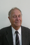
Vasily Ivanovich Ferronsky was born on 3 August 1925 in Voronez region, Russian Federation. He graduated from Department of Roads, Moscow Civil Engineering University (1952) and he received Ph.D. of technical sciences in 1956, Doctor of Sciences of nuclear geophysics in 1968. He was Head of Laboratory for Isotope Hydrology and Deputy Director in Research Institute of Hydrogeology and Engineering Geology, Moscow; Division Director of Research and laboratories, International Agency of Atomic Energy (1970 -1973 and 1983 - 1987) Vienna; Head of Department of Isotope Hydrology, principal Researcher, of Water Problems Institute, Russian Academy of Sciences (1987 up to now) Moscow. He has more than 300 publications. His Subjects of scientific interests are Nuclear geophysics, Global dynamics, Global water Exchange.
Abstract:
The effects of the Earth oblateness and the related problems of irregularity in the rotation and the planet’s pole motion and also the continuous changes in the gravity and electromagnetic field have a direct relation to the solution of a wide range of scientific and practical problems in the Earth dynamics, geophysics, geology, geodesy, oceanography, hydrology and climatology. The satellite data play decisive role in understanding physics of the problem. It was found by interpretation of the observed geodetic satellite orbit data that the Earth and the Moon move being not in hydrostatic equilibrium. This is a fundamental conclusion important for study dynamics of celestial bodies. The satellite orbits data for solving the nature of the Earth oblateness problem are interpreted on the basis of the known in celestial mechanics theory of expansion of the gravity potential of a body by spherical functions. It was found by interpretation that the Earth is a traxial body. The differences between the major and minor equatorial semi-axes a and b was found to be as а = 6378160 m, b = 6377504 м, and a – b = 656 м. The next step in that direction is discovery of kinetic energy loss of the Earth and other celestial bodies. The ratio of the kinetic energy to the potential one is ~ 1/300, that is the same as its oblateness. Such a ratio does not satisfy the fundamental condition of the virial theorem. In fact, the other planets, namely, Mars, Jupiter, Saturn, Uranus, and Neptune, exhibit the same behavior. But for Mercury, Venus, the Moon and the Sun, the potential energy exceeds their kinetic energy by 104 times. Since the bodies in reality exist in equilibrium, the answer was found that the kinetic energy of the body’s interacted elementary particles is not taking into account. In this connection the generalized virial theorem was solved and the energy as an effect of the particles interaction instead of the vectorial force was introduced. On that basis hydrostatic equilibrium of an orbiting body by dynamical equilibrium was changed.
Galina Ilieva
Center for Mechanical and Aerospace Science and Technology
Europe
Title: Airships – An innovative and low-cost way to improvements in the area of satellite technologies

Biography:
Galina Ilieva is master engineer and PhD in Mechanical Engineering from the Technical University of Varna, Bulgaria. She holds specializations in “Turbo machinery and propulsion systems†from von Karman Institute for Fluid Dynamics (Belgium), Rosendorf Research Center in Germany, Sakaria University, Turkey and awards for elaboration of effective methodologies for numerical research of flows. She has worked as Senior Researcher in CFD laboratory-Varna and Professor Assistant in Technical University of Varna. She has worked in many national and international projects and is involved in European FP7 contracts – Center for Mechanical and Aerospace Science and Technology, Portugal. She is also a researcher in scientific organization for innovation, research and implementation in aerospace, marine and mechanical engineering. She has published more than 25 papers on CFD analysis, aero- and thermodynamics, innovative propulsion systems, design and air-vehicles and platforms. Her research interests are in the area of innovative propulsion systems, aerodynamics, turbo machinery, air-vehicles, high-altitude platforms, etc.
Abstract:
Airships are high-altitude platforms that offer promising and low-cost approach to deal with the satellite technologies. The airships are comparatively easy to be operated, cheap and light platforms. They offer a good alternative for network operators - to get more coverage to satisfy the increasing demand for more capacity; they are being examined and currently applied for application not only for broadband communications, but also for navigation, emergency services, traffic monitoring, military purposes, area surveillance, to transport satellites to definite altitude, etc. There are various currently running projects related to high altitude platforms, especially to airships and their possible application in satellite technologies. The current paper provides a thorough overview of the technologies related to airships as high-altitude platforms with satellite applications. Also, it discusses the idea, ongoing work and results regarding an unmanned lighter-than-air vehicle to transport satellites to low and higher orbits. The operating altitude is in the range of 16km - 22km. To minimize weight, the platform will be composed of high, strength but very light materials and will use lightweight innovative propulsion technologies. The airship will need a power source to maintain its position within definite kilometers in radius. The aircraft is envisaged to continuous flight into the wind and uses electric motors to avoid drifting and to keep its position. Possibilities to apply the airship as small satellite positioned at low orbits are researched also. The current research and its outcomes will significantly bring to positive solutions, overcome the high costs of conventional satellites, and affect the deployment and future developments in the field of high-altitude systems.
Yousry S. Hanna
National Research Institute of Astronomy and Geophysics
Egypt
Title: On techniques for fitting satellite laser ranging data
Biography:
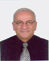
Yousry S Hanna is a Professor and the Head of solar and space researches department, Egypt. He has teaching experience at the National Research Institute of Astronomy and Geophysics (NRIAG) and experience in the field of the artificial earth satellites observations using the laser technique. He is a member of the international scientific project (with the Czech technical university, Prague, Czech Republic) for observing the artificial earth satellites using the laser technique. He is teaching pure mathematics in the Egyptian high institutes and some courses at the NRIAG in the following subjects: Numerical analysis, Differential equations and Numerical solutions of differential equations. He has published a lot of papers in the fields of space science, mathematics and astronomy in different international scientific journals and international conferences. His research interests are in pure mathematics (numerical analysis), Satellites observation techniques, data analysis, spline techniques for data fitting, Space physics.
Abstract:
The present paper is concerned with Chebyshev polynomials which are used to analyze the satellite laser ranging (SLR) data. We will apply two different techniques for fitting data. The spline technique is given to obtain a continuous approximation function of matching these Chebyshev polynomials developed for fitting data over progressively classified separate intervals. The other method is the overlapping technique. An application on the laser ranging data taken for the satellite Ajisai is given. The results followed by the discussion of the used technique are also presented. Satellite Laser Ranging (SLR) and Lunar Laser Ranging (LLR) use short-pulse lasers and state-of-the-art optical receivers and timing electronics to measure the two-way time of flight (and hence distance) from ground stations to retro reflector arrays on Earth orbiting satellites and the Moon. Scientific products derived using SLR and LLR data include precise geocentric positions and motions of ground stations, satellite orbits, components of Earth’s gravity field and their temporal variations, Earth Orientation Parameters (EOP), precise lunar ephemerides and information about the internal structure of the Moon. Laser ranging systems are already measuring the one-way distance to remote optical receivers in space and can perform very accurate time transfer between sites far apart.
Junna Meng
Tianjin University
China
Title: Determining weights of indicators assessing infrastructure
Biography:
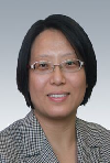
Junna Meng has completed her PhD in 2007 from Tianjin University. She is an associate professor in the college of economy and management of Tianjin University. Besides, she is the deputy director of Academic Committee for Youth in China Association of Plant Engineering Consultants. She was responsible for construction and research of constructor qualification examination database from 2009 to 2011, which was supported by Ministry of Housing and Urban-rural Development of the PRC. She has been performing project “Study on Dynamic Evaluation Mechanism of the Sustainability of Urbanization Infrastructure in the Perspective of Whole Life Cycle†and “International Project Risk invested Decision Optimizationâ€, which are supported by National Natural Science Foundation of China. In terms of academic achievements, she has published 3 books and more than 10 papers in academic journals.
Abstract:
Infrastructure sustainability assessment plays an important part in promoting infrastructures’ achieving sustainable development. The result of sustainability assessment depends not only on indicator system but on indicators’ weight. Predecessors who studied infrastructure sustainability assessment mainly focused their studies on the construction of indicators , while there is few systematic and scientific methods on the determination of the weights of indicators comparatively, which directly affect the accuracy of the assessment result. On the basis of indicators developed by predecessors, project information was collected through Report of Environment Effect of Completed Project as the value of indicators. Then, PLS-PM is applied to verify the reliability of the construct of indicators and to analysis influence characteristic that indicators have on the assessment outcome based on item loadings and path coefficients. In the end, the weights of indicators are determined based on the path coefficients, which can be used as reference of weight to conduct infrastructure sustainability assessment (ISA).
George Kordzakhiaa
Georgian Technical University
Georgia
Title: Satellite earth observations processing to determine main characteristics of small glaciers of east georgia
Biography:
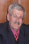
George Kordzakhia has completed his PhD at the age of 28 years from Hydrometeorological Centre, Moscow and postdoctoral studies in the Hydrometeorological institute of the Technical university of Georgia. Dr. George Kordzakhia’s professional interests are concentrated on the researches of atmosphere dynamics, satellite earth observations; climate change, hydrology, glaciology oceanology. Participated in several international programmes (UNDP, EC FPs, NATO Programme for Peace etc.). Participated in several international conferences, symposiums, sessions, WGs work of several international organizations (WMO, IPCC, UNEP etc). Member of the several international organizations at national/regional levels. He has published more than 25 papers in reputed journals.
Abstract:
The variations in glaciers are the important indicators of regional climate change. The research of glacier melting is important for studies of sea/ocean level changes. Satellites earth observations (EO) are powerfool tool that allow creation of glacier’s data sets with needed regularity. The accurate determination of the glaciers characteristics needs precize definition of glaciers counturs. Glaciers contours automatic determination is based on different spectral properties between the ice and snow by a combination of different spectral channels from visible and infrared range.Satellite data processing, first of all, means radiometric calibration of the satellite specific channels. For glacier research it is necessary to use: i. Slope gradient calculations on the bases of Aster DEM; ii. Slope exposure and the illumination of the highlights of the glacier region. Article presents results of determination of snow line altitude from satellite (EO) data for certain glaciers of Great Caucasus, in the eastern part of Georgia. Landsat-8 OLI TIRS images for the end of ablation period were used to identify snow line position. Snow line altitude was extracted from Advanced Spaceborne Thermal Emission and Reflection Radiometer digital elevation model (Aster DEM). For simplicity the glacier are classified into three classes, which correspond: the first and second - accumulation zone, third - the ablation zone. The border line between accumulation and ablation zones refers to snow line. Using the DEM glacier, band ratios and NDSI calculations snow line heights are determined.
Matviyenko Sergiy Anatoliyovich
State enterprise "Design office" Yuzhnoye "of M.K.Jangel"
Ukraine
Title: The conceptual project of the geophysical microsatellite
Biography:
S A Matviyenko was born on 26.09.1960. In 1984 he has finished the Dnepropetrovsk State University, physico technical faculty. Since 1986 he is been working in SDO ''Yuzhnoye''. In 2011 has protected the master's thesis on a theme «the Radio physical method of measurement of parameters of a gravitational field of the Earth» which is based on five patents of Ukraine and eighteen publications in collections Ð’ÐК of which five are made without co-authors. In 2015 the senior scientific employee has received an academic status. He has five copyright certificates of the USSR, 11 patents of Ukraine, three demands for the invention, eight «Certificates on registration of the copyright to product», and also has published 43 scientific articles.
Abstract:
In SDO ''Yuzhnoye'' have been developed a radio physical method of measurements of parameters gravitational field of the Earth, which is based on measurement of size of change of frequency of electromagnetic radiation by gravity with the subsequent definition of a gradient or acceleration of free falling. This method has two versions: - Differential radio physical method; -Integrated radio physical method. Technically the difference between these two versions of a method consists that gravitational displacement of frequency is measured in a differential method between two receivers of electromagnetic radiation, and in integrated - between a source of radiation and the receiver. Within the limits of project STCU № 3856 experimental researches of a radio physical method have been spent. Considering specific requirements on realisation of a differential radio physical method the project of the gravitatsionno-focused geophysical microsatellite has been developed. The project of the geophysical microsatellite is innovative as regarding a method of measurements, and a part of design-layout scheme microsatellite : • The Radio physical method allows to measure gravitational potential, acceleration of free falling, a gravitational constant and weight of planets. • The Design-layout scheme of the geophysical microsatellite excludes necessity of use of active system of stabilisation, provides constant light exposure of solar batteries, excludes the revolting moment caused by influence of external factors, and allows to solve problems of measurement of parameters gravitational field of the Earth • The Radio physical method is based on measurement of relativistic effect of gravitational displacement of frequency of an electromagnetic signal which has not found till now practical realization.
Valery Korepanov
Lviv Center of Institute for Space Research
Ukraine
Title: Earthquake precursors’ detection from space – possible mission analysis
Biography:
Valery Korepanov is a Scientific Director of Lviv Centre of Institute of Space Research of NASU and SSAU. He got his PhD degree in Electromagnetic Measurements in Lviv Polytechnical Institute in 1970 and Habilitation of PhD in Geophysics in Institute of Physics of the Earth (Moscow) in 1991. He has more than 500 publications. His area of interests are; Development of theoretical and methodological aspects of electric and magnetic fields’ investigations in different media: space plasma, marine water and on-land, study of electromagnetic precursors of natural hazards, design and manufacturing of different types of magnetometers and electrometers.
Abstract:
The ionospheric precursors of earthquakes (EQ) are now the recent challenge in this hazard evaluation. The future space missions optimized for the study of these precursors are under wide discussion nowadays. There is necessary to answer two important questions before to plan any experiment to study ionospheric precursors of EQ. First one – whether the variations in the ionosphere definitely connected with the EQ preparation process do exist, and the second one – if they do, whether using these signals, the precursors of EQ can be reliably identified and used for, if not prediction, for the warning that the EQ in the given area approaches. To answer these questions, the available information about the EQ-connected signals collected in former spatial experiments, mainly in DEMETER, is analyzed. Possible mechanisms of energy transfer from EQ preparation area to the ionosphere are reviewed and the mostly supported ones - FWC and AGW – are discussed. Most probable, real lithosphere-atmosphere-ionosphere coupling includes several mechanisms and in dependence of momentary factors one or other prevails. The main physical values are proposed which would be advisable to monitor in the planned spatial mission in order to try to increase the EQ precursors’ detection rate. The instrumentation composition for such study is discussed and it is stressed that the monitoring of such parameters has to be made minimum in two, better in three points. The very low price multi-points space experiment realization possibility is discussed.
Yavor Shopov
Sofia University
Bulgaria
Title: Using of microsatellites for remote locating of unknown caves and underground facilities

Biography:
Yavor Shopov has completed his PhD from Sofia University and Postdoctoral studies from McMaster University. He is Head of the University Centre for Space Research & Technologies, Sofia University. He is supervisor of Master programme on Aerospace engineering of small satellites and co-supervisor of the Master programme on Space research of Sofia University. He has published more than 100 papers in reputed journals and has been serving as an Editorial Board Member of repute. His fields of research: Applications of satellites in applied and fundamental research, space and solar terrestrial physics, development of optical and spectral equipment for multispectral imaging.
Abstract:
Location of caves on Mars can be of vital importance for future manned exploration of the planet, because such caves are appropriate for storage chambers and shelters of astronauts during the initial stages of the planet exploration. International Union of Speleology (UIS) started a new international programme on Techniques for Remote Location of Caves (RLC) using thermal vision technique. It is leaded by the author. This project aims to locate new unknown caves in hardly accessible regions and will be extremely helpful to locate caves in remote regions with extremely rough surface and even on other planets. This programme consists of the following stages: 1) To optimize techniques on the surface of the Earth and to calibrate it on known caves and artificial underground facilities. 2) To use it to locate new unknown caves. 3) To use thermal vision cameras on airplanes and helicopters to locate caves in hardly accessible regions from the sky. 4) To install observational instruments for location of caves on microsatellites. 5) To design equipment for space probes for location of caves on Mars.
Ali Cheknane
Amar Telidji University of Laghouat
Algeria
Title: An approach to defect detection and yield control of grid-connected PV systems via satellite monitoring

Biography:
Ali Cheknane is a full-Professor at the Amar Telidji University of Laghouat-Algeria. He has completed his PHD in physics. He is having 20 years teaching graduate and post-graduate teaching experience at the university as temporary, associated and permanent position. He has published many papers in various journals and conference proceedings on renewable energy subjects. He has supervised 10 PhD students (04 theses have been defended) and 14 Master students' projects (Magister). He has supervised more than 40 projects (Engineer and Technician) in electrical engineering and Computing. He got an incentive award from “Centre de Development des Energies Renouvelables- CDER”. He was awarded for the best publication in physics in Algeria from the ANDRU agency in 2008. He is the Head of the research team: “Photovoltaic Systems & Devices”. He is a reviewer in many Journals as: Solar Energy, Conversion Energy and Management Journal; Electronics Journal, International Journal of Engineering Innovations and Research, Measurement, International Journal of Electronics. Actually, He is the Dean of the Faculty of Technology at Amar Telidji University of Laghouat- Algeria.
Abstract:
In the case of unexpected occurrence due to an unforeseen defect, the grid-connected photovoltaic systems could operate below their optimal performance. Thus, the implementation of a monitoring system becomes paramount to measure the energy yield and to assess the system performance. The monitoring-inverter via a router, which is a device integrating a smart phone, will communicate by satellite. To allow the satellite communication, it is necessary to integrate a data-logger and a chip inside the inverter. The present work focuses on the defect detection in a grid-connected photovoltaic system by satellite monitoring, and the yield control for timely intervention to prevent economic losses. Throughout the literature review, we will present some approaches and methodologies. We will discuss, among other points, the limits of the approaches. We will then present our proposed methodology as a promising approach for defect detection grid-connected PV systems via satellite monitoring, achieving highly good results.
Rushi Ghadawala
Aryavarta Space Organization
India
Title: Space Applications: Sustainable and sensible usage during disaster relief

Biography:
Rushi Ghadawala has pioneered India's first and only private space R&D organization, operating on global industrial platform, Aryavarta Space Organization. He has got expertise in interplanetary mission operations, Space Debris removal and Space applications in climate change. He is actively involved into international projects, leading his organization, with his collaborative partners on the global front.
Abstract:
When it comes to disaster applications; space applications are the most efficient resources for rescue and relief. It is highly important to utilize these sophisticated applications during the time of emergencies, for effective operations, especially when the region is cut off from the world physically. Recently, South Asia witnessed two major events when space applications were been used for quick disaster response in India (2013) and Nepal (2015). However, the impletion also triggered issues due to lack of effective communications between the data providers and end users. In today's time, there is a serious need for bridging the gap between data providers and end users for sustainable and sensible usage of space applications during disaster relief. This paper contains strategic recommendations emphasizing smooth operations between the operative teams for the effective and efficient disaster response.
