Day :
- Satellite Engineering & Technology
Vibration Design and Satellite Remote Sensing
Integral Manoeuvres for the Future

Chair
Yi Lung Mo
University of Houston, USA

Co-Chair
Hyongki Lee
University of Houston, USA
Session Introduction
Yi Lung Mo
University of Houston
USA
Title: Periodic material-Based vibration isolation for satellites
Time : 11:40-12:05

Biography:
Y L Mo is a PhD and PE holder. He is a Professor of Civil Engineering and Director of Thomas TC Hsu Structural Laboratory at the University of Houston, Houston. He has done his PhD in Structural Engineering from University of Hannover, Germany. He has 5 awards and 2 pending patents and has written eight books and book chapters and has had 149 technical papers published in international journals, also 152 conference papers and 51 technical reports. Based on his research performance, he has received the Alexander von Humboldt Research Fellow Award from Germany, the Distinguished Research Award from the National Science Council of Taiwan.
Abstract:
The vibration environment of a satellite is very severe during launch. Isolating the satellite vibrations during launch will significantly enhance reliability and life-span, and reduce the weight of satellite structure and manufacturing cost. Guided by the recent advances in solid-state physics research, a new type of satellite vibration isolator is proposed by using periodic material that is hence called periodic isolator. The periodic isolator possesses a unique dynamic property, i.e., frequency band gaps. External vibrations with frequencies falling in the frequency band gaps of the periodic material-based satellite system were to be mitigated. Using the elastodynamics and the Bloch-Floquet theorem, the frequency band gaps of periodic isolators were determined. A parametric study was conducted to provide guidelines for the design of periodic isolators. Based on these analytical results, a finite element model of a micro-satellite with a set of designed periodic isolators was built to show the feasibility of vibration isolation. The periodic isolator was found to be a multi-directional isolator that provides vibration isolation in the three directions.
Hyongki Lee
University of Houston
USA
Title: Applications of satellite remote sensing for hydrologic studies
Time : 12:05-12:30

Biography:
Hyongki Lee from civil and environmental engineering is specialized in hydrologic remote sensing. His research interest spans from tackling fundamental science questions to implementing practical applications, including quantifying terrestrial water stores in large river basins and predicting floods in trans boundary river basins using satellite data. He has published 15 peer-reviewed articles as worked as a Co-Author at top-ranked journals. He has been a recipient of NASA’s new investigator award.
Abstract:
Various satellite geodetic instruments have been used with their own advantages and disadvantages to quantify terrestrial water dynamics. For example, satellite radar altimeter, which was originally developed for ocean circulation studies, has also been successfully used to observe water height changes over rivers, lakes, and wet-lands. However, it is a nadir-looking one-dimensional profiling instrument, and thus the satellite ground track must intersect with the water bodies. On the other hand, Inter-ferometric Synthetic Aperture Radar (InSAR) has been a unique technique to map two-dimensional water height changes beneath flooded forests between SAR acquisition dates with high spatial resolution (~40 m). However, InSAR can provide only spatially relative water height changes, and thus it requires a vertical reference to retrieve absolute water height changes. The Gravity Recovery and Climate Experiment (GRACE) mission has also been extensively used in many areas of hydrologic studies. GRACE has been successfully used to reveal Terrestrial Water Storage (TWS) changes, in terms of total changes in water stored in surface, soil, and ground water reservoirs, over large river basins. However, GRACE also has its own limitations, including its coarse spatial resolution (>300 km half wavelength) and its inability to separate a vertical structure of a TWS change into individual components. In this paper, we have discussed how we can integrate different types of satellite remote sensing observations to characterize and quantify terrestrial water dynamics in large river basins.
Guoquan Wang
University of Houston
USA
Title: Introduction to GPS geodesy infrastructure in the houston metropolitan area for urban geological hazards study
Time : 12:30-12:55
Biography:
Guoquan Wang is an Associate Professor at the University of Houston. He got his Ph.D. degree in Solid Earth Geophysics from the Institute of Geology, China Earthquake Administration in 2001. He is the director of the Houston GPS Network. His current research interests lie on high-accuracy GPS and its applications in natural hazards study.
Abstract:
High-accuracy GPS technology has been frequently applied to study geological hazards, such as earthquakes, volcanos, faulting, and subsidence, during the past two decades. Currently, there are over 200 permanent GPS stations in the Houston metropolitan area. Data from these stations are available to the public through the Harris-Galveston Subsidence District and public data archive facilities at UNAVCO and the National Geographic Survey (NGS). A sophisticated local GPS geodetic infrastructure should comprise three components: a dense GPS network (hardware), a stable local reference frame (firmware), and software packages for real-time and post-processing positioning (software). The U.S. GPS employs the World Geodetic System (WGS-84) developed by the U.S. Department of Defense as its reference frame (datum) for defining the orbits and positioning its satellites. As a result, GPS positions are initially referred to a global reference. GPS positions within a global reference frame (e.g., IGS08) are not sufficient by themselves to precisely measure local-scale ground deformation. Slow local ground deformation could be overlooked or biased within a large-scale reference frame. This presentation will introduce the Houston GPS geodesy infrastructure with the newly established Stable Houston Reference Frame (SHRF). Current faulting and subsidence activities derived from GPS observations within the Houston metropolitan area will also be discussed.
David Olowokere
Texas Southern University
USA
Title: Case Study of Satellite-Based AIS system for continuous tracking at sea of global movement of Nigerian liquefied natural gas.
Time : 13:45-14:10
Biography:
Olowokere received his PhD degree from the State University of New York in Buffalo NY, and he currently heads the engineering programs at Texas Southern University, Houston, Texas (TSU). He has served as principal investigator for research grants from several organizations including U.S. National Science Foundation, NASA, U.S. Department of Energy and the U.S. Department of Defense. He has been actively involved in the development of front-office geospatial software application that tracks vessel positions and other critical data in real time for hydrocarbon-carrying sea vessels. His publications have appeared in several peer-reviewed journals, and he has made presentations in numerous conferences, workshops and symposia worldwide in the general area of engineering education, engineering management and information technology.
Abstract:
All international ships of more than 300 tons and all passenger vessels, irrespective of size, are mandated by the International Convention for the Safety of Life at Sea (SOLA) to carry a transponder that broadcasts their position, course and speed. This tracking system, called the automatic identification system (AIS), sends information to other nearby vessels so it can be displayed and utilized in conjunction with radar. Satellite AIS data are transmitted through very high frequency (VHF) radio waves, so its horizontal range has generally been limited to approximately 50 nautical miles or less. Maritime authorities, recognizing the benefits of tracking a ship's identification, location, heading, speed and cargo, have installed AIS receivers on shore that capture relevant real-time ship information, allowing tracking of ships. The use of AIS information in congested shipping areas has indeed become standard practice for many nations. This paper is a case study of the tracking of movements of selected shipments of LNG from the Bonny terminal in Nigeria to selected global destinations. Real-time movement along certain paths which are considered off-course will be demonstrated. Explanations of motives and intentions of the displayed errant movement will be put forth, and conclusions postulated.
Wael Ahmed Aboneama
Helwan University
Egypt
Title: Improving BIM as an architectural design tool towards sustainability through applying LEED categories on its database
Time : 14:10-14:35
Biography:
Wael Ahmed Abonema completed his PhD in 2009 from Polytechnic of Athens and Helwan University and Master Studies from Helwan University, Faculty of Fine Arts and Architecture department. He is the Design Director of Engineering Consultant Group. He has published more than 11 papers in reputed international conferences and journals. All his researches focused on sustainable design and enhancing architectural design tool using the artificial intelligence. In 2013, he got his Master of Business Administration (MBA) from International school of Scandinavia, Denmark. He has a European consultancy and membership in Technical Chamber of Greece (TEE).
Abstract:
Architectural design was influenced through the last century by several high-tech design tools. Last decade Building Information Model "BIM" has proved its capabilities as an effective production tool for construction industry. It helps the architect to go through the construction documents accurately and faster for building calculations, coordination between all disciplines, and to carry out the architectural drawings faster with minimum problems. Architectural design tools development is running in two directions: First, one depends on developing a helpful tool for the architect to facilitate producing complicated forms and construction problems; the second one is the implementation of artificial intelligence to solve design problems and to lead towards better building performance. This research is oriented to the second direction. In case of applying LEED categories, which describes sustainability principals into the BIM database, we will ensure that the outcome of this design tool will meet sustainability guidelines. One of the best direction of enhancing BIM as an architectural design and documentation tool is to enlarge the scope and hierarchy of its database to include LEED categories as one of the most important rating system in the world and applied in many regions. It will push architects forward towards sustainable designs and saving environmental resources based on up to date information.
William Walker
National Aeronautics and Space Administration
USA
Title: Thermo-electrochemical testing and simulation of lithium-ion batteries operating in radiation driven space environments
Time : 14:35-15:00

Biography:
W Walker graduated from West Texas A&M University with a BS in Mechanical Engineering and began his career with the National Aeronautics and Space Administration (NASA) Johnson Space Center (JSC). He is currently pursuing PhD in Materials Science and Engineering from the University of Houston with a research focused on thermo-electrochemical testing and analysis of lithium-ion batteries designed for space applications. He is the Recipient of a 2015-2016 NASA JSC Academic Fellowship offer to focus on lithium-ion battery thermal runaway and propagation research. His publication center is around the use of Li-ion batteries in thermal radiation driven space environments, the passive thermal design of batteries for spacecraft, thermo-electrochemical test and analysis techniques and the general use of Li-ion batteries in the aerospace industry.
Abstract:
Advanced energy storage and power management systems designed through rigorous materials selection, testing and analysis process are essential for ensuring mission longevity and success for space exploration applications. Comprehensive testing of Boston Power Swing 5300 lithium-ion (Li-ion) cells utilized by the National Aeronautics and Space Administration (NASA) to power humanoid robot Robonaut 2 (R2) is conducted to support the development of a test-correlated Thermal Desktop (TD) Systems Improved Numerical Differencing Analyzer (SINDA) (TD-S) model for evaluation of power system thermal performance. The temperature, current, working voltage and open circuit voltage measurements are taken during nominal charge-discharge operations to provide necessary characterization of the Swing 5300 cells for TD-S model correlation. Building from test data, embedded FORTRAN statements directly simulate Ohmic heat generation of the cells during charge-discharge as a function of surrounding temperature, local cell temperature and state of charge. The unique capability gained by using TD-S is demonstrated by simulating R2 battery thermal performance in example orbital environments for hypothetical Extra-Vehicular Activities (EVA) exterior to a small satellite. Results provide necessary demonstration of this TD-S technique for thermo-electrochemical analysis of Li-ion cells operating in space environments.
Robert P. Whearty
Marsh Space Projects
USA
Title: Satellite launch and In-orbit insurance
Time : 15:00-15:25
Biography:
Robert P. Whearty is Senior Vice President at Marsh Space Projects. He has completed his BSEE in the year of 1984. He did his MSEE in Electro physics from the University of Southern California in the year 1987 and MBA in finance/international business concentration from the University of Maryland. Presently he is working on new business development, risk management consulting, policy design, loss formula development and satellite and launch vehicle contract review, in support of insurance placement, and claims settlement. Major accounts supported include, Iridium, Aireon, SES, O3b, Lockheed Martin, Blue Origin and Sierra Nevada.
Abstract:
Despite the reliability of launch vehicles and the mature nature of many commercial satellites, getting a satellite to its intended orbit remains a risky proposition. The recent Proton failure of the Mexsat-1 satellite has already had a negative impact on other service providers due to the likely delay in the Proton return to flight following a failure review board. Commercial satellite operators such as SES, Iridium and Eutlesat, to name a few, typically manage this risk through risk transfer (insurance) contracts. As there is no “standard satellite” each policy is bespoke and each risk must be marketed to the approximately 40 underwriters globally who underwrite such risks. To help them in the development of a suitable insurance program based on the company’s risk tolerance, they typically hire a broker. The broker as a go between to commercial operator and the insurance underwriting community works to develop a coverage design tailored to the specific company and then translate that design into an insurance policy wording. As can be expected, the marketing and underwriting of these risks tends to be very technical in nature with most underwriters and brokers employing former satellite engineers.
Narayanasetti Venkata Vighnesam
Visvesvaraya Technological University
India
Title: India’s first Moon and Mars missions orbit determination
Time : 15:45-16:10
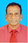
Biography:
N.V.Vighnesam is currently working as Professor at Dayanandasagar College of Engineering, Bangalore, India. He holds his M.Sc. from Andhra University and Ph.D. from Indian Institute of Technology, Bombay, India. He worked as Head, Orbit Dynamics Division, Flight Dynamics Group, ISRO Satellite Centre. He was responsible for design and development of orbit determination system for all ISRO Satellites. He has published more than 65 technical papers.
Abstract:
India’s first Moon mission (Chandrayaan-1) and Mars Orbiter Mission (MOM) carrying several scientific instruments for the purpose of expanding scientific knowledge about the Moon and Mars were launched in October 2008 and November 2013 respectively. The spacecrafts were put into their target orbits by carrying out sequence of orbit maneuvers. Precise orbit determinations are carried out during each phase of the mission using tracking data from network of tracking stations configured for the mission. The determined orbital solutions are used for spacecraft navigation, mission planning, and science data processing. ISRO’s operational orbit determination program (ODP) used for low earth missions was suitably updated and validated before the launch of these missions. Orbit Determination methodology and the performance of Chandrayaan-1 and MOM orbit determination systems during initial phase of the mission along with achieved orbit determination accuracy in the early normal phase is presented.
Ning Cao
University of Houston
USA
Title: A time domain along-Track SAR interferometry method
Time : 16:10-16:35

Biography:
Ning Cao received the B.S. and M.S. degrees in electronic engineering from Harbin Institute of Technology, Harbin, China, in 2011 and 2013, respectively. He is currently at his second year working toward the Ph.D. degree in Geosensing Systems Engineering in the Department of Civil & Environmental Engineering, University of Houston. His main research interests focus on multitemporal interferometric SAR techniques, and airborne SAR image processing.
Abstract:
Differential interferrometric synthetic aperture radar (DInSAR) has already been proven to be a useful technique for measuring ground displacement at millimeter level. One major drawback of traditional DInSAR technique is that only the 1-D deformation in the slant range direction can be detected. In this study, a time domain along-track SAR interferometry method is proposed to extract the terrain deformation in the azimuth direction. Therefore, 2-D terrain deformation map can be obtained from one InSAR pair. Using traditional time domain backprojection, the phase component corresponding to slant range direction offset can be estimated and removed from the range compressed signal. Then an along-track phase compensation is implemented to align the phase of the signal in the specified azimuth direction. Finally, the phase component in the along-track direction can be obtained by time domain coherent summation process. Comparing with the recently developed multiple-aperture interferometry (MAI), it has been found that the proposed method can utilize much larger aperture than the MAI process, which indicates that finer resolution and SNR can be acquired.
Ting Yuan
University of Houston
USA
Title: Diffusion modeling of water flow in the congo floodplains using geodetic and remote sensing measurements
Time : 16:35-17:00

Biography:
Ting Yuan received the B.S degree in Geomatics engineering and M.S degree in Geomatics and Geodesy both from Wuhan University, China in 2009 and 2011. She is now pursuing the PhD degree in Geosensing Engineering and Science at University of Houston. Her research includes SAR, InSAR and other remote sensing data processing for hydrologic applications.
Abstract:
The Congo Basin is the third largest in size (~3.7 million km2) and second only to Amazon in terms of discharge (~40, 200m3s-1 annual average). Hydrological flux in the Congo Basin is of great importance to local and global climate, biogeochemical cycling. Whether water in wetlands comes from upland runoff or fluvial exchange could make a difference in the sediment supplies, carbon and nutrient exchange. The remote location and vast size of the Congo Basin leaves remote sensing tool the only viable and effective tool to investigate its hydrology. In this study, we utilized water surface height from Envisat altimeter, precipitation from TRMM products and Hillslope River Routing (HRR) model derived upland runoff to estimate hydrological parameters including manning’s coefficient n in 1-D diffusion model. Based on this 1-D diffusion model and multiple repeated Envisat altimetry measurements, we will quantify the temporal change in volume of water in Congo’s floodplains received from and drained to its mainstem along the Envisat ground passes.
Shin-Young Kim
Korea University
Korea
Title: Comparison analysis of global horizontal irradiance between Korea institute of energy research and NASA
Time : 17:00-17:25

Biography:
Shin Young Kim has completed her Master’s from Department of Electrical, Information and Control Engineering in Hongik University and PhD studies from Department of Electricity and Electronic Engineering in Korea University. She is a Student Researcher of KIER, a government-contributed research institute of energy technology field.
Abstract:
Solar energy is one of the typical energy of new and renewable energy. Research and development about photovoltaic power generation, solar heat power generation, and solar heat directly use solar energy which has been proceeding consistently. Insolation is the total amount of solar radiation energy received on a given surface area during a given time. It generally classifies 3 sorts. Global Horizontal Irradiance (GHI) which includes both Direct Normal Irradiance (DNI) and Diffuse Horizontal Irradiance (DIF). It has a significant effect on installation and analysis of photovoltaic system. Korea Institute of Energy Research (KIER) had measured GHI in 15 cities from 1982. By 1990s, GHI and DNI had been measured in 16 cities. Measurement area had been decreased from 2008 to 2009. But the area has been increased recently. In this paper, the GHI measurement value of KIER and satellite data of NASA SSE were compared for verifying reliability of the measurement value. Daejeon was selected for comparison area and daily GHI data was compared based on long term database from 1992 to 2005.
Clarence Eder
George Washington University
USA
Title: Beyond Integration Readiness Level (IRL): A multi-Dimensional framework to facilitate integration of system of systems
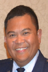
Biography:
Clarence Eder works as a Principal Acquisitions Associate for Quantech Services Inc. supporting the United States Air Force Space and Missiles Systems Center in El Segundo, CA. Clarence retired as an active duty Air Force officer with over 18 years of program management and systems engineering experience in space, intelligence, aircraft, and missile defense acquisitions and operations. He is also a Systems Engineering PhD candidate at George Washington University. He completed his Bachelor of Science degree in Mechanical Engineering at the University of Hawaii, his MBA at Wright State University, and his Systems Engineering Graduate Certificate at George Washington University.
Abstract:
Integration Readiness Level (IRL) was introduced to help understand the maturity of integrating different systems. The need to expand the use of IRL is increasingly becoming relevant in the United States’ Department of Defense (DoD) Acquisitions as programs try to acquire systems with the intent to have multiple capabilities and interfaces. As DoD continues to reduce the budget for weapon systems acquisitions along with the need to expedite the deployment of capabilities into operations, the need to improve systems engineering processes is critical with program decisions. DoD Acquisitions adopted the use of Technology Readiness Level (TRL) in 2002 to explain the maturity of a system based on the technology used for that system. IRL was later introduced as an integration tool to complement TRL, but IRL was never implemented in DoD Acquisitions. IRL could become a necessary tool to help reduce integration risks of complex systems. DoD Space Acquisitions continues to provide examples of complex system of systems. With very limited opportunities to do operational tests and analyses for satellite systems and rocket launches, space systems provide a platform to incorporate the latest technologies and processes to attain successful operational systems. The current research is to show the effectiveness of IRL in facilitating integration of system of systems. The research will focus on understanding and identifying integration issues and challenges of space systems, and developing weighted variables. The weighted variables will be included as part of a systems integration architectural framework, which will be used as the research methodology.
Jiangbo Yu
University of Houston
USA
Title: GPS geodesy infrastructure for coastal subsidence in the gulf coast region

Biography:
Jiangbo Yu is currently a third year PhD student in Geophysics at the University of Houston. He got a M.S. degree in Exploration Geophysics from the University of Houston in 2012 and a Bachelor degree in Geophysics from the China University of Petroleum in 2009. His current research is focused on the GPS geodesy infrastructure in the Gul Coast region. He is particularly interested in geodetic reference frame and its applications in natural hazards study. Currently he is a Graduate Teaching Assistant in the department and has published several papers on reference frame and Houston subsidence.
Abstract:
The Gulf Coast region includes southern U.S. states and the Gulf Coast of Mexico. Over 800 Continuous Operating Reference Stations (CORS) have been installed in the Gulf Coast region by the joint efforts of local governmental agencies, private land survey companies, and research institutes during the past two decades. In this presentation, I will introduce the current GPS geodesy infrastructure in the Gulf Coast region. The infrastructure is consisted of the CORS in the Gulf Coast region, and a newly defined Stable Gulf of Mexico Reference Frame (SGOMRF). SGOMRF is a local reference frame established for precisely delineating local ground motion associated with fault creep, salt dome uplift, and land subsidence in the Gulf Coast region. The root-mean-squares (RMS) of the velocities of 13 reference stations have achieved 0.2 mm/year in horizontal and 0.3 mm/year in vertical directions within the local reference frame. Using this GPS geodesy infrastructure, significant spatial variation of subsidence rates has been observed in both Mexico City and the Houston-Galveston area. GPS stations in southeastern Louisiana have indicated minor (< 6.0 mm/year) but consistent subsidence over time and space. SGOMRF is also critical for deriving long-term absolute seal-level changes.
Leshan Uggalla
University of South Wales
United Kingdom
Title: Mitigating the effects of rain-induced fading in Ka-band satellite video broadcast system using time diversity in concert with maximal ratio combining
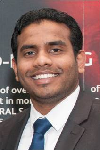
Biography:
Leshan Uggalla is a Doctoral Researcher in the area of satellite communications at University of South Wales, UK. His research interest focused on characterisation and prediction of propagation impairments on earth-space paths, design of Fade Mitigation Techniques for EHF satellite communication systems, design of satellite-integrated networks and similar areas. Also he is a qualified engineer with over 10 years of working experience in the telecommunication sector. This includes planning, installing and managing of a wide range of advanced telecom equipments.
Abstract:
Steadily-increasing user demand for a wide range of high-quality video services delivered via satellite has driven broadcasters to move into the higher frequency bands in order to accommodate the necessary data rates. However, a major issue at these frequencies is the effect of severe rain-induced fading on link reliability, which requires that the system must be designed to implement mitigation techniques in order to achieve an acceptable quality-of-service. These techniques generally involve the use of adaptive modulation and data rates, together with various forms of diversity, switching or combining. During the presentation, we analyse and quantify the benefits of adding i) time diversity (TD) and ii) maximal ratio combining (MRC) to the widely used DVB-S2 standard. Our results, which are based on combining a) 3 years of satellite beacon propagation measurements from 2 UK sites; b) high-fidelity computer simulations of the DVB-S2 standard for a typical satellite-broadcast communications link; and c) our new TD / MRC technology, indicate that substantial improvements in data throughput and significant reductions in outage time are readily achievable.
Roberta Mugellesi Dow
European Space Operations Centre
Germany
Title: ATVCAP- Knowledge capture in ESA projects

Biography:
Roberta Mugellesi Dow obtained her degree in Mathematics and Post-graduate degree from the University of Pisa, Italy, and the MBA in International Business from the University of Heidelberg, Germany. She worked more than 20 years in the European Space Operations Centre of ESA in Germany in the Flight Dynamics Division, in the Planning and Management Office and now in the Ground Segment Engineering Support Office. Currently she is working in the ESA Integrated Application Programme in ESA centre in UK. Since years she is responsible for the knowledge management activities in ESOC and she coordinates KM projects and initiatives for the overall ESA.
Abstract:
Knowledge Management (KM) has been around in ESA since several years leading to initiatives and pilot projects in different areas. To be successful, KM must clearly meet the Agency real needs. It must suit the way of working and must be linked to the core business that is the assembly and execution of space missions. In particular, it needs to address the issues of how projects are managed. The opportunity to apply the KM tools and methodologies already developed to an ESA project arose late 2013 when KM was requested to support the capture and preservation of the knowledge, experience and documentation built over the several missions of the Automatic Transfer Vehicle (ATV). This presentation describes the work which is being conducted for the ATV knowledge capture project called ATVCAP. In particular, it specifies the objectives and the steps required in order to achieve it. At the very end, a dedicated user interface (portal, search) has been developed for an efficient retrieval of the information by the future users of the preserved knowledge. The project started in January 2014 and the first knowledge area handled was Rendezvous and Docking, which was used as the base for the Proof of Concept, demonstrated by end of March 2014. Of course, the conduct of the ATV capture project requires the involvement of the relevant teams of the ATV project and the members of the KM group. Some general remarks concerning the archiving of documentation and the retention of knowledge highlighting the critical areas are outlined
Paul Richard Price
Blogtalkradio
USA
Title: Gravitational propulsion in a fluid membrane- A new propulsion methodology

Biography:
Paul Richard Price is a researcher with over 24 years in the field of physics pertaining to gravity and plasma interactions dealing with their potential uses in alternative energy and propulsion systems. He is an expert in the field of gravity control systems. He has presented a peer reviewed paper on the subject that was presented at the STAIF 2 conference in 2012. He’s a member of AIAA.
Abstract:
An alternative hypothesis is provided to redefine gravity as an interaction between plasma-like membranes that represent gravity. This membrane may be considered as ether or the space-time continuum. In this alternative theory, the membrane is not stationary but moving; gravity is the primary effect of the interaction. The spinning of the solid matter creates a disturbance in the membrane that acts as a pushing force that expands the universe that may create an anti-gravity effect. The physical effect generates a shock wave that produces a vibration in this membrane by a spinning magnetic field. In this scenario a craft with this effect it true may bypass faster than the speed of light. This effect might be engineered by using a torsion field system so that the wave effect bends the membrane during rotation. This also explains the effect of rotating magnetic systems that may produce an observable loss of weight shown in recent experiments. The higher rotation will compress the intensity of the magnetic field and dilates the membrane. This effect could allow for space travel to other solar systems. Gravity may be manipulated by electromechanical means allowing for counter gravitational effect to power a possible warp drive.
Stefan Belz
University of Stuttgart
Germany
Title: Development of photobioreactor technology for algae cultivation in the International Space Station (ISS)

Biography:
Stefan Belz is a Scientific Researcher at the Institute of Space Systems at the University of Stuttgart. He holds a PhD in Aerospace Engineering since 2012 and leads the Energy & Life Support group. Advanced life support system investigation by modelling and simulation, development of photobioreactors for algae cultivation in space, fuel cell integration in space systems and synergetic utilization of hydrogen are his main research areas. He gives lectures (life support and energy systems related) and arranges lab trainings for students.
Abstract:
Life Support Systems (LSS) are an essential subsystem of human spaceflight systems. An LSS allows humans to survive, to live and to work in space. Existing physicochemical technologies used on the International Space Station (ISS) enable water and oxygen generation. Far-distant and long-term exploration missions (e.g. lunar surface habitat or a manned mission to Mars) require a higher closure of the water, oxygen and carbon loop. Especially the carbon loop can only be closed by biological technologies, i.e. food production in space. Higher plants offer an in-situ resource for food. These systems are of a high biological order and require a specific environment to grow. High engineering effort is necessary to provide such an environment in space, especially under microgravity conditions and higher radiation loads. However, microalgae as single-cell organisms compared to higher plants have a higher harvest index, up to 10-fold higher growth rate, a higher light exploitation and need no soil. Microalgae enable an efficient use of photosynthesis in space (conversion of carbon dioxide into biomass and oxygen). Engineering solutions are developed to provide the optimum growth condition of a microalgae species such as temperature, pH value, dissolved carbon dioxide and oxygen concentrations. The Institute of Space Systems investigates cultivation techniques since 2010 in cooperation with the DLR. Knowledge and expertise on cultivation, feeding, harvesting, gas supply and gas extraction are now the basis for the spaceflight experiment PBR@ACLS (Photobioreactor at the Advanced Closed Loop System). The on-going results and development of breadboard testing are presented.
Stanislav I. Klimov
Space Research Institute of the Russian Academy of Sciences
Russia
Title: Results and prospects of fundamental space research on microsatellite realizable in the ISS infrastructure

Biography:
Stanislav I.Klimov Born on 27 June 1937 in Tula region, Russia. He graduated from Department of Physics, Moscow State University (1966), received Ph.D. of physics-mathematics in 1984, Doctor of Scinces of physics-mathematics in 1994. He is Head of Laboratory for Electro - Magnetic Emissions Investigation, Department of Space Plasma Physics, Space Research Institute (IKI) and Russian Academy of Sciences. He has more than 100 publications. His Subjects of scientific interests are Waves in solar wind/magnetospheres and comet plasma interactions, magnetospheric convection and magnetosphere-ionosphere coupling, interaction of the supper large bodies (orbital station) with ionosphere.
Abstract:
Microsatellite «Kolibri-2000» (weight 20.5 kg) was designed and manufactured in IKI RAS. Its delivery to the orbit has been performed using the infrastructure of ISS in 2002, which was the first step of the program on using of microsatellite for fundamental space research. Despite its small size the microsatellite (MS) was carrying 3.6 kilograms of scientific payload which was used for the realization of wide range of scientific research in the field of «classical» cosmophysics. Also the study was made of space weather, atmospheric and ionospheric processes supposedly associated with thunderstorm activity manifested in the detection of electrons near the equator. Due attention was paid to solve the problems of space education. For transportation and direct launch to the orbit in autonomous flight of both MS «Kolibri-2000» and «Chibis-M» the transport and launch container (TPC) was designed and manufactured in IKI. The monitoring of the environment dynamics which was carried out on «Chibis-M» MS proved to be extremely effective. The volume and quality of received information from its scientific payload «Groza» focused on the study of discharges at high altitudes confirmed the uniqueness of the project as to the number and speed of the simultaneously measured parameters. Experience of successful implementation of such projects as «Kolibri-2000» and «Chibis-M» shows: 1. The full cycle of design, manufacture and ground tests of microsatellite platforms for fundamental space research was worked out. 2. Unique scientific equipment adapted to the microsatellite platform was created. 3. The scheme of microsatellite launch to the orbit using the infrastructure of the Russian ISS segment to the altitude of ~ 500 km has been worked out. 4. Lifetime of microsatellite platforms in the orbit without using of «military» component can significantly exceed the guaranteed service life. 5. The ground segment of project created in IKI in particular for the project «Chibis-M» fully provides the operation of microsatellite on orbit for the implementation of scientific program, for receiving and processing of a large volume of scientific data (tens of gigabytes) and for the transfer of scientific information to participants including international ones. At present the development of new space experiments «Chibis-AI» and «Trabant» based on «Chibis» platform has been started and these projects are included in the Long-term program of scientific and applied research and experiments on the Russian ISS segment. The research leading to these results was financially supported by the Russian Government (contract No. 14.B25.31.0023) and partially by the RFBR (research project No. 13-05-307 12102 ofi m) in Russia and State Space agency of Ukraine (contract No. 4-03/13).
V.I. Ferronsky
Water Problems Institute of the Russian Academy of Sciences
Russia
Title: Satellite data in fundamental physics and global dynamics study
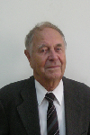
Biography:
Vasily Ivanovich Ferronsky was born on 3 August 1925 in Voronez region, Russian Federation. He graduated from Department of Roads, Moscow Civil Engineering University (1952) and he received Ph.D. of technical sciences in 1956, Doctor of Sciences of nuclear geophysics in 1968. He was Head of Laboratory for Isotope Hydrology and Deputy Director in Research Institute of Hydrogeology and Engineering Geology, Moscow; Division Director of Research and laboratories, International Agency of Atomic Energy (1970 -1973 and 1983 - 1987) Vienna; Head of Department of Isotope Hydrology, principal Researcher, of Water Problems Institute, Russian Academy of Sciences (1987 up to now) Moscow. He has more than 300 publications. His Subjects of scientific interests are Nuclear geophysics, Global dynamics, Global water Exchange.
Abstract:
The effects of the Earth oblateness and the related problems of irregularity in the rotation and the planet’s pole motion and also the continuous changes in the gravity and electromagnetic field have a direct relation to the solution of a wide range of scientific and practical problems in the Earth dynamics, geophysics, geology, geodesy, oceanography, hydrology and climatology. The satellite data play decisive role in understanding physics of the problem. It was found by interpretation of the observed geodetic satellite orbit data that the Earth and the Moon move being not in hydrostatic equilibrium. This is a fundamental conclusion important for study dynamics of celestial bodies. The satellite orbits data for solving the nature of the Earth oblateness problem are interpreted on the basis of the known in celestial mechanics theory of expansion of the gravity potential of a body by spherical functions. It was found by interpretation that the Earth is a traxial body. The differences between the major and minor equatorial semi-axes a and b was found to be as а = 6378160 m, b = 6377504 м, and a – b = 656 м. The next step in that direction is discovery of kinetic energy loss of the Earth and other celestial bodies. The ratio of the kinetic energy to the potential one is ~ 1/300, that is the same as its oblateness. Such a ratio does not satisfy the fundamental condition of the virial theorem. In fact, the other planets, namely, Mars, Jupiter, Saturn, Uranus, and Neptune, exhibit the same behavior. But for Mercury, Venus, the Moon and the Sun, the potential energy exceeds their kinetic energy by 104 times. Since the bodies in reality exist in equilibrium, the answer was found that the kinetic energy of the body’s interacted elementary particles is not taking into account. In this connection the generalized virial theorem was solved and the energy as an effect of the particles interaction instead of the vectorial force was introduced. On that basis hydrostatic equilibrium of an orbiting body by dynamical equilibrium was changed.
Galina Ilieva
Center for Mechanical and Aerospace Science and Technology
Europe
Title: Airships – An innovative and low-cost way to improvements in the area of satellite technologies

Biography:
Galina Ilieva is master engineer and PhD in Mechanical Engineering from the Technical University of Varna, Bulgaria. She holds specializations in “Turbo machinery and propulsion systems†from von Karman Institute for Fluid Dynamics (Belgium), Rosendorf Research Center in Germany, Sakaria University, Turkey and awards for elaboration of effective methodologies for numerical research of flows. She has worked as Senior Researcher in CFD laboratory-Varna and Professor Assistant in Technical University of Varna. She has worked in many national and international projects and is involved in European FP7 contracts – Center for Mechanical and Aerospace Science and Technology, Portugal. She is also a researcher in scientific organization for innovation, research and implementation in aerospace, marine and mechanical engineering. She has published more than 25 papers on CFD analysis, aero- and thermodynamics, innovative propulsion systems, design and air-vehicles and platforms. Her research interests are in the area of innovative propulsion systems, aerodynamics, turbo machinery, air-vehicles, high-altitude platforms, etc.
Abstract:
Airships are high-altitude platforms that offer promising and low-cost approach to deal with the satellite technologies. The airships are comparatively easy to be operated, cheap and light platforms. They offer a good alternative for network operators - to get more coverage to satisfy the increasing demand for more capacity; they are being examined and currently applied for application not only for broadband communications, but also for navigation, emergency services, traffic monitoring, military purposes, area surveillance, to transport satellites to definite altitude, etc. There are various currently running projects related to high altitude platforms, especially to airships and their possible application in satellite technologies. The current paper provides a thorough overview of the technologies related to airships as high-altitude platforms with satellite applications. Also, it discusses the idea, ongoing work and results regarding an unmanned lighter-than-air vehicle to transport satellites to low and higher orbits. The operating altitude is in the range of 16km - 22km. To minimize weight, the platform will be composed of high, strength but very light materials and will use lightweight innovative propulsion technologies. The airship will need a power source to maintain its position within definite kilometers in radius. The aircraft is envisaged to continuous flight into the wind and uses electric motors to avoid drifting and to keep its position. Possibilities to apply the airship as small satellite positioned at low orbits are researched also. The current research and its outcomes will significantly bring to positive solutions, overcome the high costs of conventional satellites, and affect the deployment and future developments in the field of high-altitude systems.
Yousry S. Hanna
National Research Institute of Astronomy and Geophysics
Egypt
Title: On techniques for fitting satellite laser ranging data
Biography:
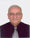
Yousry S Hanna is a Professor and the Head of solar and space researches department, Egypt. He has teaching experience at the National Research Institute of Astronomy and Geophysics (NRIAG) and experience in the field of the artificial earth satellites observations using the laser technique. He is a member of the international scientific project (with the Czech technical university, Prague, Czech Republic) for observing the artificial earth satellites using the laser technique. He is teaching pure mathematics in the Egyptian high institutes and some courses at the NRIAG in the following subjects: Numerical analysis, Differential equations and Numerical solutions of differential equations. He has published a lot of papers in the fields of space science, mathematics and astronomy in different international scientific journals and international conferences. His research interests are in pure mathematics (numerical analysis), Satellites observation techniques, data analysis, spline techniques for data fitting, Space physics.
Abstract:
The present paper is concerned with Chebyshev polynomials which are used to analyze the satellite laser ranging (SLR) data. We will apply two different techniques for fitting data. The spline technique is given to obtain a continuous approximation function of matching these Chebyshev polynomials developed for fitting data over progressively classified separate intervals. The other method is the overlapping technique. An application on the laser ranging data taken for the satellite Ajisai is given. The results followed by the discussion of the used technique are also presented. Satellite Laser Ranging (SLR) and Lunar Laser Ranging (LLR) use short-pulse lasers and state-of-the-art optical receivers and timing electronics to measure the two-way time of flight (and hence distance) from ground stations to retro reflector arrays on Earth orbiting satellites and the Moon. Scientific products derived using SLR and LLR data include precise geocentric positions and motions of ground stations, satellite orbits, components of Earth’s gravity field and their temporal variations, Earth Orientation Parameters (EOP), precise lunar ephemerides and information about the internal structure of the Moon. Laser ranging systems are already measuring the one-way distance to remote optical receivers in space and can perform very accurate time transfer between sites far apart.
Junna Meng
Tianjin University
China
Title: Determining weights of indicators assessing infrastructure

Biography:
Junna Meng has completed her PhD in 2007 from Tianjin University. She is an associate professor in the college of economy and management of Tianjin University. Besides, she is the deputy director of Academic Committee for Youth in China Association of Plant Engineering Consultants. She was responsible for construction and research of constructor qualification examination database from 2009 to 2011, which was supported by Ministry of Housing and Urban-rural Development of the PRC. She has been performing project “Study on Dynamic Evaluation Mechanism of the Sustainability of Urbanization Infrastructure in the Perspective of Whole Life Cycle†and “International Project Risk invested Decision Optimizationâ€, which are supported by National Natural Science Foundation of China. In terms of academic achievements, she has published 3 books and more than 10 papers in academic journals.
Abstract:
Infrastructure sustainability assessment plays an important part in promoting infrastructures’ achieving sustainable development. The result of sustainability assessment depends not only on indicator system but on indicators’ weight. Predecessors who studied infrastructure sustainability assessment mainly focused their studies on the construction of indicators , while there is few systematic and scientific methods on the determination of the weights of indicators comparatively, which directly affect the accuracy of the assessment result. On the basis of indicators developed by predecessors, project information was collected through Report of Environment Effect of Completed Project as the value of indicators. Then, PLS-PM is applied to verify the reliability of the construct of indicators and to analysis influence characteristic that indicators have on the assessment outcome based on item loadings and path coefficients. In the end, the weights of indicators are determined based on the path coefficients, which can be used as reference of weight to conduct infrastructure sustainability assessment (ISA).
George Kordzakhiaa
Georgian Technical University
Georgia
Title: Satellite earth observations processing to determine main characteristics of small glaciers of east georgia
Biography:
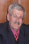
George Kordzakhia has completed his PhD at the age of 28 years from Hydrometeorological Centre, Moscow and postdoctoral studies in the Hydrometeorological institute of the Technical university of Georgia. Dr. George Kordzakhia’s professional interests are concentrated on the researches of atmosphere dynamics, satellite earth observations; climate change, hydrology, glaciology oceanology. Participated in several international programmes (UNDP, EC FPs, NATO Programme for Peace etc.). Participated in several international conferences, symposiums, sessions, WGs work of several international organizations (WMO, IPCC, UNEP etc). Member of the several international organizations at national/regional levels. He has published more than 25 papers in reputed journals.
Abstract:
The variations in glaciers are the important indicators of regional climate change. The research of glacier melting is important for studies of sea/ocean level changes. Satellites earth observations (EO) are powerfool tool that allow creation of glacier’s data sets with needed regularity. The accurate determination of the glaciers characteristics needs precize definition of glaciers counturs. Glaciers contours automatic determination is based on different spectral properties between the ice and snow by a combination of different spectral channels from visible and infrared range.Satellite data processing, first of all, means radiometric calibration of the satellite specific channels. For glacier research it is necessary to use: i. Slope gradient calculations on the bases of Aster DEM; ii. Slope exposure and the illumination of the highlights of the glacier region. Article presents results of determination of snow line altitude from satellite (EO) data for certain glaciers of Great Caucasus, in the eastern part of Georgia. Landsat-8 OLI TIRS images for the end of ablation period were used to identify snow line position. Snow line altitude was extracted from Advanced Spaceborne Thermal Emission and Reflection Radiometer digital elevation model (Aster DEM). For simplicity the glacier are classified into three classes, which correspond: the first and second - accumulation zone, third - the ablation zone. The border line between accumulation and ablation zones refers to snow line. Using the DEM glacier, band ratios and NDSI calculations snow line heights are determined.
Matviyenko Sergiy Anatoliyovich
State enterprise "Design office" Yuzhnoye "of M.K.Jangel"
Ukraine
Title: The conceptual project of the geophysical microsatellite
Biography:
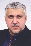
S A Matviyenko was born on 26.09.1960. In 1984 he has finished the Dnepropetrovsk State University, physico technical faculty. Since 1986 he is been working in SDO ''Yuzhnoye''. In 2011 has protected the master's thesis on a theme «the Radio physical method of measurement of parameters of a gravitational field of the Earth» which is based on five patents of Ukraine and eighteen publications in collections Ð’ÐК of which five are made without co-authors. In 2015 the senior scientific employee has received an academic status. He has five copyright certificates of the USSR, 11 patents of Ukraine, three demands for the invention, eight «Certificates on registration of the copyright to product», and also has published 43 scientific articles.
Abstract:
In SDO ''Yuzhnoye'' have been developed a radio physical method of measurements of parameters gravitational field of the Earth, which is based on measurement of size of change of frequency of electromagnetic radiation by gravity with the subsequent definition of a gradient or acceleration of free falling. This method has two versions: - Differential radio physical method; -Integrated radio physical method. Technically the difference between these two versions of a method consists that gravitational displacement of frequency is measured in a differential method between two receivers of electromagnetic radiation, and in integrated - between a source of radiation and the receiver. Within the limits of project STCU № 3856 experimental researches of a radio physical method have been spent. Considering specific requirements on realisation of a differential radio physical method the project of the gravitatsionno-focused geophysical microsatellite has been developed. The project of the geophysical microsatellite is innovative as regarding a method of measurements, and a part of design-layout scheme microsatellite : • The Radio physical method allows to measure gravitational potential, acceleration of free falling, a gravitational constant and weight of planets. • The Design-layout scheme of the geophysical microsatellite excludes necessity of use of active system of stabilisation, provides constant light exposure of solar batteries, excludes the revolting moment caused by influence of external factors, and allows to solve problems of measurement of parameters gravitational field of the Earth • The Radio physical method is based on measurement of relativistic effect of gravitational displacement of frequency of an electromagnetic signal which has not found till now practical realization.
Valery Korepanov
Lviv Center of Institute for Space Research
Ukraine
Title: Earthquake precursors’ detection from space – possible mission analysis
Biography:
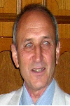
Valery Korepanov is a Scientific Director of Lviv Centre of Institute of Space Research of NASU and SSAU. He got his PhD degree in Electromagnetic Measurements in Lviv Polytechnical Institute in 1970 and Habilitation of PhD in Geophysics in Institute of Physics of the Earth (Moscow) in 1991. He has more than 500 publications. His area of interests are; Development of theoretical and methodological aspects of electric and magnetic fields’ investigations in different media: space plasma, marine water and on-land, study of electromagnetic precursors of natural hazards, design and manufacturing of different types of magnetometers and electrometers.
Abstract:
The ionospheric precursors of earthquakes (EQ) are now the recent challenge in this hazard evaluation. The future space missions optimized for the study of these precursors are under wide discussion nowadays. There is necessary to answer two important questions before to plan any experiment to study ionospheric precursors of EQ. First one – whether the variations in the ionosphere definitely connected with the EQ preparation process do exist, and the second one – if they do, whether using these signals, the precursors of EQ can be reliably identified and used for, if not prediction, for the warning that the EQ in the given area approaches. To answer these questions, the available information about the EQ-connected signals collected in former spatial experiments, mainly in DEMETER, is analyzed. Possible mechanisms of energy transfer from EQ preparation area to the ionosphere are reviewed and the mostly supported ones - FWC and AGW – are discussed. Most probable, real lithosphere-atmosphere-ionosphere coupling includes several mechanisms and in dependence of momentary factors one or other prevails. The main physical values are proposed which would be advisable to monitor in the planned spatial mission in order to try to increase the EQ precursors’ detection rate. The instrumentation composition for such study is discussed and it is stressed that the monitoring of such parameters has to be made minimum in two, better in three points. The very low price multi-points space experiment realization possibility is discussed.
Yavor Shopov
Sofia University
Bulgaria
Title: Using of microsatellites for remote locating of unknown caves and underground facilities
Biography:
Yavor Shopov has completed his PhD from Sofia University and Postdoctoral studies from McMaster University. He is Head of the University Centre for Space Research & Technologies, Sofia University. He is supervisor of Master programme on Aerospace engineering of small satellites and co-supervisor of the Master programme on Space research of Sofia University. He has published more than 100 papers in reputed journals and has been serving as an Editorial Board Member of repute. His fields of research: Applications of satellites in applied and fundamental research, space and solar terrestrial physics, development of optical and spectral equipment for multispectral imaging.
Abstract:
Location of caves on Mars can be of vital importance for future manned exploration of the planet, because such caves are appropriate for storage chambers and shelters of astronauts during the initial stages of the planet exploration. International Union of Speleology (UIS) started a new international programme on Techniques for Remote Location of Caves (RLC) using thermal vision technique. It is leaded by the author. This project aims to locate new unknown caves in hardly accessible regions and will be extremely helpful to locate caves in remote regions with extremely rough surface and even on other planets. This programme consists of the following stages: 1) To optimize techniques on the surface of the Earth and to calibrate it on known caves and artificial underground facilities. 2) To use it to locate new unknown caves. 3) To use thermal vision cameras on airplanes and helicopters to locate caves in hardly accessible regions from the sky. 4) To install observational instruments for location of caves on microsatellites. 5) To design equipment for space probes for location of caves on Mars.
Ali Cheknane
Amar Telidji University of Laghouat
Algeria
Title: An approach to defect detection and yield control of grid-connected PV systems via satellite monitoring

Biography:
Ali Cheknane is a full-Professor at the Amar Telidji University of Laghouat-Algeria. He has completed his PHD in physics. He is having 20 years teaching graduate and post-graduate teaching experience at the university as temporary, associated and permanent position. He has published many papers in various journals and conference proceedings on renewable energy subjects. He has supervised 10 PhD students (04 theses have been defended) and 14 Master students' projects (Magister). He has supervised more than 40 projects (Engineer and Technician) in electrical engineering and Computing. He got an incentive award from “Centre de Development des Energies Renouvelables- CDER”. He was awarded for the best publication in physics in Algeria from the ANDRU agency in 2008. He is the Head of the research team: “Photovoltaic Systems & Devices”. He is a reviewer in many Journals as: Solar Energy, Conversion Energy and Management Journal; Electronics Journal, International Journal of Engineering Innovations and Research, Measurement, International Journal of Electronics. Actually, He is the Dean of the Faculty of Technology at Amar Telidji University of Laghouat- Algeria.
Abstract:
In the case of unexpected occurrence due to an unforeseen defect, the grid-connected photovoltaic systems could operate below their optimal performance. Thus, the implementation of a monitoring system becomes paramount to measure the energy yield and to assess the system performance. The monitoring-inverter via a router, which is a device integrating a smart phone, will communicate by satellite. To allow the satellite communication, it is necessary to integrate a data-logger and a chip inside the inverter. The present work focuses on the defect detection in a grid-connected photovoltaic system by satellite monitoring, and the yield control for timely intervention to prevent economic losses. Throughout the literature review, we will present some approaches and methodologies. We will discuss, among other points, the limits of the approaches. We will then present our proposed methodology as a promising approach for defect detection grid-connected PV systems via satellite monitoring, achieving highly good results.
Rushi Ghadawala
Aryavarta Space Organization
India
Title: Space Applications: Sustainable and sensible usage during disaster relief

Biography:
Rushi Ghadawala has pioneered India's first and only private space R&D organization, operating on global industrial platform, Aryavarta Space Organization. He has got expertise in interplanetary mission operations, Space Debris removal and Space applications in climate change. He is actively involved into international projects, leading his organization, with his collaborative partners on the global front.
Abstract:
When it comes to disaster applications; space applications are the most efficient resources for rescue and relief. It is highly important to utilize these sophisticated applications during the time of emergencies, for effective operations, especially when the region is cut off from the world physically. Recently, South Asia witnessed two major events when space applications were been used for quick disaster response in India (2013) and Nepal (2015). However, the impletion also triggered issues due to lack of effective communications between the data providers and end users. In today's time, there is a serious need for bridging the gap between data providers and end users for sustainable and sensible usage of space applications during disaster relief. This paper contains strategic recommendations emphasizing smooth operations between the operative teams for the effective and efficient disaster response.
- Satellite Navigational Systems
Types of Satellites & Applications
Satellite Subsystems
Space Missions
Military and Non-Military Satellite Technology

Chair
Dorian Gorgan
Technical University of Cluj-Napoca, Romania

Co-Chair
Luiz Sampaio Athayde Junior
Federal University of Bahia, Brazil
Session Introduction
Dimitar Ouzounov
Chapman University
USA
Title: Testing geospace technologies for alerting large earthquakes: An integrated approach of space and ground observations
Time : 11:05-11:30
Biography:
Dimitar Ouzounov is an Associate Professor at Chapman University. He works as a Research Scientist in geo-physics, satellite earth observations, and geo-computing. He conducts research on utilizing near-space earth observations for studying geodynamics processes. He contributed in validation of the new geophysical theory of lithosphere-atmosphere-ionosphere coupling in relation to earthquake processes. He has coordinated international initiatives on utilizing space-borne and ground observations for earthquake hazard risk assessments. He has won multiple NASA grants and has published more than 150 papers. He teaches satellite applications in natural hazards at Chapman University. He is a Keynote Speaker at international conferences.
Abstract:
The most recent catastrophic earthquakes (Nepal 2015, Japan 2011, Haiti 2010, China 2009, Pakistan 2007 and Sumatra 2004) claimed thousands of lives and caused extensive economic losses in the affected region. The science community is seeking new ideas in the development of earthquake hazard mitigation scheme. We are proposing a scheme requiring interdisciplinary which has the latest Geo-space and remote sensing technology based on multi platform data observations. A new multi-sensory approach of analyzing atmospheric and ionospheric signals and the search for pre-earthquake physical phenomena, which is being developed using geospace sensing techniques and ground data segments. This new approach is still in an early stage of testing and is based on data fusion of satellite thermal observations (LEO, GEO) in conjunction with GPS/TEC (GNSS) and ground multi parameter (seismicity patterns, gas content) continuous measurements. The proposed methodology uses existing satellite sensors and ground observations in one integrated Sensor Web framework defined by the Lithosphere-Atmosphere-Ionosphere Coupling (LAIC) concept. Our initial test results show that simultaneous satellite and ground measurements, used as an integrated web, could provide earthquake short-term alert capabilities (several days) for major earthquakes by combining the information from multiple space born platforms. The significance of initial prospective testing of short-term alerts is discussed within the framework of the latest M7.9 earthquake in Nepal and major activities in 2012-14.
Ramesh L Shrestha
University of Houston
USA
Title: Geodetic imaging technologies for research and education
Time : 11:30-11:55
Biography:
Ramesh L Shrestha is a PI and the Director for the NSF funded center, the National Center for Airborne Laser Mapping. NCALM’s other goal is to provide state-of-the-art research capabilities in geosensing and remote sensing technologies. He has been elected as a University Professor of College of Engineering at UH. His research activities are associated with the application of advanced geodetic and remote sensing techniques, including airborne LiDAR and digital imaging.
Abstract:
Geodetic imaging represents a golden age in geodesy, enabling geodesists to provide never-before-available quantitative information to researchers and educators in the geosciences community, and related fields of science. Air-borne LiDAR, Light Detection and Ranging observations, and such derived products as ‘bare earth’ digital elevation models, are being used to study about the earthquake deformation fields, fault slip rates, folding mechanisms, landslide dynamics, channel network evolution, landscape response to tectonics, marsh evolution, forestry, archaeological sites and more. LiDAR technology is still developing rapidly, with high priority being given to multi-color systems, and instrument miniaturization that will enable the deployment of LiDAR in remotely piloted aircraft, also known as drones. Therefore these technological improvements become operational new scientific problems which will be brought within reach of an increasingly diverse community of researchers. The National Center for Airborne Laser Mapping (NCALM) provides geodetic imaging technology using airborne LiDAR systems owned by UH to scientific communities at large. In addition to operational funds provided by United States National Science Foundation (NSF) for NCALM’s PIs, Co-PIs and staff, the center also receives funding for projects from other federal agencies (e.g., USGS, NASA, NOAA, and the US Park Service), Japanese Government, state agencies, academic institutions, and private sector companies. During the past 12 years NCALM has completed some 130 projects, including 90 ‘seed projects’ proposed by graduate students as part of their research to earn graduate degrees. In the past 5 years NCALM has extended its operations to collect airborne LiDAR observations, which is well beyond the continental United States, including remote projects in Hawaii, New Zealand, Central America, and Antarctica. This presentation will highlight NCALM accomplishments during the last 12 years.
Luiz Sampaio Athayde Junior
Federal University of Bahia
Brazil
Title: Paradoxical Variation of the solar day related to Kepler/ Newton System
Time : 11:55-12:20
Biography:
Luiz Sampaio Athayde Junior is a Professor at School of Accounting Sciences of Federal University of Bahia (FCC/UFBA) and also Professor of Astronomy Course of Physics Institute (IF/UFBA) and the University Jorge Amado (Unijorge), ex Professor at Cairo University of Viscount (FVC) of over graduation and has experience as a Tax Analyst. He completed his Master in Business Administration and Extension in Higher Education Methodology by the School of Administration of Federal University of Bahia (EA/UFBA), Post Graduate MBA in Financial Management and Company, Post Graduate and Research Center at Cairo University of Viscount (CEPPEV/FVC). Accountant and Degree Bachelor of Accounting Sciences by Estacio University Center of Bahia (Estacio/FIB) and is certified by IAFC First Degree in International Standards of Accounting-IFRS. His publications of accounting area have appeared in many websites specializing in tax and international accounting standards-IFRS. He is author of the Blog www.contabeisufba.blogspot.com.br. His research in the accounting area also made him the creator of New Accounting Policy, recently published in the Brazilian Journal of Accounting (RBC), the most important publication in Brazil in this area. His research interests in Astronomy area helps to create a Tropical Astronomy and new seasons for tropical zone.
Abstract:
According to the first law of Kepler, the planets orbit the sun in elliptical path. This ellipse causes a slowdown in the world when it goes from the nearest point of the sun to the farthest point and also causes acceleration when the opposite occurs. This variation of the velocity of the planet combined with the inclination of its imaginary axis creates the anal Emma chart, which can be found with the overlap of the positions of the sun in a particular location always in the same time set on a watch. The anal Emma, in turn, describes variations in the durations of the solar day. In some dates, these variations in solar days occur in accordance with the change in velocity of the planet, but at other times, they get along perfectly Conversely, showing in some parts of the solar days year that will gradually reducing their periods as the planet decelerates and also increases periods as the planet accelerates.
Dorian Gorgan
Technical University of Cluj-Napoca
Europe
Title: Flexible and adaptive processing of earth observation data over high performance computation architectures
Time : 12:20-12:45

Biography:
Dorian Gorgan is a Professor in Computer Science Department of the Technical University of Cluj-Napoca, PhD supervisor in Computers and Information Technology, and coordinator of the Computer Graphics and Interactive System Laboratory. The fields of interest involve parallel and distributed processing over HPC infrastructures such as Grid, Cloud, Multicore, and cluster, development of platforms and applications for spatial data processing and visualization, interdisciplinary research in the domains of Earth Sciences and Earth Observations. He has been involved as scientific coordinator and WP leader in national and international research projects such as BIGEARTH, PECSA, enviroGRIDS, IASON, SEE-GRID-SCI, GiSHEO, mEducator, iTRACE, MedioGrid, COMPLEXHPC, and KEYSTONE. He has been member of scientific and reviewing committees of many ISI Journals and international conferences, and gave more than 300 papers and presentations in journals and prestigious conferencesin the domains of Computer Science and Earth Observation
Abstract:
The earth observation data repositories increasing dramatically by several terabytes each day become a big issue for organizations. The administration of the storage capacity of big datasets, access policy, data governance, protection, searching, fetching, and complex processing require high costs that force the organization to search for solutions to balance the cost and value of data. Data can create value only when it is used, and the data protection has to be oriented toward allowing innovation that sometimes depends on creative people, which achieve unexpected valuable results through a flexible and adaptive manner. The users need to describe and experiment themselves different complex algorithms through analytics in order to valorize data. The analytics uses descriptive and predictive models to gain valuable knowledge and information from data analysis. Possible solutions for advanced processing of big earth observation data are given by the HPC platforms such as cloud and cluster. With platforms becoming more complex and heterogeneous, the developing of applications is even harder and the efficient mapping of these applications to a suitable and optimum platform, working on huge distributed data repositories, is challenging and complex as well, even by using specialized software services. From the user point of view, an optimum environment gives acceptable execution times, offers a high level of usability by hiding the complexity of computing infrastructure, and supports an open accessibility and control to application entities and functionality. This presentation exemplifies some earth observation use cases based on flexible description of processing, and adaptive and portable execution over HPC infrastructures.
Matviyenko Sergiy Anatoliyovich
State enterprise \"Design office\" Yuzhnoye \"of M.K.Jangel\"
Ukraine
Title: The conceptual project of the geophysical microsatellite
Time : 13:35-14:00
Biography:
S A Matviyenko was born on 26.09.1960. In 1984 he has finished the Dnepropetrovsk State University, physico technical faculty. Since 1986 he is been working in SDO ''Yuzhnoye''. In 2011 has protected the master's thesis on a theme «the Radio physical method of measurement of parameters of a gravitational field of the Earth» which is based on five patents of Ukraine and eighteen publications in collections Ð’ÐК of which five are made without co-authors. In 2015 the senior scientific employee has received an academic status. He has five copyright certificates of the USSR, 11 patents of Ukraine, three demands for the invention, eight «Certificates on registration of the copyright to product», and also has published 43 scientific articles.
Abstract:
In SDO ''Yuzhnoye'' have been developed a radio physical method of measurements of parameters gravitational field of the Earth, which is based on measurement of size of change of frequency of electromagnetic radiation by gravity with the subsequent definition of a gradient or acceleration of free falling. This method has two versions: - Differential radio physical method; -Integrated radio physical method. Technically the difference between these two versions of a method consists that gravitational displacement of frequency is measured in a differential method between two receivers of electromagnetic radiation, and in integrated - between a source of radiation and the receiver. Within the limits of project STCU â„– 3856 experimental researches of a radio physical method have been spent. Considering specific requirements on realisation of a differential radio physical method the project of the gravitatsionno-focused geophysical microsatellite has been developed. The project of the geophysical microsatellite is innovative as regarding a method of measurements, and a part of design-layout scheme microsatellite : • The Radio physical method allows to measure gravitational potential, acceleration of free falling, a gravitational constant and weight of planets. • The Design-layout scheme of the geophysical microsatellite excludes necessity of use of active system of stabilisation, provides constant light exposure of solar batteries, excludes the revolting moment caused by influence of external factors, and allows to solve problems of measurement of parameters gravitational field of the Earth • The Radio physical method is based on measurement of relativistic effect of gravitational displacement of frequency of an electromagnetic signal which has not found till now practical realization.
Masayuki Itoh
Kobe University
Japan
Title: ARD (Alpha-Ray Detector) on board SELENE : design, in-orbit performance and scientific outcome
Time : 14:00-14:25
Biography:
Masayuki Itoh is a professor at the Graduate School of Human Development and Environment of Kobe University. He recieved PhD from the University of Tokyo in 1988. His research field is observational astrophysics. He participated in the Japanese X-ray astronomy missions including Ginga, Asuka, and Suzaku. He is a member of the SELENE/ARD and playing leading role in the in-orbit calibration and analysis of the data.
Abstract:
Measurement of alpha-particles from 222Rn and 210Po in the decay series of 238U on the moon provides informaton on subsurface distribution of uranium, gas emisson on the lunar surface, and hence the crustal structures. Radon alpha-particles were detected by the experiments on board Apollo 15, 16, and Lunar Prospector. They revealed radon emanantion in the Aristarchus region during the observation periods, indirect evidence of time variation of the gas emanation sites, and radon emanation in the last several decades at sites on the edges of mare regions. However, the spatial resolution was limited, and time variation was not directly observed because of the insufficient statistics of the data in both experiments and relatively short observation periods in the case of Apollo. Alpha-Ray Detector (ARD) onboard the Japanese lunar explorer SELENE was designed to observe the alpha-particles with improved statistics. It is an array of 48 SSD chips with anticoincidence to reduce the cosmic-ray background. The effective area is 326 cm2 which is more than an order of magnitude larger than the detectors in the previous missions. This paper introduces the design of the ARD and reports its in-orbit performance and the scientific outcome. Althoug the anticoincidence function did not operated properly in the orbit, the large area of the detector made it possible to map the radon alpha-particle intensity distribution with improved spatial resolution and detect time variation of the radon emanation. Concentration of radon emanation in the last several decades was observed at craters in Aristarchus and Kepler regions.
Porzia Federica Maffione
Polytechnic of Turin
Italy
Title: A GUI for optimization of low-thrust trajectories for nuclear and solar electric propulsion
Time : 14:25-14:50

Biography:
Porzia Federica Maffione completed her Master’s degree in Mechatronic Engineering from Polytechnic of Turin. Her project thesis was on space propulsion for human spaceflight with VASIMR and the aim of this project was to study the optimization problem with indirect method. Currently, she is doing PhD at Polytechnic of Turin on astrodynamics and space robotics. Her first publication was on optimal low-thrust trajectories.
Abstract:
The optimization of low-thrust trajectories is a well know subject and now-a-days it is important to have a simple graphical interface in order to obtain in a very fast way the optimized results to compare different solutions. The optimization, in this case, is made with indirect method and it is possible to optimize travels in the entire solar system. The optimization of the trajectory and the optimization of the spacecraft are two separated steps, linked together by a single parameter: The specific mass of the power generator. The entire problem is solved under the assumption that the specific mass of the power generator is constant for the nuclear propulsion. In the case of solar propulsion, this key parameter depends on the distance of the spacecraft from the sun. In this work, the optimization is solved for circular orbit and taking into account all phases of the journey, spiraling around the departure planet, interplanetary cruise and spiraling around the destination. It is also possible to evaluate the opportunity of journey in presence of space elevator, very effective gateway to solar system, able to make robotic and human explorations faster and cheaper. All results are strongly documented with a large variety of plots.
Heejin Bae
KARI (Korea Aerospace Research Institute)
Korea
Title: Optimized image collection planning for KOMPSAT
Time : 14:50-15:15

Biography:
Heejin has completed her Master’s Degree from Korea University of Electronical engineering and worked at Samsung Electronics. Her major is equalizer algorithm of mobile communication. She developed the receiving system and operation system of satellite at KARI. At present, she works as TLO (Technolgy Licensing Organization) and manages the overall patents of KARI.
Abstract:
KARI (Korea Aerospace Research Institute) has four Low-Orbit Satellite as KOMPAST (KOrea Multi-Purpose Satellite)-2, KOMPSAT-3, KOMPSAT-3A and KOMPSAT-5 on operation at present. Because each KOMPSAT has different sensor characteristics, KOMPSAT series provide high-level and various services for satellite image. But above all, we should consider optimized image collection planning problem for KOMPSAT-2 to minimize human resource. Image collection planning must be considered to minimize human resource and maximize satellite resource. And, because image collection planning is considered not as single satellite but as multi-satellite, the process will be so complicated. KOMPSAT-2 operates under several complicating operational constraints such as camera roll tilt, satellite resource availability, weather conditions, and order priorities. The satellite image collection planning problems are known to be difficult in practice. Because customer requests usually span large geographical areas and their images can only be obtained from certain satellite orbits, each of the requested areas is usually divided into several small-size continuous-observation areas, which are called segments. Under the strip mode operation, the satellite collects the segments one at a time. The length of a segment is determined beforehand by an expert based on the configuration of the region of interests before the image collection planning starts. Given a set of several segments, many of which are overlapping, the planning problem becomes a selection problem to choose as many non-overlapping segments as possible under several operational constraints.
Ali Emre Destegul
Turkish Air War College
Turkey
Title: The use of satellites in the border security
Time : 15:35-16:00

Biography:
Ali Emre Destegul, was born in 1986. He graduated from Department of Electronic Engineering of Turkish Air Force Academy in 2007. After graduating from 2nd Main Jet Base(MJB) as an jet pilot, he was assigned to 4th MJB where he became an F-16 pilot. He was assigned to 8th MJB, Diyarbakır between 2010 and 2014. He has approximately 1000 flight hours. He has a master degree study on “Image Fusion” from Aeronautics and Space Technologies Institute in Istanbul. He attended Turkish Air War College(TAWC) in 2014. He has published a few papers in local military organizations and is a student officer in TAWC.
Abstract:
The progress in satelite technologhy has been a source of solutions to many problems and it seems to continue. One of the best example that civil and military technology work on together is providing detection ability by satellites. We can benefit from this feature to ensure the security of borders. In the first part of the study it is investigated that how military and civil technology has been evolved. Also the importance of technology that developed by the contribution of communication, energy and remote sensing is specified. In that ongoing parts of the study, the efficiency of reconnaissance and intelligence capability that obtained from different dimensions of space by satellites to ensure the safety of land borders is examined. In this context today’s satellite reconnaissance and surveilllance capabilities have been analyzed. After analyizng the effects of factors that create security problems such as terrorism and smugling tactics, a qualitative research has been made to solve the problems encountered. In the conclusion chapter, as a result of SWOT analysis application some important procedures have been proposed to ensure the security of land borders through satellies more efficently.
Lt. Abdullah Kaya
Turkish Air War College
Turkey
Title: Will high-altitude long-endurance (HALE) UAVS replace satellites?
Time : 16:00-16:25
Biography:
Lt. Abdullah Kaya graduated from Department of Electronic Engineering of Turkish Air Force Academy. During his graduation period, he was assigned to 4th MJB where he became an F-16 pilot, from his 2nd Main Jet Base (MJB). He is a Student Officer in Turkish Air War College in Istanbul. He has published a few papers in local military organizations.
Abstract:
The types, sizes, missions, and capabilities of Unmanned Aerial Vehicles (UAVs) have expanded at increasing speed since the last 10 years and States that the budged of R&D to this technology have been increased. States seek further ways to the mission of satellites especially communication and surveillance due to highly price and difficulty of maintaining satellites. Solar-powered, long-endurance UAVs can remain in the atmosphere for many years. After produced of (HALE UAVs), High-Altitude Long-Endurance Unmanned Aerial Vehicles, States began to discuss functions which are provided by the satellites. HALE UAVs can perform more cost-effective, moreover, development of anti-satellite missile in the military field revealed the necessity of questioning the security of satellites. No longer had that Satellite become clear target against threats, so states should search for new secure system or provide security of satellites. So, states have begun researching alternatives to space-based platforms. The purpose of this research is especially about usability of the HALE UAVs replace of satellites, interoperability, and about advantages and disadvantages of these systems. Also, it is investigated that which level can be used and can be used in which context and reveals by the SWOT analysis.
Boris A Khrenov
Lomonosov Moscow State University
Russia
Title: Phenomenology of near UV flashes in the earth atmosphere collected in satellite observations and their relation to thunderstorm regions
Biography:
B A Khrenov is a Professor of Skobeltsyn Institute of Nuclear Physics (SINP), Lomonosov Moscow State University. He has an MS, PhD and DSc in Physics and Mathematics. He is a Leading Staff Researcher, SINP MSU, Moscow, Russia. He did his PhD “High energy muons in EAS” in 1962 and his Doctor of Sciences (DSc), Professor in Physics and Mathematics, “Experimental study of EAS high energy muons by underground magnetic spectrometer” in 1987 and has published many papers.
Abstract:
In flights of four satellites: Tatiana; Tatiana-2; Chibis and Vernov (RELEC before launching) near UV flashes in wide range of energies (from 1 K Joule to M Joule in UV) were studied by detectors capable to measure temporal profile of the event in range of 1- 128 ms. Among all data on those flashes the most interesting are observations in Tatiana-2 and Vernov satellites series of short flashes (1 ms duration) correlated in trace of 128 ms and in several minutes of satellite flight. Series of flashes are strongly correlated with thunderstorm regions. Orbits of Tatiana’s and Vernov satellites are close to geomagnetic field while Chibis orbit crosses geomagnetic field. Series of flashes were not registered by Chibis detector. This difference gives evidence for correlation of flash series with geomagnetic field. A qualitative interpretation of data on series of UV flashes is considered. UV flashes are suggested to be generated by lightning electromagnetic pulses partly going through ionosphere to the magnetosphere as whistlers. Whistlers’ tracks are correlated to geomagnetic lines. They have a chance to come back to the atmosphere where they produce secondary flashes which could be detected by satellite following geomagnetic lines. Longer series (during seconds and up to minutes) also directed along geomagnetic field lines are due to additional effect of lightning high rate in specific thunderstorm regions.
Galina Nikolaevna Gostilova
Herzen State Pedagogical University
Russia
Title: The navigation network as the basis for the organization of geo-cultural and information space
Biography:
Alina Paranina has received a diploma (with distinction) of the Voronezh State Pedagogical University in "Geography and biology" In 1986. In 1995 she received the academic degree PhD of Geography "11.00.01 - Physical geography, geophysics and landscape geochemistry" Since 1997 she worked at the Department of Physical Geography and Nature resources, Herzen State Pedagogical University, since 2005 - as a lecturer, since 2012 – tutoring in doctoral studies. 2001 – Research on the topic "Information in the geographical space." Over the past 5 years on a research theme she has written more than 100 studies, including one individual monography and two collective monographies.
Abstract:
Navigation is common to all living things: taxis, photoperiodism, orientation reflexes. Special feature of a human is the development of navigation based on instruments, which can be traced back to the Stone Age. Based on field studies and paleo-astronomical calculations, stages of the evolution of ancient navigation technology can be distinguished: 1. natural navigational tools; 2. direct visioning of horizon observatory; 3. using the same facilities as a network in which the elements are bound by the shade; 4. reverse visioning of the shadow of the gnomon: graph of shade - full trajectory of the light source in the sky, the shape of the graph - a reflection of the space-time, the basis of sign systems. Local level of navigation networks and individual instruments provides information in real time to reflect the unique conditions of the location (latitude, the shape of the physical horizon, tradition). The regional level provides internal communication; tools have similarities, reflecting regional special features of lighting modes and the applied technology. Global - provides inter-regional communications. Information modeling of the world on the basis of navigation is provided by: the relative stability of the space super-system in comparison with the dynamics of landscape; value in the life-support system and the general practice; the ability to refer to any object by its position in space-time. Basic levels of modeling of the world: the formation of geo-cultural area based on the physical development of the geographical space, the formation of information space on the basis of modeling of the world (graphic, phonetic symbols and images, the system of abstract concepts). The basic principles of modeling: polycentrism, flow, networking.
Gerard (Jake) Szatkowski
United Launch Alliance
USA
Title: Approaches to interplanetary rideshare accommodations for CubeSats
Biography:
Gerard (Jake) Szatkowski is part of Advanced Programs as project manager for Technology Flight Demonstrations and SmallSat accommodations on Atlas and Delta launch vehicles for United Launch Alliance. In this capacity, he is working for numerous Small Satellite projects supporting the USAF, NASA, and foreign governments for LEO, GSO, Lunar, and MARS missions. He has earned 5 degrees from Rensselaer Polytechnic Institute. And has 37 yrs. service on the EELV program.
Abstract:
ULA would like to offer mission solutions to the CubeSat community beyond a dedicated launch vehicle. Rideshare provides satellite developers the opportunity to fly their spacecraft in an inexpensive and reliable manner. The ability to marry Rideshare and Earth-escape disposal of the Atlas-Centaur upper stage provides some new capabilities for performing interplanetary science exploration using CubeSats. ULA mission delivery approaches for CubeSats can take advantage of the newest developments and technologies. One is the operational Aft Bulkhead Carrier (ABC), which can launch up to 24 1U CubeSats to orbit. Second is the Aquila system developed by Adaptive Launch Solutions, which allows for up to a 1000 Kg spacecraft to be launch from inside the Aquila system. A third is the ULA's Lite-electric 3’rd stage (MULE) "tug" that uses an ESPA ring structure as a delivery system. HALL thrusters, using iodine as propellant, would provide for Mars capture and on-orbit maneuvering with 3X the density of xenon. Once in orbit, the MULE can deploy CubeSats from multiple NPSCuL carrier systems. After deployment, the MULE can act as a data relay station for a comm-link between the CubeSats and the Earth DSN. This paper outlines a potential mission opportunity.
E.M. Galimov
Moscow State University
Russia
Title: The concept of origin of the Earth-Moon system from a supraplanetary gas-particles body.
Biography:
Galimov Erik was born on 29/07/1936 in Vladivostok. He graduated from the Gubkin University in Moscow in 1959. He has completed his Ph.D. in 1965 and Doctor of science in 1970. Academician of the Russian Academy of Sciences (from 1994). He is an Honorable professor of the Moscow State University and Director of the V.I.Vernadski Institute (1992-2015). He is an Editor in Chief of Geochemistry International (from 1997). Chairman of the Russian meteorite Committee. President of International Association of Geochemistry and Cosmo chemistry (2000-2004). Fellow of GSA and EGA, Alfred Treibs Medal from GSA (2004).
Abstract:
Present knowledge of the Moon geochemistry allows formulation several constraints on its origin: The Moon and the Earth are identical in their isotopic features including similarity of the 16O-17O-18O fractionation lines and identical Ti, W, Cr, Mg, Si, Li isotopic compositions. The isotopic similarity indicates origin of the Earth and the Moon from the common source. On other hand they are different in chemical composition. The Moon contains much smaller iron core compared to the Earth. The Moon is enriched in refractory main rock forming elements such as Al, Ca, and Ti. The Moon is depleted in volatiles, including heavy volatiles, which could not be lost gravitationally, for instance Rb and Pb. The mega impact model fails to meet these constraints. The model that we have proposed suggests formation of the Earth and the Moon from initial large (within the Hill sphere) gas-particles body (cloud). Its contraction resulted in an adiabatic temperature increase in its interior part and partial evaporation of the particles. The vapor was expelled from the inter-particles space during contraction by the carrier gas, which are hydrogen and water. The latter forms due to reduction of the primordial FeO into elementary Fe. The hydrodynamic flow excludes isotope fractionation during escape of volatiles and explains the loss of the heavy elements (Rb, Xe, and Pb). We show that the iron may also escape in this process.
S. Savin
Space Research Institute
Russia
Title: Intermittency development via plasma jets in the solar plasma flow at magnetospheric boundaries

Biography:
S. Savin is a Leading Research Staff of the Laboratory of Electromagnetic Radiation Investigation at Space Research Institute, Russian Academy of Sciences. He has completed his Ph.D. in Moscow Physical-Technical Institute in the year of 1988 and Doctor Physics/Math. Sciences in the year of 2005. From 1978-1990, he is working as a Research Staff, Senior/ Leading Research Staff of the Laboratory of Electromagnetic Radiation Investigation, Co-I of the Combined Wave Diagnostic Experiments onboard the Prognoz-8 and -10 spacecraft in 1980 and 1985. He worked as a Project Scientist of the APV-N VEGA-1, 2 and APV-F Phobos-1, 2 plasma wave experiments in 1984-1989 and that of the Regatta-Cluster Project. Co-PI of wave instruments on board Interball-1 (1995-2000). Project Scientist of STRANNIK (PILGRIM) Project, Project Scientist of ROY Project
Abstract:
A multi-point study at lowest frequency resonances at the outer magnetospheric boundaries on the fluctuations inside the magnetosphere is presented. The correlations of the dynamic pressure data from CLUSTER, DOUBLE STAR, GEOTAIL, ACE/ WIND, particle data from LANL, Goes with the magnetic data from polar ionosphere stations on March 27, 2005, show that: i) The boundary resonances and their harmonics penetrate inside the magnetosphere; ii) Correlations between the dynamic pressure fluctuations and magneto spheric disturbances can exceed 80%; iii) The new resonance frequencies are lower by an order of magnitude compared with our previous studies being down to 0.02 MHz Analysis of different types of correlations shows that in ~48% of the cases with pronounced maximum in the correlation function the geosynchronous/ionosphere response is seen BEFORE the magneto sheath (MSH) reactions. We propose that some global magneto spheric resonances (e.g. membrane bow shock (0.2-0.5 MHz) and/or magnetopause (0.5-0.9 MHz) modes along with the cavity MHS/ cusp (3-10 MHz) and magnetospheric global modes (0.02-0.09 MHz)) can account for the data presented. Namely, the particular jets at the sampled MSH points can be a consequence of the resonances, while initial disturbance, resulted in the resonance excitations (e.g. through the SW fluctuations at frequencies being close to the resonance ones, interplanetary shocks, Hot Flow Anomalies, foreshock irregularities etc.), passed beside some MSH spacecraft.
Serge Plattard
European Space Policy Institute
Austria
Title: Could introduction of space payload management be the next natural step to space traffic management
Biography:
Serge Plattard, after a Doctorate in Nuclear Physics, followed by 12 years of research work in France and in the US, moved to science and technology policy/cooperation, at the French Ministry of Foreign Affairs, and in several French Embassies as Science Counsellor. He then joined CNES (1998) as Director of international relations before becoming the founding Director of the European Space Policy Institute (2004-07). Back at ESPI since late 2012, he currently works on GNSS governance issues, space security, and dynamics of the space exploration. He is Honorary Professor of University College London since 2013 and has lectured at post grad level for 10 years in two French universities, and a Business School. He also authored/co-authored over 50 publications /communications, and a book.He is member of the International Academy of Astronautics and a founding member of Euroscience.
Abstract:
Significant initiatives on space traffic management have been recently taken, essentially by developing principles of outer space transparency and confidence building measures (TCBM) beneficial to a safer conduct of space activities. The need for improved practices in space traffic management is a consequence of the increasing number of space-faring nations allowing for more types of missions, growing number of space debris, new private entrants, and rising space content in running critical national infrastructures, to name a few. These expanding space activities underscore the society’s dependency on space systems and henceforth its vulnerability vis-à -vis the latter, calling for an enhanced long-term sustainability of outer space activities. But the lack of information on the nature of some space payloads and their associated missions introduce a persistent flaw in succeeding to achieve a long sought stable and safer space environment. Indeed this noticeable weakness in the mentioned initiatives is not taken into account at this stage. To overcome this difficulty, a space situational awareness system (SSAS) based on a multinational organization, or under the purview of a UN steered agency, is proposed. It could be implemented promptly, provided there is a shared political will and a recognized urgent need to do so by major space-faring nations gauging their long-term interest while there is still time. The space deterrence postures by dominant space powers that have been identified during the past ten years, or so, argues in favor of broadening as soon as possible the scope of the current TCBM.
Narayanasetti Venkata Vighnesam
Visvesvaraya Technological University
India
Title: India’s first Moon and Mars missions orbit determination
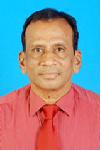
Biography:
N.V.Vighnesam is currently working as Professor at Dayanandasagar College of Engineering, Bangalore, India. He holds his M.Sc. from Andhra University and Ph.D. from Indian Institute of Technology, Bombay, India. He worked as Head, Orbit Dynamics Division, Flight Dynamics Group, ISRO Satellite Centre. He was responsible for design and development of orbit determination system for all ISRO Satellites. He has published more than 65 technical papers.
Abstract:
India’s first Moon mission (Chandrayaan-1) and Mars Orbiter Mission (MOM) carrying several scientific instruments for the purpose of expanding scientific knowledge about the Moon and Mars were launched in October 2008 and November 2013 respectively. The spacecrafts were put into their target orbits by carrying out sequence of orbit maneuvers. Precise orbit determinations are carried out during each phase of the mission using tracking data from network of tracking stations configured for the mission. The determined orbital solutions are used for spacecraft navigation, mission planning, and science data processing. ISRO’s operational orbit determination program (ODP) used for low earth missions was suitably updated and validated before the launch of these missions. Orbit Determination methodology and the performance of Chandrayaan-1 and MOM orbit determination systems during initial phase of the mission along with achieved orbit determination accuracy in the early normal phase is presented.
Sergey I Ivashov
Bauman Moscow State Technical University
Russia
Title: Non-destructive testing of rocket fuel tank thermal insulation by holographic radar
Biography:
Sergey I Ivashov completed PhD from Space Research faculty, Moscow Institute of Physics & Technology, with honours in 1972 and as a Post-graduate student he had successfully submitted the thesis for a PhD degree in 1975. He worked as a Scientific Researcher in rocket industry of the USSR in 1975-1977. Since 1977 up to 2000 he had been working in the Central Scientific and Research Institute of Radio & Electronic systems, Moscow, as a Senior Scientific Fellow and thereafter he had been promoted to Head of Laboratory. From January 2001 up to now he is the Head of the Remote Sensing Laboratory at the Bauman Moscow State Technical University, Moscow. His latest research relates to NDT&E of thermal insulation of rocket cryogenic fuel tanks by holographic radar. Other scientific interests are connected with holographic subsurface radar design and its applications for searching of bugging devices and civil construction engineering. He was rewarded with the Russian Federation government's prize in the field of science and technology for creation of the RASCAN holographic radar technology. He is a member of Editorial Board of an International Journal “Sensing and Imagingâ€.
Abstract:
The Space Shuttle Columbia disaster occurred on February 1, 2003, killing all seven crew members. This and other incidents (e.g. with the Russian return vehicle which fortunately did not lead to catastrophic consequences) have aroused interest in the development of new methods for non-destructive testing of insulation and thermal protection coatings of spacecrafts and fuel tanks. In the opinion of NASA investigators, one cause of the Columbia disaster was defects in the thermal protection coating of the shuttle’s external fuel tank containing cryogenic components. To reduce fuel vaporization and prevent icing of the tank surface which could damage the shuttle, the tank is covered with insulating polyurethane foam. Methods of ultrasonic diagnostics, which are widely applied for non-destructive testing of different constructions, are ineffective for foam insulation due to polyurethane's high porosity, which leads to high levels of acoustic attenuation. Similar considerations apply to the silicate fiber tiles that shield the outer surfaces of the USA Space Shuttle and Russian Buran. High porosity of the fiber tiles also produces incoherent scattering and attenuation. Microwave diagnostics using holographic subsurface radars could be a good alternative to ultrasonic testing. The basic advantage of microwave in comparison with ultrasonic methods is the fundamental difference in physical properties effecting the propagation of electromagnetic versus acoustic waves in heterogeneous media. Electromagnetic waves reflect from heterogeneities only when their dielectric contrast is sufficient. Thus, electromagnetic waves propagate practically without loss in foam insulation in which the matrix polyurethane has approximately the same permittivity as the air in the pores. A new method for using the holographic subsurface radar RASCAN 5/15000 to reveal internal defects of foam materials was proposed, and experiments on models of thermal insulation coatings were performed. The experimental results were displayed in the form of radar images on which defects in the heat insulation were shown to provide a good contrast and effective detection.
Natalia Petrova
Kazan Federal University
Russia
Title: Results of computer simulating the lunar physical liberation for lunar polar telescope

Biography:
Natalia Petrova has completed her PhD in Pulkovo Astronomical Observatory from Saint Petersburg, Russia. Her investigations were connected with theoretical description of the lunar rotation. She worked in Japan in SELENE-mission data processing as the Invited Researcher. At present, she has been elected as the Docent at the Computer Sciences Department at the Kazan Power Engineering University. Simultaneously she works as the Senior Researcher at the Kazan Federal University. She has published more than 30 papers in reputed journals.
Abstract:
The study of lunar rotation (physical libration) gives reach information about the lunar interior because of this the space experiments to pose on the lunar polar zone a small optical telescope are planned in Russia and in Japan. The purpose of the experiment was to detect the lunar physical liberation with millisecond accuracy. Computer simulation of these future observations is being done with the purpose of optimizing the observations of effective placement of measuring system on the lunar surface and testing of sensitivity of new observations to various features of the lunar interior structure. The software for the selection of stars and reduction of their coordination onto the period of observations was developed at the simulation, the tracks for the selected stars are constructed and analyzed and their sensitivity to the internal characteristics of the lunar body, in the first place, to the seleno-potential coefficients, was tested. Inverse problem of lunar physical liberation was formulated and solved. It was shown that seleno-graphic coordinates of polar stars were insensitive to longitudinal liberations ï´(t). Comparing coordinates calculated for two models were a rigid and deformable moon which is carried out and the components sensitive to love number K2 were revealed. Analytical theory of physical liberation was a very convenient tool for modeling the upcoming observations.

Biography:
Akano Yhokha has completed her PhD this year only at the age of 29 years from National Central University, Taiwan ROC. She has received her M.Sc. degree in Geology from the Department of Geology, Kumaun University, Nainital, India in the year 2008. She now focuses her research field in InSAR, crustal deformation and neotectonics activity in Indian Himalayan. She has published just 2 papers in reputed journals and about 9 conference papers.
Abstract:
The Himalaya and adjoining Ganga (also called Gangetic) plain are traversed by a number of neotectonically active longitudinal and transverse faults. However, the pattern and extent of present day slip rate along these faults is not yet well known. We herein present the results of our investigations directed in this direction. Surface deformations induced by active faults during a period of three years from August 2008 to August 2010 in the southern part of Uttarakhand state of India have been monitored. Multidate ENVISAT radar images of the area have been analyzed by applying the lastest Interferometric Synthetic Aperture Radar (InSAR) remote sensing techniques of Persistent Scatterer Interferometry (PSI) and Atmospheric Correction InSAR (ACI) using the MODIS data. Both the PSI and ACI techniques were found capable of extracting valuable surface information despite the natural challenges of vegetal cover and mountain terrain. The study revealed some conspicuous surface deformation patterns, which are related to active movements along some of the major faults/thrusts of the area, e.g., the Himalayan Frontal Thrust (HFT) and the transverse Garampano-Kathgodam Fault (G-KF). The G-KF acts as a segment boundary fault, dividing the study area into two distinct part with relative subsidence on the east and uplift in the west. Based on our presumption about the G-KF, a generalised tectonic model of the study area has been created. The study has provided a better understanding of the active tectonics of the area

Biography:
Xiaoxin Ye is a PhD from Department of Materials Science and Engineering, Tsinghua University, China. His research fields involve the biomedical titanium alloy processing/characterization, surface modification, mechanical/corrosion/biocompatibility property. His research is currently about electro pulsing-assisted processing and characterization of titanium alloy. Electro pulsing ultrasonic striking and electro pulsing-induced topographical oxidation have been also brought in to modify the materials surface for improving the micro hardness, corrosion resistance and biocompatibility. His research interests include green materials processing, surface coating, nanomaterials, energy materials and biomaterials.
Abstract:
The effects of electro pulsing induced gradient topographic oxide coating of Ti-Al-V alloy matrix strips on the fibroblast adhesion and growth were investigated. The goal in biomaterial surface modification was to possess desired recognition and specificity through modifying its surface condition like topological structure. Here we developed a unique strategy of high-energy electro pulsing treatment (EPT) for manipulating surface gradient bio-functionalization of basal textured Ti-6Al-4V alloy strips with the surface gradient topographic oxide coating, which brings in the gradient distribution of surface conditions including matrix alloy, ordinary TiO2 film and TiO2 microwaves on a single strip. High-energy electro pulse is frequently used as an electrically-treated method in improving the materials microstructure and mechanical property. This paper reports firstly the surface modification under EPT aiming to improve the biocompatibility, which will meet the demand of biomaterials in different parts of human beings. Novel TiO2 microwaves topological structure on the materials surface resulted in better biocompatibility with more active fibroblast bio-reaction including higher cells viability, better physiological morphology and stronger adhesion binding, which is ascribed to surface chemical components, surface energy and specific surface area under EPT manipulation. The key role of forming TiO2 microwaves structure solely under EPT is the selective effect of the electro pulses going through the textured specimen, which thus builds a selective growth of the oxide and forms the microwaves topological structure on the materials surface. The positive contributions of EPT in the thermodynamics and kinetics of oxide coatings growth are attributed to the reduction of nucleation energy barrier and acceleration of atomic diffusion. Thus, the gradient functionalization of biomaterials can be tuned over several seconds EPT in the titanium alloys, opening an energy-saving and high-efficiency door to diverse biomedical applications including the tissue engineering and biological interfaces.
Alexander M Krot
United Institute of Informatics Problems of National Academy of Sciences
Belarus
Title: The universal stellar law and its application to the explanation of stability and forms of planetary orbits

Biography:
Alexander M Krot, Professor, DSc is a Head of the Laboratory of Self-Organization System Modeling at the United Institute of Informatics Problems of the National Academy of Sciences of Belarus. He graduated from the Belarusian State University, Department of Radiophysics in 1982. He received PhD in 1985, then degree of Doctor of Sciences (DSc) in 1991 and became Professor in 1997. He has published 275 scientific works including 3 monographs and more than 60 articles in refereed journals.
Abstract:
This work considers the universal stellar law (USL) for explanation of stabilities and forms of planetary orbits in extrasolar systems based on the statistical theory of gravitating spheroidal bodies. It shows that knowledge of some orbital characteristics for multi-planet extrasolar systems refines own parameters of stars based on the combined 3rd Kepler’s law with universal stellar law (3KL-USL). The proposed 3KL-USL explains the stability of planetary orbits in the extrasolar systems entirely and predicts statistical oscillations of the orbital angular velocity of rotation of planets around stars. This work applies the statistical theory of gravitating spheroidal bodies to explore forms of planetary orbits with regard to the Alfvén’s oscillating forces in the Solar system as well as other exoplanetary systems. It explains an origin of Alfvén’s radial and axial oscillations modifying forms of planetary orbits within the framework of the statistical theory of gravitating spheroidal bodies. This work finds that temporal deviation of the gravitational compression function of a spherically symmetricalspheroidal body (under the condition of its mechanical quasi equilibrium) induces the additional periodic force. In turn, as shown here if the additional periodic force becomes counter balance to the gravitational force then the principle of anchoring mechanism is realized in extrasolar systems, i.e. the stability of planetary orbits occurs. The work also notes that spatial deviation of gravitational potential of the rotating spheroidal body from spherically symmetrical one implies the difference of values of the radial and the axial orbital oscillations (even in the case of its mechanical equilibrium).
Valery Korepanov
Lviv Center of Institute for Space Research
Ukraine
Title: Miniature scientific-grade electromagnetic sensors for cubesats
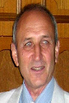
Biography:
Valery Korepanov is a Scientific Director of Lviv Centre of Institute of Space Research of NASU and SSAU. He got his PhD degree in Electromagnetic Measurements in Lviv Polytechnical Institute in 1970 and Habilitation of PhD in Geophysics in Institute of Physics of the Earth (Moscow) in 1991. He has more than 500 publications. His area of interests are; Development of theoretical and methodological aspects of electric and magnetic fields’ investigations in different media: space plasma, marine water and on-land, study of electromagnetic precursors of natural hazards, design and manufacturing of different types of magnetometers and electrometers.
Abstract:
The mini-, micro- and nanosatellites (including cubesats) became the popular way to get access to the scientific experiments in space for universities and small companies. There are several successful examples of the development and manufacturing of cubesats in the universities throughout the world and some of them offer well designed sophisticated basic structure with attitude control and location determination facilities and enough informative telemetry link. Still one advantage of cubesats is, relatively low launch cost – normally, they are launched in a swarm as piggy-back payload. The most complicated problem for the realization of scientific experiments onboard cubesats remains, the development of small and light but enough sensitive sensors. Because of this the majority of cubesats launches, as far as the author could find it in available publications, are aimed at the technology demonstration missions, the goals of which are mostly the tryout of advanced cubesats service systems and not the measurements of space plasma parameters with necessary for scientific tasks solution sensitivity threshold. The present report describes the new design of miniature three-component sensors for measurements of DC and AC magnetic field and possible extension to measure electric field in space plasma which is good enough for scientific research technical parameters. Their parameters, application example and test results are discussed.
Claudiu-Lucian Prioroc
University of Turku
Finland
Title: Stabilizing satellite relative motion using low thrust nonlinear time-delay feedback control

Biography:
Claudiu-Lucian Prioroc has completed his PhD from University “Politechnica†of Bucharest with the dissertation titled Small satellite attitude determination. Between 2010 and 2012 he worked on the ESA educational ESMO mission as the team leader of the Attitude and Orbit Control System (AOCS) team in Bucharest. During this period he took part in internships at SSTL and Advance Space Concepts Laboratory Strathclyde University, where he worked on the development of the AOCS. Starting from 2012 he is an AstroNet-II Marie Curie Research Fellow at University of Turku, Finland. The main focus of research is directed towards satellite formation flying and relative motion.
Abstract:
This paper describes the development of a stabilizing control method for the relative motion between two satellites using continues low thrust. The relative motion of two satellites is considered in the two body problem with J2 perturbation and it is described by the Clohessy–Wiltshire equations. The satellites’ orbits are considered to have slightly different periods and inclinations, thus the relative motion between them will not be bounded. To stabilize the relative motion, time delay feedback control is used. The time delay feedback control eliminates the necessity of having a pre-defined reference relative motion to be tracked by the follower satellite, by using the previous relative orbit as a reference for tracking. First we consider the stability in the sense of Lyapunov. Once the Lyapunov function is found, a first order sliding mode time delay feedback controller is developed to stabilize the relative motion, based on the free variable transformation, Lyapunov transformation and considering that the J2 perturbation is bounded. Numerical simulations are used to compare the performance of the developed nonlinear time delay feedback controller with linear feedback time delay control as well as with PD controller. Also it is shown that by using the time delay feedback control one can design artificial reference relative orbits that can be tracked by using feedback control laws. Numerical simulation results prove the effectiveness of bounding the relative motion for long periods of time using the proposed stabilizing method.
George Kordzakhia
Javakhishvili Tbilisi State University
Georgia
Title: The Study of Glaciers Based on Satellite Earth Observations and Snow-ice Boundary Determination
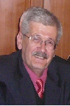
Biography:
George Kordzakhia has completed his PhD at the age of 28 years from Hydrometeorological Centre, Moscow and postdoctoral studies in the Hydrometeorological institute of the Technical university of Georgia. Dr. George Kordzakhia’s professional interests are concentrated on the researches of atmosphere dynamics, satellite earth observations; climate change, hydrology, glaciology oceanology. Participated in several international programmes (UNDP, EC FPs, NATO Programme for Peace etc.). Participated in several international conferences, symposiums, sessions, WGs work of several international organizations (WMO, IPCC, UNEP etc). Member of the several international organizations at national/regional levels. He has published more than 25 papers in reputed journals.
Abstract:
The variations in glaciers are the important indicators of regional climate change. The research of glacier melting is important for studies of sea/ocean level changes. Satellites earth observations (EO) are powerfool tool that allow creation of glacier’s data sets with needed regularity. The accurate determination of the glaciers characteristics needs precize definition of glaciers counturs. Glaciers contours automatic determination is based on different spectral properties between the ice and snow by a combination of different spectral channels from visible and infrared range.Satellite data processing, first of all, means radiometric calibration of the satellite specific channels. For glacier research it is necessary to use: i. Slope gradient calculations on the bases of Aster DEM; ii. Slope exposure and the illumination of the highlights of the glacier region. Article presents results of determination of snow line altitude from satellite (EO) data for certain glaciers of Great Caucasus, in the eastern part of Georgia. Landsat-8 OLI TIRS images for the end of ablation period were used to identify snow line position. Snow line altitude was extracted from Advanced Spaceborne Thermal Emission and Reflection Radiometer digital elevation model (Aster DEM). For simplicity the glacier are classified into three classes, which correspond: the first and second - accumulation zone, third - the ablation zone. The border line between accumulation and ablation zones refers to snow line. Using the DEM glacier, band ratios and NDSI calculations snow line heights are determined.
Yavor Shopov
Sofia University
Bulgaria
Title: Extended microsatellite up/down link using transmission through a GEO satellite
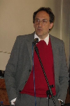
Biography:
Yavor Shopov has completed his PhD from Sofia University and Postdoctoral studies from McMaster University. He is Head of the University Centre for Space Research & Technologies, Sofia University. He is supervisor of Master programme on Aerospace engineering of small satellites and co-supervisor of the Master programme on Space research of Sofia University. He has published more than 100 papers in reputed journals and has been serving as an Editorial Board Member of repute. His fields of research: Applications of satellites in applied and fundamental research, space and solar terrestrial physics, development of optical and spectral equipment for multispectral imaging.
Abstract:
Hyperspectral imaging from satellites produces vast amount of data, which is extremely hard to download. To extend the download period, large satellites use extended up/down link time by transferring of their data through a GEO satellite when their orbital position does not allow direct connection with their ground station. Recent state- of –the- art of development of micro satellites still does not apply this innovative technology. Here we discuss possibilities to apply such technology in the micro satellites design. It will allow obtaining of high resolution multispectral images or video from micro satellites. We are designing a satellite bus “OK Express†with mass <35kg, size 330x330x630 mm, powered by silicone cell rotating panels with power ~ 160W. It has telemetry, sun sensor, earth sensor, magnetometer, active stabilization with reaction wheels, magnetic coils and propulsion with hot gas micro thruster. Its extended download period is produced by steerable phase array antennas (with large coverage) pointing to a GEOs at, steerable ground pointing phase array antennas (with large coverage), a differential GNSS receiver for position and attitude determination and high speed S-band data up/down link - DVB S2. DVB S2 is a new broadband satellite technology for broadcasting of digital video or TV signal with higher efficiency of utilization of the spectrum. This micro satellite will record high-resolution images and video with ~ 6m GSD at visual wavelengths and ~ 20 m GSD at thermal infrared imaging from 600km orbit.

Biography:
K V Suryabhagavan is an Assistant Professor at the Remote Sensing and GIS in School of Earth Sciences, Addis Ababa University, Ethiopia. He received his BSc and MSc degrees in Geology from Andhra University in 1992 and 1994 respectively and his PhD degree in Geology from Andhra University in 2001. He received his MTech in Remote Sensing and GIS from IIRS, Dehradun in 2004. He mainly deals with the application of remote sensing for geology, climate change and vegetation dynamics. He has published more than 25 papers in reputed journals and has been serving as an Editorial Board Member.
Abstract:
The successes of military operations depend on how decision makers and planners evaluate the battle field prior to the deployment of armed forces on the ground. Off-road trafficability of the terrain is one of the key military operations that should be provided for military commanders at all levels in a real time scenario. This paper evaluates the state-of-the-art of spatial modeling techniques for off-road trafficability of wheeled military vehicles using GIS and remote sensing techniques. The expert systems and Weighted Overlay Analysis (WOA) were compared for modeling off-road trafficability. Similar data layers of land-use/land-cover, soil, slope, rivers and manmade obstacles were used to generate the off-road trafficability maps from the two methods. The goal of comparison of these decision making tools was to test whether data in an ordinal scale from the WOA to produce comparable result with the Expert system that use hierarchy of decisions. There was a strong spatial correspondence between the outputs from the two methods with a spatial correlation of 0.78. A zonal cross tabulation between results showed that the two methods strongly accord to each other in the SLOW-GO and NO-GO trafficability classes with 86% and 75% summarized in the same zone, respectively. There was also a significant disagreement between the two methods in the GO and VERY SLOW-GO classes with only 53% and 31% summarized in the same zone, respectively. This study as a whole can explore variations of these two methods of the military planning and its relationship with existing roads.
Benhard Sitohang
Institute of Technology BandungIndonesia
Indonesia
Title: Finding new fishing grounds using sea surface temperature data from satellite remote sensing in case indonesian waters
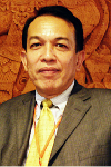
Biography:
Benhard Sitohang has finished his master (informatics) in 1980 and Ph.D degree (informatics) in 1983, both from Universite de Sciences et Techniques et Languedoc-Montpellier II, France. From 1984, he has been working at Institut Teknologi Bandung (ITB). Since Ph.D degree, he teach and doing research in Database, Non-Alphanumeric Data processing, and Big Data.
Abstract:
Indonesian marine fisheries potential of approximately 65 million tons per year and become the largest in the world, but only about 15 percent exploited (10.5 tons per year). The fish taken from waters that have exceeded the maximum sustainable yield. This is a challenge for us to find new fishing grounds. Remote sensing satellite data utilization is the solution to predict the fishing grounds in Indonesian waters. Fishing grounds can be predicted by observing the phenomenon of upwelling in the ocean waters. Upwelling phenomenon can be detected by analyzing sea surface temperature (SST) data acquired by satellites such as NOAA and Terra/Aqua. Several algorithms have been developed to process satellite data resulting SST similar to actual SST. We develop a model of upwelling detection using SST data from satellites Terra / Aqua MODIS Level 3. We exploit the concept spatiogram to determine upwelling region of interest (RoI) in the study area, then use the structure growing to ensure that the RoI is a valid upwelling. We define indicators upwelling areas where there is a temperature difference of 0.5oC within a radius of 3 km, then all pixels in a radius of 3 km (12 pixels) from the center of mass must be taken into account. We assume the RoI is determined as far as 21 km which is equivalent to 84 pixels. We are still working on intensive research; the results are highly dependent on the quality of the satellite data used, in particular the case of cloud cover.
V K Srivastava
Maharashtra Forest Department
India
Title: Managing forest through working plan prepared using satellite data and GIS: A case study of Pune forest division, Maharashtra, India

Biography:
V K Srivastava obtained PhD in Ecology in 1979 from Saurashtra University, Rajkot, but started carrier as Research Officer at Forest Research Institute and Colleges, Dehra Dun, India in 1977. Thereafter, he joined Space Applications Centre, Ahmadabad, as a Subject Matter Specialist (Forestry) in 1983 and continued till June 2006. Here, he developed remote sensing methodologies for Forestry. Subsequently, he joined National Remote Sensing Centre, Hyderabad and continued till superannuation in March 2012. Here, he worked on Land use/ cover dynamics in Indian River basins. He has published 70 research papers in various journals, seminars and symposia, scientific and technical reports.
Abstract:
Forest management in India is carried out as per the guidelines prescribed in the Working Plan of a division, at compartment level which is the smallest management unit. Forest working plan is a written document prescribing the management practices in view of the forest health, general land use, anthropogenic and topographic features in a forest division. The working plan is implemented over a period of ten to fifteen years. At the end of the plan period, the working plan is either revised or rewritten owing to the existing variability both in crop and other conditions. Preparing or revising a forest working plan conventionally is a costly affair. It takes about two to three years to prepare a working plan of a forest division. Satellite data has been found to be of much use to derive thematic maps at desired scale. These maps along with other collateral data can be integrated in GIS. A query can be subsequently be made to allocate area for specific management practice. A working plan thus prepared is cost effective. Realizing the importance of geomatices, Maharashtra Forest Department joined us in revising/preparing the Forest Working Plan for Pune forest division as a pilot project. The present study describes the methodology to derive various thematic maps from satellite data at desired scale and their integration with other collateral maps in GIS. It also elucidates the criteria for defining working circles. For each working circle, a management practice was also prescribed which was approved by the state for implementation.
Archana Nandibewoor
Visvesvaraya Technological University
India
Title: Remote monitoring of agricultural crops using the application of spectral imaging- spectral remote sensing

Biography:
Archana Nandibewoor is currently working as Assistant Professor in the Department of CSE, and Deputy COE, SDM College of Engineering and Technology, Dharwad, Karnataka India. She holds her MTech in CSE and BE in ECE from Visvesvaraya Technological University, Belgaum, India. She is currently pursuing her PhD in the field of Image Processing-“Satellite Remote sensingâ€. She has more than 05 Scientific Papers in National and International Peer Reviewed Journals and conference proceedings to her credit. Her work is indexed and cited in various peer reviewed journals like IEEE, ELSEIVIER, etc. She has successfully Guided 06 Students for MTech Degree and 15 for BE Degree. She has travelled countries like London, Germany, Belgium, France, for presenting research papers in conferences. She is member of International Association of Engineers (IAENG).
Abstract:
One of the emerging technologies that can be used to study the rate of vegetation is spectral remote sensing. This study includes two types of image data - Hyper spectral satellite image and Multi spectral satellite image. Hyper spectral satellite image data was used to calculate different spectral indices. The study on spectral indices which show some significant changes with variation in vegetation are discussed. These spectral indices normalized differential vegetation index (NDVI), simple Ratio pigment index (SRPI), red edge (Clrededge) and SG (VI green) are used to monitor the vegetation. All these spectral indices stated above showed significant changes with change in rate of chlorophyll and nitrogen concentration. The graph plotted for different wavelengths verses the reflectance values showed different curves for change in the area. Hence satellite images can give lot of information that needs to be explored. Three datasets of Multi spectral satellite image data (7 Dec 2013, 8 Jan 2014, 9 Feb 2014) have been acquired from Land sat 8 OLI (Operational Land Imager)/TIRS (Thermal Infrared Sensor) satellite periodically by providing appropriate path and row in order to assess the growing stages of crop. The acquired images are in the form of a set of bands. Appropriate bands are combined to form a multispectral RGB image. A spectral line graph is plotted by using reflectance data of the specified area of crop. It is found that there is high reflectance in green bands during growing stage and this value gets decreased during the near harvesting stage. Also NDVI value has been calculated at each stage. The status of the maize crop has been concluded by experimental analysis at Laboratory and by using NDVI values. Finally, it is observed that the crops are healthy.

Biography:
Abstract:
As spacecraft operators continue to launch more satellites in LEO, MEO, GEO these orbits becomes very dense with huge number of working satellites, non-working and space debris. This may affect future space exploration. Of course as per today’s situation we need satellites for various purposes like Communication, GPS, Military, Weather and etc. Instead of sending new and separate satellites for every fields. We can send a common satellite with major payloads or otherwise we can reuse those old nonworking satellites. This can reduce space debris, clean space, etc. Here we are proposing an idea which can help to keep our space clean. Our idea is to make common satellite for all fields. Our project is Multitudinous Objective Satellite it as three phases 1st Phase: MOS-A – It is a scientific research satellite which will help us to Know about earth atmosphere, climate, electron & photon Counts in atmosphere, change weather, imaging, monitor Crops radar and tracking space debris, etc. 2nd Phase: MOS-B - It is mainly used for tele-communication, navigation, etc. 3rd Phase: It is reuse the old satellites Our main objective of this MOS project is to do more scientific researches and by sending MOS-A & MOS-B we can get more resources and this can reduce space traffic in future. Advantages of our project clean space, it can keep future space exploration safe, instead of sending many satellites in single field we can send MOS satellite it saves more budgets.
Amit Patel
Charotar University of Science & Technology
India
Title: Onboard Intelligence system development for Remote sensing Application

Biography:
Amit Patel is an Assistant Professor at Charotar University of Science & Technology (CHARUSAT), He has completed his M. Tech in April, 2008 from Gujarat University and he is presently doing Ph.D. in the field of Microwave Passive component design from CHARUSAT University, Changa, and Gujarat, India. I have submitted my thesis for review. Currently, he is deputed in CHARUSAT Space Technology Center as Researcher. Here, In CHARUSAT Space Technology Center we are designing and developing Experimental Payloads as well as our university Small Satellite. He has published more than 20 research papers in well reputed journal and conferences.
Abstract:
In Remote sensing satellites, information is transmitted in store and forward mode, which acquired by sensors (camera) imagery stored on board till ground stations come not within view. Satellite imaging sensors generate mass volumes of data at very high speeds. On the other hand, storage capacity and communication bandwidth are crucial parameters for satellite resources and that decided cost and power requirements. By processing on the data in terms of compression and detection of objects which are required based on applications at onboard and only those data are transmitted at ground level is create an efficient utilization of resource. Here, we have proposed an algorithm based on ratio and threshold method which work on color images that work very efficiently for discriminating different objects of earth as well as clouds. Accuracy of algorithm is more than 97% and gives better PSNR (peak signal to noise ratio). Reconfigurable computing technology, which combines the flexibility of traditional microprocessors with the performance of ASIC devices, is very promising for space applications. FPGA is used for verification and testing of the proposed algorithm, the results are accurate and matched with the simulation results.
Keyur Mahant
Charotar University of Science & Technology
India
Title: Back-end realization of AIS protocol using FPGA

Biography:
Keyur Mahant is an Assistant Professor at Charotar University of Science & Technology (CHARUSAT). He has completed his M.Tech in April, 2011 from CHARUSAT University, Changa, Gujarat, India. Currently, he is deputed in CHARUSAT Space Technology Center as Researcher. Here, In CHARUSAT Space Technology Center we are designing and developing Experimental Payloads as well as our university Small Satellite.
Abstract:
This research and development paper gives the information about AIS protocol, its applications and implementation of the protocol in Field Programmable Gate Array (FPGA). Automatic Identification System (AIS) protocol is a scheme for generating a self-organized data network between marine vessels. AIS can be used for Collision avoidance, Search & rescue, Fishing Fleet Monitoring and Control, Vessel traffic services and aids to navigation. AIS Transponder on ship broadcast information regarding its speed, position and navigational status at regular interval using VHF transponder at 161.975 MHz and 162.025 MHz’s These speed, position and direction information is generated from the ship's navigational sensors, navigation satellite system (GNSS) receiver and gyrocompass. Other information like name of the vessel and VHF call sign is programmed when installing the equipment and it is also transmitted at regular intervals. This research paper proposes a technique for implementation of AIS protocol in FPGA. In this paper FPGA is used for processing the data because this technology gives flexible designs with relatively short design time and at the same time maintain some of the good properties of ASICs, such as relatively high performance and low power consumption.

Biography:
P S Roy is a Chair Professor in University of Hyderabad, India. He has 37 years of experience in remote sensing and geospatial science with ISRO. He has completed his PhD. He has been involved in research and academics in the field of spatial analysis and modeling. He is Fellow of National Academy of Science, India (FNASc) and National Academy of Agriculture Sciences (NASI). He has published more than >150 research papers in reputed journals and has been serving as an editorial board member of repute.
Abstract:
India has experienced major land use and land cover Change (LULCC) over the past few decades. It has resulted in changes in the natural ecosystems and habitats supporting the rich biodiversity and threatening conservation efforts. For the first time satellite remote sensing has been used to prepare a seamless national level vegetation type (2005) and land use and land cover (LULC) maps (at decadal intervals for 1985, 1995 and 2005) has been prepared and for understanding the long-term usage patterns of natural resources and facilitating sustainable management to plan, monitor and evaluate development. The study characterizes and maps detailed vegetation type distribution in the country in terms of occurrence and distribution, area, percentage of protected area (PA) covered by each vegetation type, range of elevation, mean annual temperature and precipitation over the past 100 years. The LULC maps follow the classification to ensure compatibility with other global/regional LULC datasets for comparison and integration. The study highlights the changes i.e., loss of forest cover in central and northeast India, increase of cropland area in western India, growth of peri-urban area, and relative increase in plantations. The study compares national vegetation and decadal LULC maps with Glob Cover, Hold ridge’s life zone map and potential natural vegetation (PNV) maps) and global LULC products (Glob Cover and MODIS) respectively, using 15,565 ground control points to assess the accuracy (>90%). The database is used for national and regional studies on land dynamics, drivers of change and climate change research. The digital vegetation map is now available through a web portal (http://bis.iirs.gov.in).
- New Satellite Technologies For Cleaner Low Orbits
Applications of Satellite Technology
Satellite Challenges and Solutions
Integral Manoeuvres for the Future

Chair
Ruisong Xu
Chinese Academy of Sciences, China

Co-Chair
Antonio G Accettura
OHB System AG, Germany
Session Introduction
Atri Dutta
Wichita State University
USA
Title: Algorithms for optimal scheduling of multiple spacecraft maneuvers
Time : 10:00-10:25
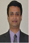
Biography:
Atri Dutta is an Assistant Professor in Aerospace Engineering at Wichita State University. Prior to his joining in WSU, he was a Post-doctoral Research Associate at Princeton University and a Research Engineer at Georgia Institute of Technology. All his degrees are in aerospace engineering which includes; Doctor of Philosophy, Master of Science from Georgia Institute of Technology and Bachelor of Technology from Indian Institute of Technology, Kharagpur, India. His research interests are optimal control, space dynamics, optimization and spacecraft design.
Abstract:
Future space missions like on-orbit refueling of satellite constellations or on-orbit debris removal will require the optimization of multiple spacecraft maneuvers. Usually, such a mission requires the determination of an optimal sequence of targets visited by the servicing spacecraft, along with the computation of the optimal trajectory for each orbital transfer. Some problems, such as Peer-to-Peer (P2P) refueling, requires the determination of satellites that make the maneuvers and the optimal trajectory for each maneuvering satellite. Both classes of problems are challenging, which involve a mixture of continuous and discrete decision variables, and belong to the NP-hard class of optimization problems that are difficult to solve. Recently, novel algorithms inspired by the Greedy Random Adaptive Search Procedures (GRASP) have been developed to solve mixed integer nonlinear programming problems that form the crux of both classes of spacecraft maneuver planning problems. GRASP methodology has been widely studied in the field of combinatorial optimization, and have been demonstrated to efficiently compute good-quality sub-optimal solutions for NP-hard assignment problems; these procedures also provide the benefit of parallelization. These algorithms use a two-step methodology: The first step involves creation of basic feasible solutions to the problem using a greedy, random and adaptive methodology, while the second step involves performing local search about the generated basic feasible solution. The solutions generated by the GRASP based algorithms are sub-optimal; however, for P2P refueling problems, they have already shown to compute optimal or near-optimal set of satellite, which pairs with the minimum fuel expenditure during the mission.
Antonio G Accettura
OHB System AG
Germany
Title: Future telecomsats as a new paradigm for satellite industries and operators
Time : 10:25-10:50

Biography:
Antonio G Accettura has a MS in Aerospace Engineering from University of Rome “La Sapienza”. He is Project Procurement Manager for Galileo in OHB, a premier satellite manufacturer. Previously he worked in AVIO, Arianespace, ELV and Alenia covering several positions from technical to business development domains. He has published more than 40 papers in reputed journals and conferences and has published a book in the frame of advanced space propulsion technologies.
Abstract:
In Europe OHB is the third large satellite manufacturer. There are currently 33 satellites under manufacturing, and 10 companies are part of the OHB Group. There is not a single growth factor that contributed OHB becoming one of the most successful space industries present in Europe and one of the most interesting to work with: a lean organization, a focused long-term vision, a system-oriented team, and an international mindset. After this phase that leads OHB among the satellite manufacturer leaders, the revolution currently ongoing is related to the telecommunication satellites. What we are trying to implement, and we are well on track, is a new paradigm based on few strategic lines that can be summarized as follows: 1. Standard platforms for all telecom sats 2. Use of COTS available on the market 3. Electric propulsion as a basic configuration for future satellites 4. Development of Electrasatellite, taking benefit from equipment developed on last projects What is currently under development with Electra is a brand new concept, not paper based but exactly substantiated with a strong technical background and will be shown in the present paper. The telecom sats fleet currently under development at OHB will be also presented, as well as the roadmap for a unified satellite platform that could match satellite capabilities and operator needs. This mutual growth will provide an exceptional added value to the market, including disclosing new opportunities for both governmental and commercial customers.
Claudio Maccone
International Academy of Astronautics (IAA)
Italy
Title: Protected Antipode Circle (PAC) on the Farside of the Moon
Time : 11:10-11:35
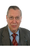
Biography:
Claudio Maccone is an Italian SETI astronomer, space scientist and mathematician. In 2002 he was awarded the “Giordano Bruno Award” by the SETI League, for his efforts to establish a radio observatory on the farside of the Moon. In 2010 he was appointed Technical Director for Scientific Space exploration by the International Academy of Astronautics. Since 2012, he has chaired the SETI Permanent Committee of the International Academy of Astronautics, succeeding Seth Shostak of the SETI Institute, who held that position from 2002 to 2012. He obtained his PhD at the Department of Mathematics of King's College London in 1980. He then joined the Space Systems Group of Aeritalia in Turin as a technical expert for the design of artificial satellites, and got involved in the design of space missions. In 2000 he was elected as Co-Vice Chair of the SETI Committee of the IAA. He has published over 100 scientific and technical papers, most of them in “Acta Astronautica.” In 2010, he was appointed Technical Director of Scientific Space Missions for the International Academy of Astronautics. In 2012, he became a founding member of the Advisory Council of the Institute for Interstellar Studies.
Abstract:
The international scientific community and especially the IAA (International Academy of Astronautics) have long been discussing the need to keep the Farside of the Moon free from man-made RFI (radio frequency interference). In fact, the center of the Farside, specifically crater Daedalus, is ideal to set up a future radio telescope (or phased array) to detect radio waves of all kinds that are impossible to detect on Earth because of the ever-growing RFI. Nobody, however, seems to have established a precise border for the circular region around the antipode of the Earth (i.e. zero latitude and 180° longitude both East and West) that should be Protected from wild human exploitation when several nations will have reached the capability of easy travel to the Moon. In this presentation we propose of PAC, the Protected Antipode Circle, centered around the antipode on the Farside and spanning an angle of 30° in longitude, in latitude, and in all radial direction from the antipode. There are sound scientific reasons for this: 1) PAC is the only area on the Farside that will never be reached by radiation emitted by future human space bases located at the L4 and L5 Lagrangian points of the Earth-Moon system; 2) PAC is the most shielded area of the Farside, with an expected attenuation of man-made RFI of 100 dB or higher; 3) PAC does not overlap with other areas of interest to human activity except for a minor common area with the Aitken Basin, the southern depression supposed to have been created 3.8 billion years ago during the “big wham” between the Earth and the Moon. In view of the unique features, we propose PAC to be officially recognized by the United Nations an International Protected Area, where no radio contamination by humans will possibly take place now and in the future for the benefit of all humankind.
Ruisong Xu
Chinese Academy of Sciences
China
Title: Remote sensing monitoring and driving force analysis of urban expansion in Guangzhou City, China
Time : 11:35-12:00
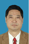
Biography:
Ruisong Xu is born in China on Autumn Provence, 1950. He is graduated in space and earth sciences department from Chinese Sciences and Technology University in 1976. He is a Dr. in geochemistry and a senior scientist in biogeochemical remote sensing in Guangzhou Institute of Geochemistry, Chinese Academy of Sciences between 1977 to now. There are more than 150 research papers of him has been published in SCI academy journal. His 7 research monographic has been published. He has been finished more than 30 national research programs in remote sensing application, geochemistry, nature resources, environment and ocean. He is a member of World ESCH expert group and a national scientist. He got a Denying Scientist award in 1993. He got 15 Chinese, USA, Japanese, Russia, Australia, European etc. patents. He has been awarded 16 Sciences and Technology awards from national of China.
Abstract:
Based on Land-satellite remote sensing data and by means of specific extraction and supervised classification of remote sensing information, a dynamic study was carried out on urban expansion of the built-up area of Guangzhou City, China in different periods. A detailed analysis was made of the area, orientation and rate of variation of urban expansion of Guangzhou City, China in the period of 23 years lasting from 1979 to 2002, and a model for urban expansion was proposed in this paper. As demonstrated by our research results, urban expansion of Guangzhou City, China is very fast with high speed development of the economy. In the 23 years period, the built-up area of Guangzhou City, China attains a net increase of 325.5 km2, and reaches 397.4 km2 in 2002, which is nearly 4.5 times of that in 1979 and means an annual average expansion of 14.2 km2 and an annual growth rate of 19.7%. The model of urban expansion in Guangzhou City, China is basically characterized by radial expansion centered on the old city town, which takes the form of expansion in rings, in layers and along major traffic routes. Here the rate of urban expansion varies in different periods, and is the most outstanding in various periods in the east of the city. The built-up area of Guangzhou City, China is highly correlated with the gross domestic product (GDP), total population, urban resident income and urban traffic of the city, which are the dominating driving factors for expansion of the built-up urban area of Guangzhou City, China.
Vladislav V Demyanov
Irkutsk State Transport University
Russia
Title: GNSS positioning availability control under space weather hazards
Time : 12:00-12:25

Biography:
Demyanov V V completed his PhD in Radio-physics at the age of 28 from Irkutsk State University and was graduated as a Doctor of Science in Radio-navigation at the age of 40 from Siberian Federal University. He is a Professor of Irkutsk State Transport University and Senior Researcher of Institute of Solar and Terrestrial Physics (Siberian Branch of Russian Academy of Science). He worked as Invited Researcher in Shanghai Astronomic Observatory. He has published more than 50 papers in reputed journals, prepared 3 monographs and 2 chapters of monographs. The main research interests are GNSS performance under Space Weather hazards, GNSS remote sensing and GNSS for transport applications.
Abstract:
A problem of real-time GNSS user positioning availability control under geomagnetic storms, solar radio flares and other irregular impacts is considered. A new methodology of positioning availability control under irregular external impacts is offered. The positioning availability value is defined as a full probability of event when we get a personal GNSS user’s required navigation parameters (RNP) taking in account the current Positioning Delusion of Precision (PDOP), ranging errors and positioning errors. On a basis of GNSS/LAAS network dataset we get current GNSS performance statistics, such as positioning error standard mean and standard deviation and a number of positioning failures within the observation period. The PDOP values are used in order to compute an ancillary alarm index of a probable sudden positioning deterioration under poor GNSS satellite vehicles (SV) geometry. The method can be recommended for some transportation applications which have strong RNP, such as aviation landing systems and automatic railroad traffic control.
Wael Ahmed Abonema
Helwan University
Egypt
Title: Enhancing LEED as a sustainable rating system by applying its regional priority for all environmental regions
Time : 12:25-12:50
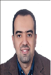
Biography:
Wael Abonema has completed his PhD in 2009 at the age of 35 years from Polytechnic of Athens and Helwan University. His master studies from Helwan University, Faculty of Fine Arts, and Architecture department. He is the Design director of Engineering Consultant Group. He has published more than 11 papers in reputed international conferences and journals. All his researches focused on sustainable design and enhancing architectural design tool using the artificial intelligence. In 2013, He got his Master of Business Administration (MBA) from International school of Scandinavia, Denmark. He has a European consultancy and membership in Technical Chamber of Greece (TEE)
Abstract:
Sustainable design nowadays is not an option for the construction industry all over the world; it becomes a mandatory because of environmental requirements. Big Countries all over the world have started in last decade of the twentieth century to create sustainable rating systems based on their environmental needs. The three pillars of sustainability which is environment, people and economy composite certain categories for each rating system. Those rating systems categories cover the project site, water consumption, Energy efficiency, planet atmosphere, construction regional material, and indoor quality. LEED as a rating system for sustainable design has started to be applied not just in the US but also in many countries in the Middle East and Egypt. LEED as sustainable rating system has a rigid category weights. The impact of this rigidity leads to unpractical situation, which is every part of the world suffers from certain lack of resources by the same amount, and it is not true. Countries are not the same in everything. For example in the Middle East, they have big area of desert and suffer from lack of potable water resources, but they have plenty of energy resources. Country like Japan lives on the opposite side. It means that each part of the world should have different category weights. That is the reason of creating many rating systems, but Regional priority as a category can make the balance for LEED to can modify all weights based on the region.
Tamer Mekky Ahmed Habib
National Authority for Remote Sensing and Space Sciences
Egypt
Title: Reliability and cost effectiveness of spacecraft attitude and orbit monitoring
Time : 13:40-14:05
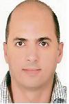
Biography:
Tamer Mekky Ahmed Habib has completed his PhD, MSc and BSc from Cairo University, Faculty of Engineering, Aerospace Department. He is the Head of Spacecraft Dynamics and Control Department. He has published 14 journal and conference papers in the field of spacecraft guidance, navigation, and control. He is currently a Researcher at the National Authority for Remote Sensing and Space Sciences. He is a Reviewer for the Aerospace science and Technology Journal, in addition to four journals.
Abstract:
This article reviews current state of the art reliability and cost effectiveness of spacecraft attitude and orbit monitoring. Failure analysis showed that more than 30% of spacecraft failures are due to attitude, orbit monitoring and control subsystem. Sometimes, the whole mission life time depends solely on this subsystem. Thus, spacecraft attitude and orbit monitoring subsystem design is considered to be challenge due to the high cost, high reliability requirements, limited power budget, processing budget and mass budgets usually associated with space missions. The monitoring system of spacecraft attitude and orbit consists of hardware and software components. This complicates the process of reliability calculation and implies the need for effective cost estimation methods.
Leshan Uggalla
University of South Wales
United Kingdom
Title: Mitigating the effects of rain-induced fading in Ka-band satellite video broadcast system using time diversity in concert with maximal ratio combining
Time : 14:05-14:30
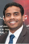
Biography:
Leshan Uggalla is a Doctoral Researcher in the area of satellite communications at University of South Wales, UK. His research interest focused on characterisation and prediction of propagation impairments on earth-space paths, design of Fade Mitigation Techniques for EHF satellite communication systems, design of satellite-integrated networks and similar areas. Also he is a qualified engineer with over 10 years of working experience in the telecommunication sector. This includes planning, installing and managing of a wide range of advanced telecom equipment's.
Abstract:
Steadily-increasing user demand for a wide range of high-quality video services delivered via satellite has driven broadcasters to move into the higher frequency bands in order to accommodate the necessary data rates. However, a major issue at these frequencies is the effect of severe rain-induced fading on link reliability, which requires that the system must be designed to implement mitigation techniques in order to achieve an acceptable quality-of-service. These techniques generally involve the use of adaptive modulation and data rates, together with various forms of diversity, switching or combining. During the presentation, we analyse and quantify the benefits of adding i) time diversity (TD) and ii) maximal ratio combining (MRC) to the widely used DVB-S2 standard. Our results, which are based on combining a) 3 years of satellite beacon propagation measurements from 2 UK sites; b) high-fidelity computer simulations of the DVB-S2 standard for a typical satellite-broadcast communications link; and c) our new TD / MRC technology, indicate that substantial improvements in data throughput and significant reductions in outage time are readily achievable.
Essayas Kaba Ayana
Columbia University
Columbia
Title: Estimating total suspended sediment (TSS) budget of a freshwater lake using remote sensing
Time : 14:30-14:55

Biography:
Essayas Kaba Ayana was born in 1971 and grew up in Addis Ababa, Ethiopia. After he completed high school at Entoto Academic, Technical and Vocational Secondary School, he joined the then Arba Minch Water Technology Institute in 1998. During his four year stay at the institute, he became interested in GIS and remote sensing supported hydrologic modeling. He got his Bachelor of Science degree in Hydraulic Engineering in 2002. He then became a faculty member at Bahir Dar University, Engineering Faculty. After working for three years he was awarded a Dutch scholarship to study GIS and remote sensing at the International Institute for Geo – Information Science and Earth Observation (ITC) in Enschede, the Netherlands and earned a master’s degree in integrated catchment and water resources management. In his MSc. research he evaluated the performance of radar altimetry data over Lake Tana, a source to the Blue Nile River. Up on return he served as chair of the Department of Water Resources Engineering at Bahir Dar University. In addition, he taught courses in the area of GIS and remote sensing. He then became a vice dean for the Engineering Faculty in 2009. He joined Cornell University in fall 2009 to start his Ph.D. in the Biological and Environmental Engineering Department.
Abstract:
Sediment plumes to freshwater lakes and reservoirs decreases storage volume, reduces sunlight penetration in lake water and degrade the productivity of the whole food web in the aquatic system, reduces zooplankton growth and makes water supply disinfection costly. Intensive sampling of either sediment concentration or turbidity on many locations is prohibitively expensive. Techniques using remotely sensed images have become increasingly effective in estimating total suspended solid and turbidity in open water bodies. Nevertheless these techniques use relationships of remotely sensed reflectance and sediment concentration which are site specific. In this study calibrated coefficients from literature are used to establish a global relationship that relates TSS and reflectance measured by MODIS in one of the stream flowing into a fresh water lake. Site correction is applied to the established relationship and TSS time series is constructed for other four inflowing streams flowing and a major outflowing river, the Blue Nile. Out flowing TSS from remote sensing is validated using TSS samples taken at outlet of the lake. The TSS budget of the lake indicated that in a given season nearly 64% of the TSS accumulates in the lake.
Yoshinari Minami
Advanced Science-Technology Research Organization
Japan
Title: Conceptual Design of Manned Space Transportation Vehicle Using Laser Thruster in Combination with H-II Rocket
Time : 14:55-15:20

Biography:
Yoshinari Minami received his BS Degree in Electrical Engineering from Ritsumeican University and eventually joined NEC Corporation after that. He has been engaged in the design and development of TT&C Sub-system and data handling system of many Japanese satellites in the space development division. After that, he has been engaged in the design and development of Japanese Experimental Module (JEM) in the Space Station Systems Division. He is now designated as an Administrative Director of Advanced Science-Technology Research Organization. He is a Member of the Institute of Japan Society for Aeronautical and Space Sciences and a Member of the Institute of the Physical Society of Japan. Furthermore, he is a Member of IAA Scientific Committee on the future of space exploration.
Abstract:
This paper describes the conceptual design of Manned Space Transportation Vehicle (MSTV) using laser thruster in combination with H-II rocket. By combined use of laser thruster and H-II rocket, space trip to International Space Station (ISS) or round trip around the moon can be performed. Once MSTV with one crew boarding is put into circular orbit in an altitude of 200 km around the Earth, parking orbit by H-II rocket, MSTV is put into circular orbit in an altitude of 400 km, ISS orbit from 200 km circular orbit by laser thruster. Laser thruster using water propellant, power source for laser, orbital transfer calculations to ISS or moon and so on was examined. MSTV using laser thruster that carries laser source and power supply was investigated. Due to the latest developments of high power Laser Diode (LD) and fuel cell, a laser space vehicle that carries both laser device and power supply on board is found to be feasible. Laser vehicle is no longer constrained by a ground-based laser system. MSTV is launched with H-II rocket and put into circular orbit in an altitude of 200 km. After then, MSTV is put into circular orbit in an altitude of 400 km, ISS orbit from 200 km circular orbit by laser thruster. MSTV equipped with the above-mentioned laser engine system will fly from the space platform, ISS and the space hotel on the Earth orbit to the moon.
Alexander G. Yushchenko
National Technical University
Ukraine
Title: Electrodynamics of new submillimeter transmission lines based on flat waveguide splitters
Time : 15:20-15:45
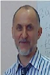
Biography:
Alexander G. Yushchenko is a multi-science investigator at National Technical University “Kharkiv Polytechnic Institute”, Ukraine. His research interests cover electrodynamics of new types of dielectric waveguide structures, expert systems, evolutionary modeling, theory of creative processes, neural networks, etc. For a long time he worked in Microwave Devices Laboratory of a Karazin State University, Kharkiv, Ukraine, where he made a career from an engineer to a chief designer of filter development for defense industry of the former USSR (S-300 and Buk-M2 missiles, etc.). He led the competitive research of the Ministry of Science and Education of Ukraine that was devoted to the development of satellite and cable communications and television in Ukraine. He has published about 150 scientific papers, has 12 patents of the USSR, Russia and Ukraine. His principal scientific achievements and CV have been listed in international directories.
Abstract:
Submillimeter waves become even more widely used in satellite technologies. The evolution of the circuit technology of send/receive devices is largely determined by the quality of transmission lines. The advanced circuit technologies are used not only in power transmission but also as a basis for construction of filters, antennae, mixers, splitters, polarizers, etc. We provide an overview of new types of transmission lines based on planar cut-off waveguides with or without dielectric filling. The idea for the new class of transmission lines was inspired be a discovery made in Microwave Devices Laboratory, Karazin State University, Kharkiv, Ukraine. The laboratory found that cut-off waveguides are able to maintain eigen-oscillation mode in their branching areas acting as semi-open resonators. Using an original method of partial areas, we obtained and calculated dispersion relations that describe the spectrum dynamics of normal modes. The characteristic feature of the method used consists in term by term satisfaction of the boundary conditions for the electric component of a mode; that technique ensures a high convergence rate of the calculations. We provide calculated losses for the most promising transmission lines. The calculation results demonstrate the advantages of these lines over the known line types.
Alexander G. Yushchenko
National Technical University
Ukraine
Title: WDR-based bandpass filters and an intelligent system for their optimal design
Time : 15:20-15:45
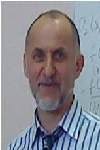
Biography:
Alexander G Yushchenko is a multi-science Investigator at National Technical University, Ukraine. His research interests cover electrodynamics of new types of dielectric waveguide structures, expert systems, evolutionary modeling, theory of creative processes, neural networks, etc. He worked in Microwave Devices Laboratory of a Karazin State University, Ukraine, where he made a career from an Engineer to a Chief Designer of filter development for defense industry of the former USSR (S-300 and Buk-M2 missiles, etc.). He has led to the competitive research of the Ministry of Science and Education of Ukraine that was devoted to the development of satellite and cable communications and television in Ukraine. He has published 150 scientific papers, has 12 patents of the USSR, Russia and Ukraine. His scientific achievements have been listed in international directories
Abstract:
Bandpass filters in send/receive systems, protect the receivers from spurious emissions, split broadband signals to separate channels for better handling, stabilize local oscillator frequencies, etc. Among the known filter designs, the original filters based on partially-filled WDRs are distinguished for their high quality and sparse spectrum of spurious modes; they can be a basis for creation of ultra-wideband, millimeter and sub-millimeter devices. Being constructed with superconducting materials in combination with quartz and leucosapphire, they have no competitors in terms of overall quality indices. We show that the advantage of WDR filters consist in selective properties and discuss the ways of their adaptation to planar technologies. It was demonstrated that electrodynamic properties of WDR filters allow creating devices ranging from narrow to ultra wide passbands. But development of high quality filters largely depends on how much the CAD systems are able to optimize the filter construction basing on such criteria as steepness of the frequency response curve, out-of-band suppression value and maximum achievable bandwidth. Since the known CAD systems lack such functions, we propose an original knowledge-based CAD program implementing the strict electrodynamic models of coupled resonators obtained using generalized scattering matrix method.
Yehia Abdel-Aziz
National Research Institute of Astronomy and Geophysics
Egypt
Title: Spacecraft formation flying control subject to Lorentz force perturbations

Biography:
Yehia Abdel-Aziz is Full Professor of Space Flight Dynamics and Control at Solar and Space Research Department, NRIAG, Egypt. He is the Secretary General of the National Egyptian Committee of Space Research for COSPAR since February 2005 up to 2014. He is the founder of the Spacecraft Charging Laboratory at NRIAG. He is leading two different teams working in orbital and attitude control, and spacecraft charging. He received the BSc Degree in Applied Mathematics (1991) and MSc in Attitude Dynamics of spacecraft (1998) from Mansoura University, Egypt. In December 2002 he received his PhD in Orbital Mechanics from Adam Mickiewicz University, Poland. He is also a Visiting Scholar at UNESP, Brazil and CETP, Paris- France. He published more than 32 papers in reputable journals. His area of interest: Attitude dynamics and control of spacecraft, orbital mechanics, formation flying satellite, and space debris. He is the PI for three projects and member of other four projects.
Abstract:
A spacecraft that generates an electrostatic charge on its surface in the Earth magnetic field will be subject to a perturbative Lorentz force in Low Earth orbit (LEO). The Lorentz force acting on an electrostatically charged spacecraft may provide a useful thrust for controlling a spacecraft’s orbit. In this work, the Lorentz force will be developed as a function of the orbital elements. The orbital perturbations of a charged spacecraft due to Lorentz force in the Earth’s magnetic field, which is modeled as a titled dipole is investigated using the Gauss variation of the Lagrange Planetary Equations. The dynamical models of the relative motion will develop what leads to approximate analytical solutions for the motion of a charged spacecraft, subject to Lorentz force. The innovative concepts of this work is replacing the usual control like propellent or thruster by electrostatic force. The model is derived when the chief spacecraft’s reference orbit is either circular or elliptical and the deputy spacecraft is capable of established electrostatic charge. The expected results will focus on how to control and correct the in track position or/and plane orbit of the charged spacecraft using the Lorentz force. The trajectories of the both spacecraft (chief and deputy) will be estimated for short time intervals with different charge to mass ration (q/m) for different orbits in LEO.
Yizhou He
Beijing University of Posts and Telecommunications
China
Title: Random access preamble design based on time pre-compensation for LTE-satellite system

Biography:
He Yizhou is a PhD final year student. He will get his PhD degree in this year in the Information and Electronics Technology Laboratory, Beijing University of Posts and Telecommunications, China. His current research interests include mobile satellite communications and physical layer technology.
Abstract:
Because of the integration of Long Term Evolution (LTE) technology and mobile satellite communication systems, uplink access technology for LTE-based GEO satellite has become a popular research topic for satellite system. In order to solve the problem of unreasonable design for PRACH signal structure and reduce the effect of time uncertainty, this paper proposes a novel random access preamble based on Time Pre-Compensation (TPC) for LTE-Satellite System. In this scheme, by applying the method of non-linear least squares, the user terminal (UT) can use the receiving power to estimate the communication round trip delay (RTD) and based on the transmission delay of the beam center and the satellite, RTD can be compensated before transmission. Therefore, the preamble length and duration can be reduced without related to the maximum of RTD. In order to verify the performance of the scheme, the Mat lab is used to build a test system. The simulation results show that the proposed preamble satisfies the requirements of LTE-Satellite System, and the better performance than previous researches is obtained.

Biography:
Mohamed H Khalil has completed his PhD from Cairo University. He is a Professor in the geophysics department, Cairo University and senior advisor in the Center of Environmental Hazard Mitigation (CEHM), Cairo University. He has published more than 40 papers in reputed journals and has been serving as an Editorial Board Member of repute.
Abstract:
A detailed ground magnetic survey, geoelectric vertical electric sounding (VES), and groundwater & soil quality analysis were conducted in the area of the abandoned landfill of the Awadallah lead (Pb) smelter, Cairo, Egypt. The integration between the applied techniques located successfully the buried solid waste, demarcated the groundwater and its possible contamination, and determined the lead level in soil. Magnetic survey comprised 50 magnetic profiles each 190 m length. Vertical derivatives, wavelength filters, and continuation filters characterized the eastern and central parts of the landfill by high intense magnetic anomalies reflecting metal and lead wastes. The geoelectric survey comprised 16 VES with maximum AB/2 of 100 m. The inverted data demarcated effectively the groundwater aquifer with depth ranged from 11 to 18 m and true resistivities ranged from 96 to 118 Ohm.m. The second layer (Holocene-Q3) of semi-permeable silty and sandy clay cap (true resistivities 29 ~ 51 Ohm.m and thickness 9 ~ 17 m) constituted a considerable role in limiting the possible contamination from the landfill. The analyzed groundwater parameters pH, Eh, TDS, SEC, and DO indicated a good water quality with homogenous aquifer characteristics. Whereas, the lead concentration in groundwater (0.033~0.036 mg/L) was slightly exceeding the safe limits identified by the U.S.EPA (≤ 0.015 mg/L). Lead in soil samples revealed elevated concentrations (3130 mg/Lit/kg at VES-3) around the Awadallah smelter. Whereas, a gradual decrease in concentrations recorded in the northwestern direction.
S. Savin
Space Research Institute
Russia
Title: Magnetospheric studies: from PROGNOZ-8 till ROY experiments

Biography:
S. Savin is a Leading Research Staff of the Laboratory of Electromagnetic Radiation Investigation at Space Research Institute, Russian Academy of Sciences. He has completed his Ph.D. in Moscow Physical-Technical Institute in the year of 1988 and Doctor Physics/Math. Sciences in the year of 2005. From 1978-1990, he is working as a Research Staff, Senior/ Leading Research Staff of the Laboratory of Electromagnetic Radiation Investigation, Co-I of the Combined Wave Diagnostic Experiments onboard the Prognoz-8 and -10 spacecraft in 1980 and 1985. He worked as a Project Scientist of the APV-N VEGA-1, 2 and APV-F Phobos-1, 2 plasma wave experiments in 1984-1989 and that of the Regatta-Cluster Project. Co-PI of wave instruments on board Interball-1 (1995-2000). Project Scientist of STRANNIK (PILGRIM) Project, Project Scientist of ROY Project
Abstract:
Multi-spacecraft measurements in the magnetosheath and in the solar wind by PROGNOZ-8, 10, Interball-1, Cluster and Polar, DOUBLE STAR, GEOTAIL, ACE/ WIND, SPECTR-R are presented. Wev show that coherent structures with magneto sonic Mach number up to 3 – Super magneto sonic Plasma Streams – generate transient and anomalous boundary dynamics, which may cause substantial displacements of the magneto spheric boundaries and the riddling of peripheral boundary layers. We describe a direct plasma penetration into the flank boundary layers, which is a candidate for being the dominant transport mechanism for disturbed magnetosheath periods. We present the data confirming the magnetopause charging and compare the data with recent theoretical models. We discuss the future projects, such as STRANNIK and ROY, which could in a cooperative manner proceeds the past results.
You Cheng Tang
National Changhua University of Education
Taiwan
Title: The relationship between intellectual capital and knowledge management

Biography:
Lois Tang has completed her PhD in the field of Accounting from Cardiff Business School (Cardiff University) in 2004. She was head of the Dept. of Curriculum Coordination of National Changhua University of Education (NCUE) and is Associate Professor of the Accounting Department of NCUE. She has participated in various research projects to improve the methods by which capital budgeting investment can be applied to enterprises. Among her recent research interests are innovation capital, intellectual capital, behavior theory and performance evaluation and management.
Abstract:
Innovation is a crucial key for business survival. A business wants to create innovation as much as it can, however, it must have enough and effective intellectual capital within its organization. How can a business retain intellectual capital? This relies on how it manages its knowledge data base. Therefore the relationship between intellectual capital and knowledge management becomes very important. This talk will outline the links from the knowledge base to intellectual capital and then to the creation of innovation.
Boris A Voronin
V.E. Zuev Institute of Atmospheric Optics SB RAS
Russia
Title: Time of weak lines and poor parameters

Biography:
Boris A Voronin is a Senior Staff scientist in V.E. Zuev Institute of Atmospheric Optics of Siberian Branch of the Russian Academy of Science (IAO SB RAS). He has published more than 60 papers in reputed journals. He also received the award of Academician VE Zuev (SB RAS).
Abstract:
A lot of high quality information, both experimental and theoretical, about spectra of molecular gases has been obtained in the last time for the purpose of atmospheric and astronomic applications. For example, very detailed linelists were calculated for: water vapor H216O - BT2 (Barber-Tennyson containing about 500,000,000 transitions), HD16O–VTT (Voronin, Tennyson, Tolchenov~700,000,000 transitions), some other gases–NH3 BYTe (~1.1 billion transitions), SO2 (4,000,000), CH4 (~1 billion transitions). All these linelists involve huge number of strong and weak lines, which possess accurate line position and strength. But other spectroscopic parameters, such as air-broadening, self-broadening, temperature exponents are absent. So, there is a need to determine these parameters for different applications. This present work is aimed at developing of simple methods of estimation of needed line parameters for HD16O. Also similar data will be presented for H216O, NH3, CO, SO2.

Biography:
Omotara Olayinka Theophilus was born on March 26. He was appointed as a Professor on June 8, 2012. He is an alumnus of the University of Kuwait and University of Ibadan. His appointment as Dean, Faculty of Education took effect from August 1, 2010 to July 31, 2012 in accordance with the provision of Article 8 of the University of Lagos Statute. He has started his academic career with the University of Lagos as a Lecturer II from 2009 after a brief spell in part-time Lectureship at the University of Ibadan for a year. By a dint of hard work and dedication, he was rose steadily through the rank to the chair of Christian studies in 2010 the renowned Christian scholar has held various administrative positions in the University.
Abstract:
In the near future due to extensive use of energy, limited supply of resources and the pollution in environment from present resources e.g. (wood, coal, fossil fuel) etc., alternative sources of energy and new ways to generate energy which are efficient, cost effective and produce minimum losses are of great concern. Wireless electricity (Power) transmission (WET) has become a focal point as research point of view and nowadays lies at top 10 future hot burning technologies that are under research these days. In this paper, we present the concept of transmitting power wirelessly to reduce transmission and distribution losses. The wired distribution losses are 70 – 75% efficient. We cannot imagine the world without electric power which is efficient, cost effective and produce minimum losses is of great concern. This paper tells us the benefits of using WET technology specially by using Solar based Power satellites (SBPS) and also focuses that how we make electric system cost effective, optimized and well organized. Moreover, attempts are made to highlight future issues so as to index some emerging
Hang Guo
Nanchang University
China
Title: Kalman filtering for the GPS/Magnetometer Navigation system
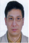
Biography:
Hang Guo has completed his Ph.D. in Geomatics and Geodesy with emphasis on navigation from Wuhan University, China in 2003, and now he is a Professor of Academy of Space Technology at Nanchang University, ION member, and was a visiting scholar at the Ohio State University, USA, University of FAF, Munich, Germany, University of New Brunswick, and University of Calgary, Canada. He has published more than 50 papers in reputed journals,Proceedings, and has been serving as an editorial board member of repute.
Abstract:
This paper investigated the data processing method of Kalman filtering for a GPS/ magnetometer integrated system. The practical field test was performed near UNB, Canada. GPS receiver and magnetometers were installed on the car. Two GPS receive lined as a baseline on the top of car to measure the car orientation as the reference, while the magnetometers were put into the car, which measure the car orientation as well. The observation is the difference between GPS azimuth and the magnetic azimuth with the magnetic declination reduction. The observation equation was derived and composed of the car velocity components. And the observation noise was derived by both GPS and magnetic measurement errors. The dynamical equation used the constant acceleration model with the rate of the acceleration as the model error. The results shown that the averages of the east, north, and up RMS are 0.013, 0.014, and 0.013 m; the averages of the east, north, and up velocity RMS are 0.019, 0.020, and 0.016 m/s; the averages of the east, north, and up acceleration RMS are 0.032, 0.032, and 0.026 m/s2. The further purpose of the paper is to study the possibility of the magnetic azimuth bridging the GPS azimuth gap with the help of Kalman filtering.
V K Srivastava
Maharashtra Forest Department
India
Title: Agent based model for land use/land cover dynamics
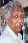
Biography:
Srivastava V K obtained PhD in Ecology in 1979 from Saurashtra University, Rajkot, but started carrier as Research Officer at Forest Research Institute and Colleges, Dehra Dun, India in 1977. Thereafter, he joined Space Applications Centre, Ahmadabad, as a Subject Matter Specialist (Forestry) in 1983 and continued till June 2006. Here, he developed remote sensing methodologies for Forestry. Subsequently, he joined National Remote Sensing Centre, Hyderabad and continued till superannuation in March 2012. Here, he worked on Land use/cover dynamics in Indian River basins. He has published 70 research papers in various journals, seminars and symposia, scientific and technical reports.
Abstract:
The changes in land use/cover, coupled with human dimensions, climate change and variability, affect the natural resources and ecosystem in a complex way. These changes have important implications for future changes in the earth’s climate and for subsequent land-use change. Many forces affect the human activity including local culture, economics, environmental conditions, land policy and development program which drive the land use/cover change. Models which are abstraction of complex interaction between various drivers can be used to describe the spatial and temporal relationships between drivers and the resulting patterns of land use and their changes. Models are also used to predict future configurations of land use patterns under various scenarios of bio-physical and socio-economic change. Though many LULCC models are available in literature, but all are case and region specific. No model can be adopted for a different place other than the place for which it was developed. In India where population density is high along with high cultural, social, climatic and physiographic diversity, none of the exiting LULCC model performs to the satisfaction. Therefore, an agent based statistical model was developed to meet the requirement in Indian River basins. The spatial and temporal integrity in view of significant available drivers have been maintained using statistical tools. The model predicts the future land use/land cover scenarios with respect to the past changes in the two time frames. This model though was developed and evaluated for Goa, India and used in all the river basins of the country.
Ali Said
Tripoli university
Libya
Title: Data enhancement for mineral resources using GIS and remote sensing

Biography:
Ali Said is an Associate Professor at civil engineering department, faculty of engineering, Tripoli University. He got his B.Sc. in civil engineering 1986 from Tripoli University. His M. Phil. In surveying and GIS 1996 from Newcastle University, UK. His area of interests are; Remote sensing applications for monitoring environment changes, mapping from satellite images, GIS applications in mining, map projection systems. He has a lot publication in these areas.
Abstract:
The northeast Libya area acquired great interest by the Libyan Industrial Research Center (LIRC), so they contracted with a number of companies to produce 1:250,000 scale geological survey maps for the area. Those companies were of different scientific references and different nationalities, which led to the production of metal maps differ in their mineral classifications, and the symbols used in identifying the mineral, which caused a lack of clarity of the information when producing unified map of the area. This paper aims to improve the mineral information available from these maps using Geographic Information Systems (GIS) and remotely sensed data (e.g. satellite images). The unification of the map projection system for the whole area was done. A data-base was designed representing the mineral resources located in the northeast Libya area. A unified classification of mineral resources was established based on the existing geological maps and the satellite images interpretation. Also general mineral map was produced and good results were achieved.
Hina Fathima. A.
VIT University
India
Title: Optimization in Microgrids integrating Battery Energy Storage Systems - A Review

Biography:
Hina Fathima A completed her Undergraduate in Electrical Engineering in 2006. After serving as a Lecturer at an engineering institute she completed her Post graduate studies in 2011. She is currently pursuing her PhD and is serving as a Research Associate in the School of Electrical Engineering, VIT University. Her areas of expertise include optimization in renewable energy and energy storage systems and power management. Her PhD work involves optimized integration of energy storage systems into grid-connected renewable systems in India. She has published three papers in various international conferences and journals.
Abstract:
Fast depleting fossil fuels and the growing awareness for environmental protection have led us to an energy crisis. Hence, efforts are being made by researchers to investigate new ways to extract energy from renewable sources. ‘Microgrids’ with Distributed Generators (DG) are being implemented with renewable energy systems. Growing penetration of renewable sources in the power scenario has also led to a bilateral increase for the need of storage systems. Unpredictability and high intermittence in the power generated from renewable systems like wind have driven the need for adequate back up energy reserves and power quality improvement according to grid standards. Optimization methods justify the cost of investment of a microgrid by enabling economic and reliable utilization of the resources. Thus the concept of Hybrid Renewable Energy Systems (HRES) with state of art application of optimization tools and techniques to microgrids has gained prominence. An extensive literature survey on HRES reveals a framework of diverse objectives for which optimization approaches could be applied to empower the microgrid. Battery Energy Storage Systems (BESS) have been the most popular and mature technology for grid applications from a long time. Lot of research is pursued in BESS to develop its volumetric capacity, specific discharge rates and efficiency by improving the material properties, integration topologies and control mechanisms. A brief overview of the future scope of development in BESS by exploring their developments, properties as well as the applications in wind power grids is outlined.
SANJAY K. JAIN
National Institute of Hydrology
India
Title: Glacier variations in response to climate change in the baspa basin, western Himalaya
Biography:
SANJAY K. JAIN is a Scientist at the National Institute of Hydrology. He got his Ph.D. degree in Snowmelt runoff modeling and sediment studies in Satluj basin using remote sensing and GIS from Indian Institute of Technology in 2001. He is the member of Editorial Board at Water Resources Management of International Journal. He has published more than 119 papers in International Journals, National Journals, International /National Conferences.
Abstract:
Himalayan glaciers are generally difficult to monitor by field observation due to the highly rugged and extremely inaccessible mountainous terrain. Thus, in this study, changes in glacial area, perimeter, length, ELA, snout and debris cover were examined based on MSS (1976), ETM+ (2000 & 2006) and TM (2011) in the Baspa river basin, a major tributary of Satluj River, located in western Himalayan region. Additionally, the Survey of India (SOI) topographical maps (1962) and LISS III (2007) Satellite data were used for the collection of additional information to attain higher accuracy in glacier mapping. The investigations have generated a new inventory of 80 glaciers for the year 2011. Over a period of 36 years from 1976 to 2011, the glacier area has changed from 253.4 km2 to 195.7 km2 i.e., 57.7 (22.8%) at a rate of 1.6 ma-1, where as the perimeter changed from 900 to 799 km i.e., 101.0 (11.2%) at rate 2.8 ma-1, and the length changed from 266.1 to 217.2 km i.e., 48.8 (18.4%) at a rate 1.4 ma-1. Moreover, the equilibrium line of altitude (ELA) had gone up from 5126 m asl to 5235 m asl i.e., 109m (2.1%) upward rise at a rate of 3 ma-1 where as the snout has retreated from 4740 m asl to 4812 m asl i.e., 72.1 m (1.5%) at a rate of 2 ma-1 recession. The glacier changes are significantly controlled by the size, altitude, aspect, slope and debris cover in the basin. Generally, the clean, small sized, low altitude glaciers with south to southwest aspect and steep slope have lost large area and vice versa. Furthermore, the glacier changes in the region are a response to temperature (Tmax & Tmin) increase particularly Tmin along with rainfall and snowfall decrease from 1985 to 2008.
