Day 1 :
Keynote Forum
Benjamin K. Malphrus
Morehead State University
USA
Keynote: A New Era of Planetary Exploration with Small Satellite Platforms
Time : 09:05-09:45

Biography:
Benjamin K. Malphrus is Professor of Space Science at Morehead State University where he also directs the Space Science Center. He has served on the scientific staff of the National Radio Astronomy Observatory, NASA’s Wallops Flight Facility, the University of South Carolina and West Virginia University. He served as Principle Investigator (PI) on nanosatellite missions including KySat-2, the Cosmic X-Ray Background Nanosatellite (CXBN), and CXBN-2, and has had various roles on other smallsat missions. He is currently PI on the Lunar IceCube Mission- a $15 M NASA project designed to investigate the transport physics of water ice on the Moon. He has published papers on topics ranging from extragalactic astrophysics to instrumentation in radio astronomy, to nanosatellite systems development and was awarded over $18 million R&D grant funding. In the late 1990s, he developed a theory of galaxy formation that has gained wide acceptance among the astronomical community.
Abstract:
A new era of solar system exploration is being ushered in by NASA’s Exploration Mission-1 (EM-1). EM-1 is the maiden voyage of NASA’s Space Launch System (SLS), which when it launches in 2018, will be the most powerful rocket ever built. SLS will support human exploration beyond LEO and will also serve as a platform to launch small satellites as secondary payloads to Earth escape. NASA has selected 13 secondary payloads, to launch on EM-1, all 6U CubeSats that will travel to planetary destinations to perform science investigations that address NASA Strategic Knowledge Gaps. CubeSats are “nanosatellite” class research spacecraft that are built in standardized units. The standard unit (U), is 10 cm × 10 cm × 11 cm, and has a mass of 1.33 kilograms per U. Four lunar EM-1 CubeSats, Lunar Flashlight, Lunar IceCube, LunaH-Map and Skyfire will work together to investigate water ice and other volatiles on the lunar surface. NEA-Scout will rendezvous with a near Earth asteroid to investigate its composition, geology, volatile resources and orbit dynamics. Biosentinel will investigate the effect of the deep space environment on biological systems. The manifest will include two JAXA CubeSats, EQUULEUS and OMOTENASHI, an ESA and Italian Space Agency CubeSat- ArgoMoon, and two CubeSats to be selected from NASA’s CubQuest challenge. A variety of enabling technologies including electric propulsion, solar sail technologies, miniature science instruments, radiation tolerant processors, precise attitude control systems, compact ranging transponders and high data rate communication systems will be demonstrated by these missions. Innovative low energy manifold trajectories will be employed to allow the spacecraft to travel to deep space destinations with limited propellant mass and constrained delta-v. The 13 secondary payloads to be deployed on EM-1, including Lunar IceCube, will usher in a new era of solar system exploration with small satellite platforms.

Keynote Forum
Kent Miller
Air Force Office of Scientific Research
USA
Keynote: Space Research at AFOSR
Time : 09:45-10:25

Biography:
Kent L. Miller is an International Program Officer at the Air Force Office of Scientific Research (AFOSR). He received his BS in Physics from Utah State University and his MS and PhD in Physics from the University of Illinois at Urbana-Champaign. His doctoral dissertation examined small-scale ionospheric structures using data from sounding rockets and incoherent scatter radar. He was a research physicist at the Lockheed Palo Alto Research Laboratory and a Research Professor at Utah State University. He was advisor to the “Get-Away-Special” program at Utah State and the University NanoSatellite Program at AFOSR. He joined AFOSR in 1996 and has been the program office for space science and SSA in the Arlington office and at EOARD in London. He is a Senior Executive Fellow of the Kennedy School of Government, Harvard University and a Fellow of the Air Force Research Laboratory.
Abstract:
International cooperation in space research and in space education is the source of opportunities that are of mutual benefit internationally. We describe opportunities for the United States military to promote international cooperation in research and to cooperatively offer graduate space education to overseas partner nations.
The mission of the International Office of the Air Force Office of Scientific Research (AFOSR) includes bridging and building mutually beneficial relationships between scientists overseas and scientists in the United States that will result in the acceleration of S&T achievement. Program officers at AFOSR discover, shape, and champion basic science that profoundly impacts the future US Air Force. In doing so, they also impact civilian science. International program officers have the additional responsibility of acting as liaison officers for all programs of the Air Force Research Laboratory to the international science community. Space technology research seeks new concepts for space instrumentation. Research related to space situational awareness seeks better understanding of astrodynamics and of the observation and tracking of space objects. Space weather research is focused on the understanding of the space environment with a goal to enable and extend operational forecasting.
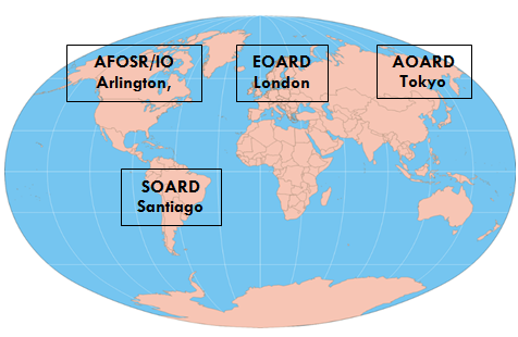
The AFOSR and the Air Force Institute of Technology (AFIT) have teamed to sponsor newly developed space education programs offered by faculty from the United States Naval Postgraduate School’s Graduate School of Engineering and Applied Science and AFIT’s School of Strategic Force Studies. An initial “Introductory Space” course has been taught in Santiago, Chile; while both Columbia and Brazil have expressed interest to be the next participants. The introductory course allows the students to ascertain their readiness to study at the graduate-level. Success at the introductory course permits the students to proceed into a graduate certificate, followed by a master’s degree using distance learning technologies.
Keynote Forum
O. Romberg
German Aerospace Center DLR
Germany
Keynote: Postâ€ISS Concept for 2025 and Beyond
Time : 10:45-11:25

Biography:
Oliver Romberg studied Mechanical Engineering with specialization in Mechanics, performed his phD at the Institute for Mechanics of the University of Hannover in 1998 and worked since then in the field of Space Technology. In the year 1998 he started in the company OHB System in Bremen, Germany as Systems Engineer, Project Manager and later as deputy department head. In parallel he gave lectures in Mechanics at the University of Applied Science in Bremen. Since 2007 Dr. Romberg works as head of the DLR department System Analysis Space Segment for the German Aerospace Center. As assistant professor he gives lectures in Systems and Concurrent Engineering at the University of Bremen.
Abstract:
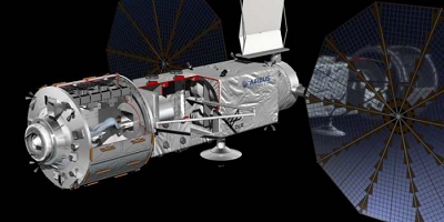
The International Space Station (ISS) demonstrates successful international cooperation between many partners regarding engineering as well as programmatic aspects. There are more and more ideas in the development of new markets by shifting responsibilities to private entities and broadening research disciplines, demanding faster access by users and including new launcher and experiment facilitator companies. A review of worldwide activities shows that all spacefaring nations are developing their individual programs for the time after ISS . Europe is interested in LEO and human spaceflight as discussed by the ISECG, depending on funding commitments. ISS follow-on activities should comprise clear scientific and technological objectives combined with commercial application and the long term view on space exploration. This includes key competences like robotics, internal and external space structures, module/facility and experiment operations as well as supply systems. Based on Concurrent Engineering (CE) processes, DLR started to investigate future low cost options by evaluating various LEO infrastructure concepts including opportunities for national realization and international cooperation based on feasible budgets. Using the Concurrent Engineering Facility (CEF) of DLR Bremen, scientists and users from various disciplines are involved in assessing the feasibility of various Post-ISS options. Resulting payloads are based on Mir and ISS experience with respect to future scientific and technological research questions. Further, together with US and European industry, NASA and ESA astronauts, operation specialists, current ISS users and scientists, DLR conducted extensive CE studies for Post-ISS concepts. This work converged into a Phase A design called Orbital -Hub based on a small low cost manned LEO platform including Free Flyer. The first flying hardware components could be realised in the frame of moderate budgets in the next eight years. The Orbital-Hub would guarantee a smooth transition between ISS and further space activities beyond LEO and would represent an important step towards long term human space exploration.
- Track 1: Space Missions | Track 03: Space exploration | Track 4: Earth Observation Satellites | Track 7: Satellite Navigation and Communication

Chair
Nicolas H Younan
Mississippi State University, USA

Co-Chair
Joseph Seckbach
The Hebrew University of Jerusalem, Israel
Session Introduction
Benjamin K. Malphrus
Morehead State University
USA
Title: Lunar IceCube: Pioneering Technologies for Interplanetary Small Satellite Exploration
Time : 11:25-11:45

Biography:
Benjamin K. Malphrus is Professor of Space Science at Morehead State University where he also directs the Space Science Center. He has served on the scientific staff of the National Radio Astronomy Observatory, NASA’s Wallops Flight Facility, the University of South Carolina and West Virginia University. He served as Principle Investigator (PI) on nanosatellite missions including KySat-2, the Cosmic X-Ray Background Nanosatellite (CXBN), and CXBN-2, and has had various roles on other smallsat missions. He is currently PI on the Lunar IceCube Mission- a $15 M NASA project designed to investigate the transport physics of water ice on the Moon. He has published papers on topics ranging from extragalactic astrophysics to instrumentation in radio astronomy, to nanosatellite systems development and was awarded over $18 million R&D grant funding. In the late 1990s, he developed a theory of galaxy formation that has gained wide acceptance among the astronomical community.
Abstract:
Lunar IceCube, a 6U CubeSat designed to prospect for water in solid, liquid, and vapor forms and other volatiles from a low-perigee, highly inclined lunar orbit, has been selected by NASA to fly on Exploration Mission -1 (EM-1). The mission is a partnership between Morehead State University, NASA Goddard Spaceflight Center, JPL, the Busek Company, and Vermont Tech. Lunar IceCube will be deployed during lunar trajectory by the Space Launch System (SLS) and use an innovative RF Ion engine to achieve lunar capture and the science orbit (inertially locked, highly elliptical, 100 km periapsis) to investigate the distribution of water as a function of time of day, latitude, and regolith composition in the context of lunar mineralogy. IceCube will include the Broadband InfraRed Compact High Resolution Exploration Spectrometer (BIRCHES), developed by GSFC- a compact version of the successful New Horizons instrument designed with the high spectral resolution (5 nm) and wavelength range (1 to 4 μm) needed to distinguish forms of water, including ice. The mission will complement the scientific work of other missions by focusing on the abundance, location and transportation physics of water ice on the lunar surface at a variety of latitudes. Lunar IceCube, while primarily a science mission, will demonstrate technologies that will enable future interplanetary exploration with small satellite platforms including radiation-hardened subsystems, a precise ranging transponder/transceiver, a capable attitude determination and control system, a high power solar array and an innovative electric propulsion system (EP). The EP (Busek BIT-3 Iodine engine) generates 1.2km-1 of delta-v and, combined with an innovative low energy manifold trajectory, allows the spacecraft to reach lunar orbit from Earth escape with minimal energy. The 13 secondary payloads to be deployed on EM-1, including Lunar IceCube, will usher in a new era of solar system exploration with small satellite platforms.
Gert Finger
European Southern Observatory
Germany
Title: Electron photoavalanche diode arrays: a new technology for noiseless high speed near infrared sensors
Time : 11:45-12:05

Biography:
He was leading the detector group at ESO. Since his retirement he holds an emeritus position at ESO and is still actively pushing the development of eAPD technology which has been recently deployed in the GRAVITY instrument at the VLTI. For more than three decades Gert Finger has developed infrared arrays for astronomy and deployed them in many instruments at the European Southern Observatory.
Abstract:
To conduct high angular resolution observations of astronomical objects from ground based observatories, adaptive optics is needed to correct the images distorted by atmospheric turbulence. For the adaptive optics (AO) systems, low noise high speed near infrared sensors are needed for wavefront sensing and fringe tracking. Until now the performance of those sensors was based on CMOS detectors. Due to the high analog bandwidth needed for achieving frame rates of 1 KHz the readout noise severely limited the sensitivity. The only way to overcome the CMOS noise barrier is the amplification of the photoelectron signal directly at the point of absorption inside the infrared pixel by means of the noiseless avalanche gain.
A breakthrough has been achieved with the development of the near infrared SAPHIRA 320x256 pixel electron avalanche photodiode arrays (e-APD) which have already been deployed in the wavefront sensors and in the fringe tracker of the instrument GRAVITY at the Very Large Telescope Interferometer VLTI located on Cerro Paranal in Chile.
Results obtained with this new technology will be presented. The detectors now show flat response with high quantum efficiency in the wavelength range from 0.8μm to 2.5 um. Subelectron readout noise at frame rates of 1KHz has been demonstrated. The dark current is as low as 0.02 e/s/pixel for an APD gain up to 8. With this performance, e-APD arrays also have the potential to outperform conventional large format NIR science focal planes.
For AO systems of extremely large telescopes and for co-phasing segmented mirror telescopes larger formats are needed. Therefore, a 512x512 pixel SAPHIRA array optimized for AO applications will be developed, which has 64 outputs operating at 10 Mpixel/s/output. This corresponds to frame rates of 2 Kframes/s for a full single frame readout. The design of this large format SAPHIRA array will be discussed.
Gloria Garcia-Cuadrado
Celestia Aerospace
Spain
Title: Nanosatellites, the tool for a new economy of space: Opening space frontiers to a wider audience
Time : 12:05-12:25

Biography:
Gloria Garcia-Cuadrado is President & CEO of Celestia Aerospace, a company devoted to the opening of space access to SMEs and research groups through the use of nanosatellites. She firmly believes a new economy of space has to be developed for the benefit of all. Garcia-Cuadrado is Theoretical Physicist graduated from the Physics Faculty of the University of Barcelona; Master in Theoretical Physics; and Diploma in Space Studies, specialization in Space Business and Management, by the International Space University (California; U.S.A). She has been researcher at the Institute of Space Studies of Catalonia; Head of Human Space Flight and Advanced Concepts at the Aerospace Research & Technology Centre; and General Director of the Aerospace Cluster of Catalonia, gathering more than 80 Enterprises, University, Technology Centers and Government, devoted to enhance the aerospace industry. She is also a passionate advocate for scientific education and communication..
Abstract:
Space is still a frontier. The advantages of research in microgravity conditions are still somehow a private niche of the big aerospace contractors and main space agencies. But the landscape is changing and an incipient effort is being pursued to open space frontiers to small and medium-sized companies, universities, under-developed countries and non-profits. We will revise the advantages of microgravity research and a tool to conduct it at low-cost, rapid response and flexibility through the use of nanosatellites opening thus space frontiers to a wide audience. These highly capable satellites can support a wide range of mission objectives, from pure research to technology demonstrators and space qualification tests. The small satellites market is valued 600 M USD to 1.000 M USD yearly with an estimated 2.200 to 2.700 needed launches in the 2015-2020 timeframe. We will also introduce a new launcher under development to serve specifically the nanosatellite incipient market to help solve the scarce launching opportunities served today by conventional launchers.
Simona-Mariana Cretu
University of Craiova
Romania
Title: Research methodology in mechanical systems and bionics: from Plato to contemporary science
Time : 12:25-12:45

Biography:
Simona-Mariana Cretu was born in Craiova, Romania (1960). She received a BSc degree in mechanical engineering in 1984, and a PhD degree in mechanisms in 1999, from the University of Craiova. From 1984 to 1992 she was a Research Engineer at the Research Laboratory for CAD Systems, ICMET, Craiova. Since 1992, she has been working in the Department of Applied Mechanics and Civil Engineering, Faculty of Mechanics, Craiova, where she is currently a Professor. She wrote scientific papers and books in the fields of mechanisms, biological robots, creative techniques, philosophy and history of science. She realized new models for legged robots and viruses inspired from nature, and proposed a new interpretation of Plato’s books.
Abstract:
Statement of the Problem: During the process of scientific creation innovators can apply creativity techniques either intuitively, either by using the most appropriate research methodology. A research methodology can use present or historical knowledge. Many scientific matters of current interest are described in Plato’s work, and some contradictory topics from his work are still debated. A short overview referring to the methodological rules from Plato’s work - which have not been exceeded - is considered to be necessary. The aim of this paper is to promote the utilization of the appropriate research methodology in the process of scientific creation in the field of mechanical systems and bionics, to present some applications, as well as focusing our attention on new historical research with useful results in the present. Methodology & Theoretical Orientation: Some of the streams used in solving difficult problems are: experimental analysis, thought experiments, visual analogy, inventive principles recommended by TRIZ method (the Theory of Inventive Problem Solving), and maintenance of the idea in long-term-memory. Findings: The paper presents the author’s point of view referring to the interpretations of Plato’s books. Some new applications of Plato’s ideas in mechanical systems are included. The author’s strategy utilized in the process of scientific creation in bionics was applied to obtain several biological robots and models of mechanical systems inspired from nature, e.g. viruses. The applications of TRIZ method in the field of mechanisms and robots, even for the calculus, e.g. global mobility, are obtained. Conclusion & Significance: The author aims for the paper to be useful to other young researchers who strive to improve their strategy in the process of scientific creation. In addition to that, the paper encourages researchers from different fields to collaborate together for solving the contradictions from Plato’s work.
Marcos A. Diaz
University of Chile
Chile
Title: SUCHAI 2 and 3: Scientific grounds and challenges of the new space mission of the University of Chile
Time : 12:45-13:05

Biography:
Marcos Diaz is a Professor in the Electrical Engineering Department at University of Chile, Santiago, Chile. He received his Electrical Engineering degree in 2001 from University of Chile, his M.S. and Ph.D. degrees in Electrical Engineering in 2004 and 2009, respectively from Boston University. His research interests are related to the study of ionospheric turbulent plasma, incoherent scatter radar techniques, low-frequency-radio-astronomy/space instrumentation and nano-satellite technologies.
Abstract:
Developing countries and their educational institutions are taking advantage of the Cubesat standard in order to either accelerate or even start space programs. Chile, and in particular the University of Chile, has started a space program based on Cubesats. The first university Cubesat, the Satellite of the University of Chile for Aerospace Investigation 1 (SUCHAI-1), is awaiting launch in a Falcon 9 (Space X). SUCHAI-1 was a proof of concept with simple payloads and experiments. We present the learned lessons of SUCHAI-1 and the process of starting a university program funded by sources external to the university in a country without a space agency nor a space program. We also present the university new space mission, which continues the efforts of the first one. The new mission under development involves the construction of 2 3U Cubesats, SUCHAI 2 and 3. The main payloads under design for this mission, and eventually for future more dedicated missions, are: magnetometers, Langmuir probes, dual frequencies GPS receivers and radio beacons. These payloads expect to gather information of the ionosphere. In particular, we will show the current status of the payloads, paying attention to the first designs of them together with the current performance. We analyze the type of physics we might obtain with these instruments and with the fusion of data among them as well as with ground based instruments such as GNSS receivers, magnetometers networks, ionosondes and Incoherent Scatter Radars (ISRs).
Valentine A. Yankovsky
St. Petersburg State University
Russia
Title: Proposals on multi-channel methods for the simultaneous remote sensing of [O(3P)], [О3] and [CО2] altitude profiles in the mesosphere and lower thermosphere in daytime
Time : 13:45-14:05

Biography:
Valentine A Yankovsky is an Associate Professor in Atmospheric Physics of St. Petersburg State University (from 1990). In 1986, he has completed his PhD from SPBU “Laboratory studies of aeronomical reactions with participation of negative ions, excited oxygen atoms and molecules” which was based on his investigation of processes in the glow discharge oxygen plasma. His main fields are the atmospheric photochemistry in the MLT region, the sensitivity and uncertainty study of complex photochemical systems and the retrieval of ozone and atomic oxygen in the MLT. He has published more than 25 papers in reputed journals.
Abstract:
Three small components of O(3P), O3 and CO2 in the daytime mesosphere and lower thermosphere (MLT) of the Earth are responsible for the thermal regime of the atmosphere. Among these components only the altitude profile of ozone concentration can be measured by a direct method for absorbing radiation from the Sun or the stars in the UV range of the spectrum. However, this method is most often realized in the conditions of twilight, so cannot give an exhaustive presentation of the altitude profile of [O3] throughout the daytime hours. Height profile of the atomic oxygen is usually restored on the assumption that it is looped with ozone. Despite the attractiveness of this approach, it cannot explain the altitude profile of atomic oxygen above 96-98 km, where the ozone concentration decreases by catastrophic style. The CO2 concentration in the MLT region is usually retrieved indirectly by solving complicated kinetic problem for the non-LTE radiative transfer. The analogous difficulties of [O3] retrieval from the observation of emission in 9.6 μm band are explained by the complexity of the vibrational kinetics of O3 molecule. Retrieved values of both CO2 and O3 to some extent depend on a prior information about the O(3P) altitude profile. The problem can be solved by using individual proxy for each of the target component. Using a sensitivity study and uncertainty analysis of the contemporary model of O3 and O2 photolysis in the MLT, YM2011, we have tested three excited components; namely the electronic-vibrational excited molecules, О2(b1Sg+, v = 0, 1, 2), as [O(3P)], [O3] and [CO2] proxies. We conclude that in the altitude range of 50-85 km, simultaneously independent retrievals of [O3] and [CO2] are possible (see Figure 1); and in the range of 85-100 km, the emissions in three channels from the О2(b1Sg+, v = 0, 1, 2) molecules make it possible to retrieve the [O3], [CO2] and [O(3P)] simultaneously.
Alexander V. Bagrov
Institute of Astronomy of the Russian Academy of Sciences (INASAN)
Russia
Title: Single-satellite global positioning system
Time : 14:05-14-25

Biography:
Alexander V. Bagrov as astronomer studies minor bodies of our Solar System. Besides that he was lieder of Russian team that worked out space optical interferometer for precision measurements of stellar coordinates. When this project was cancelled due lack of financial support, he proposed a conception of single-satellite global positioning system for 1-mm accuracy geodesy and for improvement of selenodetic coordinate frame. In the field of space technique he proposed interstellar spaceship with super-conductive magnet mirror, lunar elevator, method of non-rocket launch from Mars, solar 3-D printer for lunar building. He honored by the Russian Cosmonautic Federation to be “Space Technique Constructor”.
Abstract:
The Earth global positioning systems are based on numerous set of geodetic space probes that send special signals to receiver on the Earth surface. These systems need simultaneous Earth-based precision astrometrical observations of every satellite spatial position, and even so the accuracy of instant positioning is only few meters. As for the Moon as well for the Mars, there is no global positioning system of this kind, and it seems that it never will be build. On the other hand we need to determine instant coordinates of points of interest on the lunar surface and coordinates of space probes near the Moon or landing to target point. To get it the Russian mission “Luna-25” will deliver to the Moon light beacons that will became referent points for precision selenodetic coordinate frame. The brightness of these light beacons will be enough for observation by any on-board TV-camera from near-Moon orbit and by Earth-based telescopes. In the case of from-orbit observations the angular position of the beacon relative to referent stars will be measured with support of onboard orientation system. Row of such angular measurements will provide us to calculate selenodetic coordinate (latitude) of the light beacon and instant coordinates of lunar satellite with accuracy about few meters by geodetic equalization methods. The “Luna-25” will be landed near lunar pole, so its beacon will be very good for latitudes measurements, but not suitable for longitudes. This problem will be solved by “Luna-26” mission, which will be a satellite on low polar lunar orbit. It will be supplied with laser projector to illuminate existing on lunar surface retro-reflectors and observe them as point-like sources. As existing retro-reflectors are not far from lunar equator, they will be good for longitudes determination.
Peter Johnson
University of Manchester
UK
Title: Optimal detection of changes in real-time data: Applications in Satellites
Time : 14:25-14:45

Biography:
Peter Johnson’s research area is in applied probability. To date he has mainly worked with optimal stopping and free boundary problems in the area sequential analysis. However, he also has a keen interest in HMM tracking algorithms, filtering theory and non-linear optimal stopping problems. He is very passionate about his research area, having worked hard to build new collaborative projects outside its traditional applications and has a strong ambition to lead this research area into new avenues in the future.
Abstract:
Detecting changes in random processes as quickly and accurately as possible, is important for many scenarios. Examples include: detecting a plane using radar; identifying nuclear material at ports; reacting to breakages in atomic clocks on satellites and; determining when is the best time to buy/sell stocks and shares. Using advanced applied probability, it is possible to provide an 'optimal' time to stop and declare that a change has occurred (optimal in the sense of minimising the delay after the change) with a fixed probability of error.
This collaborative work looks at problems of this type applied to issues in detecting breakages in clocks on board satellites. The sophisticated solutions of these optimal stopping problems show that the first hitting time of a test statistic to a defined boundary is the quickest possible decision time for a given level of accuracy (see Figure). This means that no other method can outperform the algorithms used, which is a valuable asset in high performance systems.
This research has two high profile satellite applications: The New Horizons mission, and The Galileo Project. Most recently solutions of this type have been involved in helping engineers from NASA detect an unusual change in the two on-board quartz clocks (which are replied upon to beam accurate data back to earth) as its satellite passed Pluto.
These methods are also helping resolve similar problems in detecting the breakages in the atomic clocks used in the Galileo project, the first global navigation system primarily for civilian use, that is being developed by the European Union. The accuracy of these clocks is critical to accurate positioning, with a 100 nanosecond error meaning positioning could be out by up to 30 meters on the ground.
Irena Ymeti
University of Twente
The Netherlands
Title: Using Object Based Image Analysis to monitor soil aggregate breakdown under natural conditions
Time : 14:45-15:05

Biography:
Irena Ymeti is following the PhD program at the Earth Systems Analysis department at ITC, University of Twente, The Netherlands working on monitoring soil aggregate breakdown using Remote Sensing technology. She started to work at the Institute of Geosciences, Energy, Water and Environment at the Polytechnic University of Tirana, Albania. Building a geo-information (GIS) and RS laboratory for processing and analyzing data for earth science applications was the focus on her work.
Abstract:
Statement of the Problem: Monitoring of soil aggregate breakdown still remains a challenge. Using remote sensing approach changes on soil surface such as soil aggregate breakdown that occur over a short period of time can be detected in a fast and non-destructive way. To understand these changes it is important to monitor the interaction between soil surface and the surrounding environment at high temporal resolution. Methodology & Theoretical Orientation: We designed an outdoor experiment to monitor soil aggregate breakdown under natural conditions at a micro-plot scale using a regular digital camera. Five soils susceptible to detachment (silty loam with various organic matter content, loam and sandy loam) were photographed each day. We collected images and weather data from November 2014 until February 2015. When an image has a sufficient high spatial resolution, pixels are smaller than the object so grouping of pixels is possible in order to obtain real-world homogeneous features. Object-based image analysis (OBIA) approach, which allows estimation of the image area occupied by soil aggregate was used. OBIA consider not only the spectral reflectance and neighbour relations, but also the shape and the size of objects. Findings: Our results show that the image area covered with soil aggregate decreases over time. The trigger that initiates the decrease of area covered with aggregate is freezing-thawing followed by the rain events. Conclusion & Significance: This research concludes that when dealing with images with very high spatial resolution object based approach should be consider for monitoring soil aggregate breakdown. The OBIA approach allows to quantify the image area covered with soil aggregate.
Giancarlo Genta
Politecnico di Torino
Italy
Title: Space Exploration: A matter for Governments or for private operators?
Time : 15:05-15:25

Biography:
Giancarlo Genta is Professor of Construction Machines at the Politecnico (Technical University) di Torino. He is member of the Academy of Sciences of Torino and of the International Academy of Astronautics. Since 2012 chairs study group SG 3.16 of the International Academy of Astronautics: Global human Mars system missions exploration, goals, requirements and technologies.
In 2013 received the Yangel Medal for outstanding contributions to the development of the international space sciences and technologies and the Engineering Science Award of the International Academy of Astronautics for outstanding achievement in engineering science
He authored 90 papers, published in Italian, American and English Journals, 268 papers presented to symposia and 25 books, some of which are used as textbooks in some American Universities.
He is also the author of two science fiction novels, published in Italian, English and Ukrainian.
Abstract:
Initially space exploration was based on a direct involvement of governments. The main reasons were the general cold war climate, the programmatic non-existence of a private sector in one of the main actors (the Soviet Union) and perhaps also the novelty of this enterprise, allowing to forecast that its cost was beyond the possibilities of any private organization.
Consequently, the main international treaties dealing with this subject were heavily influenced by the belief that states were the actors in space and that exploration could be peaceful only if everything of value existing beyond Earth was considered as belonging to humankind in general, and could be exploited, if at all, in the interest of all.
Space activity allowed the development of a space industry. The governmental agencies (and the military) were the customers of these companies, and managed the missions directly. Slowly, a new model started emerging, with space agencies not dealing with all kinds of space activities, leaving all the industrial ones, in particular telecommunication, metereological and Earth resources satellites, to private companies, concentrating on their main business, namely science and exploration.
Later, starting with 2000, the idea that also in science and exploration missions space agencies should buy many services from private companies emerged, with transportation to LEO operated by privates. The launchers for scientific and exploration missions should not only be built, but also studied, designed and operated by privates.
Exploration missions could be completely run by private enterprises that decide their goals, recruit the crew (if any), build the equipment, operate the mission and finally own the outcome, of whichever nature it is.
Private exploration is possible only if the outcome of the mission is lucrative enough to justify the investments and the risks, like it was the case of the sea exploration journeys of the sixteenth Century.
Leonid V. Ksanfomality
Space Research Institute
Russia
Title: Hypothetical discovery of life on Venus
Time : 15:25-15:55

Biography:
Leonid V. Ksanfomality has completed his PhD at the age of 31 years at the Abastumany astrophysical observatory and postdoctoral (professor) studies at the age of 46 years at the Space research institute, Moscow. His position is the Main researcher, Planetary Physics dept. He has published more than 300 papers in reputed journals and has been serving as an editorial board member of scientific journals.
Abstract:
Some of exoplanets possess physical conditions close to those of Venus. Therefore, the planet Venus, with its dense and hot (735 K) oxygen-free atmosphere of CO2, having a high pressure of 9.2 MPa at the surface, can be a natural laboratory for this kind of studies. The only existing data on the planet’s surface are still the results obtained by the Soviet VENERA landers in 1975-82.
The VENERA TV experiments returned 41 panoramas of Venus surface (or their fragments). The experiments were of extreme technical complexity. They have not been repeated by any space agency in the subsequent 40 years. The VENERA panoramas have been treated anew by modern processing codes. Relatively large objects, from a decimeter to half a meter in size, with an unusual morphology have been found which moved very slowly or changed slightly their shape. Certain unusual findings that have a structure similar to the Earth’ fauna and flora were found in different areas of the planet. Analysis of treated once again VENERA panoramic images revealed objects that might indicate the presence of about 11 or 12 hypothetical items of Venusian flora and fauna. Among them is ‘amisada’ that stands out with its unusual lizard shape climbing up at stone plates surrounding it.
Ugo Cortesi
Institute for Applied Physics “Nello Carrara†(IFAC-CNR)
Italy
Title: AURORA project: a challenge for synergistic exploitation of Sentinel-4/-5 ozone operational products
Time : 16:15-16:35

Biography:
Ugo Cortesi is a research scientist with 25-year experience in the field of Earth Observation and, in particular, in remote sounding of the Earth’s atmosphere. His activity focused on a variety of subjects: from design and development of atmospheric emission sounders, to engineering and scientific campaigns on-board high altitude platforms, to atmospheric data validation, to radiative transfer applied to forward and inverse modeling, to development and application of data fusion techniques. He is currently a member of the Mission Advisory Group of Sentinel-4 and Sentinel-5 and is acting as the scientific coordinator of the AURORA project funded by the European Commission in the Horizon 2020 Framework Program.
Abstract:
An unprecedented quantity and quality of data on the Earth’s atmosphere will become available with the launch of the Sentinel-4 and Sentinel-5 operational missions of the Copernicus Program by the early 2020. The extraordinary amount of information associated to the geostationary (S-4) and Low Earth Orbit (S-5) measurements will shed new light into our understanding of air quality, climate, ozone and solar radiation. The envisaged advancement in atmospheric monitoring capability and the need to manage the volume and complexity of the data stimulated the investigation of an innovative approach to synergistic exploitation of measurement products. The AURORA H2020 project (2016-2019) is currently developing, implementing and testing a new concept based on combined use of data fusion techniques and data assimilation models to derive advanced quality products for vertical profiling of ozone from the surface to the top of the atmosphere. The ultimate goal of the scientific and technological effort of the project is to demonstrate the comparative advantages of the assimilation of fused products versus assimilation of standard operational products. Advanced quality ozone profiles will then be used to calculate tropospheric partial columns and UV surface radiation products, which might foster the development of pre-market applications, for instance in the health sector. Along with the scientific background and core elements of AURORA, a synthetic insight will be offered into the technological infrastructure constituting at the same time the set of tools for building the system and the overall assembly as final product of the project in itself. The focus on applications will aim to describe their relevance for demonstration purposes, as well as in the perspective to possible follow-up of the concept extended to a variety of atmospheric targets and application sectors.
Yavor Shopov
Sofia University
Bulgaria
Title: Micro-Satellite Hosted Laser- gated System for Space Debris Tracking, Forest Fires and Plants’ Health Monitoring and Underground Facilities’ Location
Time : 16:35-16:55

Biography:
Yavor Shopov has completed his PhD from Sofia University, Bulgaria and postdoctoral studies from McMaster University, Canada. He is head of the University Centre for Space Research & Technologies, Sofia University. He is supervisor of Master programme on Aerospace engineering of small satellites of Sofia University. He has published more than 100 papers in reputed journals and has been serving as an editorial board member of repute. Fields of research: applications of satellites in applied and fundamental research, space physics and solar- terrestrial physics, design and development of optical and spectral equipment for photographic observations and photometry in different regions of the spectrum.
Abstract:
Here we propose a space platform integrating telescope with an interchangeable head holding 5 receptors: NIR, MIR, FIR and VIS cameras and laser range meter. Such construction is very appropriate for using on micro satellites and space probes because it is much more compact and light than conventional payload with separate optics for each receptor. It allows high resolution imaging for Normalized Difference Vegetation Index (NDVI) estimation of the wilting (water loss) of the vegetation to determine the degree of drying of plant, for monitoring the state of health of the vegetation, for early tracing of illness of plants, and to determine fire hazardous areas of dry vegetation in order to prevent forest fires. It is very useful for: prediction of forest fires; natural disaster warning; accurate determination of the area of ​​the forest fire-affected areas and to monitor fire hazard areas of dry vegetation. Most effective and precise method for remote localization of forest fires is with mid-IR (MIR) camera, mounted on board of an unmanned aerial vehicle (UAV) or high resolution satellite. MIR camera “sees” clearly the hot spot of the fire even through dense smoke which is impossible for observations in the visible range of the spectra. Therefore they are particularly useful for localization of the hot spots of forest fires and their extension. FIR camera allows location of entrances of underground facilities due to temperature difference of the ambient air and this coming from the facility. At the same time laser ranging is very useful for space surveillance and tracking of space debris, etc. Presented Laser-gated imaging for debris observation/detection use common telescope with other cameras
Eva Tresaco
Universidad de Zaragoza
Spain
Title: Necklaces theory applied to Satellite Constellation design
Time : 16:55-17:15

Biography:
Eva Tresaco obtained her degree in Mathematics in 2003, and her PhD in 2010, both from University of Zaragoza. She has gained experience in research, teaching and administration both in aerospace companies and institutions of higher education. Currently she works as Associate Professor at the Centro Universitario de la Defensa Zaragoza (Spain). Her main research interests are Celestial Mechanics and Dynamical Systems where she has coauthored over 20 scientific papers, and she has participated in many research projects. She is Senior Member of American Institute of Aeronautics and Astronautics, an also member of Sociedad Española de Matemática Aplicada
Abstract:
Satellite constellations are groups of satellites working cooperatively and following the same goal. In this work, we recall different ways to design satellite constellations. Satellite constellation design has been since its beginning a process that required a high number of iterations due to the lack of established models for the generation and study of constellations. This situation resulted in the necessity of specific studies for each particular mission, being unable of extrapolate the results from one mission to another. Fortunately, in the last decade, new theoretical models were developed that include in their formulation all the former configurations. One of these models is the Flower Constellations (cf. [1]). In this work we present these constellations along with the 2D-Lattice Flower Constellation theory (cf. [2, 3]), which represents an improvement of the original theory since its formulation is simpler and has a physical meaning. We focus on the application of the theory of necklaces to the determination of the reference orbit of the constellation. This approach opens new design possibilities and brings what we named Necklace Flower Constellations (cf. [4]). Finally, we introduce a time distribution methodology (cf. [5]) to generate constellations whose satellites share a set of relative trajectories, and maintain that property over time without orbit corrections. This distribution methodology is able to generate all kinds of satellites configurations including equally spaced time distributions (as the Flower Constellations Theory does) but also formation flying. To sum up, we will present examples of missions in which the satellites present the ground-track repetition property, constellations based on high eccentricity orbits and formation flying designs.
Imran Ahmad
Debre Tabor University
Ethiopia
Title: Spatial technology: Hydrological perspectives
Time : 17:15-17:35

Biography:
Imran Ahmad has completed his Ph.D. in Environmental sciences from Tamil University, India in 2013. He received his B.Sc. degree from the University of Kashmir, India, in January 2004, followed by a M.Sc. degree in Environmental sciences from the University of Kashmir, India, in January 2008. He is an excellent researcher in the field of earth and environmental sciences. His research work has been published in various international journals such as Journal of Hydrology (Elsevier) and Environmental Monitoring and Assessment (Springer). Imran Ahmad is an editorial board member in several international journals, also acting as a scientific reviewer in many others. He is listed in the committee of the International Association of Management Science and Engineering Technology, Hong Kong, and he is the founding editor of a journal International Journal of Water Sciences, InTech (Croatia).
Abstract:
State-of-the-art geospatial technologies for imaging the earth and its subsurface are invaluable tools; especially when direct measurements are sparse or even impossible. Geospatial technology with their advantages of spatial, spectral and temporal availability and manipulation of data covering large and inaccessible areas within a short time have become very handy tools in accessing, monitoring and conserving groundwater resources. In hard rock terrain such as the Palar basin (South India), interpretation of satellite data for delineation of lithological units, weathered zones, mapping of lineament density and their trends as well as intensity, are discriminatory features and form a valuable aid for the location of groundwater areas..This paper mainly deals with the approach of geospatial technology to delineate groundwater potential zones in Palar basin, South India. Digitized vector maps pertaining to chosen parameters, viz. geomorphology, geology, land use/land cover, lineament, relief, and drainage, were converted to raster data using 23 m × 23 m grid cell size. The raster maps of these parameters were assigned to their respective theme weight and class weights. The individual theme weight was multiplied by its respective class weight and then all the raster thematic layers were aggregated in a linear combination equation in Arc Map GIS Raster Calculator module.
George Zhou
Guilin University of Technology
China
Title: Future Intelligent Earth Observing Satellites
Time : 17:35-17:55

Biography:
George Zhou received the Ph.D. degree from Wuhan University, Wuhan, China, with expertise in Earth Observing. He was a Visiting Scholar with the Department of Computer Science and Technology, Tsinghua University, Beijing, China. He continued his research as an Alexander von Humboldt Fellow with the Technical University of Berlin, Berlin, Germany from 1997-1998, and afterward became a Researcher with The Ohio State University, Columbus, OH, USA from 1998 to 2000. Dr. Zhou has published 2 books and more than 300 peer-reviewed papers, and has worked on 48 research grant and contractors as a Principal Investigator or a Co-Principal Investigator.
Abstract:
This invited paper presents the future intelligent earth observing system (FIEOS) and event-driven earth observation concepts as well as their connections to societal benefits for both decision-makers and the general public. The elucidated linkage and flow of information from FIEOS to societal benefits is interoperable. With the envisioned FIEOS, this paper places an emphasis on (i) How to apply the FIEOS to increase the efficiency of monitoring natural disaster, to improve the natural disaster management, and to mitigate disasters through providing highly accurate, and reliable surveillance data for experts, analysts, and decision-makers; (ii) How to significantly increase and extend societal benefits to the future U.S. Earth observation application strategy in, for example, real-time response to time-critical events, and disastrous environmental monitoring. Therefore, this paper presents the analysis of FIEOS to society benefit in the realms: (i) reducing loss of life and property from natural and human-induced disasters, (ii) improving human health and well-being, (iii) improving wealth forecasting, (iv) supporting sustainable agriculture, and (v) serving lay people.
Webinars & Conferences By Continents
Asia-Pacific
Webinars & Conferences By Subject
- Agri, Food & Aqua
- Animal Science and Veterinary
- Biotechnology
- Cardiology
- Chemistry
- Dermatology
- Environmental Sciences
- Expert Conferences
- Geology & Earth science
- Immunology
- Materials Science
- Microbiology
- Nephrology
- Nursing
- Oncology & Cancer
- Pathology
- Pharma Marketing & Industry
- Physics
- Psychiatry Congress
- Surgery
- Vaccines