Day 3 :
- Dear Satellite 2017 attendees!
We would like to inform you that 3rd Day of the conference i.e., (May 13th, 2017) is scheduled for Business to Business Meeting, Networking with Keynotes, speakers, moderator and lunch will be provided from 12:30 -13:30.
We are very much glad to anticipate your presentation at networking and lunch session on 3rd day of the conference.
Thanks and regards,
Valentina Esther
Satellite 2017
Biography:
20 More Speaker Slots Available
Submit your abstract and confirm your Speaker slot at Satellite-2017. All proposals must be submitted to satellite@conferenceseries.net
Abstract:
Biography:
Garik Gutman has been Program Manager for the NASA Land-Cover/Land-Use Change (LCLUC) Program since 1999. He is author of about 80 publications in peer-reviewed scientific journals and of several chapters in various climate and land-cover related scientific books. He has been a lead or co-editor on several books on LCLUC-climate interactions: globally and regionally, such as in the Eurasian Arctic, in Siberia, in East Asia drylands, and in Eastern Europe. Dr. Gutman’s current research interests include the use of remote sensing for detecting changes in land cover and land use, and analyzing the impacts of these changes on climate, environment and society. His NASA research program helps to develop the underpinning science and promotes scientific international cooperation through supporting the development of regional science networks over the globe under various international programs. He is Program Scientist for Landsat, EO-1 and Terra satellites
Abstract:
Studies of land-cover and land-use change (LCLUC) on a global scale became possible when the first satellite of Landsat series was launched about 45 years ago. Since then land-change science has been rapidly developing to answer the questions on where changes are occurring, what is their extent and over what time scale, what are their causes, their consequences for ecosystems and human societies, their feedbacks with climate change, and what changes are expected in the future. LCLUC studies use a combination of space observations, in situ measurements, process studies and numerical modeling. To get the most out of current remote sensing capabilities researchers strive to utilize different remote sensing data sources, e.g. from Landsat and Sentinel-2, thus increasing frequency of observations, which is important for a number of science questions and applications. Fusing observations from optical sensors with radar data, e.g. Sentinel-1, helps filling the cloud-induced gaps in optical data. For the foreseeable future, the goal is to develop multi-sensor, multi-spectral methods based on increased temporal-spatial coverage to advance the virtual constellation paradigm for moderate spatial resolution (10-60m) land imaging systems with continental to global scale coverage. On the other hand, social and economic science research plays an important role in land-change science and includes analyses of the impacts of changes in human behavior at various levels on land use, studies of the resultant impacts of land-use change on society, or how the social and economic aspects of land-use systems adapt to climate change. The NASA LCLUC program is developing interdisciplinary approaches combining aspects of physical, social, and economic sciences, with a high level of societal relevance, using remote sensing tools, methods, and data. This presentation will include illustrations of recent, significant results in the LCLUC program for various sectors, including forestry, agriculture and urban.
Darren S. McKnight
Integrity Applications, Inc.
USA
Title: Proposed series of Orbital Debris remediation activities
Biography:
Darren McKnight is currently Technical Director for Integrity Applications, Inc. (IAI) based in Chantilly, Virginia. He leads teams to develop creative solutions across widely disparate domains: space systems, renewable energy, predictive awareness for infectious disease outbreaks, bioterrorism, orbital debris, workforce productivity, and youth soccer training. Dr. McKnight released his fifth book, Make Yourself Indispensable, in March 2015.
Abstract:
Orbital debris is a growing hazard to reliable space operations and the sustainability of space-based systems that increasingly support national security and economic stability for many countries. Short-term attention has been focused on collision avoidance for operational payloads and enhanced debris mitigation guideline compliance while long-term attention has been focused on studying debris remediation via Active Debris Removal (ADR).
These three activities must be continued and augmented by three new efforts that work together to provide improved debris remediation activities to enhance space flight safety. The three new efforts are (1) an international Spacecraft Anomalies and Failures Workshop; (2) Massive Collision Monitoring Activity (MCMA) operations; and (3) Just-in-time Collision Avoidance (JCA) development.
This paper provides a plan that is focused on maintaining progress in three existing initiatives and starting three new ones.
Biography:
Gonzalo Munévar has been keenly interested in many aspects of science, as can be seen in the numerous books and papers he has published since receiving his Ph.D. from U.C. Berkeley. He has a particular interest in the nature of scientific exploration as found in the pursuit of space missions. In his latest manuscript, The Dimming of Starlight, now in its final editing, he takes a close look at the value of space exploration, analyzing in detail the significance of space missions for all of natural science and for the wellbeing of humankind. He also discusses the most promising directions for space research, the tension between machines and humans in exploration, and then uses his background in evolutionary biology and experimental neuroscience to examine the possibility of alien life and intelligence. He closes the book by showing the connection between space exploration and human survival.
Abstract:
The main value of the exploration of space is that it transforms our views of the Earth and the universe to the significant benefit of our species. As we explore space we challenge our science, and as we challenge our science we change it in ways so profound that we come to face a different panorama of problems and opportunities in our dealings with the world. Indeed, it is as if a new world opens up to us; and when we try to adapt to the new “lay of the land,” ideas and inventions occur to us that would have been unimaginable under the old perspective. It has often been argued that scientific exploration leads to serendipitous discoveries, but such arguments are supported mainly by historical anecdotes. In my view, however, serendipity is a natural, practically inevitable consequence of scientific exploration. My argument thus depends on the very nature of scientific exploration and on the way that nature is illustrated in space science and other aspects of our space missions. For example, our mission to study the chemistry of Venus’ atmosphere led to the discovery of the depletion of the ozone layer on Earth. Space telescope missions led to the discovery of Dark Energy, on the heels of the confirmation of the existence of Dark Matter, and to the realization that the standard model in physics accounts for only a very small percentage of phenomena in the universe. Similar illustrations of serendipity can be found in practically all types of space missions. They are more likely the more our spaceships move into the unknown. And they will help us discover hitherto unsuspected problems and transform science so as to place us in a better position to find solutions.
Biography:
Oliver Romberg studied Mechanical Engineering with specialization in Mechanics, performed his phD at the Institute for Mechanics of the University of Hannover in 1998 and worked since then in the field of Space Technology. In the year 1998 he started in the company OHB System in Bremen, Germany as Systems Engineer, Project Manager and later as deputy department head. In parallel he gave lectures in Mechanics at the University of Applied Science in Bremen. Since 2007 Dr. Romberg works as head of the DLR department System Analysis Space Segment for the German Aerospace Center. As assistant professor he gives lectures in Systems and Concurrent Engineering at the University of Bremen.
Abstract:
The International Space Station (ISS) demonstrates successful international cooperation between many partners regarding engineering as well as programmatic aspects. There are more and more ideas in the development of new markets by shifting responsibilities to private entities and broadening research disciplines, demanding faster access by users and including new launcher and experiment facilitator companies. A review of worldwide activities shows that all spacefaring nations are developing their individual programs for the time after ISS . Europe is interested in LEO and human spaceflight as discussed by the ISECG, depending on funding commitments. ISS follow-on activities should comprise clear scientific and technological objectives combined with commercial application and the long term view on space exploration. This includes key competences like robotics, internal and external space structures, module/facility and experiment operations as well as supply systems. Based on Concurrent Engineering (CE) processes, DLR started to investigate future low cost options by evaluating various LEO infrastructure concepts including opportunities for national realization and international cooperation based on feasible budgets. Using the Concurrent Engineering Facility (CEF) of DLR Bremen, scientists and users from various disciplines are involved in assessing the feasibility of various Post-ISS options. Resulting payloads are based on Mir and ISS experience with respect to future scientific and technological research questions. Further, together with US and European industry, NASA and ESA astronauts, operation specialists, current ISS users and scientists, DLR conducted extensive CE studies for Post-ISS concepts. This work converged into a Phase A design called Orbital -Hub based on a small low cost manned LEO platform including Free Flyer. The first flying hardware components could be realised in the frame of moderate budgets in the next eight years. The Orbital-Hub would guarantee a smooth transition between ISS and further space activities beyond LEO and would represent an important step towards long term human space exploration.

Biography:
Jasmin Belle-Isle is a canadian family doctor. He is a Principal Investigator in medical research and working for Alpha Research in Quebec city, Canada. His reputation in medical research is very well established in North America. Even though he's a doctor, his passion is Astrophysic and every free moment is an opportunity to read, think, imagine and elaborate on his theory about physics and the Universe.
Abstract:
The search for truth and the true face of the Universe is a constant preoccupation for many scientists. After all, knowing the Universe better in the end, means knowing more about ourselves and others. I propose a vision in respect with science and actual laws of physics that will reveal the reality that has permitted the emergence and propagation of life and is called : The Universe
Astronomers launched many satellites over the past years including COBE in 1989, WMAP in 2001, and PLANK in 2009. Theses satellites observed the Universe while it was only 380,000 years old and further improved the precision of previous results. Some evidential findings emerged from these observations including the temperature of the Universe exactly 2.725 above absolute zero acting like a ''Black Body'' and the calculation by inference of a so called ''Dark Energy''. Theses observations and thoses made by Alexander Friedman, Georges Lemaître, Edwin Hubble, Arno Penzias and Robert W. Wilson support the theory that a big explosion took place some 13,7 billion years ago and has given birth to the Universe and is called : The Big Bang. This huge amount of pure energy then spreaded in a space not yet present. How this energy spreaded in the Universe ?
Einstein once said that matter is energy and energy is light and that we were all light beings. How energy could be matter and light at the same time ? My theory answer this question. My theory put the photon at the center of the Universe and is a big step toward the ''Theory of Everything'' so sought by scientists like Albert Einstein and Stephen Hawking. It could even reveal where hide theses mysterious constituents of the Universe called ''Dark Matter'' and ''Dark Energy'', mystery of the millenium.
Biography:
Humphrey Kalibo interested in the application of geospatial technology (remote sensing and GIS) in the management of natural resources, notably forests. A native of Kenya, I recently completed a doctorate in Geography from the University of Nebraska, Lincoln. My previous work has focused on participatory ethnobotanical research where I argue that traditional ecological knowledge and people's perception of resources is a critical component to adaptive collaborative management. He is currently seeking a position where he can use both participatory and geospatial techniques in resource management, especially in developing countries where livelihoods are still dependent on a vibrant natural resource base.
Abstract:
Vegetation fraction (VF) greatly influences crucial processes like photosynthesis and evapotranspiration. However, it is among the least studied of the biophysical parameters, yet it is needed in several applications, notably estimating soil erosion, analysis of carbon storage estimates, and development of atmospheric models, which have policy implications regarding climate research. Existing methods for deriving VF, e.g., using satellite imagery and spectral mixture analysis have limitations. Consequently, an alternative methodology for quantitatively estimating this parameter for different vegetation types, especially over the growing season, is needed. This study describes a simple technique for estimating VF that combines the power of spectral vegetation indices (VIs) and the simplicity of digital photography. It employs upward-looking hemispherical photographs of twelve deciduous tree canopies and eight VIs calculated from in-situ single-leaf level reflectance data to calculate VF. When plotted over time, the VIs showed very similar seasonal patterns as the photo-derived VF of each tree, and the VF values estimated by the VIs were temporally similar for each tree over the growing season. NDVI and SAVI had the highest estimation accuracy. SR showed temporal similarity with the VF of low-foliage trees, and had considerably higher accuracy of prediction. Seasonality and amount of foliage cover significantly affected estimation accuracies. This methodology is simple, inexpensive, and could be adapted to other settings. It can complement existing methods, and can potentially be used to study other critical parameters such as LAI and biomass in other types of vegetation, but further research is needed to validate it.
Ruth Bamford
Rutherford Appleton Laboratory
UK
Title: Could mini-magnetospheres really be used to protect spacecraft from `cosmic rays’?

Biography:
Ruth Bamford has been a research scientist at Rutherford Appleton Laboratory (RAL) in Oxfordshire in the U.K. since 1996. Her research areas include Space Weather and fundamental plasma physics. Her particular emphasis is on kinetic effects in plasmas. She is the principle investigator of the Mini-Magnetospheric project for space craft protection. The concept concerns ‘Active’ or electromagnetic plasma shielding of manned spacecraft for long stay and interplanetary missions, and satellites in radiation belts. Prior to working at RAL, Ruth spent 10 years at the home of what is currently the world’s largest “tokamak”, JET, at the Culham Centre for Fusion Energy (CCFE) in Oxfordshire. She gained her 1st Class Honours in Applied Physics from the University of Sunderland in 1988 and her PhD from the Uni. Of Essex. She worked as a post-doc of Imperial Collage, London before moving in 1996 to work on space plasmas.
Abstract:
Spacecraft in interplanetary space and the radiation belts are vulnerable to `cosmic rays’. Solar storms produce large numbers of energetic ions and electrons that can penetrate and disrupt solar panels, electronics and human tissue. Due to their larger mass, the energetic ions are the greater hazard as they are not easily stopped. Thick material cladding around vulnerable parts of the vessel provides diminishing effectiveness at the higher energies.
Ideas of electromagnetically deflecting the energetic charged particles fall down due to unrealistically high power requirements needed to create the size of electromagnetic field thought to be needed. Proponents over the years have focused on optimising the engineering on board the spacecraft. Until recently nobody has reexamined how the particles interact with the magnetic or electric field. It is assumed to be straightforward. However, laboratory experiments and theory have shown that this is not simple. The presence of the diffuse solar wind makes for a far more efficient shield than single particles dynamics would predict.
The question then becomes: how does this change the potential for effective active shielding for manned interplanetary spacecraft and/or satellites in the radiation belt?
What we find is for a manned mission to Mars of ~20kW of on-board power being redirected to superconducting magnetic coils system weighing approximately 3000 kg including cooling. This would reduce the energetic (> 50MeV) particle flux by about 20% during a major solar storm (assuming a severe solar storm flux of ~1010 protons/cm2sec). Additional augmentations, such as adding extra plasma into the bubble, can greatly enhance its effectiveness up to 80 to 90% exclusion overall and the extend the range of energies capable of being deflected.
Evidence that these principles will be presented from laboratory and space from the natural magnetic shielding occurring on the Moon.
Ben Jarihani
University of the Sunshine Coast
Australia
Title: Studying hydrological processes in dryland landscapes: Can satellites help in data-poor regions?
Biography:
Ben Jarihani is a postdoctoral research fellow at Sustainability Research Centre, University of the Sunshine Coast working on erosion estimation and sediment transport modelling with collaboration with CSIRO. He received bachelor and master of engineering in irrigation, drainage and water resources management (1996-2001), followed by eight years industry work experience as a professional water engineer, hydrologist and project manager. He has done his PhD in hydrological sciences at University of Queensland, Australia with collaboration with CSIRO (2011-2015) entitled “developing remotely-sensed data approaches to studying hydrological processes in data-poor dryland landscapes”. Jarihani research interests include application of remote sensing and geographic Information system in water resources management and hydrological/hydrodynamic modelling. He has published several papers in reputed journals and has been serving as an active reviewer of repute. He received European Geosciences Union 2011Outstanding Student Poster awards in hydrological science, The University of Queensland Research Scholarship and The Integrated Natural Resource Management top-up scholarship from CSIRO.
Abstract:
Drylands occupy one third of the Earth’s surface and are home to around 400 million people, yet the water resources of these regions are often poorly understood because of a lack of fundamental hydrological data. Thus fundamental questions of (eco) hydrological function of these river systems cannot be understood at a detailed scale. Earth observation satellites have been proved to provide data and information on water cycle in multiple spatio-temporal scales.
This research project aims to develop remotely-sensed data approaches in order to improve our understanding of hydrological processes in data-sparse dryland landscapes. Four objectives were investigated: (i) to evaluate the accuracy and effectiveness of satellite derived altimetry data for estimating flood water depths in low-gradient, multi-channel rivers; (ii) to detect and map flood extents and optimize the trade-off between image frequency and spatial resolution using Landsat and MODIS satellites imagery; (iii) to assess satellite-based Digital Elevation Models (DEMs) accuracy for hydrodynamic modelling; and (iv) to use a hydrodynamic model supported by satellite-derived data to investigate flood water transmission loss.
This research concluded that it is now possible to realistically constrain water balances in data-sparse dryland rivers using hydrodynamic models in combination with satellite-derived data to address limitations in the availability of conventional hydrological datasets. This research has implications for the opportunities, limitations, and future directions of using remotely-sensed data to better understand water balance and hydrodynamics of data-sparse regions. This knowledge is imperative for improved management of the limited water resources in dryland, both in Australia and around the world.
Giulio Avanzini
Università del Salento
Italy
Title: Attitude manoeuvre planning and control of underactuated spacecraft: a kinematic approach
Biography:
Giulio Avanzini is Professor in Flight Mechanics at the Università del Salento, where he teaches Fundamentals of Aerospace Engineering (B.Eng), Flight Mechanics and Aircraft Design (M.Sc). He served as assistant professor at the Politecnico di Torino for 13 years (1998-2011), teaching courses on Atmospheric and Space Flight Mechanics. He was visiting professor at the University of Glasgow and University of Illinois at Urbana Champaing. He obtained a Ph.D. in Applied Mechanics and a Laurea degree summa cum laude in Aeronautical Engineering from the University of Rome “La Sapienza”. His research activity spans various fields of atmospheric and space flight mechanics: analysis of aircraft dynamics in nonlinear flight regimes; aircraft, rotorcraft and spacecraft inverse simulation; fixed and rotary wing aircraft dynamics; autonomous flight and uninhabited aerial vehicles; spacecraft attitude dynamics and control; satellite formation flight; fundamental problems in orbit dynamics and space mission analysis; analysis of flying qualities of entry vehicles.
Abstract:
A spacecraft is in underactuated conditions when three rotational degrees of freedom need to be controlled by means of actuators, delivering control torque components around two non-collinear axes only. This condition can be the consequence of an actuator failure, when the satellite is equipped with a non-redundant system or multiple failures, for redundant ones. It can also be a natural condition for spacecraft equipped with magnetic actuators, which can deliver a control torque, which lies on a plane perpendicular to the direction of the local geomagnetic field. Since it is not possible to simultaneously control attitude and angular speed of a rigid body with two control torque components by means of a continuous time-invariant feedback, the problem of attitude stabilization and control becomes significantly more difficult.
Discontinuous control approaches (e.g. switching control logics [2, 3]) as well as time-varying controllers [4, 5] has been proposed. In the paper, a review of these techniques will be proposed and a focus will be placed on kinematic approaches, developed by the author in cooperation with Fabrizio Giulietti, from University of Bologna, and other collaborators. The kinematic approach allows for tackling many control problems for underactuated spacecraft by means of controllers, which are at one time very efficient in terms of required computational effort and effective in terms of convergence time. The results for various operational scenarios, such as detumbling by means of magnetic actuators only [6], or pointing of an axis in an arbitrary direction by means of only two reaction wheels will [7] be discussed.
Sadroddin Alavipanah
Humboldt University of Berlin
Germany
Title: How three dimensional data could improve the concept of urban ecosystem services
Biography:
Sadroddin Alavipanah is a doctoral researcher, research assistant and GIS lecturer since 2014 at Geographical institute, Humboldt University of Berlin, Germany. Sadroddin completed his masters in ‘Global Change’ studies at University of Bayreuth, Germany, in 2013. His research interest lies in the area of urban remote sensing and cities mitigation strategies to the changing climate. In recent years he advanced his researching skills on integrating three dimensional remote sensing data to improve the understanding on urban ecology. He believes that three-dimensional studies could advance the concept of sustainability in cities.
Abstract:
Recent urban ecosystem service research projects have focused on the spatial configuration of urban environment and its Impact on local and global scales. These result of these studies were mainly two dimensional. However, studies focusing on producing three dimensional results (3D) –such as volume, shadowing effect, height- were absent. In a systematic review we have selected 298 articles were selected for in-depth critical analyses. Selected publications show that satellite technologies have become popular and have provided useful data for monitoring and mapping cross-scale ecological research at various spatial, temporal, and spectral scales. Analyzing selected publications also show that there is a shift in the sub-theme of reviewed publications toward climate change adaptation and mitigation by using remote sensing data in a regional scale. Understanding and considering 3D data into research will improve our understanding in environmental interactions in urban area. Further studies should progress in the development of both 3D data and results. Implementing 3D data and results helps to better understand the coupling of humans and their environs. It will be then a critically important step toward developing ecologically friendly cities.

Biography:
Ignacio Barrios has his expertise in Space System Engineering. He started as an AOCS engineer working for different kinds of missions such as Earth Observation and Rendez-vous missions in SENER, Spain and EADS Astrium Toulouse, in France. He was soon interested in satellite AIT and got the chance to work as a System Engineer for the first Cubesat at the Universidad Politecnica de Madrid. This gave him the chance to learn about all the different phases of a satellite project very deeply from Mission Analysis to Operations. He has been always attracted by education and during his career he has paid attention to the different ways to train new engineers. He also teaches and shares his experience so that young engineers can benefit from his experience.
Abstract:
The Universidad Politécnica de Madrid (UPM) started in the academic year 2009/10 educational innovation activities in space engineering. The implementation of several topics in the Conceive - Design - Implement – Operate (CDIO) syllabus was pursued, mainly focused on the next topics: Hardware and software integration, Test, Verification, Validation and Certification.
With this objective the use of demonstrator satellites was included in the practical lessons. The development of a self-designed demonstrator satellite was started leading to the ESAT’s birth.
ESAT has been created and developed by Theia Space, an initiative born at the Spanish User Support and Operations Center (E-USOC) which belongs to the UPM and is one of ESA’s delegated centers for the operation of scientific payloads onboard the International Space Station.
ESAT is an educational satellite designed for hands-on learning for all education levels: STEM education, university studies and professional training. It is a 10x10x10 cm nanosatellite based on the successful CubeSat standard and weighing less than 1 kg.
ESAT has the typical spacecraft subsystems: Electrical Power, Command and Data Handling, Attitude Determination and Control and Structure.
The user can choose to focus and work on each subsystem independently or to practice with the fully integrated satellite. ESAT features a Wi-Fi communication system allowing the connection with a PC, where the ESAT GUI allows an easy operation of the satellite.
ESAT is perfectly fitted to train on design, manufacture, integration, validation and operation of satellites.
It has been developed with the open source philosophy and the users are able to expand its functionalities. ESAT allows to integrate and test new user developments, both SW and HW. For the HW developments the user has access to all the lines in the satellite, including power and communication lines and analog and GPIO lines.

Biography:
Francisco J. Arias is a Reader in Fluid Mechanics and Nuclear Energy at the University of Catalunya-BarcelonaTech. He received his BA in Physics from University of Barcelona and his BA in Material Engineering at University of Catalunya-BarcelonaTech where also obtained his PhD in Nuclear Engineering. He was subsequently elected to a Research Fulbright fellowship at University of California at Berkeley (UCB) and Massachusetts Institute of Technology (MIT) at USA. After, he gained the Beatriu de Pinos fellowship for Catalunya governement, working at the National University of Australia -University of Tasmania and finally at the University of Cambridge (UK) where currently continues as collaborator in several research projects, and the became a Senior Research Associated at University of Catalunya-BarcelonaTech. Arias researches into the application of advanced energy concepts in solar, nuclear and marine energy. He also works with alternative concepts for space applications, rocket and planetary science.
Abstract:
Nowadays, Mars Entry Descent and Landing Systems (EDLS) technology dates back to NASA’s Viking which are based on the traditional heatshield/parachute combination and on the use of inflatable or retro-thrusters technologies.
On the other hand, the essential Viking parachute design has been used ever since — and was employed again in 2012 to deliver the Curiosity rover to Mars. Unfortunately, because the low density of the Martian atmosphere, the use of parachutes is not enough, and it is necessary the use of retro-thrusters or inflatable airbags. This stage is the most challenging stage during the entire Martian mission, and is where failures occur. Indeed, the most recent failure in the exploration of Mars, the ExoMars Schiaparelli module by the European Space Agency (ESA) ended up following its descent on 19 October this year, was lost in final minutes of descent, because failure in the retro-thrusters time control system. One possible alternative to avoid or at least to mitigate the dependence on the use of retro-thrusters or inflatable airbags is by developing new drag enhancement devices. These new drag devices may be one of the first steps on the technology path to potentially landing humans, habitats, and their return rockets safely on Mars.
Since 2015, the University of Catalonia, Spain, in collaboration with University of Cambridge have developed a novel, simple, and reliable concept for decreasing the ballistic coefficient of the spacecraft.
In this work, it will be presented for first time the preliminary results of te concept to the scientific and engineering community. Where the theoretical background, Computational Fluid Dynamics (CFD) simulations, Laboratory testing, and a mock-up model tested at free fall where used. The preliminary results are highly encouraging where it is shown that ballistic coefficient can effectively be reduced at least up to 20 times its initial value.
Junhui Meng
Beihang University
China
Title: Influences of initial launch conditions on flight performance of tethered stratospheric satellite

Biography:
Junhui Meng has his expertise in design and mechanical properties analysis in stratospheric airship or satellite. He and his partners in the Advanced Aircraft Research Center of Beihang University designed China's first stratospheric airship and completed its flight test successfully. He developed the dynamic model of their stratospheric airship and simulate the whole ascending processes. After the flight test, he turn his research in the other direction to study the coupling effects of thermal and mechanical performances.
Abstract:
The stratospheric satellite has attracted much attention due to its potential application in military and economy. In order to fulfill the tasks of a tethered stratospheric satellite, ascending process is an essential part of ballooning. During ascending, the lifting force is very sensitive to thermal effect. Both the balloon itself and the environment conditions affect ascending process. Among those factors, launch conditions are of vital importance due to their controllability. The initial launch conditions were classified into three types: inflating quantity, launch time and launch position. The ascending velocity and the differential pressure were defined and used as evaluation parameters of flight performance. To achieve better ascent performance, proper choices of launch conditions are required in the satellite mission preparation. In this paper, a novel dynamic model with thermal effects is addressed to describe thermodynamic and kinetic characteristics of the stratospheric satellite. Based on the model, ascending processes of a tethered stratospheric satellite under different initial launch conditions were simulated. Based on the dynamic simulation, influences of the trajectory control system on meridional migration of the stratospheric satellite are analyzed. It improves the controllability and security of the stratospheric satellite effectively. By using the iterative calculation of multi-body dynamics system, the equilibrium point of the stratospheric satellite is received. The computational accuracy is improved and the computational quantity is reduced enormously by setting initial values of several parameters in advance. Results showed that the inflating quantity is the most effective factor for ascending process, and the upper and lower limits were also proposed separately from safety and performance perspectives. For both launch time and launch location conditions, different solar radiation is the main effect approach during ascending process. Specifically, the influence mechanism of launch time in one day and launch longitude are completely identical due to the Earth’s rotation.
Catherine Doldirina
International Institute of Space Law
Italy
Title: Protection of satellite remote sensing data in the light of open data trend

Biography:
Catherine Doldirina is an independent consultant on matters related to legal issues regarding access to and use of data. Previously she worked as a researcher at the Joint Research Centre of the European Commission (Italy) is focusing on policies and regulations regarding access to and use of geographic and Earth observation data. Her expertise is strongly linked to the research for her PhD thesis “Remote Sensing Data and the Common Good” that she wrote at the Institute of Air & Space Law, Faculty of Law McGill University. Her expertise lies in the field of intellectual property law some fields of European law, (geographic) data policies and regulations, as well as general questions of space law. She lectures on European competition law, European copyright law and space law. She authors work on various aspects of space law and is a member of the International Institute of Space Law.
Abstract:
Statement of the Problem: Satellite remote sensing (RS) data represent a growing and valuable resource for many scientific, research and practical applications carried out by users around the world. Access to RS data for some applications or activities, like climate change research or emergency response activities, becomes indispensable for their success. However, often RS data or products made of them are (or are claimed to be) subject to intellectual property law protection and are licensed under specific conditions regarding access and use. Restrictive conditions on data use can be prohibitive for further work with the data. Taking into account the specificities of RS data the author will highlight complex regulatory environment – various legal norms applicable to RS data that impact the ability to access and use them.
Methodology & Theoretical Orientation: The primary tool of author's research is comparative analysis of regulatory and other sources that determine scope and boundaries of protection applicable to RS data. Primarily relevant norms of international law, as well as European law (both the EU and Member States' regulatory sources) and the US law and policies are used. Occasionally recourse to examples from other jurisdictions is made.
Conclusion & Significance: The author seeks to emphasize potential and actual difficulties that arise from the application of various protection regimes to RS data, particularly regarding restrictions on access to and use of RS data by various users in different countries and for diverse purposes.
Philipp Hartlieb
Mining Engineering and Mineral Economics Montanuniversitaet Leoben
Austria
Title: Alternative fragmentation concepts for possible space mining applications
Biography:
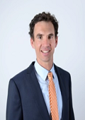
Philipp Hartlieb is a senior researcher at Montanuniversitaet Leoben, Austria. He holds a MSc in Applied Geosciences and did his PhD as member of the Chair of Mining Engineering of Montanuniversitaet Leoben on “Investigations on the effects of microwaves on hard rock” in 2013. He received the Hugh E. McKinstry Fund student research grant from the Society of Economic Geologists in 2007 and was ranked 1st at Young Researchers Competition, Saint Petersburg State Mining University (RUS) in 2010.
His current research focusses on microwave irradiation of rocks and ores with the goal of enhancing mechanical excavation tools and / or mineral processing and is sponsored by industry and research funds.
Abstract:
Extra-terrestrial mining means operating in remote areas under extreme radiation conditions and low gravity. These circumstances necessitate rethinking current excavation methods used for extracting raw materials from the earths’ crust. Especially the low-gravity conditions will change the way forces are applied to the rock mass in order to using its fragment size and subsequently processing it. With currently used machinery and technology mining machines are comparably heavy and apply high forces to the rock mass. Blasting will apply an even bigger shock wave causing fragmentation of ores. Since a) the application of high forces will not be possible in space and b) it is extremely expensive to transport heavy equipment to space alternative ways of rock fragmentation and excavation which mitigate these issues are widely investigated.
This paper will discuss the problems associated with mining in remote environments, especially under low gravity conditions as on asteroids or the moon. An overview will be provided on different alternative fragmentation concepts highlighting their pros and cons in this context. Special insights will be provided on the use of microwave irradiation of hard rocks and the consequences on excavation forces. Experimental results will be provided showing how microwave irradiation of hard rocks leads to a reduction of cutting forces by 10%.
Kuo-Ying Wang
National Central University
Taiwan
Title: Climate Change Detection with the FORMOSAT-3/COSMIC GPS RO Satellite
Biography:
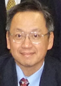
Wang has developed computer models for weather prediction since 1991 in Taiwan's Central Weather Bureau. He has developed tools for modeling global chemistry and air pollution since 1995 when he did his PhD work in Cambridge University with Professor John Pyle in the Department of Chemistry. Wang has built a network of CO2 sensors to collect CO2 data over global oceans on a fleet of nine global container cargo ships operated by Evergreen Marine Corporation (EMC) since 2009. Started from 2006, Wang has used FORMOSAT-3/COSMIC data to build tools for studying climate change. Wang has partnered with EMC, China Airlines, Taiwan Environmental Protection Administration, Tao-Yuan Environmental Protection Bureau, Le & Der Co. Ltd., Cambridge University, CPC Corporation, European IAGOS-AISBL consortium, University of Stockholm, Landseed Hospital, and Taiwan National Space Organization to develop new tools and collect new data that can help managing air pollution and climate change problems.
Abstract:
Statement of the Problem: The Intergovernmental Panel on Climate Change (IPCC) reports has made predictions of a persistent and wide-spread warming of temperatures close to the surface over the entire globe in the 21st century (IPCC, 2013). How realistic are the predictions made by the IPCC models, especially over the polar region where the highest increases in temperatures were predicted? Due to the lack of accurate temperature measurements over polar region, the estimate of temperature trends over the polar region remains to be determined. Methodology & Theoretical Orientation: In this work we use profiles of temperature measurements from the FORMOSAT-3/COSMIC (F3C) to determine global temperature trends during the period 2006-2016. Based on known sources from the radio waves provided by the Global Positioning System (GPS), the F3C uses radio occultation (RO) technique to obtain profiles of atmospheric temperatures from surface to 40-km altitudes. With a good global coverage by the F3C, we can work out temperature trends on a global scale. Findings: Distinctive warming over the northern hemisphere polar regions. This warming in the polar region, identified by the F3C observations, confirms the predictions made by the IPCC models. The continuously warming trends in the polar region can lead to progressive reduction in sea ice extent, melting glaciers, etc. Our work with the F3C data proves that this terrifying picture is actually happening now. Conclusion & Significance: The F3C data demonstrates that significant warming has occurred during the period 2007-2016, and most pronounced warming areas have occurred over the polar region. The pronounced warming over the polar region are exacerbating sea ice lost, and melting glaciers. Satellite measurements are keys for mankind to continuously observe what have occurred over the polar region.
Bo Huang
Chinese University of Hong Kong
Hong Kong
Title: Unified Satellite Image Fusion for sustainable urban environment
Biography:
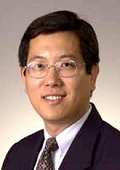
Bo Huang is a Professor in the Department of Geography and Resource Management, The Chinese University of Hong Kong, where he is also the Associate Director of Institute of Space and Earth Information Science and the Director of MSc Program in GeoInformation Science. He received Changjiang Scholar Chair Professorship, the highest academic award issued to an individual in higher education by the Ministry of Education of PR China. Dr. Huang’s research interest focuses on geographical information science and he has published extensively in this field, including over 100 refereed international journal articles. He currently serves as the Asia-Pacific Editor of International Journal of Geographical Information Science (Taylor & Francis). In recent years he has been exploring along the line of unified remote sensing image fusion, convinced that this new paradigm will revolutionize the way how remote sensing data are integrated, analyzed and utilized in the future.
Abstract:
The recent decades have witnessed the launch of a large number of orbiting satellite sensors with different spatial, temporal, spectral, and angular (STSA) characteristics, resulting in dramatic improvements in the ability to acquire images of the Earth surface, and a boom in remote sensing (RS) applications in environmental, ecological, and disaster monitoring. However, current RS technology cannot meet the requirement of monitoring dense and dynamic urban environments with complex structures and changes that require high spatial detail, frequent coverage, fine spectral resolution, and multi-angle observation. This is largely due to the fact that there is no satellite sensor that can achieve simultaneously high STSA resolution. Unified satellite image fusion aims to circumvent this obstacle by achieving high resolution with respect to all the image properties for a virtual satellite sensor. The generated high STSA resolution imagery can greatly contribute to the exploration and improvement of existing satellite image resources for urban environmental applications by detecting more details in a more accurate manner. This presentation will introduce to you the speaker’s endeavors along this line of research, including both the methodologies and applications in environmental and land use monitoring.
Jianbo LIU
Chinese Academy of Sciences
China
Title: China EO system and Virtual Ground Station - A new way to access remote sensing satellite image

Biography:
Jianbo LIU, Research professor and deputy director of Institute of Remote Sensing and Digital Earth, Chinese Academy of Sciences. He specializes in satellite remote sensing image processing and data management. He has more than 20 years experience in satellite remote sensing ground station construction, operation, and management. He proposed and develops a virtual ground station system which can provide near real time, full resolution satellite image to users. This system is installed in a few countries to help their needs for quick monitoring and response.
Abstract:
This presentation introduces major Chinese satellites program, including satellite classification, specification, timeline, and ground station system. On second part, it introduces a virtual ground station technology. It presents some disadvantages of the current remote sensing data distribution mode and proposes a new way to access remote sensing satellite image. The new way, by making use of strong capacity nowadays, transfer, calculate, and compress the remote sensing data immediately after data reception from a satellite, and provide the image in near real-time to users. The major functions include full resolution, overlaid with vector data such as longitude/latitude and administrative name, image zooming/panning, satellite/sensor information, data reception schedule, etc. Data can be searched by key words to find a path or location. The technical system is composed of four parts, which are respectively data comprehensive processing component, data management component, product distribution component and data display component. Virtual ground station users can access satellite image directly and timely. We expect that this kind of system is able to promote some new remote sensing applications fields, such as disaster monitoring, monitoring of progress for a big construction project, monitoring of natural heritage site, or monitoring of current events from the news.
Amr Elgamal
Dar Al-Handasah Shair and Partners
Egypt
Title: Impact analysis of satellite rainfall products on flow simulations in the Magdalena River Basin, Colombia

Biography:
Amr Elgamal is a water resources engineer, working with Dar Alhandasah (Shair & Partners). Mr. Elgamal has over five years of working experience in hydrology, hydrogeology and flood risk management. Mr. Elgamal has been working with several international research and consultant entities and involved in a wide range of projects in the Middle East, Africa and South America. Mr. Elgamal is passionate about helping improve the life quality of communities facing water resources challenges. His research and projects are primarily focused on integrating sustainable solutions for flood risk and draught management.
Abstract:
The Magdalena River is the most important river in Colombia in terms of economic activities and is home to about 77% of the country´s population. The river faces water resources allocation challenges, which require reliable hydrological assessments. In this research the reliability of ground-based measurements, different satellite products of rainfall and their combinations are tested for their impact on the discharge simulations of the Magdalena River.
Two different satellite rainfall products from the Tropical Rainfall Measuring Mission (TRMM) namely (TRMM-3B42 & TMPA), have been compared and merged with the ground-based measurements and their impact on the Magdalena river flows were quantified using the Representative Elementary Watershed (REW) distributed hydrological model.
It has been found that the use of TRMM-3B42 satellite product does not produce a reliable estimation of the spatial and temporal rainfall patterns over the study area. The performance of TRMM products had clear dependence on elevation. On the other side, TRMM best performed over areas gently rolling landscape and mild rainy parts. For hydrological modeling purposes the two products did not reproduce reliable estimation for the discharge at the downstream. Both TRMM-3B42 and TMPA tended to suffer from a systematic overestimation of the peak flows.
The impact of merging the rainfall products with ground-based measurements to generate a continuous rainfall field over areas with sparse raingauges, was investigated. Merging the TRMM-3B42 product with ground-based measurements had a negative impact on the model efficiency compared to the case of using ground-based data only. Merging the TMPA product with ground-based measurements, had a marginally positive impact on the simulated discharge. The estimation of the heterogeneous rainfall patterns and the hydrological modeling of the Magdalena River can be improved by using an enhanced assessment of the complex rainfall fields on the basis of merged TMPA satellite rainfall and ground station measurements.

Biography:
Huadong Guo was a Project Leader of over ten key programs related to Earth observation. For the past tens of years, he has been one of the Principal Investigators for Spaceborne Imaging Radar-C/X-Band Synthetic Aperture Radar (SIR-C/X-SAR), Japanese Earth Resources Satellite-1 (JERS-1) SAR, ERS-1/2 SAR, Radarsat-1/2, Environmental Satellite, Shuttle Radar Topography Mission, and Advanced Land Observing Satellite (ALOS) programs. He is currently with the Key Laboratory of Digital Earth Sciences, Institute of Remote Sensing and Digital Earth, Chinese Academy of Sciences, Beijing. He is also currently a Guest Professor of seven universities in China. He has authored or coauthored over 200 papers and 17 books. Prof. Guo is a member of the International SAR Working Group, the Chairman of the Association on Environment Remote Sensing of China, and the Secretary General of the International Society for Digital Earth. He is an Editorin- Chief of the International Journal of Digital Earth and a member of the CoDATA executive committee. He was a recipient of three national awards on science and technology and nine awards by the Chinese Academy of Sciences.
Abstract:
The large manned objects flying in low Earth orbit, e.g., the U.S. and Russia’s human space vehicles, the International Space Station, and Chinese Tiangong experimental space laboratory, provide unique platforms for Earth observation. On the other hand, as the only natural satellite of the Earth, the moon can become a bran-new Earth observation platform. Both of these space vehicles and the moon can be categorized as large Earth observation platforms, which have many common advantages, such as holding various different kinds of Earth observing sensors, which can measure multiple environmental parameters simultaneously under the same view geometry, illumination and atmospheric conditions.
Accompanying the development of manned space flight programs, Earth observation activities from large space vehicles have acquired various and large amount of datasets using both handheld cameras by crewmembers and automated sensors installed onboard these platforms. These datasets have been applied in multiple geoscience studies, demonstrating the importance and uniqueness of studying Earth from a vantage point of large platforms. For instance, the first near global digital elevation model (DEM) was produced by data obtained during the shuttle radar topography mission (SRTM).
Our humanity are ambitious in deep space exploration and have achieved gratifying progress. One objective of the exploration is to build the livable base in other planets. Moon base building could be the most achievable step in the near future. After the moon base being constructed, Earth observation could be one of its three main objectives (two others are studying the moon itself and observing the deep space from it). Extending Earth observing activities from the traditional artificial satellites in lower Earth orbit to the moon may trigger revolutionary applications for the Earth system science study. The Earth-moon distance is far enough to ensure the sensors can collect datasets covering half of the Earth surface. By studying events captured in these datasets may reveal some new large scale natural phenomena on Earth. Furthermore, utilizing different kinds of Earth observing sensors deployed on moon, detecting different parameters of the Earth, we can study the mechanism of the global environmental change system. It is our believe that the Earth observation from large platform and moon can play more important, and even unique role on Earth study in the future.
Afify. Abbas. Afify
Agricultural Research Center
Egypt
Title: Characterizing land utilization types for ahead use of paleo-drainage delta as well as adapting land and water practices in the Delta of River Nile
Biography:
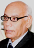
Afify Abbas Afify is currently a Chief of Research in Soil, Water and Environment Research Institute. Egypt. Part times of his scientific and technical activities were managed for the Authority for Remote Sensing and Space Sciences, Egypt. His conceptual approach is to optimize the use of land resources in Egypt for more food production. Afify shared with different international teams for land evaluation and land cover mapping, using the remote sensing data for Egypt and some other countries. His publications is covering the field of physiographic-soil identification; land cover assessment and land use planning; monitoring the land degradation and urban encroachment over the Nile Alluvium and the identification of new promising areas for the agricultural development. He always uses his publications to launch precautionary calls for protecting the Nile Alluvium to be a protectorate.
Abstract:
Nile Delta is facing problems of high population, water scarcity and sea water intrusion. Solutions can be inside and outside this delta. Delineating aquatic rice belt cultivation is required in its northern part to be protected from the sea water intrusion and for saving amounts of water. The soils in this part are heavy clay having capacity of holding water 2.6 times more than that in outside that proposed rice belt. (748874.8 hectares). Westwards from this Delta a virgin one of paleo- drainage in the Western Desert of Egypt is covering 6561199 hectares including Al Qattara Depression. Most of its physiographic units are profitable as olive cultivation belt, which can be associated with some grain, fodder crop and oil seed crops. The water logged pro delta. (-65 to -134 below sea level) can be filled with sea water for a massive hydroelectric project creating an artificial lake. The lake can be used for producing evaporates, distilled water and fish reserving manufactories. It is a strategic solution for facing the pressure of the food requirement and for the environmental enhancement and also for well demographic distribution.
Oleg Troshichev
Arctic and Antarctic Research Institute
Russia
Title: Space weather monitoring and now casting by ground-based means

Biography:
Oleg Troshichev graduated from Leningrad University, USSR. He has completed his PhD in physics in 1969 at the Siberian Institute of Earth Magnetism, Ionosphere, and Radiowave Propagation (Irkutsk,). He takes charge of Department of Geophysics in AARI (St.Petersburg) from 1985. The main subject of his investigations is physics of the Earth’s magnetosphere and solar-terrestrial relations. Prof. Oleg Troshichev is author of the polar cap magnetic activity (PC) index that has been endorsed by the IAGA (2013) as a proxy of the solar wind energy that entered into the magnetosphere. He has published more than 250 papers in reputed journals.
Abstract:
The polar cap (PC) magnetic activity index was approved by International Association of Geomagnetism and Aeronomy (IAGA) in 2013 as a new international index assigned to monitor the energy that enters into the magnetosphere during solar wind-magnetosphere coupling. The following experimental data form the basis for this statement: (1) the PC index strongly follows the time evolution of interplanetary electric field (EKL) reduced to magnetopause, (2) delay time ΔT in response of PC index to EKL variations is controlled by the EKL field growth rate (dEKL/dt), (3) magnetic storms and substorms are always preceded and accompanied by РС index growth, (4) substorms and magnetic storms start to develop as soon as the PC index exceeds the threshold level of 1.5 mV/m, (5) the substorm sudden onsets are commonly associated with a sharp increase in the PC (and EKL) growth rate, (6) the solar drivers (ICMEs or SIRs determine the type of magnetic storm, such as “classic” storm, related to ICME impact, with well-defined PC maximum and clearly expressed one maximum of depression, “pulsed” storm, related to SIR impact, with periodically repeating oscillations in PC and geomagnetic field depression, and “combined storms”, which are regarded as effect of simultaneous ICME and SIR action, (7) maximal depression of magnetic field responds to maximal PC value with a delay of ~1 hour, the storm intensity (Dstmin) being linearly depending on PCmax value. In ~10% of the substorm events the correlation between EKL and PC is practically absent, in spite of actual substorm onset related to the PC index rise; in these cases the actual solar wind, measured in the Lagrange point, passes by the magnetosphere. It implies that РС index can be used also to verify whether or not the solar wind measured in Lagrange point L1 is in contact with the magnetosphere.

Biography:
Pinheiro spent a research period with the Industrial Plasma Engineering Group lead by Prof. John Reece Roth, at the University of Knoxville, Tennessee, USA. Prof. Roth is a pioneer in the application of plasma propulsion in drone technology. His main scientific interests are Plasma Electrodynamics, Electromagnetic Propulsion and Fundamentals of Physics. He has been working in plasma processes modeling, and in the last years is dedicated to study advanced propulsion systems and try to understand the flyby anomaly. He is author of about 50 articles published in peer-reviewed journals and up to 60 papers presented at International Conferences. He has a degree in Physics from the University of Paris-Orsay and the PhD in Physics from the University of Lisbon.
Abstract:
The central task of dynamical astronomy is to obtain solutions for equations of satellite motion. This analytic methodology employs Newtonian dynamics with gravitational fields that pulls on matter to get it going. After 100 years the inception of the General Theory of Relativity (GTR) by Einstein, a cornerstone of modern physics, even accomplished theories might have difficulty explaining a certain class of astronomical phenomena - in particular, small astrometric anomalies. At the end of the 19th century, astronomers discovered that the perihelion of Mercury was slowly advancing in a way that could not be explained by Newtonian physics. As it turned out, this small anomaly in Mercury's orbit has found an explanation in GTR. We may point four classes of astrometric anomalies: i) the flyby anomaly, addressed in this work; ii) the slow increase of the astronomical unit (AU), approximately the distance from the Earth to the Sun; iii) the Pioneer anomaly, which is now a solved puzzle; iv) the increase in the eccentricity of the Moon's orbit. The flyby anomaly has been a puzzling issue, addressed in the present work and by other numerous authors.
We suggest a possible theoretical explanation for the physical process underlying the unexpected orbital-energy change observed during close planetary flybys based on the new concept of topological torsion current (TTC). This approach is along the line of non-standard physical models used to explain the anomalous velocity increase by means of torsion gravity, the majority based on the Ehlers-Pirani-Schild program of constructive axiomatization of the geometric structure of spacetime. Our theoretical framework is classical and shows that there is an asymmetry when a spacecraft approaches a planet in prograde or retrograde direction, but the anomaly occurring only in retrograde direction.
Mukesh S. Boori
Samara National Research University
Russia
Title: Food security and flood risk dynamics in Myanmar
Biography:
Mukesh Singh Boori is Senior Scientist in Samara University Russia (03/2015–Present, funded by Russian Federation), Visiting Professor in JKLU University India (10/2016-11/2016), Visiting Senior Scientist at University of Bonn, Germany (05/2016–07/2016), Visiting Scientist/Professor at Hokkaido University Japan (12/2015–02/2016) and Adjunct Professor in American Sentinel University Colorado USA (07/2015–Present). He was involved in European Union Project as well as Visiting Assistant Professor in Palacky University Olomouc, Czech Republic (04/2013–06/2015), Ruhr University Bochum Germany (09/2014–12/2014) and University of Leicester, UK (Honorary Fellow 2014) funded by European Union; at the same time he was Assistant Professor in JECRC University India (01/2013–06/2015). He was Scientist in Satellite Climate Studies Branch (NOAA/NASA) selected by National Research Council (NRC) Central Govt. of USA Washington DC. During that time he completed his Postdoc from University of Maryland USA (10/2012). He has done PhD (EIA & Management of Natural Resources) from Federal University – RN (UFRN) Natal –RN Brazil (08/2011) funded by Brazil–Italy Govt. fellowship. He has done Predoc (Earth & Environmental Science) from Katholieke University Leuven Belgium (08/2008) selected by Ministry of Human Resource Development (MHRD) New Delhi India and funded by Govt. of Belgium. He has done MSc (Remote sensing & GIS) from MDS University Ajmer (2004) and BSc (Bio-group) from University of Rajasthan Jaipur India (2002). In early career he was scientist in JSAC/ISRO (2006-2007) and before that Lecturer (PG) at MDS University Ajmer (2005-2007Sessions). He received international awards/fellowships from UK, USA, Brazil, Italy, Indonesia, Belgium, Czech Republic, Germany, Russia, China, Japan and India. He known Six Language and visit four Continents for Awards, Meetings, Trainings, Field Trips, Seminars and Conferences. He is an active Organizing Committee Member in Earth & Space Science Conferences, Co-Chaired a session and gave Conference Opening Ceremony Speech as Reynold Speaker (08/2012) Chicago USA and (05/2017) Barcelona Spain. He is editor and member of more than 10 International Scientific Societies/Journals/Committees related to Earth & Space Science; which include organize conferences. His prime research interest is “EIA and Management of Natural Resources through Remote Sensing & GIS Technology”. He has more than 100 Peer-reviewed International Publications including Books as a first author on Vulnerability, Risk Assessment and Climate Change.
Abstract:
The Central Dry Zone area of Myanmar is the most water stressed and one of the most food insecure region in the country. In the Dry Zone area, the total population of 10.1 million people in 54 townships, in which approximately 43% live in below poverty line and 40-50% of the rural population is landless. Agriculture is the most important economic sector in Myanmar as it is essential for national food security and a major source of livelihood for its people. In this region the adverse effects of climate change such as late or early onset of monsoon season, longer dry spells, erratic rainfall, increasing temperature, heavy rains, stronger typhoons, extreme spatial-temporal variability of rainfall, high intensities, limited rainfall events in the growing season, heat stress, drought, flooding, sea water intrusion, land degradation, desertification, deforestation and other natural disasters are believed to be a major constraint to food insecurity and flood risk. Theses extreme climatic events are likely increase in frequency and magnitude of serious drought periods and extreme floods. Food insecurity is an important thing that must be reviewed because it relates to the lives of many people. Food security is composed of subsystems, availability, distribution, and consumption so that if one of subsystem is not well functioning, there will be a problem of food insecurity. This paper gives a structured overview of the current scientific knowledge available and reveals the relevance of this information with regard to food security and flood risk dynamics in central dry zone area of Myanmar.
Dae-Eun Kang
Yonsei University
South Korea
Title: Development of Relative Navigation Test-bed using GPS and Femtosecond Laser

Biography:
Dae-Eun Kang is a graduate student at Yonsei University. He is getting a master’s course in Department of Astronomy at Astrodynamics and Control Laboratory (ACL). He graduated from Yonsei University, Department of Astronomy in 2016.
Abstract:
Formation flying using small satellites can be operated with lower budget. There are various formation flying missions. A precise relative navigation system is required to operate the formation flying with good performance. Sometimes a laser distance meter is utilized as distance measurement data for precise relative navigation. Many previous studies [1-3] have used the laser distance data generated by software-based simulator which was formulated by femtosecond laser ranging theory. However, the previous studies did not include information from a real distance meter. The current study will present a real-time relative navigation test-bed based on GPS signal and miniaturized femtosecond laser distance meter. For this study, the laser simulator is developed to include actual hardware properties omitted in the former software-based simulator. An ultimate goal is to replace the laser data of software-based simulator with real measured data by the hardware of the laser distance meter. Short-distance simulations can be performed with a raw data measured by the distance meter. On the other hand, the measurement data should be generated by the simulator for long-distance simulations. To generate long distance information, the hardware properties should be improved to include the characteristics of design parameters and measurement errors. The design parameters in the simulator are modulated same as the manufactured instrument. The design parameters are associated with random noise of measured data. If a mathematical relation between them is deduced, the parameters can be estimated for a long-distance navigation in formation flying. The measurement errors of instrument contain not only errors of laser hardware parts but also errors of other device parts. The test-bed is developed by adding the errors of the device parts to the previous software-based data. With the integrated test-bed, the results can be used for a relative navigation utilizing femtosecond laser ranging data. The relative navigation algorithm developed in this study will be verified for spacecraft formation flying mission.

Biography:
Oleg V. Goriachkin is head and professor of theoretical basics of radio-engineering and telecommunication systems department of VSUTI. He has her expertise in theory of SAR, UWB and low-frequency SAR, digital signal and image processing in telecommunication and SAR applications, theory of blind identification of dispersive channels, applications of SAR remote sensing, blind signal processing.
Abstract:
Remote sensing spacecrafts allow observing the Earth's surface in different bands of the electromagnetic spectrum. Radar satellites used today X, C, S, and L bands of frequencies. Increased interest in the use of space synthetic aperture radar (SAR) P band to monitor subsurface, hidden objects, geological mapping, measuring the biomass of vegetation and other applications [1,3,4,5].
The purpose of the conducted experiments per “AIST-2D”, successfully launched in April 2016 from the cosmodrome “Vostochny”, it consists in finalizing of the technology of radar surveillance of the earth's surface in P band [2]. Onboard equipment of the SAR is the multimode impact transmitter, which ensures the wide range of stable signals at the carrier frequency 435 MHz, in the strip to 6 (30) MHz the possibility of reconstruction from 1 to 30 MHz. Types of the signals: the sequence of square pulses, the sequence of chirp, the sequence of the phase-keyed signals, coded M-sequences. Onboard transmitting antenna is Yagi antenna, polarization – linear, the antenna gain - 5 dB. Ground-based stationary equipment is two-channel tuned radio receiver (to 110 dB) with digital registration of quadrature components at the frequency to 200MHz and subsequent digital processing of signals. The ground-based receiving antenna “reflected” channel is “stack” of two Yagi antennas, antenna polarization – circular, the antenna gain of the “reflected channel” – 20 dB, “straight” – 9 dB.
Onboard equipment bistatic of the radar with the synthesized aperture, which works in the P- band to 01.11.2016, could not be switched into the mode of regular work. The analysis of causes for failure and the search for the versions of the start of transmitter continue.
Biography:
Valentin Sysoev, Doctor of Technical Sciences, Deputy Head of the Design Centre of FSUE "NPO. SA Lavochkin" (“Lavochkin Association”). Specialist in space instrumentation, laser opto-electronic devices and laser technology of non-metallic materials. Author of over 200 scientific articles and patents. He is currently working on projects Luna-25, Exomars and the creation of small high precision optoelectronic devices guidance and orientation of the spacecraft. I participate in the conduct of laboratory work on the sintering models of lunar soil by using simulated solar radiation.
Abstract:
A concept of a 3-D printer on solar energy to build permanent constructions on the moon from lunar regolith and waste is proposed. The main part of printer is a spherical mirror that focuses the sunlight into the working spot. Very easily mirror can be made of a thin film mirror. At this point, the temperature reaches 5000 degrees. If solid particles of lunar regolite pour to this place, they will melt therein, and connected with the substrate. With a diameter of 4 meters focusing mirror regolite processing rate is 10 g / s. During the lunar day (14 Earth days), the printer will process 12 tones of regolith. The controlled movement of the spot will create a gas-tight space of any configuration entirely from local materials. The proposed construction of a 3-D printer does not contain a print head, in which the molten regolith may freeze during lunar night and disable it. After sunrise the printer will continue its work. After sunrise, the printer will continue its work. If you now run the printer on the Moon, at the time of landing astronauts on him, he will have a solid frame building, able to protect the crew from cosmic radiation. Constructed building will be necessary to ensure the transition hatches sealed and provide them with life-support systems.
Russian Federal Space Program for 2016-2025 envisages the creation of the necessary groundwork for a full-scale lunar exploration after 2025 and the implementation by 2030 of landing a man on the moon. Laboratory and accommodations of a permanent station on the moon shall ensure full protection the crew from harmful cosmic radiation, in the first place - from hard solar radiation. In the absence of a protective atmosphere and magnetic field on the moon, the premises must be protected sufficiently thick coating of absorbent material. The thickness of the walls of the space module, developed for placement on the lunar surface, in 20 ... 40 times less than required. For full protection, would be enough 5-meter layer of of fused lunar regolith. We believe that it would be rational to build a multi-storey building with a wall thickness of 0.5 m. This will ensure maximum protection on the lower floors. Proposed 3-D printer for five years could construct a building with an area of about 150 m2 with a ceiling height 2.5 m
Biography:
Orlando Alvarez Pontoriero, Doctor in Geophysics. Current position as Assistant Researcher at CONICET and Professor at Instituto Geofísico y Sismologico Ing. F.S. Volponi, Facultad de Ciencias Exactas Fisicas y Naturales, Universidad Nacional de San Juan. His current research is the study of great megathrust earthquakes rupture zones and its relation to Satellite Gravity. Other Research interests: Geophysics, Geodynamics, Subduction zones, Earthquakes forecasting and prediction.
Abstract:
Satellite gravimetry is a useful tool to identify mass anomalies along a subduction interface, interpreted as heterogeneities related to the rupture process during megathrust earthquakes. Different works with data derived from satellite gravity missions as GRACE and GOCE, have analyzed the static component of the Earth gravity field and its temporal variations. During the last decade the Chilean margin has been affected by three megathrust earthquakes with Mw>8. Then, the recently completed GOCE mission offered a unique opportunity to study this events by means of gravity gradients, which allowed mapping density heterogeneities with greater detail than the gravity anomaly which has been used in most studies up to now.
We derived the vertical gravity gradient from GOCE, corrected by the topographic effect and by the sediments on depocenters of the offshore region at the Peru-Chile margin, in order to study a spatial relationship between different lobes of the gravity derived signal and the seismic sources of large megathrust earthquakes. Then we find a good correlation between vertical gravity gradients and main rupture zones, correlation that becomes even stronger as the event magnitude increases. A gravity fall in the gravity gradient and in geoid heights was noticed over the area of the main slip patch at least for the two years before 2014 Mw=8.2 Pisagua earthquake. Additionally, we found temporal variations of the gravity field after 2010 Mw=8.8 Maule event, related to coseismic deformation. Therefore, we analyzed variations in the gravity field as an indirect measure of the variable seismic coupling. These relationships exemplify the strong potential of the satellite only derived models as a predictive tool to determine potential seismic energy released in a subduction segment, determining the potential size of a potential rupture zone, and in particular internal slip distribution that allows inferring coseismic displacement field at surface.
L.I. Miroshnichenko
Lomonosov Moscow State University
Russia
Title: Retrospective analysis of GLE events and estimates of radiation risks

Biography:
L.I. Miroshnichenko is working at IZMIRAN, Skobeltsyn Institute of Nuclear Physics Lomonosov Moscow State University (SINP MSU)), RUSSIA. He published many articles in national and international journals.
Abstract:
Near-Earth's environment can be considered as a unique place where different space radiation fields are co-existing and can play a significant role in the estimation of radiation risks both for robotic and manned space missions. One cannot exclude the synergetic effects for particular spacecraft orbits as the result of simultaneous impact of the different radiation fields.
Modern state of the problems related to Ground Level Enhancements (GLEs) of Solar Cosmic Rays (SCR) is critically analyzed based on available direct and proxy data. We also consider extremely large fluxes on non-relativistic solar energetic particles (SEP). Special attention is paid to recent debate on validity, origin and properties of the events AD775 and AD1859 (Carrington event). We demonstrate that, in spite of existing uncertainties in proton fluences above 30 MeV, all of them are fitted well by a unique distribution function, at least, with present level of solar activity. Extremely large SEP fluxes are shown to obey a probabilistic distribution with a sharp break in the range of large fluences (or low probabilities). The studies of this kind may be extended for the periods with different levels of solar activity in the past and/or in the future. Considering the recent confirmation of super-flares on solar-type stars, this issue merits attention.
Dose rates at aircraft altitudes are also demonstrated during the GLE60 (15 April 2001) along two actual flights (computed from the GLE parameters deduced by different groups), as well as ambient dose equivalent during GLE69 (20 January 2005) computed by different groups for three assumed flights.
We consider some examples of using of the models to estimate changes of radiation hazard in the interplanetary space for the expected reduction of solar activity during the nearest solar cycles 25-26.
Gustavo Mendoza-Torres
Autonomous University of Puebla
Mexico
Title: Fuzzy control for stabilization and position of a Nano-satellite
Biography:
Gustavo Mendoza Torres is an applied mathematician. He completed his PhD in Mechanical System Stabilization and Fuzzy Control, His personal interest for the application in aerospace systems is in the category of mechanicals systems for Nano-satellites. And apply his experience to build the inertial mechanicals systems controlled by fuzzy control, and obtain its position.
Abstract:
In this work, we propose a control system based on a Fuzzy Control in order to counter the chaotic Nano-satellite and position motion. The control is founded on the variation of angular acceleration from which the torque of an inertial system is modified. A disk and a DC motor compose the inertial system. We develop a fuzzy control algorithm for each axis, x, y. For each control algorithm, we include information in both directions x and y, and with their combination we get the control of the third axis. This control system can be adequate for using in low-orbit satellites. Through of an accelerometer we obtain the information of the axis x, y. To test the fuzzy control proposed, we built a scale model with the standard dimensions of a CubeSat. In this scale model was included the inertial system with the accelerometer and the tests of the fuzzy control conducted were under conditions of gravity on the Earth's surface. The control variables are specified by the value given by the accelerometer as input variable, and the pulse width of the DC current as output variable. The processed information by the fuzzy control is sent to the DC motors, which handle the disks, generating the torque required to steady the chaotic and position of Nano-satellite movement.
Biography:
Dmitry Pozdnyakov has his expertise in hydro-optics in application to environmental remote sensing. With his team he developed a set of biooptical models as tools for investigating natural turbid waters, which by nature are most challenging for remote sensing. Went through numerous verifications in a variety of marine and lacustrine water bodies, these tools were used by him in numerous studies in the area of aquatic ecology with special emphasis on the influence of ongoing climate change and anthropogenic forcing as well as aqua-ecological problems related to harmful and nuisance algae. Twice, in 1992 and 2005, he was recipient of the Chandler-Misener award.
Abstract:
Owing to developed original algorithms, multi-year time series of variations in the E. huxleyi blooming occurrence, surficial extent as well as the content of particulate inorganic carbon (PIC) and partial pressure of CO2 (DCO2) in the North, Norwegian, Greenland, Barents and Bering Seas were obtained from OC CCI data for the time period 1998-2013.
The bloom areas in the North Atlantic-Arctic water are the lowest in the Greenland Sea (10000 -3000 km2) and by an order of magnitude higher in the Barents Sea. The same pattern holds for total PIC within blooms: 400-14000 t in the Greenland Sea and ~350 000 t in the Barents Sea.
Annually invariable spatio-temporal pattern of E. huxleyi blooming advancement across the North Atlantic and Arctic Oceans is revealed. Starting from the southern Great Britain, blooms eventually appear firstly in the North and Norwegian Seas (in early June), then in the Greenland Sea (in late June), and finally in the Barents Sea (in late July-early September). In the Bering Sea the counter pattern is highly irregular: before and after the 1997-2013 period of high intensity of this phenomenon, the blooms are sporadic and their extent is insignificant. The bloom area extents and PIC contents in the Barents and Bering Sea are very similar. The assessed values of (DCO2) indicate that within E. huxleyi blooms the ocean CO2 absorption capacity is appreciably decreased.
Biography:
Victor Sergeevich Seleznev–Deputy Director of Geophysical Survey of RAS and Director of Seismological Branch of Geophysical Survey of RAS, Russia, city of Novosibirsk. His areas of expertise involve local and engineering seismology, geophysical methods of research of the Earth deep structure. The observation seismological net in earthquake-prone regions of Siberian part of Russia has been appreciably extended and equipped with modern recording equipment under his guidance, new prognostic geophysical testing areas are created and got further development, unique devoid world analogues technologies of active geophysical monitoring and deep seismic studies with powerful vibration sources have been accomplished. The technology of detailed engineer-seismological researches of buildings and constructions, based on standing waves studies has been developed. It allows giving an objective appraisal of the seismic resistance of different construction facilities and determining defects in objects. Technologies of seismic and electrical river exploration are created.
Abstract:
Researches are dedicated to the identification of parameters of meteoroid “Chelyabinsk” exploded on 15 February 2013. The explosion took place over the territory of Chelyabinsk region (Russia) in heavily populated area (Fig. 1). Bolide was caught on many surveillance cameras, dashboard cameras and mobile phones which videos were quickly spread all over the world through the Internet. Using these videos we defined the trajectory and traverse speed of meteoroid from the moment of first visible light and till the moment of disruption. At the moment of explosion acoustical wave set and when it reached the Earth's surface, it formed long-period (T~10-15sec) surface seismic wave registered at the distance of 1000 km. Waves of such type appear under nuclear and thermonuclear explosions in the air. There are methods to determine the energy of high-altitude explosion under the amplitudes of surface waves at a distance of it. We used the records of broadband seismic stations and at times of entrance this wave we determined exact explosion time – 03:20:34 UTC. According to amplitudes of the surface wave we estimated explosion energy in hypothesis that it was the point source similar to the altitude thermonuclear explosion. The energy of explosion according to data of 5 seismic stations was about 70 kt-140 kt (on the average, 100 kt) in the trinitrotoluol equivalent.
Ahmed Hafez Mohammed Ibrahim
Al-Azhar University Faculty of science
Egypt
Title: N –Body problem: The Theory and Application
Biography:
Ahmed Hafez Ibrahim has completed his MSc degree in Space Dynamics from Al-Azhar University in August 2014. He is an Assistant Lecturer and PhD student at Faculty of Science of Al-Azhar University He got prize the best MSc thesis in astronomy field from Faculty of Science. He is working to finalize his PhD degree.
Abstract:
The history of the n-body problem: when appeared this problem? Who scientist and researches help in solutions of this problem? Examples of the n-body: two body problem, three - body problem and four- body problem. Types of solutions are used as analytical solution, numerical solution, semi-analytical solutions, qualitative solutions and quantitative solutions .types of restrictions are used to solve n-body problem. Types of systems of equations are used to solve n-body problem: Newtonian equations of motion and Hamiltonian equations. Application of n-body problem on Sun-Earth-Moon-Spacecraft, treatment this problem as a restricted four-body problem finding liberation points as special solution. These liberation points can use in space mission as parking orbit or space station. The effect of solar radiation in these liberation points is studied.

Biography:
Vladislav A. Leonov, PhD, research scientist of the Solar System Investigations Department of Institute of Astronomy Russian Academy of Sciences. He has his expertise in meteor astronomy. He studies meteor masses distributions in main meteor showers and sporadic flow to estimate real risks for space activity. He is author of the patent “Earth-Moon elevator”. Further development of this idea lead him to conception of Martian elevator, inter-asteroid navigation with tether harpoons and solar system settlements.
Abstract:
Time, when the expedition to Mars and back will start, is near. To go back to Mars will need to use a missile capable to overcome the exhaust velocity of 5 km/s. Delivery of such a missile from Earth to Mars is a difficult technical challenge. As an alternative, we propose to consider the use of local resources to launch from Mars without missiles. Martian natural moon Phobos has one side constantly turned to Mars. If one end of the of the rope is attached to it, and the lower end is close to the surface of Mars, the spacecraft on the rope can be lifted straight from Mars into space. The length of the tether between Phobos and Mars should be about 9500 kilometers. You can start with the rocket taking off from Mars to dock with rope end, which has a speed of about 2 km / s, which is much less than the required speed to escape from Mars. One can calculate the trajectory of the sub-satellite point and to place on its trajectory the launch site of a spacecraft , and use the elastic rope with a hook at the end of the rope to ensure the capture of a loop attached to the device. If the lower end of the cable will be added glider controlled, it can be targeted to virtually anywhere on Mars, and it will allow for the launch of the spacecraft from any region of Mars 8 times a day.
Solution non-rocket start from Mars is similar to creating a space elevator between the Earth and the Moon. The material for the required strength of the cable has already been developed; long-length cable manufacturing technology can be developed in the coming decades. Lifting gear lunat space elevator can be used on Mars. In order to secure the cable in the body of Phobos a penetrator may be used.
Yaroslav Yatskiv
Main Astronomical Observatory
Ukraine
Title: Ground-based support and data processing for the Aerosol-UA satellite experiment
Biography:
Yaroslav Yatskiv has his expertise in the field of geodynamics and evaluation of Earth rotation peculiarities. His evaluations of Earth Pole movement are well known as open set of pole coordinates. Ya. Yatskiv initiated the development and application of new observation methods to determine the parameters of Earth rotation: laser satellite location, VLBI radio interferometry, GPS-observations. He proposed new approaches for the global planetary and celestial coordinate systems. He actively participated in preparing and fulfillment of several space missions according to the programs Vega, FOBOS, MARS, and is serving as coordinator of Space Research Program of Ukraine Academy of Sciences. In 2012 he initiated the development of the satellite project "Aerosol-UA" for microphysics of atmospheric aerosol properties study from the orbit.
Abstract:
The support of the "Aerosol-UA" satellite experiment by ground-based measurements is based mainly on algorithm, equipment and experience of the sunphotometer AERONET network. Methods for the satellite data validation using AERONET network, mobile sunpotometer station, lidar soundings (Figure 1) and in situ measurements are discussed. Validation of the "Aerosol-UA" mission instruments data obtained by scanning polarimeter ScanPol and wide-angle multispectral imager-polarimeter MSIP will be performed on global and regional scales using aerosol ground-based remote sensing measurements by AERONET sunphotometers, mobile and portable sunphotometers used in the Maritime Aerosol Network (Smirnov et al. 2011). Validation of the ScanPol and MSIP space-born polarimeters data will be performed by comparison of the columnar spectral aerosol optical depth and columnar aerosol particles properties obtained from simultaneous measurements of the optical characteristics of the same air mass by both the orbital polarimeters and ground-based sunphotometer. We expect that international scientific community will also be involved in the Aerosol-UA mission support and validation. The data processing facility, physical and logical structures, are being developed for processing the ScanPol and MSIP polarimeters data. Preliminary synthetic data simulations have been performed using the GRASP algorithm for ScanPol and MSIP instruments. The simulations were designed for mimic satellite observations over the AERONET ground-based sunphotometer located in Kyiv site, Ukraine (Danylevsky et al. 2011). The preliminary results of the synthetic data test showed that we can robustly derive Aerosol-UA aerosol parameters that are in good agreement with the parameters retrieved from POLDER/PARASOL and AERONET measurements. Therefore we expect that GRASP algorithm will be a powerful tool to retrieve the columnar properties of the aerosols layer and the particles microphysical characteristics from ScanPol and MSIP measurements coincident with the ground-based sunphotometer and lidar observations.
Biography:
15 More Speaker Slots Available
Submit your abstract and confirm your Speaker slot at Satellite-2017. All proposals must be submitted to satellite@conferenceseries.net
Abstract:
P. Tematio
University of Dschang
Cameroon
Title: Mapping bauxite indices using Landsat ETM+ imageries constrained with environmental factors in Foumban area (West Cameroon)
Biography:
Paul TEMATIO is an Associate Professor with a PhD in Earth Science. He is a Senior Researcher and Lecturer in the University of Dschang, Cameroon. He is experienced in Soil and Water resources management, Mineralogy and geochemistry of weathering products as well as Remote sensing applied on mineral resources exploration. He published two major papers in the use of GIS and ETM+ Imageries to map Bauxite ore deposits in humid tropical environment of Cameroon (Tematio et al., 2015; Momo Nouazi et al., 2016). This approach might be promising for larger scale investigations of other mineral resources in tropical regions.
Abstract:
The present study aims at mapping some western Cameroon bauxites combining results of digital processing of satellite data (ETM+ of LandSat) with the geological, structural, mineralogical and geochemical characteristics of the Foumban area. Two categories of encrusted bauxitic surfaces have been identified: (i) discontinuous surfaces covering a total area of 11.13 km2, and (ii) continuous surfaces overlapping 2.41 km2. Field observations portray discontinuous surfaces with 5.5 m thick bauxitic mantle subdivided into 1.5 m thick discontinuous duricrust lying on 4.0 m thick continuous duricrust. The continuous surfaces are 4.1 m thick bauxitic duricrust. Mineralogical studies showed that the Foumban bauxites exhibit 78–86% of gibbsite, 7–22% of goethite and less than 7% of kaolinite. Geochemically, Al is the most abundant element with 45.6–58.7 wt.% of Al2O3; followed by Fe with 12.9–20.1 wt.% of Fe2O3 and Si with 1.0–3.7 wt.% of SiO2. Element mobility stated with enrichment factor (EF) allows differentiating three chemical elements: strongly depleted with EF < 1 (Si, Ca, Mg, K, Na, Cu, Mn, Zn); strictly enriched with EF > 1 (Al, Fe, Cr); and with irregular depletion and enrichment behavior with EF Â} 1 (Nb, Sr, V, Zr). Based on mass-transport function (M), elements decrease as follows: Sr > Nb > Cr > Al > Zr > V > Zn > Fe > Cu > Si > Ca > K = Na > Mg > Mn. The Foumban encrusted bauxites are classified as laterite and iron-rich high grade orth-bauxites with 45.6–58.7 wt.% of Al2O3 and 1.0–3.7 wt.% of SiO2, with bauxite reserves estimated to 75.8 million tons. The mapping approach has shown to be suitable for delineating encrusted bauxitic surfaces within loose laterites in tropical regions.
Benhard Sitohang
Bandung Institute of Technology
Indonesia
Title: Finding New Fishing Grounds Using Sea Surface Temperature Data from Satellite Remote Sensing in case Indonesian Waters
Biography:
Benhard Sitohang finished his master (informatics) in 1980 and Ph.D degree (informatics) in 1983, both from Universite de Sciences et Techniques et Languedoc-Montpellier II, France. From 1984, he has been working at Institut Teknologi Bandung (ITB) as Lecturer and Researcher. Actually he is chair of “Knowledge & Software Engineering Research Division”.
Abstract:
Indonesian marine fisheries potential of approximately 65 million tons per year and become the largest in the world, but only about 15 percent exploited (10.5 tons per year). The fish taken from waters that have exceeded the maximum sustainable yield. This is a challenge for us to find new fishing grounds. Remote sensing satellite data utilization is the solution to predict the fishing grounds in Indonesian waters. Fishing grounds can be predicted by observing the phenomenon of upwelling in the ocean waters. Upwelling phenomenon can be detected by analyzing sea surface temperature (SST) data acquired by satellites such as NOAA and Terra/Aqua. Several algorithms have been developed to process satellite data resulting SST similar to actual SST. We develop a model of upwelling detection using SST data from satellites Terra / Aqua MODIS Level 3. We exploit the concept spatiogram to determine upwelling region of interest (RoI) in the study area, then use the structure growing to ensure that the RoI is a valid upwelling. We define indicators upwelling areas where there is a temperature difference of 0.5oC within a radius of 3 km, then all pixels in a radius of 3 km (12 pixels) from the center of mass must be taken into account. We assume the RoI is determined as far as 21 km which is equivalent to 84 pixels. We are still working on intensive research; the results are highly dependent on the quality of the satellite data used, in particular the case of cloud cover.
Haydee Karszenbaum
Institute of Astronomy and Space Physics (IAFE)
Argentina
Title: Efforts in remote sensing products development for earth observing satellite missions

Biography:
Haydee Karszenbaum has her expertise in developing applications for earth observing satellite missions with emphasis in forward and inverse models. She leads an interdisciplinary remote sensing group compose by physicists, biologists, electronic engineering and computer experts. End to end product simulations that include sensor specifications, forward and inverse models and errors estimations are among the core activities of the group. Also, bayesian based algorithms for soil moisture estimations have been developed and compared with NASA and USDA algorithms. The group she leads is also involved in technology transfer developments related to current missions of the Argentine Space Program (SAOCOM and SABIAMAR under development).
Abstract:
Statement of the Problem: Earth observing satellite missions carry sensors that measure physical variables in different spectral ranges from visible to microwaves. Nevertheless, the main interest of these missions are not the physical variables itself such as reflectance in the visible, Land Surface Temperature in the infrared and or microwave brightness temperature and backscattering coefficient in the passive and active microwave regions respectively. The interest are the biogeophysical variables that are referred in the main objectives of the missions such as ocean color, soil moisture, sea surface salinity, sea surface temperatures and others. The generation of derived products from satellite physical variables includes several lines of expertise which can be combine in simulation systems that can address the different subjects in a related rigorous procedure. This aim of this presentation is to show the efforts done toward the development of products of satellite missions already developed or under development in Argentina. Methodology & Theoretical Orientation: the methodology is based on the development of Observing System Simulation Experiments (OSSEs), they consist of a conceptual framework for the development of satellite missions and derived products. This includes different modules related to sensor design, products forward and inverse models and error estimations. This presentation will focus in the development of the interaction and retrieval models needed to go from physical variables such us microwave brightness temperatures to soil moisture products. Different approaches will be analyzed and their performance compared. Conclusion & Significance: Although there is a good understanding of how electromagnetic radiation interacts with different targets, when a specific product is being derived, the difficulties arise in the different issues related to retrieval models, such as the parameters needed, constrains and validation. The success of an earth observing satellite mission is strongly related to the performance of derived products. This subject is carefully addressed in this presentation.
Biography:
Aleksei Vladimirovich Liseikin – geophysicist of Seismological Branch of Geophysical Survey of RAS, Russia, city of Novosibirsk. In 2002 he is graduated from the Novosibirsk State University. He is PhD in geological sciences since 2009. His areas of expertise involve local and engineering seismology, geophysical methods of research of the Earth deep structure. He develops methods of seismic monitoring of the state of large buildings and equipment.
Abstract:
6.12.2016 at 18:36 local time (18-36 UTC) on the territory of the Republic of Khakassia there was a rare astronomical phenomenon that thousands of people could see – it was a fall of large enough astronomical body. In spite of the fact that this fall didn’t cause damage it was necessary to say that the most powerful impact wave was near high-security objects – Maina and Sayano-Shushenskaya HPP. The last one was equipped with the local seismological net which the explosion impact wave was recorded on. (Fig. 1). The analysis of data from surveillance cameras and dashboard cameras showed that the azimuth of meteoroid trajectory was 135°±10°, and the luminous trace finished over the seismological net surrounding Sayano-Shushenskaya HPP. The interpretation of seismologic data let us specify in a substantial way the trajectory of bolide flight and determine the territory of potential falling out of meteor body fragments. At the moment of explosion there was a surface seismic wave which amplitude was incomparably lower than same of “Chelyabinsk” meteoroid explosion and it was recorded only by seismic stations situated at the distance of 10 km from the epicentrum.
Vinod Kumar
ISRO Satellite Centre
India
Title: Real-Time Autonomous Attitude and Orbit Control system for Satellites: A Necessity
Biography:
Vinod Kumar is Deputy Division Head and Deputy Project Director, AOCS at Control, Dynamics and Simulation Group, ISRO Satellite Centre (ISAC), Bengaluru. He joined ISAC in 1997 where he has been involved with the design and development of Attitude and Orbit Control Systems (AOCS) of over three dozen satellites in the last nearly 20 years. Dr. Vinod has developed crucial technologies for satellites. He has developed a critical mirror motion compensation technique for ISRO’s meteorological satellite series, which achieved the ultimate pointing accuracy and stringent jitter stability of 1 micro-degree/s. This pivotal technique enables the Indian Met. Department to do accurate weather forecasting by observing oceans and clouds precisely with geostationary satellites; snow-cover mapping and snow-depth estimation for the Defence. He has developed a fault detection, isolation and reconfiguration techniques for GEO satellites which has become the backbone of ISRO’s fleet of spacecraft including Mars Orbiter Mission. This onboard autonomy continuously protects the satellites from losing the earth-lock, monitors the health of the satellites, and reports to the MCF/ISTRAC ground station. Also, because of this autonomy, the GEOSAT communication satellites provide uninterrupted mobile and Direct-to-Home communication services, ensuring continuity of revenues for the ISRO. In his doctoral research, he developed autonomous navigation (autonav) techniques for collocated geostationary satellites at a desired longitude using Indian Regional Navigation Satellites System (IRNSS). ISRO is contemplating to mechanize his absolute and relative autonav techniques by placing crosslink antennas on the collocated satellites for inter-satellite communication, and facilitate real-time sharing of IRNSS observables. His autonav technique for the collocated geostationary satellites is of tremendous value because it relieves the MCF/ISTRAC ground engineers from ground-based tracking and orbit determination of the satellites. Dr. Vinod has over eighteen publications in national and international conferences and reputed journals. His additional technical interests include terrain navigation, pulsar navigation, and interplanetary missions. Before joining the ISAC, he worked on aircraft control systems. Still earlier he held a faculty position at Regional Engineering College, Kurukshetra; Haryana.
Abstract:
In view of possibility of diverse applications from space the requirement for satellites is increasing. These applications include internet access, entertainment, broadcast, navigation, cellular phone, remote sensing missions, scientific missions and so forth, hence the requirement for more satellites. Each nation and space agency wants to harness its benefits and hence demand to launch more and more satellites arises. This calls for autonomous attitude and orbit control system for satellites from launch onwards, not only for individual satellites but also for the satellites in formation. This talk is focused on the autonomous spacecraft operations after injection till the end of life of a satellite. The autonomous attitude control system is achieved by the on-board sensors. The autonomous orbit control system needs development of an on-board navigation system. It requires precise knowledge of the absolute state (position, velocity, and time i.e. PVT) of the spacecraft as well as relative state of the neighboring spacecraft. The relative navigation requires inter satellite communication at ultra-high frequency. There exists a gap in the observability of the states of a satellite. This gap can be bridged by using Global Navigation Satellite System (GNSS) or by novel infra-red earth sensor and star sensor based autonomous navigation techniques. GNSS is used for kinematic PVT estimation. The kinematic formulation is geometric, and it is vulnerable to weak GNSS geometry, data outages, cycle slip, and large dilution of precision. In this situation, dynamics can provide the solutions with little degradation in accuracy. This requires combining the GNSS measurements with dynamics in an Extended Kalman Filter (EKF), thus providing continuity in the PVT estimates. Another challenge is contingency management in case of GNSS outages or malfunction. This requires alternate relative navigation and control using, for instance, laser range finder and optical navigation. We also discuss an optical navigation and control technique for formation flying satellites using monocular model-based vision. These methods will be useful even during the geostationary transfer orbit phase, autonomous station-keeping, rendezvous and docking, for interplanetary missions during their transfer orbit phase for some period, and to the low-Earth-orbit remote sensing satellites.
Ishita Ganjoo
ISRO Satellite Centre
India
Title: Smoothened Absolute Kinematic Position Estimation of LEO satellites using GPS Observables

Biography:
Ishita Ganjoo, completed her Bachelor of Technology in Avionics from Indian Institute of Space Science and Technology in 2014. She is currently working as a scientist/engineer in the Control Dynamics and Simulation Group at the ISRO Satellite Centre of Indian Space Research Organization, Bangalore, India-560017. Her field of work is Advanced Navigation and Control of satellite systems. Her other interests include Computer Networks and Hybrid Wireless Networks.
Abstract:
In this paper, the objective is to use the navigation signals (pseudorange and carrier phase measurements) from GPS satellites to kinematically estimate the precise absolute position of a Low Earth Orbit (LEO) satellite and their receiver clock biases. GPS observables can estimate the precise position of a satellite in near real time. The GPS satellite navigation and observables file is downloaded for the starting epoch of 01-01-2016 00:00 UT. The observables are then generated for a LEO satellite at an altitude of 901.4 km. The absolute position is estimated using pseudorange measurements. The worst case accuracies obtained are [5.68 8.04 6.17] m in ECEF frame which are observed when the dilution of precision (DOP) value is high due to poor geometry of the visible GPS constellation with respect to the LEO satellite. This estimated absolute position is smoothened with the time-differenced carrier phase measurements. The Kalman filter gains are computed in near real time. The worst case smoothened accuracies obtained are [2.24 2.60 2.6982] m in ECEF frame. This has shown improved estimated absolute position.

Biography:
SIMI K G received her Ph.D degree in space physics in the year 2013. Her research is in collaboration with Indian Space Research Organization and it focuses on Solar-Terrestrial Physics with particular emphasis on Space weather and its impacts on electrodynamics of upper atmosphere. She is mainly involved in the data analysis of various ground and space based radio probing instruments and the research output is useful for modeling the equatorial ionosphere during space weather events. She has been awarded with prestigious INSPIRE Faculty Award by Govt.of India which is given to young scientific achievers by Department of Science and Technology and Indian National Science Academy. She is also a resource person of Department of Science and Technology, Govt of India. Currently she is working as an Assistant Professor in Physics.
Abstract:
A case of the drastic effects of an eastward prompt penetration and a westward overshielding electric field successively affecting the daytime equatorial ionosphere during the space weather event that occurred on 24 November 2001 is presented. Under the influence of the strong eastward prompt penetration electric field starting from 11:25 Indian standard time (IST), the equatorial electrojet (EEJ) strength reached the maximum value of 225 nT at 12:42 IST, almost 7 times greater than the monthly quiet time mean at the same time. This peak EEJ value exceeds the maximum observed values during the month of November for the entire solar cycle by more than 100 nT, irrespective of quiet or disturbed conditions. Further, owing to an ensuing overshielding event that occurred during the main phase of the storm rather than the end of the main phase, this unusually large EEJ showed an equally strong polarity reversal along with a weakening of the sporadic E layer over the equator. The EEJ strength was reduced from +225 to - 120 nT at ~ 13:45 IST, resulting in a strong counter electrojet condition. The latitudinal variation of the F region electron density data from the CHAMP satellite reveal an ill-developed equatorial ionization anomaly at 17:00 IST (11:24 UT) over the Indian sector due to this significant weakening of the zonal electric field. Unlike other geomagnetic storm events, the event reported here occurs in the main phase of the storm, and the main phase continues even after the overshielding event. Hence, this overshielding event does not trigger the recovery of the storm, although there is a reduction in the convection due to the northward turning of the IMF Bz. Interestingly, the overshielding does trigger the recovery of the substorm.
Biography:
Zaynulla Zhumaev got his practical experience in aerospace engineering on microsatellite project Tablet Sat-Aurora, developed and launched by SPUTNIX in 2014. Currently he is responsible on product line marketing and sales in the same company. SPUTNIX OOO is a private Russian aerospace company established in 2011. Core team started their career on Chibis-M microsatellite ADCS developing project.
Abstract:
Cubesat standard was created to democratize access to space for students. Nevertheless, development of cubesat mission is still challenging today. Typical cubesat components are quite expensive even for top-level universities. There are already some projects focused on reducing cubesat missions cost but problem is still unresolved. Moreover, time by time students are faced same development problems instead of focusing on the subject of their cubesat mission.
Typical Cubesat OBC cost is more than 4000 euro, instead of it could be used COTS computer like Arduino or Raspberry-pi with cost is only around 40 euro. Raspberry-pi is a powerful computer with fully capable OS and plenty of already developed advanced software and libraries which are available for free. That’s why SPUTNIX decided to use Raspberry-pi as a core of SPUTNIX Cubesat product line.
Another feature is “SPUTNIX Cubesat API”. It is a software library for Raspberry-pi. The library will dramatically save on‑board software development time, allowing users to focus on high‑level algorithms and mission goal rather than solving tasks on low level programming.
SPUTNIX Raspberry Cubesat kit is designed for laboratory practice in school, university laboratories and for space mission as well.
The Cubesat product line will be available in 2 options: 1U Cubesat with coarse magnetic stabilization system, and 3U Cubesat with 3-axis ADCS. Each of the options is suitable for a variety of educational and applied tasks, including: design of nanosatellite, systems engineering, structure design, space missions planning, satellite mission control and telemetry processing, on-board software development, nanosatellite assembling, engineering tests, payload integration and its maintenance in laboratory and on orbit.

Biography:
Akansha Singh has expertise in the area of remote sensing, image processing and neural networks. She has to her credit several research papers in SCI indexed journals of high repute, international peer reviewed journals, and international conferences. She has also authored a number of technical books for undergraduate engineering students. Dr.Akansha has served as reviewer of various journals and conferences. Dr. Singh has chaired a number of technical session in various international conferences. She is working on sponsored projects for developing assistive tools for autistic children.
Abstract:
Classifying remote sensing images is a tedious and complex task as it involves a number of factors to be considered. Designing an efficient classification method is influenced by the user’s needs, the spatial resolution of the remotely sensed data, compatibility with previous work, available image-processing and classification algorithms, and time constraints. Also the classification system should be informative, exhaustive, and separable. Remote sensing image classification is applied to various areas like urban planning, disaster management, vegetation monitoring, and forest cover monitoring. One of the most significant areas is monitoring of natural disasters. Natural disasters are serious events which end up from earth’s natural processes. The occurrence of natural disasters in the recent years has increased greatly. The major disasters include tsunamis, floods, volcanic eruptions, and earthquakes etc. Floods are one of the most frequent and devastating natural hazards that occur worldwide. Flood occurs due to excessive rainfall in a short duration of time and consequent high river discharge causes large amount of damage. an image classification method based on GA trained RBFNN for remotely sensed images are proposed. The proposed method uses RBFNN to find the optimal centres for different land cover classes. Radial basis function network provides a way to handle the large amount of data present in remote sensing images. The efficiency of RBFNN is greatly influenced by the initial seed selection and training used. Thus to enhance the efficiency of RBFNN spectral indices and training based on GA is used in this work. GA has proved to be one of the most powerful optimization tools in a large space and hence work effectively in finding cluster centres for image classification. The training of RBFNN with GA gives a powerful and efficient method for remote sensing image classification. Landsat 8 OLI images of South China area are classified using the proposed method. The method is applied to detect the flooded area near Dongting lake in South China.
Shankar Bhattarai
Tribhuvan University
Nepal
Title: Theoretical study of spherical Langmuir probe in Maxwellian plasma

Biography:
Shankar Bhattarai completed his MSc. Physics in Patan Multiple Campus, Tribhuvan University, Nepal in the year 2017 and BSc. Physics in Patan Multiple Campus, Tribhuvan University in the year 2011.
Abstract:
The Langmuir Probe is the key plasma diagnostic used by scientists interested in plasma characterization to measure the internal parameters of the bulk of the plasma. Spherical Langmuir Probes have been installed on satellites and sounding rockets to observe the general characteristics of thermal plasma in the ionosphere for more than five decades. Because of its simplicity and convenience, the Langmuir probe is one of the most frequently installed scientific instruments on spacecraft.
This research explores the theoretical study of Spherical Langmuir Probe I-V Characteristics. With the help of the (volt–ampere curves) of spherical Langmuir probes, the different parameters of plasma can be determined such as plasma potential, floating potential, probe currents in different probe voltage and so on. The effect of electron temperature on the Electron Energy Distribution Function (EEDF) was also analyzed. At higher energy range, the shape of the distribution recovers and the tail trend with energy is maintained and decreases exponentially.
Biography:
Head specialist of the Laboratory for Electromagnetic Innovations (LEMI). Also Scientific Director at Lviv Center of Institute for Space Research of the National Academy of Sciences and State Space Agency of Ukraine. Education: Graduated from Lviv Polytechnical Institute as electric engineer in 1965. Ph.D. Degree in Electromagnetic Measurements in Lviv Polytechnical Institute in 1970. Habilitation of Ph.D. in Geophysics in Institute of Physics of the Earth (Moscow) in 1991. main field of activity: development of theoretical and methodological aspects of electric and magnetic fields investigations in different media: space plasma, marine water and on-land; design and manufacturing of different types of magnetometers, electrometers and means of their calibration. Other fields: research on monitoring methodology of electromagnetic precursors of natural hazards.
Abstract:
Small satellites are the main challenge nowadays to execute scientific and applied space experiments. Because of very dense package of electronic equipment in such satellites, the electromagnetic compatibility (EMC) problem became still more important than formerly. Especially it concerns cubesat-format scientific experiments aimed at electromagnetic processes study. Usually nanosatellites produce less electromagnetic interference (EMI) than big satellites; however, the compact design leads to a considerable increase of mutual influence between payload systems. So, special attention to EMC problem still at development stage is an essential task. The goal of the present report is to analyze the EMC problem for small satellites and to give advice how to determine existing radiation sources location inside the satellite body and their intensity. First, the EMC requirements specifications formulation for spacecraft mission and possible means to follow these requirements are discussed in the report. Next stage is to execute the measurements of electromagnetic interference sources intensity of separate units and their localization in the assembled satellite. The aim of employing EMI measures is to study whether a variety of different items of electronic equipment can operate in close proximity without causing any undue interference. These measurements are especially difficult in ELF-VLF frequency range because of specific peculiarities of field structure and high level of industrial noise. Several methods had been proposed for the localization of the stray magnetic field sources. Their analysis is made and it was concluded that the most convenient one is to use the magnetic field measurements by two sets of fixed and spaced 3-component magnetometers when the satellite is also fixed. Possible configuration of a customized EMI meter realizing this method for pre-flight analysis of nanosatellite interference is discussed. The results of its application for SEAM cubesat which is designed for electromagnetic research in the ionosphere are presented.
Joseph Olusola AKINYEDE
Federal University of Technology
Nigeria
Title: Emerging opportunities for space technology market growth in Africa
Biography:
Joseph Olusola AKINYEDE: Prof. Joseph Olusola AKINYEDE is currectly the Director, Centre for Space Research and Applications (CESRA), Federal University of Technology, Akure (FUTA), Ondo state, Nigeria. He is charged with the responsibility of leading CESRA to complement the efforts of the Nigerian Space Research and Development Agency (NASRDA) in the implementation of the national space policy and programme. His administrative and technical expertise has assisted CESRA in pioneering international cooperation in university satellite technology development in Nigeria and space-based research in general, as well as capacity building in space science and technology at the postgraduate level. He has also served as a professor and Head of the Department of Remote Sensing (RS) and Geosciences Information System (GIS) in FUTA. Between 2009 and 2013, Prof. Akinyede served as the Executive Director of the UN-affiliated African Regional Centre for Space Science and Technology Education in English (ARCSSTE-E), Ile-Ife, supervising the implementation of the UN mandate of research and capacity building in space science and technology for the Anglophone African countries. As the Director of space applications in NASRDA, from 2001 – 2009, he was instrumental to the production of the National Geoinformation Policy and the implementation of the Nigerian Space Policy and programmes, including the building and launch of NigeriaSats-1, 2 and X.
Abstract:
African countries are in fact in a fortunate position more than ever before. After declining through the 1980s and 1990s, the continent is now among the world’s most rapidly growing economic regions. Key social and demographic changes creating new domestic engines of growth in Africa includes an expanding labour force, increasing urbanisation, and the rise of the middle-class African consumer. While Africa’s resource sectors have drawn the most new foreign capital, it has also flowed into the agriculture, tourism, textiles, construction, banking, and telecommunications, as well as a broad range of industries. Rapid developments in satellite technology and its gradual adoption by African governments has brought positive economic consequences increasing their competitiveness and enabling developing nations to avoid years of gradual, costly technology adoption similar to what has taken place in the developed world. As the African economy continues to rise, satellite technology development and applications will therefore continue to play an increasingly important role in the African economy especially in the infrastructure and agricultural sectors where expenditures are rising significantly faster than in the world as a whole. In this paper, we examine the opportunity for satellite market growth in infrastructure and agricultural sectors where expenditures are rising significantly to meet the massive demand.
Yaroslav Yatskiv
Main Astronomical Observatory
Ukraine
Title: Aerosol-UA satellite project for terrestrial atmosphere aerosol study
Biography:
Yaroslav Yatskiv has his expertise in the field of geodynamics and evaluation of Earth rotation peculiarities. His evaluations of Earth Pole movement are well known as open set of pole coordinates. Ya. Yatskiv initiated the development and application of new observation methods to determine the parameters of Earth rotation: laser satellite location, VLBI radio interferometry, GPS-observations. He proposed new approaches for the global planetary and celestial coordinate systems. He actively participated in preparing and fulfillment of several space missions according to the programs Vega, FOBOS, MARS, and is serving as coordinator of Space Research Program of Ukraine Academy of Sciences. In 2012 he initiated the development of the satellite project "Aerosol-UA" for microphysics of atmospheric aerosol properties study from the orbit.
Abstract:
The development of Ukrainian space project "Aerosol-UA" for study of the terrestrial atmospheric aerosol spatial distribution and microphysics to quantify the aerosol contribution to the climate change is discussed. The aerosol remote sensing concept of the project is based on precise orbital measurements of the intensity and polarization of sunlight scattered by the atmosphere, aerosol and the surface by the scanning polarimeter ScanPol accompanied by the wide-angle multispectral imager-polarimeter MSIP. The ScanPol designed for remote sensing of aerosol properties to measure Stokes parameters I, Q, U within the spectral range from the UV to the SWIR in a wide range of phase angles (Milinevsky et al. 2016). Expected ScanPol polarimetric accuracy is ~0.15%. The spectral channels of the ScanPol are used to estimate the tropospheric aerosol absorption, the aerosol over the ocean and the land surface, the signals from cirrus clouds, stratospheric aerosols caused by major volcanic eruptions, and the contribution of the Earth's surface. The imager–polarimeter MSIP will collect images on the state of the atmosphere and surface in the area, where the ScanPol polarimeter will measure, to retrieve aerosol optical depth and polarization properties of aerosol by registration of three Stokes parameters simultaneously in three spectral channels. The main feature of the MSIP channels is the splitting of the image by a special prism-splitter for four images on the same image detector in each channel. In that way we can simultaneously measure four polarization components at 0°, 45°, 90°and 135° as images in each of three polarization channels. One of the special features of ScanPol/MSIP concept is calibration of the MSIP using ScanPol data in the same field-of-view with ~1% expected polarization accuracy. The instruments of "Aerosol-UA" experiment is planned to be launched at the new satellite platform YuzhSat developed in DO Yuzhnoye (Figure 1).
Aziza Bounhir
Cadi Ayyad University
Morocco
Title: Aerosol load in Morocco in the framework of the ELT prospect
Biography:
Aziza Bounhir is a professor at University Cady Ayyad at the Applied Physics department of the Faculty of Science and Technique at Marrakech (Morocco). She obtained her Ph.D from Paris Denis-Diderot University (Paris, France) in microelectronics. Her field of expertise was the silicun-micromachining made microactuators and micromotors. She also obtained a second Ph.D in astronomy and astrophysics at Cady Ayyad university in 2009. She obtained an expertise on aerosols, astronomical site testing, astro-climatic parameters and dedicated satellite measurements. Since 2013 her research interest is space meteorology. She participate in the establishment of the new field of space weather at the university Cady Ayyad through the teaching of the master and Ph.D students and the exploitation of the data of the equipments dedicated to space weather at the Oukaimeden observatory. She is the national coordinator in Morocco of the ISWI (International Space Weather Initiative).
Abstract:
A major concern for the community of astronomers is to find the best places on earth suitable for astronomical observations, where the sky is the clearest with least turbulent atmosphere. Satellite measurements and meteorological databases, by scanning the whole earth, are a unique tool to aid in decision making concerning the pre-selection of astronomical sites. Morocco was part in the extremely large telescope (ELT) project prospect as Oukaimeden (latitude=31°12’32’’N, longitude=7°52’52’’W, altitude=2700m) observatory was one of the candidates. Light pollution, astro-climatique parameters, aerosol load, exctinction coefficient are key parameters in the selection process. In this contribution we focuse on site testing in terms of aerosol loadings that dramatically affects the observations and most importantly in the visible and infrared wavelengths. The AERONET (AErosol RObotic NETwork) possesses hundreds of radiometers covering almost the entire globe and providing ground based measurements of the aerosol optical depth is a very precious tool. We try to adress two questions ; the first one concerne the reliability of the sky transpency satellite product, and the other one concernes the inference of the aerosol optical depth to higher altitudes typically where astronomical observatories are built. For that purpose, we used the most popular satellite products such as TOMS EP, TOMS OMI, MISR, MODIS Terra and MODIS Aqua, seven AERONET stations, and The Carlsberg Meridian Telescope nightly values of the total extinction coefficient at the obnservatory of Roque de Los Muchachos (ORM; latitude=28º45’36’’N, longitude=17º52’57’’W, altitude=2326m).
HARI SHANKAR R L
Indira Gandhi National Open University
India
Title: Probing and Analyzing Triple Asteroid System (PATA)

Biography:
Hari Shankar his an Aerospace Engineer and has passion on space science and astronomy. Participated in International Astronomical Search Campaign and made 5 preliminary asteroid discoveries. He also worked on projects like space debris, interplanetary space station. He is photographer and has interest in robotics. He make newsletter of monthly space updates.
Abstract:
Asteroids are often considered primitive objects left relatively unchanged since the formation of the solar system. A unique source of information about the early solar system, the formation of the planets, and the connection between stars and our Sun, are meteorites and asteroids. The idea of exploiting the natural resources of asteroids dates back over a hundred years, but only now has the technology become available to make this idea a reality. To uncover more details about asteroids, we need to analyze the size, mineralogy, shape and geochemistry. Earlier few missions were sending to asteroids to take images and to study its surface. The data we got from those missions helped us to know few characteristics of asteroid but not to depth. To know more detail we need asteroid sample it can help to study in depth about formation of planets and it can reveal many unknown secrets. We planned to perform Asteroid mission in two phases. Our first phase is to send an orbiter to Near Earth Asteroids and to collect asteroid sample and return back to earth successfully. Second phase is kind of mining the asteroid and use it for future space exploration and it can help in built space habitat. This mission can help in deflecting impactor asteroids.
Ryspek Usubamatov
Kyrgyz State Technical University
Kyrgyzstan
Title: Fundamental principles of gyroscope theory
Biography:
Ryspek Usubamatov has graduated as professional engineer, completed Ph.D from Bauman Moscow State Technical University and Doctor of Technical Sciences from Academy of Sciences of Kyrgyzstan. He worked as an engineer-designer of machine tools at engineering company. He is a professor of Kyrgyz State Technical University and worked at universities in Malaysia. He has published more than 300 papers in reputed journals, more than 60 patents of inventions in engineering and seven books in area of manufacturing engineering. He supervised six Ph.D and several dozens of MSc. students. His research interests in area of Gyroscope theory and Productivity theory for Industrial Engineering.
Abstract:
Gyroscope devices are primary units for navigation and control systems in aviation, space, ships, and other industries. The main property of the gyroscope device is maintaining the axis of a spinning rotor for which mathematical models have been formulated on the law of kinetic energy conservation and the changes in the angular momentum. However, known mathematical models for the gyroscope effects do not match actual forces and motions underway. The nature of the gyroscope properties is more complex than is represented by contemporary theories. Recent investigations have demonstrated that gyroscopes have four inertial forces interdependently and simultaneously acting on them. These forces are internal kinetic energies generated by the mass-elements and centre-mass of the spinning rotor and represented by centrifugal, Coriolis, and common inertial forces as well as changes in angular momentum. The applied torque generates internal resistance torques that based on action of centrifugal and Coriolis forces; and the precession torques generated by common inertial forces and by the change in the angular momentum. Apart these, the friction forces acting on the gyroscope supports play considerable role in decreasing the internal kinetic energy of the spinning rotor. The new mathematical models for gyroscope effects describe clearly and exactly all known and new gyroscope properties. Mathematical models for the most unsolvable motions of the gyroscope with one side support are validated by practical tests. Formulated models for motions of the gyroscope represent fundamental principles of gyroscope theory based on the actions of internal centrifugal, Coriolis and inertial forces and the change in angular momentum, and external applied and friction forces. This new theoretical approach for the gyroscope problems represents new challenge in engineering science.
Gurgen M. Aleksanyan
Yerevan state university
Armenia
Title: Application of InSAR modeling for monitoring of territories under landslides risk in Armenia
Biography:
Gurgen Aleksanyan: in 1981 - engineer systems analyst graduated at the age of 23 years from Yerevan Polytechnics Institute, in 1998 was promoted to leading engineer, now I'm head of the geophysical laboratory of the Yerevan state university. He has published more than 33 papers in reputed journals and have participant 18 workshops and conferences. Participated in the implementation of the 8 international projects (in 3 of them was local coordinator). Since 2007 – member of International Natural Zeolite Association. Since 2008 – member of American Association of Petroleum Geologists
Abstract:
In this article we describe works (that were carried out in the frames of NATO Project: NATO CLG: ESP.EAP.CLG. 983876) that have done for creating DEM for selected areas of Armenia with high level of risk where natural disasters such as grounds sedimentation, landslides, mudflows, earthquakes periodically happen. In the future the obtained DEM will be used to create regional system for the monitoring of natural disasters (to control topographic changes on the territories with high level of risk) in the territory of Armenia using tools such as InSAR modeling, systems of mathematical interpretation of digital models, GIS technologies and mathematical models for processing satellite images. The results of monitoring will be periodically presented to local authorities to take measures in order to prevent probable natural disasters impact on population and communications.
