Day 3 :
- Track 01: Space Missions | Track 03: Space exploration | Track 04: Earthquake Engineering | Track 07: Types of Satellites and Applications | Track 10: Aerospace Engineering and Technology | Track 11: Applications of Satellite Technology | Track 13: Climate change and Weather forecasting

Chair
Dorian Gorgan
Technical University of Cluj-Napoca
Romania

Co-Chair
Joseph Seckbach
The Hebrew University of Jerusalem
Israel
Session Introduction
Capt. Abdullah Al Zahrani
Alzahrani Space Innovation
Poland
Title: Revolution of space technology, new idea how we can speed up time travel to planets by using electromagnetic field in space

Biography:
Abdullah Al Zahrani has completed his bachelor degree in aero science from King Fisal Air Academy “KFAA†as a military pilot at the age of 23 serving around 14 years as a pilot in Royal Saudi Air force. He is the founder and CEO of ALZAHRANI SPACE INNOVATION, part of ALZAHRANI INTERNATIONAL HOLDING GROUP SP.Z.O.O, POLAND. Interested in Physics, Astrophysics and Space Science, research in medicine.
Abstract:
Humans have curious minds. The first successful expedition around the earth was undertaken in the 16th century by Ferdinand Magellan. It took them 3 years and 1 month to return home. Nowadays, we can accomplish it in less than 80 hours. The rapid development of technologies and scientific thinking has opened new horizons for exploring the world around us. The humankind has set its ambition on space exploration. Today the estimated time travel to Mars is around 7 – 9 month. It is determined by the characteristics of Earth and Mars orbits as well as technical features of the modern space shuttles. In this speech we would present an innovative approach to think about the space that would introduce how electromagnetic waves can help to speed up the travel to any planet. The idea to use the physical properties of the environment to reduce the energy output for travel is not a new one. Let’s contemplate the possibility of doing this with the space travel. The up-to-date research on warp bubble drive, gravitation waves and electromagnetic energy in space confirms the possibility of such travel. The physical properties of the space shuttle can be accommodated to the outer space in a way that the interaction of both would make the rapid space travel possible. With new technologies and innovations we are taking a step forward to fulfilling the dream of conquering the space. Making a dream a reality.
Mark A. Skinner
The Boeing Company
USA
Title: Current issues in Space Situational Awareness (SSA) and Space Traffic Management (STM)
Time : 10:35-10:55

Biography:
Skinner joined Boeing in 1999 (Maui Space Surveillance System). In 2015 he transitioned to Boeing Research & Technology (Albuquerque NM) as a senior scientist and technical manager. Skinner specializes in space object characterization; his current research focus is orbital debris, with an emphasis on debris in GEO. He is currently PM of Boeing’s Commercial ground-based SSA team, supporting Boeing's commercial satellite customers.
Abstract:
The geostationary Earth orbit (GEO) satellite belt is a unique location above the earth affording a continuous line-of-sight to satellite uplink and downlink stations. The volume defined by this belt is large, but available slots are limited. During the last fifty years of the space age, this volume has become more crowded, as humankind has launched more and more satellites into this particular orbital regime, and satellites that suffered incapacitating anomalies and space debris have remained in the belt. The latter pose a hazard since they are uncontrolled, and the only way for satellite operators to avoid collisions with space objects is to maneuver. Knowing when and where to maneuver requires space situational awareness (SSA), but this is just one aspect needed to maintain safety of flight in this very valuable orbital regime. For national and international regulatory agencies, SSA is the key to being able to initiate space traffic management (STM). This paper reports on, from the point of view of an SSA practitioner, what the current key issues and dangers are for SSA and STM, and what the best possible set of near-term actions could be, involving international cooperation (through bodies such as the UN COPUOS), data sharing between actors in the space arena, public and private sector SSA efforts, and nascent research efforts into active space debris removal. Where limited available resources should be applied to affect the best possible outcome for the sustainable use of space?
Balwant Rai
Aeronautical Dentistry
Kepler Space institute
USA
Title: Space simulated missions and space research: Human health
Time : 10:55-11:15
Biography:
Balwant Rai is founder of Aeronautic Dentistry and has written the curriculum and guidelines for the implementation of this new discipline. He is Program Director and Associate Professor of Aeronautic Dentistry at KSU in the USA. He is also the President and Founder of the JBR Institute of Health Education Research and Technology. Dr Rai has multiple published articles in international and national journals, has written books, and is Editor-in-Chief of different international journals. He is also founder of the BR formula and BR regression equation used in forensic technology. His current work involves the effect of micro-gravity & simulated space analog environment on the oral cavity, human physiology and psychology and non-invasive biomarkers, including the elaboration of technologies to prevent the adverse effects of microgravity on the human physiology and psychology. His biography has been published in different books such as Who’s Who in Health and Medicine and Who’s Who in the World, USA etc. He is invited Editor of Mars Quarterly. He is an invited reviewer to NRF, South Africa, reviewer of more than 10 different journals, and has different pending patents. He is an invited reviewer of many national and international indexed journals. He is consultant of different companies. He was selected as part of Crew 78 on the Mars Desert Research Station [MDRS] as Health and Safety Officer and appointed as Commander for 100 B crew on MDRS. He is principal investigator cum researcher on a project entitled “simulated space mission and human factors including oral cavity: noninvasive technology and herbal formulation”. Dr Rai is working on a number of space related research projects and is jury member for different space related programs. He has a strong belief in leaving a mark on space programs using non-invasive diagnostic technologies and herbal formulations.
Abstract:
Simulated space missions are very special environments for doing researches and testing new techniques related to human health which are beneficial to space and on Earth. Simulated space environments are providing best understanding of different aspects of human physiology including oral cavity, sociology and psychology which helps in developing and inventing novel protocols and technologies for monitoring the astronaut’s health. In this key note address, I will discuss our inventions and technologies related to human health in space simulated missions.
Yüksel Altiner
Federal Agency for Cartography and Geodesy in Frankfurt am Main
Germany
Title: Geodetic earthquake forecasting and crustal deformation modeling from point position changes using GPS data
Time : 11:15-11:35
Biography:
Yüksel Altiner has earned his Bachelor of Science degree from the Yildiz Technical University of Istanbul and Master and Doctoral degrees from the University of Bonn. In 1997, he was named a University Docent in Geodesy by the Turkish Interuniversity Committee. He developed an Analytical Surface Deformation Theory, which was published in a book in 1999 and later translated from English into Chinese. Since 1989, he has worked in the Geodesy Division of the Federal Agency for Cartography and Geodesy in Frankfurt am Main, Germany.
Abstract:
We can consider that the Earth is a body represented by single points; energy stored or released due to geotectonic processes then engenders pre-seismic elastic strain and periodic co-seismic waves that shake the ground and change the positions of these points. Point position changes within the CORS-TR network were determined to study pre-seismic, co-seismic, and post-seismic motions of the 23 October 2011 Van, Turkey earthquake applying a variety of processing methods on GPS data. Observed co-seismic surface deformations at the CORS-TR stations were then modelled using a theoretical earthquake source model independent of the seismic observations. This presentation focuses on, from a geodetical point of view, the set of point position changes needed to forecast earthquakes and also discusses Earth’s crustal deformations, as described by the outcomes of the analysis. To emphasize the three dimensional nature of Earth’s crust deformations, this presentation will discuss the proposed investigation of a possible tectonic (plate) boundary in the Adriatic Sea that crosses from Gargona, Italy to Sibenik/Zadar, Croatia. To do so, we will apply analytical surface deformation theory to the annual movements of ground stations in a large geodynamic network along the edges of the Adriatic Sea.
Sunil C Joshi
Nanyang Technological University
Singapore
Title: Characteristics of hypervelocity impact of Micro-particles on multi-foils shield configurations
Time : 11:35-11:55

Biography:
Sunil C. Joshi obtained his Ph.D. from Monash University (Australia) and has been a faculty in School of Mechanical & Aerospace Engineering since 2000. His expertise lies in the domain of Aerospace Materials and Structures, especially advanced composites and novel material systems. Dr. Joshi was a member of XSAT, Singapore’s first in-house designed and developed micro-satellites, team, where he served as the team leader for thermal controls sub-system. Besides currently being an Assistant Chair for Graduate Studies, he also chairs School's Aerospace Engineering (AE) accreditation committee that prepares towards accreditation of the BEng (AE) programme.
Abstract:
Numerical investigation is carried out to assess performance of multiple foils shield configurations against hypervelocity micro-particle impact. Micro particle material mainly consists of three materials, namely aluminum, float glass and steel. Further the shield configuration is modelled by aluminum in first bumper foil and Ti-6Al-4V in the second foil. The modeled impact scenario has consistent dimensions in every simulation with the micro-particle diameter, first foil thickness and second foil thickness measuring 47μm, 8μm, 15μm respectively. Numerical investigation of the shield configuration was performed using smooth particle hydrodynamic processor in AUTODYN hydrocodes and material modeling was accomplished using an equation of state with constitutive strength and cumulative damage model. The numerical results accurately depict the DC generation, kinematic and geometrical parameters of the DC, micro-particle condition, and standoff foil condition after the impact. Studies have shown that a two foil shield configuration is capable of restraining micro-particles with mechanical strength similar to float glass and aluminum. Additionally a 1-mm thick Ti-6Al-4V plate has to be added into the shield configuration at 5 mm distance from the second foil to resist the impact of rigid (steel) micro-particles.
Stanislav I Klimov
Russian Academy of Sciences (IKI RAS)
Russia
Title: Implementation of a micro-satellite program in the infrastructure of the Russian segment of the International Space Station
Time : 11:55-12:15
Biography:
Stanislav I Klimov Born on 27 June 1937 in Tula region, Russia. Head of Laboratory for Electro - Magnetic Emissions Investigation, Department of Space Plasma Physics, Space Research Institute (IKI), Russian Academy of Sciences. S. Klimov graduated from Department of Physics, Moscow State University (1966), received Ph.D. of physics-mathematics in 1984, Doctor of Scinces of physics-mathematics in 1994. Now he is the Scientific Manager of ASPI experiment INTERBALL TAIL PROBE and APW-R Relict-2 wave and field experiments and WEC Cluster wave experiment Co-I. The laboratory he leads also includes the electrostatic and magnetic cleanliness and EMC group. Now this group use the experience from the previous projects for the study of the electro-magnetic enviromnent of the MIR orbital station and in the future experiments of the International Space Station. He has more than 100 publications. His research interest includes: Waves in solar wind /magnetospheres and comet plasma interactions, magnetospheric convection and magnetosphere-ionosphere coupling, interaction of the supper large bodies (orbital station) with ionosphere.
Abstract:
JSC "RSC "Energia" and SRI RAS as part of the "Long-term program of scientific-applied researches and experiments on the ISS RS", in accordance with the decision of the Coordinating Scientific and Technical Council (KNTS) of the Federal Space Agency for programs of scientific and applied research and experiments on manned space complexes, the first in the world implemented the "dual-launch" with transport cargo vehicle (TGC) the "Progress" and the ISS RS. In accordance with this technology the microsatellites composed of other TGC goods are delivered to the ISS RS, and then after performing the TGC primary function for the delivery of goods, is re-starting the engines of the "Progress" and he brings the microsatellite to a higher orbit (500 km). This scheme increases the economic efficiency of associated output for the TGC microsatellites weighing up to 100 kg and increases the ballistic time of their existence no less than 5 times. The introduction of this technology opens up wide prospects for fundamental space research and the Russian universities the possibility of launching their own satellites for scientific and educational purposes. The paper presents the experience of implementing this technology at the launch of the scientific micro-satellite "Chibis-M" (mass 40 kg), established the Russian Academy of Sciences to conduct a comprehensive space experiment (SE) on the study of energy of high-altitude lightning discharges in a wide range of electromagnetic radiation. At present in IKI in preparation are similar to the tasks of the SE on the microsatellite "Chibis-AI" and "Trabant" (2019-2021), included in the Program of scientific and applied research on the ISS RS.
Donglian Sun
George Mason University
USA
Title: Automatic Near-Real-Time flood detection using Suomi-NPP/VIIRS Data

Biography:
Donglian Sun is an Associate Professor in Department of Geography and Geo-information Science, George Mason University, USA. She has completed her Ph.D. in University of Maryland, USA. She is expertise in Numerical Weather Prediction, Remote Sensing, Meteorology and Climate, Severe Weather, Earth Observing Techniques and Methods. She has published several research articles in national and International journals.
Abstract:
Near real-time satellite-derived flood maps are invaluable to river forecasters and decision-makers for disaster monitoring and relief efforts. With the support from the JPSS (Joint-Polar Satellite System) Proving Ground and Risk Reduction Program (JPSS/PGRR), a flood detection package has been developed using SNPP/VIIRS (Suomi National Polar-orbiting Partnership/ Visible Infrared Imaging Radiometer Suite) imagery to generate daily near real-time flood maps automatically for National Weather Service (NWS)-River Forecast Centers (RFC) in the USA. In this package, a series of algorithms have been developed including water detection, cloud shadow removal, terrain shadow removal, minor flood detection, water fraction retrieval and flooding water determination. The package has been running routinely with the direct broadcast SNPP/VIIRS data since 2014. Flood maps were carefully evaluated by river forecasters using airborne imagery and hydraulic observations. Offline validation was also made via visual inspection with VIIRS false-color composite images on more than 10,000 granules across a variety of scenes and comparison with river gauge observations year-round and NOAA flood outlook and warning products. Evaluation of the product has shown high accuracy, and the promising performance of the package has won positive feedback and recognition from end-users.

Biography:
Donald C. Barker, holds Masters Degrees in Physics, Mathematics, Psychology and Space Architecture, and is currently pursuing a Ph.D. in Planetary Geology from the University of Houston. Mr. Barker has held several positions over the past twenty years supporting the U.S. space program at Johnson Space Center including: Biomedical Engineer, Flight Controller, Systems Engineer (ISS Robotics, Crew Health Care, GNC-Propulsion & Operations Planning) and ISS Program Scientist. Mr. Barker is a Certified Flight Instructor and avid mountaineer (Colorado 14’ers, Mt. Fuji, Mt. Aconcagua, and Kilimanjaro). Research interests include lunar and Mars science and exploration mission design and architectures.
Abstract:
Humanity, within only the past 40 years, has traversed a unique technological threshold of self-enabled survival, a first in the history of life on Earth. Given current knowledge regarding potential locations in our solar system, Mars is the only neighboring world replete with the needed resources, primarily water, which can rapidly and permanently sustain human settlement. Given our imperfect understanding and tenuous control over changes to Earth’s environments and ecosystems, as well as our own population and behaviors, an ever-growing likelihood exists that an event or series of events could rapidly induce social collapse or possible extinction of our species. Prior to our recently gained technological capabilities, life on earth subsisted at the mercy of natural events, known or unknown. These same technological advances, over the past 75 years, have empowered humanity to suffer self-induced catastrophes. Such knowledge necessitates the immediate self-initiated diversification off Earth. Despite increasing financial constraints and decreased population attention-spans, the sedulous pursuit of settling humans on Mars should be our species highest imperative. It is the technological threshold of enabling interplanetary travel and habitation of other worlds that has the potential to reset humanities survival clock. Meanwhile in hindsight, as the clock ticks away, we entertain a thought experiment highlighting what might have occurred had NASA’s budget been radically different over the past fifty years. In addition to survival, concrete home world benefits in education and inspiration also exist, and the initial act of settling Mars will uniquely serve as humanities greatest globally inspiring self-initiated achievement.
Madhulika Guhathakurta
NASA-Science Mission Directorate
USA
Title: STEREO as a “Planetary Hazards†mission

Biography:
Madhulika Guhathakurta is the Lead Scientist for the Living with a Star Program at the National Aeronautics and Atmospheric Administration headquarters in Washington, D.C. LWS focuses on understanding and ultimately predicting solar variability and its diverse effects on Earth, human technology and astronauts in space. She has worked as an Educator, Scientist, and Mission Designer; has directed and managed science programs; has built instruments for spacecraft; and has authored over 70 publications. A native of India, She has a Master's degree in Astrophysics from the University of Delhi and a PhD degree in Physics from the University of Denver and the University of Colorado at Boulder.
Abstract:
NASA’s twin STEREO probes, launched in 2006, have advanced the art and science of space weather forecasting more than any other spacecraft or solar observatory. By surrounding the Sun, they provide previously-impossible early warnings of threats approaching Earth as they develop on the solar far side. They have also revealed the 3D shape and inner structure of CMEs—massive solar storms that can trigger geomagnetic storms when they collide with Earth. This improves the ability of forecasters to anticipate the timing and severity of such events. Moreover, the unique capability of STEREO to track CMEs in three dimensions allows forecasters to make predictions for other planets, giving rise to the possibility of interplanetary space weather forecasting too. As human activity expands into the solar system, the need for accurate space weather and space climate forecasting is expanding, too. Space probes are now orbiting or en route for flybys of Mercury, Venus, Earth and the Moon, Mars, Vesta, Ceres, Saturn, and Pluto. Agencies around the World are preparing to send robotic spacecraft into interplanetary space. Each of these missions (plus others on the drawing board) has a unique need to know when a solar storm will pass through its corner of space or how the subsequent solar cycle will behave. Ultimately, astronauts will follow, traveling beyond Earth orbit, and their need for interplanetary space weather and climate forecasting will be even more compelling. STEREO is one of those rare missions for which “planetary hazards†refers to more than one World. The STEREO probes also hold promise for the study of comets and potentially hazardous asteroids.
Snezana Mitrovic Minic
Simon Fraser University
Canada
Title: Mission Operations Optimization: Is Capital Investment Needed to Increase Throughputs and Profits?
Biography:
Snezana Mitrovic Minic is a Senior Research Analyst at MDA Systems and an Adjunct Professor in Department of Mathematics, Simon Fraser University, Surrey, Canada. She has completed her PhD in School of Computing Science, Simon Fraser University, Columbia, and MSc at Faculty of Electrical Engineering, University of Belgrade, Serbia, and BSc in Faculty of Mathematics, University of Belgrade, Serbia. Her research interests include Operations Research, Satellite Mission Operations, Optimization, Decision Support, Resource Management and Utilization, Logistics, Vehicle Routing, Planning and Scheduling.
Abstract:
Maximization of resource utilization in satellite industry can be achieved through application of Operations Research and Optimization methodologies. More than 25% percent increase may be reachable even without capital investment. This talk presents two scheduling problems arising in Satellite Mission Operations. Planning and image acquisition scheduling for an outward-looking satellite that monitor’s resident space object and space debris is a complex optimization problem. With several hundred thousands of pieces of space debris in the Earth orbits, tracking the debris for advanced planning of satellite Manoeuvres to avoid collisions is becoming very important. The other planning problem deals with rapid scheduling performed on-board optical satellite that could provide enhanced and more accurate cloud avoidance in image acquisitions. Scheduling problems in satellite industry are characterized with rich set of constraints and complex optimization cost functions and may be called rich scheduling problems. State-of-the art optimization methodologies including metaheuristics provide means of generating close-to-optimal solutions in a reasonable time and within realistic operational scenarios. Similar methodologies have potential to increase throughput of communication satellites and provide better service for larger number of high priority customers.
Balwant Rai
JBR Heath Education and Research Society
USA
Title: Human long duration space missions: Space dentistry, Medicine and Space policy
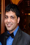
Biography:
Assoc. Professor (Dr) Balwant Rai is founder of Aeronautic Dentistry and has written the curriculum and guidelines for the implementation of this new discipline. He is Program Director and Associate Professor of Aeronautic Dentistry at KSU in the USA. He is also the President and Founder of the JBR Institute of Health Education Research and Technology. Dr Rai has multiple published articles in international and national journals, has written books, and is Editor-in-Chief of different international journals. He is also founder of the BR formula and BR regression equation used in forensic technology. His current work involves the effect of micro-gravity & simulated space analog environment on the oral cavity, human physiology and psychology and non-invasive biomarkers, including the elaboration of technologies to prevent the adverse effects of microgravity on the human physiology and psychology. His biography has been published in different books such as Who’s Who in Health and Medicine and Who’s Who in the World, USA etc. He is invited Editor of Mars Quarterly. He is an invited reviewer to NRF, South Africa, reviewer of more than 10 different journals, and has different pending patents. He is an invited reviewer of many national and international indexed journals. He is consultant of different companies. He was selected as part of Crew 78 on the Mars Desert Research Station [MDRS] as Health and Safety Officer and appointed as Commander for 100 B crew on MDRS. He is principal investigator cum researcher on a project entitled “simulated space mission and human factors including oral cavity: noninvasive technology and herbal formulationâ€. Dr Rai is working on a number of space related research projects and is jury member for different space related programs. He has a strong belief in leaving a mark on space programs using non-invasive diagnostic technologies and herbal formulations.
Abstract:
Space agencies have collected lots of scientific data regarding effects of low earth orbits and microgravity on human body health. Prolonged human space missions will face other additional problems, some still unanswered issues such as effects of different factors ( radiation levels, local environments including atmospheres, dust, gravity, day-night cycles, isolation) on human body. The presentation scrutinizes the major issues of oral and medical health (Space dentistry and space medicine) based on JBR simulated space mission as well as to discuss space policy for planning the future exploration of space.
Khrenov Boris
Moscow State University
Russia
Title: UV radiation from the atmosphere: Results of the MSU satellites measurements
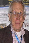
Biography:
Boris Khrenov, MS., Ph.D., D.Sc. in Physics and Mathematics. Honorary Researcher. Leading Staff Researcher, Skobeltsyn Institute of Nuclear Physics (SINP) of Lomonosov Moscow State University (MSU), Moscow, Russia. Boris Born on 30 June 1931 in Sankt-Petersburg, Russia (then Leningrad, USSR). He Graduated MSU in 1954, and PhD “High energy muons in EAS†in the year 1962. Doctor of Sciences (D.Sc.), Prof. in Physics and Mathematics, “Experimental study of EAS high energy muons by underground magnetic spectrometerâ€, in 1987.
Abstract:
Moscow State University had launched several scientific- educational micro satellites «Tatiana», «Tatiana-2» and «Vernov» with one of the tasks- a search of near UV glow of the atmosphere. Short review of their results will be presented. In 2016, as a continuation of the previous work on study of the transient atmosphere glow in near UV, new satellite «Lomonosov» expected to be launched. Large aperture telescope TUS on board this satellite is able to measure atmosphere fluorescence radiated by different transient sources in the Earth atmosphere. The shortest signals (tens of microseconds) are expected from extensive air showers generated by ultra high energy cosmic rays. Electronics of TUS starts to measure images of this phenomenon with time resolution 0.8 microseconds. Longer (up to seconds) signals are expected from atmosphere electric discharges, from dust grains and meteoroids burned out in the atmosphere. Data on the atmosphere ultraviolet transients initiated by electric discharges are of special interest.
Daniel Casanova Ortega
University of Zaragoza
Spain
Title: Analytical method for space debris propagation under perturbations in the geostationary ring
Time : 12:15-12:35
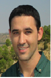
Biography:
Daniel Casanova Ortega completed his PhD in 2013 from University of Zaragoza (Spain) and Post-doctoral studies from University of Namur (Belgium). His main fields of interest on Astrodynamics are Satellite Constellations and Space Debris. He is an Assistant Professor at the University Center of Defense, affiliated with the University of Zaragoza (Spain). He has published more than 10 scientific papers. He is an active researcher in several R+D projects.
Abstract:
Space debris has become a real problem in the last decades. The quantity of space debris fragments orbiting the Earth with no control has increased exponentially. The risk of collision between spacecraft and space debris larger than 10 cm is avoided by spacecraft maneuvering. However, collision with small space debris fragments is impossible to avoid causing important damages to spacecraft. Consequently, different space debris propagation methods are required, not only to know the fragments precise position but also the statistical evolution of the space debris clouds. For this purpose, in collaboration with Prof. Anne Lemaitre and Alexis Petit from the University of Namur, an analytical method for propagating space debris in the geostationary ring considering different perturbations such as the J2 effect due to the Earth oblateness, the solar radiation pressure, or the Sun and Moon perturbations as third bodies have been developed. The Hamiltonian formulation of the problem and the use of different averaging technics have allowed the development of a powerful analytical method. The analytical model has been validated with numerical tests through different examples to confirm the reliability and accuracy of our method. The inclination period has also been analyzed as a function of the area to mass ratio. The final idea of this work is to apply this method to propagate a synthetic population of space debris.
Massimo Materassi
Institute for Complex Systems of the National Research Council
Italy
Title: Dealing with the Earth’s ionosphere’s complexity
Time : 12:35-12:55

Biography:
Massimo Materassi has completed his PhD at the age of 30 years from Perugia University and postdoctoral studies from Space Research Centre in Warsaw. He is the Italian Representative in the Commission G “Ionospheric Radio and Propagation” of the International Union of Radio Science (URSI). He has published more than 30 papers in reputed journals and has been serving as a referee in different journals. His research is about both applied Physics (ionospheric physics and space weather, ecological models) and pure Physics (fundaments of dissipation).
Abstract:
The Earth’s ionosphere is a composite system of several charged chemicals, both ions and electrons, dynamically conditioned by the important ionizing factors determining its existence, and by the forces exerted on them: in particular, the solar UV radiation (main ionizing factor) and the forces due to the geomagnetic field, gravity and the massive neutral matter containing them. Hence, ionospheric time and space variability is essentially driven by the concurrence of all these forcing factors, imprinting ionosphere’s tempos with their ones. The characteristic times of the Sun-Earth relative kinematics and geometry are recognizable in the ionospheric variability, but these forcing factors do not just superimpose, and give rather rise to a complicated non-linear composition of causes into ionospheric effects. This non-linear composition results in a complex behavior both in terms of space structures and time evolution: indeed, on the one hand large scale ionospheric patterns evolve on a quasi-periodic basis, as those systems following strange trajectories in their phase space; on the other hand, local ionospheric proxies (fields, velocities and densities) are irregular, resembling rather turbulent signals than smooth profiles. In few words, this all is ionospheric complexity. Ionospheric complexity must be deal with in modeling ionospheric effects on positioning, navigation, telecommunication. In this talk, aspects of ionospheric modeling centered on taking into account complexity will be discussed.
Oleg Troshichev
Arctic and Antarctic Research Institute
Russia
Title: РС index as a ground-based proxy of the solar wind energy incoming into the magnetoshere: means for space weather monitoring
Time : 13:35-13:55
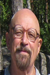
Biography:
Oleg Troshichev graduated from Leningrad University, USSR. He has completed his PhD in physics at the Siberian Institute of Earth Magnetism, Ionosphere, and Radiowave Propagation (SibIZMIR, Irkutsk, 1969). He takes charge of Department of Geophysics in AARI from 1985. The main subject of his investigations is physics of the Earth’s magnetosphere and solar-terrestrial relations. Prof. Oleg Troshichev is author of the polar cap magnetic activity (PC) index that has been endorsed by the IAGA (2013) as a proxy of the solar wind energy that entered into the magnetosphere. He has published more than 250 papers in reputed journals.
Abstract:
The space weather monitoring basically rests on of the solar wind measurements outside of the magnetosphere. The ground-based index of the polar cap magnetic activity (PC) is regarded as index characterizing the energy that entered into the magnetosphere. The following relationships between the PC-index and the solar wind parameters, on the one hand, and relations between the PC evolution and the magnetospheric substorms (AL index) and magnetic storms (Dst index) development, on the other hand, provide this concept: (1) the PC index is perfectly correlates with the interplanetary electric field (EKL), (2) delay time ΔT in response of PC index to EKL variations is controlled by the EKL field growth rate (dEKL/dt) and does not depend on such solar wind parameters, as solar wind speed VX and IMF BZ component, (3) magnetic storms and substorms are always preceded and accompanied by РС index growth, (4) substorms and magnetic storms start to develop as soon as the PC index steadily exceeds the threshold level of 1.5 mV/m, (5) the substorm sudden onsets are commonly associated with a sharp increase in the PC (and EKL) growth rate, (6) linear correlation between the PC and AL values is typical for all classes of the substorms, (7) maximal depression of magnetic field responds to maximal PC value with a delay of ~1 hour, the storm intensity (Dstmin) being linearly depending on PCmax value. The PC index can be used as a reliable ground-based means for exploration of short-term changes in space weather and magnetosphere state.
Chan Kheong Sann
Data Storage Institute (DSI)
Singapore
Title: Joint Viterbi Detector/Decoder for satellite communications
Time : 13:55-14:15
Biography:
Chan Kheong Sann obtained his bachelor's degree from Northwestern University, Illinois and his PhD from National University of Singapore in Electrical Engineering. He has been working at the Data Storage Institute, a Singapore government A*STAR reearch institute for 16 years and is currently the leader of the coding and signal processing team. One of the projects he is currently leading is an NRF funded project from the Singapore government investigating the JVDD for satellite communications.
Abstract:
Satellite broadband communication today uses the DVB-S2 second generation standard proposed and developed through the DVB consortium project in 2003. The DVB-S2 standard uses a combination of a forward error correction (FEC) with multiple code rates, and multiple modulation modes giving a range of spectrum efficiencies ranging from 0.5 to 4.5 bits per transmitted symbol. The FEC scheme used is a combination of BCH and LDPC codes with combined code rates of ¼, 1/3, 2/5, ½, 3/5, 2/3, ¾, 4/5, 5/6, 8/9 and 9/10. The modulation schemes on the other hand could be one of QPSK, 8PSK, 16APSK or 32APSK for each frame. The Joint Viterbi Detector/Decoder (JVDD) is a recently proposed scheme that performs detection and decoding jointly over an encoded ISI base-band channel, and is a competitor to the LDPC decoder operating over the same channel. Alternatively, the ISI channel can be replaced by a modulation scheme that does encoding and modulation prior to the transmission, as in the case of the DVB-S2 standard. This makes the JVDD a candidate for replacing the demodulator and decoder in a DVB-S2 receiver. Previous work over an AWGN/ISI channel has seen the JVDD outperforming the LDPC decoder at shorter codeword lengths. In this work we present simulation results benchmarking the JVDD against the LDPC iterative decoding scheme at the range of code rates and modulation schemes used in the DVB-S2 standard.
Joseph Seckbach
The Hebrew University of Jerusalem
Israel
Title: From extremophilic microbes to extraterrestrial possibilities of life
Time : 14:15-14:35
Biography:
Joseph Seckbach is the Founder and Editor-in-Chief of Cellular Origins, Life in Extreme Habitats and Astrobiology Seroes. He earned his PhD from University of Chicago and did a Post-doctorate at Caltech, then headed a group at UCLA studying extraterrestrial life possibilities. Later, he was appointed to the Hebrew University and spent sabbaticals at UCLA and Harvard. During 1997-98, he served at LSU, Baton Rouge, as the first selected Chair for the Louisiana Sea Grant. He published ~140 scientific articles including Hebrew-language Chemistry Lexicon. His interest is over enigmatic microorganisms, life in extreme environments and astrobiology. He has given seminars at numerous universities.
Abstract:
We know life all over in ‘normal’ environments with mild habitable conditions. However, there are also habitats on Earth that have very severe environmental conditions that host microorganisms. The organisms living and thriving in these harsh conditions are termed Extremophiles. While these environments are considered harsh and severe environments from our anthropocentric point of view, the extremophiles consider their environment as a Garden of Eden. Most of them are not able to live in ‘normal’ environments, which are toxic for them. Among the organisms in these harsh habitats, one can find prokaryotes such as Cyanobacteria and eukaryotes such as algal species and even micro-animals (such as Tardigrates). If extremophiles tolerate more than one extreme factor, we call them Polyextremophiles. Among these extreme conditions are high salt media (halophiles), high levels of temperatures (thermophiles or hyperthermophiles) or very low temperatures (psychrophilic, hyperthermophiles), and various pH levels (in the low pH range are the acidophilic; in high levels – alkalophilic). The extremophiles and polyextremophiles could serve as analogues or models for astrobiology. We are aware that the planet Mars contains liquid water, and several satellites have in their subsurface (icy layers) an ocean of salty liquid water. There are plans to send a human mission to Mars around the year 2030 and have it return with some extraterrestrial samples which would inform our view on the possibilities of external life (as “we know it”).
Oyvind G Gron
Oslo and Akershus University
Norway
Title: How to talk about Einstein’s general theory of relativity?
Time : 14:35-14:55
Biography:
Oyvind G Gron is a Norwegian Physicist. He took the Cand. Real. Degree at the University of Oslo in 1973, majoring in Meteorology. He followed up with Dr. Philos. Degree in 1990 with a thesis on Repulsive Gravitation. He was appointed as a Professor at Oslo University College in 1994. He has also been Professor II at the University of Oslo since 1994. He has conducted research within the areas of general relativity, cosmology and classical electromagnetism. He has thrown new light on themes like the twin paradox, the physics in a rotating reference system and repulsive gravitation associated with vacuum energy. Together with Erik Eriksen at the University of Oslo, he has also studied properties of the electromagnetic field produced by accelerated electric charges. They have in particular shown how gravitation modifies such fields. He has also found new solutions to equations in Einstein's theory of gravity that describe time space where one can travel backwards in time. In several studies, he has focused on relativistic models of the universe. He has, among other things, shown that it is possible to interpret observations from cosmos so that the concept of dark energy is unnecessary. The relationship between gravitation and time and between gravitation and entropy are also themes where he has contributed several journal articles. He has 153 research articles, and has written 3 books on the theory of relativity published by Springer.
Abstract:
I will here review the main conceptual contents of the theory of relativity in a non-mathematical way as far as possible. We start by the principle of equivalence and then go on to discuss the possibility of extending the principle of relativity to accelerated and particularly rotating motion. The significance of the phenomenon of inertial dragging in this connection is pointed out. Then we discuss whether there is any connection between experiencing acceleration of gravity and the curvature of space time. The next topic is how to obtain a proper understanding of the strange property of a classical black hole that nothing can come out of it. We point out the significance of the so called “river of space” in this connection. Finally we discuss the phenomenon of repulsive gravitation and the difference between Einstein’s interpretation of the cosmological constant and it modern interpretation.
Maffione Porzia Federica
Politecnico di Torino
Italy
Title: Analysis of launch opportunity for low-thrust interplanetary missions
Time : 14:55-15:15

Biography:
Porzia Federica Maffione completed her Master’s degree in Mechatronic Engineering from Polytechnic of Turin. Her project thesis was on space propulsion for human spaceflight with VASIMR and the aim of this project was to study the optimization problem with indirect method. Currently, she is doing PhD at Polytechnic of Turin and her research is about interplanetary missions design for NEP and SEP. Her first publications are on optimal low-thrust trajectories.
Abstract:
Interplanetary missions are strictly dependent on the launch opportunity. Mission planning requires a knowledge not only of the technological and cost constraints but also the study of the influence of the launch opportunity on the spacecraft performance and on the feasibility of the mission itself. Porkchop plots are very effective tools to design an interplanetary mission, providing a graphical and optimized overview of the relationship between the fundamental parameters of the mission design: the launch date, the duration and the energy. In this way it is possible to evaluate the best region to accomplish the mission under current constraints. Porkchop plots in their usual implementation are, however, applicable only to impulsive (chemical or NTP) propulsion. In this paper an interplanetary mission from Earth to Mars is analyzed, comparing plots similar to porkchop plots, but obtained for low thrust, NEP and SEP. As a first approximation, the orbits of the two planets are considered as coplanar and circular. Then, using the ephemerides, elliptical and non coplanar orbits are taken into account and the “ideal” plots are compared with the actual ones, referred to a particular launch opportunity. Finally, some numerical examples are carried out.
Moisés Meza Pariona
State University of Ponta Grossa
Brazil
Title: Electrochemical behavior in acidic medium of Al–2.0 wt. %Fe aerospace alloy treated by laser surface remelting
Time : 15:30-15:50

Biography:
Moisés Meza Pariona is an Associate Professor in the Department of materials engineering at State University of Ponta Grossa, Brazil. He is the supervisor of undergraduate students and master's degrees. His eduactional deatils are: Degree in physics, Master, doctorate and post doctorate in engineering and materials science. Work in research recast aluminum alloys with laser, characterized by different techniques: optical microscopy, SEM, micro hardness, x-rays, atomic force, corrosion and electrochemical impedance, etc. Finite element simulation of casting and solidification process of alloys. Several projects with various universities. He has published several research articles in national and international Journals.
Abstract:
In this research we carried out a study of the corrosion of Al–2.0 wt. %Fe alloy treated by laser surface remelting (LSR) and was compared with untreated samples (substrate). In this research LSR without protective coating with a 2 kW Yb-fiber laser (IPG YLR- 2000S) was used. Therefore, corrosion potential testing, micro and macro polarization, cyclic voltammetry and electrochemical impedance spectroscopy (EIS) were performed. The morphological and chemical characterizations of the base material (substrate) and of the material treated by LSR were made using a scanning electron microscope and optical microscopy. The results showed that the laser surface treatment effected the Al–2.0 wt. %Fe alloy leads to the formation of a structure with more compact, homogeneous and fine microstructure. Furthermore, with increased surface hardness, roughness reduction, corrosion rates was approximately 10 times smaller when compared with the untreated alloy in the aerated media 25ºC and solution of H2SO4 0.1 mol/L The resistance polarization measures the charge transfer at the interface electrode/solution and similar results were found in both experiments carried out by the techniques polarization curves which involves determining the Tafel constant and by the EIE technique, and the treated sample by LSR showed about 11 times greater than the untreated material. By the electrochemical impedance technique was possible to evaluate the oxide layer formed on the surface of Al–2.0 wt. %Fe alloy treated by LSR, as a protective film against corrosion of this alloy treated by LSR in the middle of H2SO4 0.1 mol/L compared with not treated alloy. In equilibrium conditions the sampled treated showed high capacitive effect in relation to the untreated sample at higher frequencies. In both samples also presented the inductive effect at low frequencies and it is much more noticeable in the treated sample that the untreated sample.
Alberto Gallina
AGH University of Science and Technology
Poland
Title: Analysis of (soft) soil parameter uncertainty in planetary rover mobility simulations
Time : 15:50-16:10
Biography:
Alberto Gallina has completed his PhD from AGH University of Science and Technology in Krakow where he is currently Assistant Professor and teaching subjects like Mechanics and Uncertainty Analysis. He took part in several research projects on the same topics. He had been a 15-month guest scientist in the DLR – Institute of Robotics and Mechatronics where he joined the ExoMars project. He is author of 10 papers in reputed journals.
Abstract:
A crucial aspect in planetary exploration is connected with the mobility of planetary rovers on sandy terrain largely present on the Moon and Mars surface. Travelling on soft terrain rovers may experience very high sinkage, which significantly reduces vehicle mobility. In order to reduce the risk of burying a rover’s wheel into a sandy terrain, extensive experimental and numerical analyses have been conducted. Several simulation frameworks for predicting the rover behavior on soft terrain through dedicated computer models have also been developed by research institutes. In this context, semi-empirical formulations of wheel-soil contact models based on the so called Bekker-theory have been advocated. They ensure a good compromise between model accuracy and simulation time. However, Bekker-based contact models need the estimate of a set of terrain parameters by dedicated laboratory tests. But large uncertainty always affects the soil parameters identification step. It mainly appears as the impossibility to exactly reproduce under laboratory conditions of the soil where the rover travels on. This lack of knowledge may strongly limit the rover behavior prediction capabilities of computer models. In this work different numerical frameworks are presented for uncertainty treatment in wheel-soil contact models based on Bekker’s theory. Polynomial chaos, fuzzy method and Bayesian approach are employed to propagate soil parameter uncertainty through the model for assessing possible predicted rover paths. Results from the analysis is presented and extensively commented.
Erwin De Donder
Royal Belgian Institute for Space Aeronomy
Belgium
Title: Services for space missions support within the ESA space situational awareness space weather service network
Time : 16:10-16:30
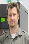
Biography:
Erwin De Donder has completed his PhD in Astrophysics within the field of close binary star evolution and galactic chemical evolution. Currently working as scientist at the Royal Belgian Institute for Space Aeronomy within the Space Weather section. Profound experience in developing services related to space radiation and effects on spacecraft’s (e.g. SPENVIS). Responsible for the end-user strategy within the frame of the current development of ESA’s Space Situational Awareness Space Weather Service Network.
Abstract:
Spacecraft operations are by nature complex and every satellite's operational environment poses a range of potential risks, often a unique combination for a given orbit. The implications of interruptions of operations, data transfer and service provision, are serious, both in terms of cost and capability, thus it is imperative to mitigate against all operational risks to the fullest possible extent. In the frame of its Space Situational Awareness (SSA) programme, the European Space Agency (ESA) is establishing a Space Weather Service Network to support end-users, in a wide range of affected sectors, in mitigating the effects of space weather on their systems, reducing costs and improving reliability. This service network is currently in a test and validation phase and encourages user engagement and feedback. Currently, the network is organised around five Expert Service Centers (ESCs) focusing on Solar Weather, Heliospheric Weather, Space Radiation Environment, Ionospheric Weather and Geomagnetic Conditions. Each ESC is connecting different expert groups, federating their space weather products, and ensuring the quality and consistency of the provided information. The service network also includes a central Data Centre and the SSA Space weather Coordination Centre (SSCC). In this presentation we give an overview of the current status of the network (http://swe.ssa.esa.int/), the targeted end-user groups and Expert Service Centers with a focus on the user domain of spacecraft operators. We are also keen to gather feedback and requirements from end-users in order to improve the network support capabilities and to tailor its services.
Mohamed Mhmod
Jilin University
China
Title: Monitor and study horizontal and verticals changes at land surface using remote sensing and gis technology
Time : 16:30-16:50
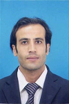
Biography:
Mohamed Mhmod is a PHD student and going to completed his PhD in june 2016 from Jilin University, China. He has published 4 papers in reputed journals. His international experience includes various programs, contributions and participation in different countries for diverse fields of study.
Abstract:
In recent years, remote sensing and geographic information systems and other technology rapid development and wide application of Land has become an effective means of status and temporal evolution of the process, providing a dynamic information environment is difficult to obtain conventional methods to solve complex spatial problems for the conduct of regional dynamic monitoring provides favorable conditions. The satellite images were used from 1974-1976 land sat-1,2, 1989-1996 land sat-4,1999-2005 land sat -7, Google earth images 2005-2008 during period of time for this study , Geomorphic features are extracted from the Shuttle Radar Topography Mission (SRTM) DEM data 2002 and 2010, SRTM DEM and Land sat data were used to extract the geo morphometric Features and structures. The relationship between the topography and tectonics is assessed to understand the evolution mode.
Alexander M Krot
United Institute of Informatics Problems of National Academy of Sciences
Belarus
Title: Development of the statistical theory of forming cosmogonical bodies to explain a stability of the orbital movements of planets and the forms of planetary orbits
Time : 16:50-17:10
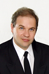
Biography:
Professor, DSc Alexander M. Krot is a Head of the Laboratory of Self-Organization System Modeling at the United Institute of Informatics Problems of the National Academy of Sciences of Belarus. He graduated from the Belarusian State University, Department of Radiophysics in 1982. He received PhD in 1985, then degree of Doctor of Sciences (DSc) in 1991 and Professor degree in 1997. He has published 275 scientific works including 3 monographs and more than 60 articles in refereed journals.
Abstract:
This work investigates the stability and forms of planetary orbits in exoplanetary systems based on a statistical theory of forming cosmogonical bodies. We show that knowledge of some orbital characteristics of multi-planet extrasolar systems refines the knowledge of the parameters of the stars based on the combined Kepler’s 3rd law with universal stellar law (3KL-USL). The proposed 3KL-USL predicts statistical oscillations of circular motion of planets around stars. This work applies the statistical theory of forming cosmogonical bodies based on model of gravitating spheroidal body to explore forms of planetary orbits with regard to Alfvén–Arrhenius’ oscillating forces in the Solar system as well as other exoplanetary systems. Unlike the traditional approaches we show that due to the Alfvén–Arrhenius’ oscillating force mainly the bodies moving in a remote zone of a spheroidal body have elliptic and inclined trajectories. We explain an origin of Alfvén–Arrhenius’ radial and axial oscillations modifying forms of planetary orbits within the framework of the statistical theory of forming cosmogonical bodies. We find that temporal deviation of the gravitational compression function of a spherically symmetric spheroidal body (under the condition of mechanical quasiequilibrium) induces an additional periodic force. In turn, as shown here if the additional periodic force becomes counterbalance to the gravitational force then the principle of an anchoring mechanism is realized in exoplanetary systems, i.e. the stability of planetary orbits occurs. We also note that the spatial deviation of the gravitational potential of a rotating spheroidal body from a spherically symmetric one implies a difference in the values of the radial and the axial orbital oscillations (even in the case of its mechanical equilibrium), therefore the interference of these orbital oscillations can lead to the nonuniform rotation of stellar layers at different latitudes of star.
Sathish Ayyappa
University of Agricultural Sciences, Bangalore
India
Title: Geospatial approaches for micro level farm planning - A step to enhance crop productivity
Time : 17:25-17:45
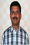
Biography:
Sathish Ayyappa has completed his PhD from University of Agricultural Sciences, Bengaluru, India by securing University Gold Medal. He is presently working as Soil Physicist at All India Co-ordinated Research Project for Dryland Agriculture, University of Agricultural Sciences, Bengaluru in India. He has published more than 20 papers in reputed journals. He is the recipient of Vasant Rao Naik National award for best Dryland Research in India during 2014-15. He is guiding students in Master’s degree programme in Soil Science at the University. He is also working in two international projects.
Abstract:
Soil and water are the most important natural resource required for crop production. Its inventory, characterization, and suitability assessment for crops is essential for conserving these natural resources and enhance crop productivity. An attempt is made to provide micro level farm planning at 1:10,000 scale using geospatial approaches in Honnenahalli micro- watershed located at 75o 54’ 54.24’’ East longitude and 14o 35’ 96’’ North latitude in Karnataka, India. The detailed land resource inventory facilitated is arriving at 29 management units in 963 hectares of micro watershed. The fertility status was also assessed using standard procedures for estimation of nutrients. Soil and water resource were assessed and mapped using Remote Sensing, GPS and GIS techniques. Land suitability for major crops (Maize, paddy, Custard apple, Lime, etc) was assessed and land capability classification was worked out. The final management plan in terms of soil and water conservation measures (contour bunding, conservation furrow, inter bund management, farm pond, etc.), soil health management (suitable amendments for soil amelioration, fertilizer recommendation for crops based on soil test results) and crop planning (crops and suitable cropping systems with varieties for agriculture, horticulture and forest component and sowing time) was provided for micro level planning by the implementing agency. The adoption of management plan would enable in changing crops and cropping system based on scientific data and enhances agricultural productivity and livelihood security.
Yasser A. Abdel-Hadi
National Research Institute of Astronomy and Geophysics (NRIAG)
Egypt
Title: Space-Based Solar Laser System Simulation to Transfer Power onto the Earth
Time : 17:45-18:05

Biography:
Yasser A. Abdel-Hadi has completed his Ph.D. in 2005 from the Technical University of Berlin, Institute of Optics and Atomic Physics. He is an Associate Professor and staff member at the Solar and Space Research Department of the National Research Institute of Astronomy and Geophysics (NRIAG). He has published more than 38 papers in reputed journals and has been organized many conferences and workshops in Egypt and Germany.
Abstract:
A simulation model of a space-based solar laser system to transfer the power onto the earth is carried out. The system consists of a solar pumped laser by a concentration system set on a satellite. The resulted laser is directed onto the earth surface, where it can be used to generate power. The intensity and the divergence of the laser are calculated in order to obtain the optimal solar laser system as a payload on the satellite and the optimal terrestrial applications in Egypt.
Hongfei Wang
Chinese Academy of Sciences
China
Title: Design and realization of payload operation and application ground system of china's space
Time : 18:05-18:25

Biography:
Hongfei Wang is currently working at Technology and Engineering Center for Space Utilization, Chinese Academy of Sciences, China. He is awarded PhD from Chinese Academy of Sciences, China in the year 2008-2012. His area of interests includes Aerospace ground systems, intelligent mission planning, Telescience.
Abstract:
China's Space Station will be launched at year 2018; this space station is China's largest space science experiment and application platform until now. It will stay in space orbit more than a decade and have many complex scientific space experimental tasks to do step by step in the future. This would mean that we are facing many challenges for our Payload Operation and application system, including complex mission planning, high-speed mass data processing, health management, payload status monitoring, remote support for teleScience and the ground system dynamically updates with the scientific mission changes all the time. This paper mainly introduces the composition of hardware architecture, design of the system architecture and the new technology we use to implement the payload operation and application ground system of China's Space Station Keyword: Human Spaceflight, China's Space Station, Ground Operations System, TeleScience
Muhammad Shakir
University of Chinese Academy of Sciences
China
Title: Major crops classification using time series MODIS EVI with adjacent years of ground reference data in the US state of Kansas
Time : 18:25-18:45
Biography:
Muhammad Shakir has completed his PhD at the age of 28 years fro University of Chinese academy of sciences. He is working as professor in university of Peshawar. He has published more than 13 papers in reputed journals and has been serving as an editorial board member of some of the reputed journals.
Abstract:
Most methods used large quantity of field data of the same reference year for crops classification which is labor-intensive and time-consuming. In this study we explored the optical application of time series MODIS EVI with adjacent years of ground reference data for classifying major crops on a regional level in US state of Kansas. Time series MODIS EVI data have been obtained between 2008 and 2013. Ground reference data (2008–2013) of the major crops (winter wheat, corn, soybeans, sorghum and alfalfa) in Kansas were acquired from the United States Department of Agriculture (USDA). A machine learning algorithm namely Antibody Network (ABNet) classifier was used to classify the major crops. The ABNet was trained using five years of ground reference data and verified by ground reference data of the other year. For instance, to classify major crops in 2008, ground reference data of (2009–2013) were used as training samples and the data of that year (i.e. 2008) were used as validation. The results evince the classification accuracy in a range from 74.4 to 81.9% and kappa coefficient of 0.6–0.8 respectively. This method can improve remote sensing imagery in the process of classification and can help to alleviate the heavy load of field data in areas where ground data are unavailable.
Seong Chan Jun
Yonsei University School of Mechanical Eng
Korea
Title: Enhanced chemical vapor sensing by single-stranded DNA-graphene
Time : 18:45-19:05

Biography:
Seong Chan JUN has completed Bachelor, master and Ph.D. degree from George Washington University (Washington D.C.), Cornell University (Ithaca N.Y.), and Columbia University (New York, NY) respectively. After he graduated, he worked at NSEC (Nano Scale Science & Research Center) and SAIT (Samsung Advanced Institute of Technology) sequently. He has been currently appointed professor at Yonsei University (Seoul, Korea) since 2008.
Abstract:
Sensor platforms lie at the heart of biochemical sensing applications. The efforts, especially for applying functionalized graphene devices have been recently highlighted in the field of biochemical sensors. However, chemical vapor sensors do not guarantee their sensing ability in high humidity since the electrical measurement is easily degraded by water molecules. We are able to overcome this limitation through the use of single stranded DNA as a functionalizing agent. The layer of ssDNA on top of graphene contributes to form another conduction path in high humidity. It is most likely that this additional conduction path provides enhanced sensing capability toward chemical vapors. Since modulation of the graphene channel in terms of electrical resistance and surface affinity depends on the applied ssDNA, the pattern from different responses of various ssDNA-graphene sensors can identify chemical vapors. This characteristic shows great promise for medical diagnostics based on exhaled breath.

Biography:
Vladimir E. Fortov was graduated from Moscow Institute of Physics and Technology with honors. In 1976 he received a doctoral degree, in 1982 was awarded the title of professor. In 1987 he was elected as corresponding member of the Academy of Sciences of the USSR, in 1991 as full member of the Russian Academy of Sciences. He is Director of the Joint Institute for High Temperatures of RAS. From 2013 he is the President of the RAS, the Vice-chairman of the Presidential Council for Science and Education and the member of the Scientific Advisory Board of the UN Secretary-General. .
Abstract:
Dusty (complex) plasmas are plasmas containing small solid particles, typically in the micrometer range, the so-called micro particles. Dusty plasmas are specially prepared to study fundamental processes in the strong coupling regime on the most fundamental (kinetic) level, through the observation of individual micro particles and their interactions. Many interesting phenomena can be studied starting from small two-dimensional (2D) and three-dimensional (3D) clusters, to larger 2D and 3D systems where collective effects play a dominant role. In laboratory conditions, the micro particles are heavily affected by the force of gravity. Under microgravity conditions, e.g. on the International Space Station (ISS), gravity is negligible. It is possible to form dusty plasmas in the bulk region of plasmas in homogeneous large 3D systems and to investigate other phenomena than those accessible on Earth in detail. Since 2001, complex plasma research under microgravity conditions is continuously performed in Russian-German cooperation onboard the ISS with the long-term laboratories PKE-Nefedov and PK-3 Plus. The laboratory PK-3 Plus was perfectly suited for the formation of large stable liquid and crystalline systems and provided interesting insights into processes like crystallization and melting, laning and phase separation in binary mixtures, electrorheological effects due to AC electric fields and projectile interaction with a strongly coupled complex plasma cloud. Although the operation of the PK-3 Plus laboratory stopped in 2013, the promising research of large three-dimensional dusty plasmas will be continued with the next microgravity laboratory, PK-4. This was launched in October 2014 and is operational now and available for the next generation of experiments with dusty plasmas under microgravity conditions onboard the ISS.
Alexander V Bagrov
Institute of Astronomy of the Russian Academy of Science
Russia
Title: Non-rocket launch from Mars
Biography:
Bagrov Alexander has completed his PhD at the age of 42 years from Odessa University (Russia) and got his Doctor of Science degree from Moscow State University. He is the Leading scientist of Institute of Astronomy of Russian Academy of Sciences and key specialist of Lavochkin Association, a premier space probes manufacturing organization. He has published more than 125 papers in reputed Russian journals and is author of 8 patents. He was awarded to title of "Honor Constructor of Space Technique".
Abstract:
Return missions to Mars (especially pilot ones) will need delivering to Mars rockets and fuel that is very expensive. We propose an elevator system for safety landing to and launch from Mars. This elevator may be based on both Martian satellites, because they are synchronized. The lifting theater being connected to a satellite will not wind it around. The far end of the elevator rope will fly over Martian surface with velocity 2 km/s or 1 km/s for Phobos and Deimos respectively. If the far end of the rope will have a hook, it can capture a loop connected to space vehicle, - just like aircraft carriers do decelerate of landing airplanes. After catching, elevator can lift spacecraft from Martian surface. To decrease hook velocity it may be installed onboard of controllable kite at far elevator's end. This will make possible to evacuate a vehicle from any point of Martian surface, not only from sub-satellite trajectory. Phobos' elevator needs 9500 km tether. It is 4 times less than it believed to be for so called "geostationary" elevator and 40 times less the length of Moon-Earth elevator. If the Martian space elevator will be constructed similarly to proposed Lunar one [Russian patent RU 121233 «Transport system "Earth-Moon"»], it will lift its cargo with acceleration, so launched spacecraft would be provided with enough velocity for returning flight to the Earth.
Anna Bodrova
Humboldt University of Berlin
Germany
Title: Size distribution of particles in Saturn’s rings from aggregation and fragmentation

Biography:
Anna Bodrova has completed her PhD from Moscow State University. She is currently working as a Research Associate at the Humboldt University of Berlin. She has 18 publications in peer reviewed journals.
Abstract:
Saturn’s rings consist of a huge number of water ice particles, with a tiny addition of rocky material. They form a flat disk, as the result of interplay of angular momentum conservation and the steady loss of energy in dissipative interparticle collisions. For particles in the size range from a few centimeters to a few meters, a power-law distribution of radii, ∼ r−q with q≈3, has been inferred; for larger sizes, the distribution has a steep cutoff. It has been suggested that this size distribution may arise from a balance between aggregation and fragmentation of ring particles, yet neither the power-law dependence nor the upper size cutoff have been established on theoretical grounds. Here, we propose a model for the particle size distribution that quantitatively explains the observations. In accordance with data, our model predicts the exponent q to be constrained to the interval 2.75≤q≤3.5. Also an exponential cutoff for larger particle sizes establishes naturally with the cutoff radius being set by the relative frequency of aggregating and disruptive collisions. This cutoff is much smaller than the typical scale of microstructures seen in Saturn’s rings.
Mauro Mameli
University of Pisa
Italy
Title: Thermal management in space: Passive two-phase heat transfer technologies

Biography:
Mauro Mameli has completed his PhD in “Energy and Environment Technology†at the University of Bergamo. He is actually involved as a post doc in several Microgravity Application Projects funded by the European Space Agency, contributing to the development of the Experiment on Pulsating heat Pipes to be performed on the International Space Station in 2018.
Abstract:
Thermal Management systems are almost ubiquitous: they are found in electronic devices, transportation, battery cooling and households in general. The demand for higher performances, sustainability, and efficient thermal control in different acceleration environments (from hyper gravity to microgravity conditions) pushes the researchers to develop a new generation of passive two-phase flow systems. However, the development of reliable devices, calls for a thorough understanding of fundamental principles and their modelling. In the past decades, several wickless two-phase passive systems born to meet a wide range of industrial requests: indeed, such technologies, like Pulsating Heat Pipes (PHPs), have an extremely high potential in terms of simplicity and, consequently, cost effectiveness. The present lecture provide a chronicles of the hyper gravity/microgravity experimental and numerical activities carried through by the International team on Pulsating Heat Pipes in order to push the technological readiness level of such devices with particular attention to the space applications.
Safaa Mohamed Hassan
National Authority for Remote Sensing and Space Sciences
Egypt
Title: Groundwater exploration and assessments in siwa Oasis, Egypt: Using Radar, ASTER and Geophysical data
Biography:
Safaa Mohamed Hassan is an Associate professor In Remote Sensing, geology and GIS. Head of Geographic information systems division of Data Reception, Analysis and Receiving Station Affairs Division. National Authority for Remote Sensing and Space Sciences. The publications are more than 50 scientific papers in high ranked international journals.
Abstract:
The present study aims to investigate the structure; ground water exploration and assessment for the study area using radar and Landsat8 remote sensing data and geophysical data. The quantitative interpretation of the seventeen vertical electrical soundings is carried out to determine the thicknesses and true resistivity values. The final results used for construction four geoelectrical cross-sections which exhibits the six different geological units represented in the study area. The isopach maps are constructed to indicate the variation of the thicknesses of the first, second, third, fourth and fifth units through the studied area. The second layer represents the fresh water aquifer in the study area for upper Miocene age. The results of resistivity interpretation for depth, thickness and resistivity values for different layers indicated that the fresh water bearing aquifer has thickness from 5 to 85m and depth raining from 5 to 25m. The Landsat8 image has been used to study the lithological rock units and lineament analysis. In this paper Robinson-3 level edge enhancement technique was applied on the ALOS radar image to emphasize the predominant fault directions in the study area as well as detection of the buried structures and drainage systems. Two band ratios are proposed in this study (1/5, 8/9 and 4/6) and (1/3, 2/5, and 4/9) for more lithological discrimination of the study area. These studies reveal that the area was dissected by different fault elements of trends E–W, NW–SE, NE–SW and the E-W trend is mostly which control the geometry of the groundwater aquifers in the study area using the analysis of the Landsat8 and RADAR data. In the other hand we evaluate the groundwater for different uses. 39 groundwater samples were collected from the study area during 2014, and were subjected to analysis for chemical characteristics. These data has been used to preliminary evaluation of suitability of groundwater for drinking and irrigation purposes by comparing those parameters with world health organization (WHO) standards and Egyptian standards. Majority of the collected water samples are unsuitable for drinking due to its high salinity and high concentration of iron and manganese. About 82% of the studied water samples which collected from the study area had total hardness ranged between hard and very hard which unsuitable for industry. According to salinity index, SAR, Na%, magnesium hazard and Kelley ratio most of the collected groundwater samples are unsuitable for irrigation purposes.
Jaeheung Park
Korea Astronomy and Space Science Institute
Korea
Title: Plasma density irregularities in the topside ionosphere

Biography:
Jaeheung Park has completed his PhD at the age of 28 years from Korea Advanced Institute of Science and Technology (KAIST) and postdoctoral studies from National Central University (NCU) in Taiwan and GeoForschungsZentrum (GFZ) in Potsdam, Germany. Now he is a scientist of Korea Astronomy and Space Science Institute (KASI).
Abstract:
Plasma density irregularities in the ionosphere can affect trans-ionospheric communication between ground facilities and satellites, and constitute an essential part of the space weather. Different latitudes and local times host different types of irregularities, such as equatorial plasma bubbles (EPBs) in nighttime low-latitude regions, medium-scale traveling ionospheric disturbances (MSTIDs) in the mid-latitude ionosphere, main trough at subauroral latitudes, and polar cap patches inside the polar cap. Low-Earth-Orbit (LEO) satellites equipped with in-situ plasma density probes or dual-band Global Navigation Satellite System (GNSS) antennae are useful for investigating these irregularities globally. In this presentation are given characteristic features of the various plasma density irregularities observed by LEO satellites, including man-made disturbance in the ionosphere. Their climatological distributions as well as concomitant deflections in electric and magnetic field are also discussed.
Giora Shaviv
Israel Institute of Technology
Israel
Title: The influence of UV radiation on exoplanets’ habitability
Biography:
Giora Shaviv is an Emeritus Professor at the Israel Institute of technology, Haifa, Israel. He held the Shwartzmann-Medvedi cjair in space sciences. He obtained his B.Sc. In 1959 from the Technion (summa cum laude), his M.Sc. in 1960 (summa cum laude), and Ph.D. in 1965 with thesis subject: fast reactor physics. He has been physics and astronomy department chair in Tel Aviv University, Dean of physics at technion, head of the Asher space research institute. Shaviv served as Vice President and President of the Israel physical Society. Shaviv was elected to the International Academy of Astronautics. His fields of interests are theoretical astrophysics, fundamental process in astrophysics, planetary atmosphere and the greenhouse effect. Shaviv published over 250 papers in the international professional literature and three popular books in Hebrew and two professional books in English.
Abstract:
High level of stellar UV radiation on a planet’s surface may prevent planet’s habitability and limit the width of the habitability zone (HZ). Hence, we wish to estimate the UV Index as a function of the stellar parameters for Earth-like planets within the HZ of main sequence stars. The stellar radiation that impinges the surface is calculated by a 1-dimensional radiative transfer model which couples the photo-chemical reactions in the atmosphere. The calculations show that the oxygen and ozone molecules provide a sufficient protection from the stellar radiation, even for hot host stars, as the UV Index can reach a maximal value of 21 units (about twice higher than on Earth). Furthermore, the UV Index is highest on planets which orbit stars with an effective temperature of about 9,000K, and is lower for hotter and colder stars.
Amotz Agnon
Hebrew University Hermann Institute of Earth Sciences
Israel
Title: SDEIGWI-Space detection of Earthquake induced ground water injection
Biography:
Amotz Agnon has completed his PhD from The University of California Berkeley Division of Geophysics and was a visiting professor at Stanford University Department of Geology. He is a professor of Earth Sciences and serves as the director of The Marine Science Program and Neev Center for Geoinfomatics. He has published more than 90 papers in reputed journals and has been serving as an editor for three special publications. He is a Freund Prize recipient (Israel Geological Society) and an International Fellow of The Helmholtz Association.
Abstract:
An anomalous concentration of barium has been reported in Lake Lisan (paleo Dead Sea) sediments showing earthquake induced deformation structures (seismites). Katz et al. (2008) were inclined to reject the hypothesis that these anomalies were formed by injection of Ba-rich reduced brines from the deep crustal depths into the lake. Regardless of the source of these chemical anomalies, large destructive earthquakes are frequently associated with injection of water originating in deep aquifers into lakes. This creates an opportunity to detect these processes from space, and to search for precursory phenomena for combining in earthquake alarm programs. For the Dead Sea, one should focus on injection of solutions lighter than the surface brine. Due to the high density of the Dead Sea brine, and it overall negative precipitation- evaporation balance, this task may prove doable even for brines arriving from considerable depth. The Dead Sea surface waters are typically super saturated with respect to sodium- chloride , evidenced by the intensive precipitation of halite on ropes and any object dipped into the lake. Brines that surface due to being warmer than ambient surface water give a detectable infrared signal in the form of a hot spot. Cold spots are also detected on the surface where buoyancy is due to lower salinity. Both cases are temporally associated with small earthquakes.
Shengcheng Cui
Chinese Academy of Sciences
China
Title: A new land surface albedo model for better characterizing surface reflective properties

Biography:
Shengcheng Cui has completed his PhD in June, 2011 from the Graduate School of Chinese Academy of Sciences (and now is University of Chinese Academy of Sciences). His major research interests include the study of the surface reflective properties (SRP) model and retrieval algorithm, global statistical analysis and applications of satellite measured SRP data. At present, he is the Principal Investigators (PIs) of the AHNSF (Anhui Provincial Natural Science Foundation) and NSFC (National Natural Science Foundation of China) projects. He has published more than 20 papers in reputed journals.
Abstract:
Land surface albedo (LSA) provides a unique interface for the coupled surface-atmosphere system (CSAS). It serves as an essential analysis tool for the surface energy balance and plays an important role in various aspects involving the state and evolution of CSAS. A new LSA model was constructed to improve the characterization of the surface reflectivity properties. This model took the real angular distribution of diffuse sky irradiance field and the multiple-reflecting effect between the surface and the atmosphere into account. The model has advantage in accuracy when the sun is located higher than 50 degrees. Satellite observed surface reflectance anisotropy and albedo is strongly affected by solar illumination angles and atmospheric conditions. A parameterization of LSA was conducted and tabulated into lookup tables (LUT) with respect to two variables – solar zenith angle (SZA) and aerosol optical depth (AOD). With the developed LSA model and the parameterized LSA LUTs, it is expected that users can easily make a fast yet accurate albedo calculations after successfully inverting surface bidirectional reflectance distribution function (BRDF) model. It is promising for in-situ truth validation against satellite-derived land surface parameters products and also useful for any radiative transfer problems in the CSAS.
Dalia Nandi (Das)
West Bengal University of Technology
India
Title: Development of channel model to predict rain attenuation time series useful for satellite communication link over the world
Biography:
Dalia Nandi (Das) has completed her PhD at the age of 34 years from Calcutta University, West bengal, India. She is working as Assistant professor (senior Grade) in Electronics and communication engineering Department of Meghnad Saha Institute of Technology. She has 13 years teaching experience and 10 years research experience. She has published 5 SCI journals and 12 proceedings to her credit. She is associated with different projects funded by Indian Space Research Organization (ISRO). Her present areas of interests are satellite communications, atmospheric remote sensing and wave propagation.
Abstract:
Due to the congestion at the lower frequency bands, the satellite communication systems are now operating at the higher frequency Ku or Ka bands (Ku or Ka). However in these bands, mainly above 10 GHz, rain events cause severe attenuation to the propagating signal along earth space communication link. If time series prediction of rain attenuation during rain events is possible, fade countermeasure techniques such as adaptive control of signal power, coding and data rate can be effectively implemented to mitigate this attenuation effect. In the present study, a channel model has been developed to predict time series of rain attenuation during rain event. This model is not only tested on long term basis but also event wise. The effectiveness of the methodology is tested for different locations in the globe. The yearly cumulative distributions of measured rain rate and attenuation data for tropical and temperate locations are compared. Separate model parameters are developed for tropical and temperate regions for better prediction of rain attenuation. Temperate model parameters obtained from a temperate location are successfully used for other temperate locations. Similarly tropical model parameters obtained from a tropical location are successfully used for other tropical locations. We are now trying to develop a global model which will be applicable to all over the world for time series prediction of rain attenuation during rain events.

Biography:
Ian McDade is Professor of Space Science at York University, Toronto, Canada. He is a Chemist by background with an MA from Queens’ College, Cambridge University (1980) and a PhD from The Queen’s University of Belfast (1979). He has published many research articles in National and International Journals.
Abstract:
The three ‘W’ questions for future satellite missions are addressed: When, Where and Why. This topic is discussed in terms of the current needs of the inhabitants of planet Earth and the lessons learnt since the days of Ned Ludd. The technological developments and our new capabilities are critically assessed with Gaia in mind.
- Track 02: Orbital Mechanics | Track 05: Satellite Remote Sensing and GIS | Track 06: Satellite Subsystems | Track 08: Satellite Communication | Track 09: Satellite Navigation | Track 15: LTE-based ground network and satellite networks

Chair
Barbara Koch
Albert-Ludwigs University of Freiburg
Germany

Co-Chair
Nicolas H Younan
Mississippi State University
USA
Session Introduction
Dennis Wingo
Skycorp Incorporated
USA
Title: ISEE III Reboot Project or How to Save an Interplanetary Spacecraft on a Shoestring Budget
Time : 10:35-10:55
Biography:
Dennis Wingo is a CEO and Founder at Skycorp Incorporated, USA. He is having 36 Years of Industry Experience in the computer, academic, and aerospace industries. He worked for many leading edge companies during the 80's such as Vector Graphic, Symbolics, and Alpharel, pioneers in the computer, artificial intelligence, and document management industries. He has built flight hardware at the University of Alabama in Huntsville, including the first MacIntosh flown on the Space Shuttle and a small sat, SEDSAT 1, the first non NASA spacecraft built in Alabama. His first book, "Moonrush", and a chapter in another book "Return to the Moon" are about developing lunar resources. He contributed to a book "Toward a Theory of Space power" published by the National Defense University. He has written dozens of articles for various publications. I have two patents, one of them global.
Abstract:
The International Sun-Earth Explorer 3 (ISEE-3) was one of a three spacecraft constellation, two by NASA and one by ESA, designed to extensively explore the earth’s magnetosphere and its relationship to emissions from the sun across a wide range of frequencies and particle energies. ISEE 1 and 2 were placed in a tandem highly elliptical orbit around the earth while ISEE 3 was placed into the earth-sun libration point 1 (ESL-1) in a halo orbit around the ESL-1 location to better enable communications with the spacecraft. ISEE-3 was the first spacecraft to fly in this orbit and it and its companions were instrumental in many engineering firsts and a plethora of science regarding what we now call solar-terrestrial physics. ISEE -3 was reborn as the International Cometary Explorer (ICE) when in 1983, through a complex series of lunar/earth flybys; it was placed into an interplanetary intercept orbit to pass within 8,000 km of the comet Giacobini-Zinner through its tail on September 11, 1985. Later it was tasked to flyby Halley’s Comet at a 21 million km distance, and to provide complimentary support to the NASA/ESA Ulysses mission in the 1990’s. In the late 1990’s ISEE-3/ICE was placed into hibernation with only its transmitter beacons providing indications of its existence. NASA in February of 1987 placed the spacecraft into an orbital configuration that would bring it back to the earth moon system in August of 2014, this is where our story begins. The space agency had eliminated it ability to command the spacecraft with the removal of the equipment designed for that task from the Deep Space Network. Due to the cost of the agency redesigning and rebuilding the equipment, and the competing needs of existing operational missions, the agency decided to forgo any attempt to contact the spacecraft in February of 2014. On April 12 2014 NASA gave preliminary permission for a private effort, led by Skycorp Incorporated and Spaceref Inc., to raise money and attempt to contact, revive, control, and place back into Earth orbit the spacecraft. Through a milestone based Space Act Agreement Skycorp and Spaceref were able to raise the funds through crowd funding and build an international technical team that, a mere 54 days later was able to command the spacecraft into engineering telemetry mode. Over the succeeding two and one half months, this international team, with foci at the world’s largest antenna at the Arecibo National Observatory in Puerto Rico, the Amateur Radio Satellite Organization-DL at the Bochum Radio Observatory in Nordrhein-Westfalen Germany, the Morehead State University Science Center, the SETI Institute’s Allen Array in Northern California, and Skycorp at NASA Ames in Mountain View California developed an Ad-hoc global network of ground stations and operations to bring the spacecraft back to life, commission a majority of science experiments, and resume limited science operations. Due to a pressurization failure in the propulsion system the team was unable to place the spacecraft back into earth orbit but did reach significant engineering and science milestones for the veteran spacecraft. This is our story.
Nicolas H Younan
Mississippi State University
USA
Title: Information retrieval from Earth Observation (EO) imagery
Time : 10:55-11:15
Biography:
Nicolas H Younan is currently the Department Head and James worth Bagley Chair of Electrical and Computer Engineering at Mississippi State University (MSU). He received the B.S. and M.S. degrees from MSU in 1982 and 1984, respectively, and the Ph.D. degree from Ohio University in 1988. His research interests include signal processing and pattern recognition. He has been involved in the development of advanced image processing and pattern recognition techniques for remote sensing applications, image/data fusion, feature extraction and classification, automatic target recognition/identification, and image information/data mining.
Abstract:
Earth Observations (EO) data are obtained from a multitude of sources and requires tremendous efforts and coordination among researchers and user groups to come to a shared understanding on a set of concepts involved in a domain. The ultimate goal of any EO system is to provide understanding, which will often require expertise and/or data sources from globally distributed resources, thus presenting unique challenges. To address these challenges, it is incumbent upon the global community to evolve and sustain a global observation network. These observations serve as the foundation for the models that are used to describe Earth processes. As this observational data accumulates in global archives, new opportunities become available for knowledge discovery about the Earth system. However, access to these observational data is optimized for the science teams for whom the instruments were launched and access by operational users may be problematic. This presentation will lay out some of the challenges for those engineers and scientists involved in pattern recognition in the Earth remote sensing arena. It describes the problem space for making decisions and introduces the concept of contextual remote sensing.
Barbara Koch
University of Freiburg
Germany
Title: Potential of different sensor combination approaches for the estimation of above ground biomass
Time : 11:15-11:35

Biography:
Professor Barbara Koch studied Forest Sciences from 1977 to 1982 at the Ludwig-Maximilians University in Munich. From 1982 to 1994 she worked as a scientific staff member at the Institute of Land Use Planning and Nature Conservation at the Technical University of Munich (Ludwig-Maximilians University in Munich). Today Ms Koch holds the chair of Remote Sensing and Landscape Information Systems at the Albert-Ludwigs University of Freiburg. She has worked in numerous research projects on remote sensing and geo-modelling in the frame of forest and landscape analyses. At this time, she is Academic Dean of the Faculty of Environment and Natural Resources, board member of the Centre for Renewable Energy, Head of the working group on Education of the University Centre for Sustainability and Transformation and Vice-Chairwoman of the Senate commission.
Abstract:
Space-borne sensors allow for wide-scale assessments of forest ecosystem assessments. Combining the products of multiple sensors are hypothesized to improve the estimation of forest biomass. We applied interferometric (Tandem-X) and photogrammetric (WorldView-2) predictors, e.g. canopy height models, in combination with hyperspectral predictors (EO1-Hyperion) using 4 different machine learning algorithms for biomass estimation in temperate forest stands near Karlsruhe, Germany. We also estimated the spatial distribution of timber volume to calculate the regional potential for lignocellulosic raw material. Here we used a combination of airborne Lidar with Landsat TM 7 data linked with terrestrial inventory net data. To enhance the accuracy we developed a socio-economic predictor regarding the ownership and size of the woods. Finally we tested the accuracy of canopy top elevation, ground elevation and vegetation height (VH) derived from space borne full-waveform LiDAR (Light Detection And Ranging) ICESat/GLAS data across forested areas, as basis for the estimation of biomass. Computed height metrics from ICESat/GLAS data were compared against airborne laser scanning (ALS) based digital elevation models. Due to the dynamic topography of the sites under investigation, a wide range of slope angles could be investigated. ICESat's raw waveform data (GLA01) and the land surface altimetry data (GLA14) products were used to determine height metrics with different methods. The presentation will provide results of the different methods and sensors for vegetation height assessment, derived estimations on timber volume and above ground biomass.
Valentine A. Yankovsky
St. Petersburg State University
Russia
Title: New methods for remote sensing of altitude profiles of the O(3P), O3 and CO2 in the daytime mesosphere and lower thermosphere
Time : 11:35-11:55
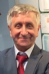
Biography:
Valentine A. Yankovsky is an Associate Professor in Atmospheric Physics of St. Petersburg State University (from 1990). In 1986 he has completed his PhD from SPBU “Laboratory studies of aeronomical reactions with participation of negative ions, excited oxygen atoms and molecules” which was been based on his investigation of processes in the glow discharge oxygen plasma. His main fields are the Atmospheric photochemistry in the MLT region, the Sensitivity and uncertainty study of complex photochemical systems and the Retrieval of ozone and atomic oxygen in the MLT. He has published more than 20 papers in reputed journals.
Abstract:
For daytime, the altitude profiles of concentrations of electronical-vibrationally excited molecules, O2(b1Σâºg, v=0, 1 and 2), depend on distributions of the O(3P), O3 and, partially, CO2 in the MLT region. It allows the use of emission bands originating from the O2(b1Σâºg, v= 0, l and 2) levels as a proxy for non-emitting, but it is very important for the atmospheric photochemistry, small components of the atmosphere. Contemporary model of O3 and O2 photolysis in the MLT, YM2011, has been investigated by methods of the sensitivity study and uncertainty analysis. It have been shown that simultaneously measuring of altitude profiles of two proxies concentrations, O2(b1Σâºg, v = 0) and O2(b1Σâºg, v = 1), allows to retrieve, simultaneously, profiles: [O3] and [CO2] in the range 50 – 90 km; [O(3P)], [O3] and, perhaps, [CO2] in the range 90 – 100 km (here, it is necessary to use a third proxy, O2(b1Σâºg, v = 2), in addition to the two above-mentioned); [O(3P)] and [O2] in the range 100 – 140 km. We believe that new remote sensing methods described above can be more fully realized as limb emission measurements from the satellite. Detailed description of the YM2011 model, database of the rate constants for aeronomical reactions, and applied analytical methods is given in the work: V.A Yankovsky et al., J. Mol. Spectrosc. (2016)
Roman Ya Kezerashvili & Elena Ancona
The City University of New York, USA
&
Polytechnic University of Turin, Italy
Title: Orbital dynamics of a solar sail accelerated by thermal desorption of coatings
Time : 11:55-12:15
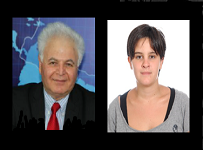
Biography:
Roman Ya Kezerashvli, Ph.D, D.Sc. in Theoretical Physics, has published over 170 papers, Professor of Physics, Corresponding Member of the International Academy of Astronautics.
Elena Ancona, Master of Science in Aerospace Engineering, 2016 from the Polytechnic University
Abstract:
For extrasolar space exploration it is convenient to take advantage of environmental effects, such as solar radiation heating, to accelerate a solar sail coated by materials that undergo thermal desorption at a particular temperature, reached at a particular heliocentric distance. This physical process of mass loss can provide additional thrust. We focus on the orbital dynamics of three scenarios that only differ in the way the sail approaches the Sun; in every case once the perihelion is reached, the sail coat undergoes desorption. When the process ends, the sail escapes the Solar System having the conventional acceleration of solar radiation pressure. We compare scenarios in which thermal desorption comes beside traditional propulsion systems, and they are the following: i. Hohmann transfer plus thermal desorption. The sail is carried as a payload to the perihelion with conventional chemical propulsion by a Hohmann transfer from Earth’s orbit to an orbit very close to the Sun (almost at 0.1 AU) and then deployed there. ii. Elliptical transfer plus Slingshot plus thermal desorption. In this case the transfer occurs from Earth’s orbit to Jupiter’s orbit where a Jupiter’s fly-by leads the sail close to the Sun, where it is deployed. iii. Two stage acceleration of the solar sail through thermal desorption. The sail has two coats of materials that undergo thermal desorption at different temperatures, so at different distances. The first desorption occurs at the Earth orbit and propels the sail toward the Sun, where the second takes place.
JoaquÃn Alonso Montesinos
University of AlmerÃa
Spain
Title: Cloud detection in the sun area of total sky images using a conventional and a low-cost sky camera
Time : 12:15-12:35

Biography:
Joaquín Alonso Montesinos has completed his PhD at the age of 26 years from the University of Almería, Spain and postdoctoral studies from the same University. He is member of a research group ‘Solar energetic resources, Climatology and Atmospheric physics’ at the University of Almería. He has published more than 10 papers in reputed journals, has authored and coauthored different conference papers, both national and international, and has participated in different projects related to solar radiation. Furthermore, he is serving as reviewer in different impact journals.
Abstract:
In the search of technologies for improving the use of solar energy, remote sensing techniques has been widely employed for different purposes. In that sense, a great variety of resources are available in the market, and whole-sky cameras with fisheye lens have supposed a novel procedure for the solar resource assessment. The hemispherical vision of this kind of cameras provides real-time sky images where the different atmospheric features can be identified. However, saturations in the sun area provoke situations where the pixels can be mistakenly identified as clouds when the sky is free of clouds. In this work, two sky cameras with two different image processing have been used to identify clouds in the solar area: firstly, a sky camera (TSI-880 model) with rotating shadow band was used to identify clouds in the sun area following an algorithm based on direct normal irradiance (DNI); whereas the second methodology is based on a low-cost sky camera without the use of DNI. For two cameras, the solar area was processed to identify clouds according to an image processing based on the different channels from the images. In this case, both methodologies presented a cloud identification success rate higher than 90% for all sky conditions, being more accurate the low-cost camera in some particular situations.
Pier Matteo Barone
The American University of Rome
Italy
Title: From space to Earth: the GPR frontiers
Time : 12:35-12:55

Biography:
Pier Matteo Barone is an adjunct faculty member of the American University of Rome teaching courses on Archaeology, Geophysics, Geoarchaeology, Remote Sensing, and Forensics, as well as courses on the Preservation of Cultural Heritage. He is a recognized expert in Forensic Geoscience employed to testify in criminal and civil cases. He is currently engaged in a three-year research project with the geological institute of CNR investigating marble quarries of the Greco-Roman world. He is an official reviewer in several peer-reviewed international journals, and he published more than 50 papers on peer-reviewed international journals on the above-mentioned topics.
Abstract:
Ground Penetrating Radar (GPR) has become the most important physical technique in Earth investigations, allowing the detection of targets with both very high vertical and horizontal resolution, and has been successfully applied in both different fields and aims of the Earth Sciences. The scope of a geophysical measurement is the detection of the “boundaries” between objects having different values of a specific physical property. The contrast between the searched target and the background should be strong enough to be detected “at distance”, i.e. it should be able to generate a measurable relative spatial variation of a physical quantity at surface. GPR technique uses radio waves to create remotely an electromagnetic image of structures and features buried in the ground. The uses of such a remote sensor are numerous: to test the equipment to its maximum potential under a variety of conditions due to construct roving vehicles for landing on Mars; to reconstruct the evolutionary history of the lava flows in an active volcano; to monitor soil water content for agriculture; to find the lines of walls in archaeological excavations; to examine the wall paintings; to assess the structural stability or damages of buildings; and, also, to help law enforcement to solve crime. The “sensitivity” of the electromagnetic waves makes this instrument very powerful in remotely and non-invasively detecting both terrestrial and extraterrestrial targets.
Pier Matteo Barone
The American University of Rome
Italy
Title: From space to Earth: the GPR frontiers
Time : 12:35-12:55
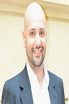
Biography:
Pier Matteo Barone is an adjunct faculty member of the American University of Rome teaching courses on Archaeology, Geophysics, Geoarchaeology, Remote Sensing, and Forensics, as well as courses on the Preservation of Cultural Heritage. He is a recognized expert in Forensic Geoscience employed to testify in criminal and civil cases. He is currently engaged in a three-year research project with the geological institute of CNR investigating marble quarries of the Greco-Roman world. He is an official reviewer in several peer-reviewed international journals, and he published more than 50 papers on peer-reviewed international journals on the above-mentioned topics.
Abstract:
Ground Penetrating Radar (GPR) has become the most important physical technique in Earth investigations, allowing the detection of targets with both very high vertical and horizontal resolution, and has been successfully applied in both different fields and aims of the Earth Sciences. The scope of a geophysical measurement is the detection of the “boundaries” between objects having different values of a specific physical property. The contrast between the searched target and the background should be strong enough to be detected “at distance”, i.e. it should be able to generate a measurable relative spatial variation of a physical quantity at surface. GPR technique uses radio waves to create remotely an electromagnetic image of structures and features buried in the ground. The uses of such a remote sensor are numerous: to test the equipment to its maximum potential under a variety of conditions due to construct roving vehicles for landing on Mars; to reconstruct the evolutionary history of the lava flows in an active volcano; to monitor soil water content for agriculture; to find the lines of walls in archaeological excavations; to examine the wall paintings; to assess the structural stability or damages of buildings; and, also, to help law enforcement to solve crime. The “sensitivity” of the electromagnetic waves makes this instrument very powerful in remotely and non-invasively detecting both terrestrial and extraterrestrial targets.
Luiz Sampaio Athayde Junior
Federal University from Bahia
Brazil
Title: The theory of solar zenith – Proposed new rules for the seasons of year in intertropical locations focusing Salvador Bahia
Time : 13:30-13:50

Biography:
Luiz Sampaio Athayde Junior Professor of Astronomy Course of Physics Institute (IF/UFBA) of Federal University of Bahia (FCC/UFBA), also Professor and the University Jorge Amado (Unijorge), and has experience as a Tax Analyst. A Master in Business Administration and Extension in Higher Education Methodology by the School of Administration of Federal University of Bahia (EA/UFBA), Post Graduate MBA in Financial Management and Company by Post Graduate and Research Center at Visconde de Cairú (CEPPEV/FVC). Accountant and Degree Bachelor of Accounting Sciences by Estacio University Center of Bahia (Estacio/FIB) and is certified by IAFC First Degree in International Financial Reporting Standards-IFRS.
Abstract:
The seasons occur across the planet because of the inclination of its longitudinal imaginary axis. The translation of the earth shows the four different astronomical positions, which help to define the four seasons, lasting ~ 90 days each. They are set also by weather patterns and the incidence of the sun throughout the year in the tropical zone, it makes the differences become more subtle, damaging its conceptualization in the region. Their differences are more bounded outside the tropics, in the dominant countries, which have created these rules and imposed through literature for northern colonized countries such as ours. The sun towards on Salvador ~ 27/10, far before the official summer, therefore, the city receives its rays back the pin, ~ 15/02, which would date the fall in the official rules. The summer of Salvador should be considered on September 12th, a date prior to the first solar zenith 45 days until April 1, 45 days after the second, because the heat comes before summer officially and lasts much longer, with high temperatures since before Spring official until after the fall, which would justify the modification. The differentiated system of direct sunlight, twice a year between the tropics, highlighting the need for different standards for stations in these localities are, however, it is taught the same rules of the temperate zone. Different companies need different types of education as long as it is taught by the master minds of education, knowledge acquisition is made by the subject's interaction with the environment, and knowledge is built with the approximation of reality by men, therefore, would be more correct to teach rules that are consistent with the observed reality in different localities, especially with the possibility of flowing information, update observation, and the presence of new technologies available for education.
Victor V Ionov
St. Petersburg State University
Russia
Title: Synoptical monitoring of climatic thermic fronts on the surface of the Southern Ocean by means of satellite remote sensing and in situ measurements
Time : 13:50-14:10
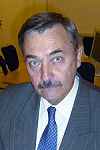
Biography:
Victor Ionov graduated from SPb (former Leningrad) State University in 1971. He has completed his PhD in Oceanology at the age of 31 years from St. Petersburg State University and was an exchange researcher at the Department of Oceanography, Florida State University, Tallahassee, USA, for seven months in 1984. He is Assoc. Prof., Department of Oceanology and Director of Division of Baltic and Arctic Projects SPbSU. He has published more than 25 papers in reputed journals and took part in several marine Antarctic Expeditions.
Abstract:
The Southern Ocean contains several oceanic fronts that together form the largest Antarctic Circumpolar Current. The methodology of synoptical monitoring of fronts is based on observations during the seasonal maritime operations for supply of Russian Antarctic stations. It happens by use of continuous registrations of variability of horizontal gradients of temperature of sea surface layer (SSLT) in situ, and horizontal gradients of surface temperature (SST) from satellite infrared (IR) data, which are taken in real-time on board of research vessel. This makes possible more detailed definition of the horizontal gradients of thermic characteristics and latitudinal extent of the fronts zones. It can be done by means of continuous data of SSLT from vessel’s automatic meteorological station, with simultaneous GPS-registration of their spatial location, on the one side; and by precise definition of geographical position of fronts zones of SST from satellite high resolution IR-images of the ocean surface, on the other side. Such data obtained during regular sub-meridional voyages of research-supply vessels between Africa and Antarctica, helps more confident than before to judge about presence/absence of trends in inter-annual changes in the latitudinal location of the main fronts in the Southern Ocean. Such a trends can be considered as an evidence of substantial change of water circulation and as the manifestations of global warming in the Ocean surface layer. During 2009‑2015 tendency in inter-annual shifts of seasonal positions of climatic fronts to the north or south on the surface of the Indian sector of the Southern Ocean, is not appeared.
Mikhail Yu. Puzachenko
Institute of Geography RAS
Russia
Title: Using multispectral and hyperspectral satellite imagery in ecological and geographical studies
Time : 14:10-14:30

Biography:
Puzachenko M.Y. has completed his PhD at the age of 32 years from Institute of Geography RAS and postdoctoral studies from Institute of Geography RAS. He is the Senior Researcher in Physical geography and Environmental management Department. He has published more than 30 papers in peer reviewed journals and has been a member of more than 15 national and international sciense projects.
Abstract:
Multi and hyperspectral measurements have been suggested as the method of assessment the state of ecosystems. Two approaches are considered: without and with the use of field data. In the first case the calculation of the thermodynamic variables (absorption of solar energy, Kullback information, the entropy of the reflected solar radiation, exergy) of the system, using the solar constant as reference, is used. Types of thermodynamic states of the system are estimated by dichotomous cluster analysis. Such states are usually well associated with known types of vegetation. The same cluster analysis is used on initial measurements of the spectral reflection with selection of the best metrics based on the principle of maximum entropy. This approach allows to differentiate the ecosystem with different forms of solar energy usage and different functioning and also to assess the ecosystems organization. The second approach is based on a regular step measurements along the transects. All points of transect are merged with spatially corresponding thermodynamic and reflectance variables for a different dates of a year. Multidimensional analysis is used to determine the systemic linkages between state of vegetation and soils on the one hand, and thermodynamic and reflectance variables on the other hand. As a results, informativity of remote measurements, its seasonal dynamic and physical basis were obtained, also the factors determining the solar energy usage, and ecosystems maps based on state of ecosystem, which are most connected with the solar energy conversion, were obtained. This study was supported by the RSCF grant 142700065.
Ebrahim Taherzadeh Mobarakeh
Ground Data Solutions R&D Sdn Bhd
Malaysia
Title: Impervious surface detection using very high spatial resolution satellite data
Time : 14:33-14:50

Biography:
Dr Ebrahim Taherzadeh was born in Isfahan, Iran in 1982. He received his PhD degree on Spatial Information Engineering from University Putra Malaysia in 2014. His PhD thesis was focused on the development of generic models to extract the roof materials using high spatial resolution satellite imagery. Currently he works as Remote Sensing Specialist at Ground Data Solutions R&D Sdn Bhd, a Malaysian LiDAR survey and mapping service provider. His major research effort includes urban remote sensing using high-resolution data, Hyperspectral and LiDAR data. He has published around 10 technical papers in these areas in international conferences and journals.
Abstract:
Satellite remote sensing data is considered as very important source of information and tool for data analysis and visualization. The detection of impervious surface (IS) in heterogeneous urban areas is one of the most challenging tasks in urban remote sensing. With the advent of very high spatial resolution such as Worldview-2(WV2) we are able to utilize high spatial and spectral information which is inherent in this type of image. This presentation investigates how this satellite data is currently being used to better detect and discriminate IS. In this presentation we will present mainly two case studies one on road and another on roof materials. In detail development of spectral index to extract road network automatically and generic model extraction for detection roof materials using WV2 satellite imagery will be discussed and addressed.
Seong Chan Jun
Yonsei University School of Mechanical Eng
Korea
Title: Enhanced chemical vapor sensing by single-stranded DNA-graphene
Time : 14:50-15:10

Biography:
Seong Chan JUN has completed Bachelor, master and Ph.D. degree from George Washington University (Washington D.C.), Cornell University (Ithaca N.Y.), and Columbia University (New York, NY) respectively. After he graduated, he worked at NSEC (Nano Scale Science & Research Center) and SAIT (Samsung Advanced Institute of Technology) sequently. He has been currently appointed professor at Yonsei University (Seoul, Korea) since 2008.
Abstract:
Sensor platforms lie at the heart of biochemical sensing applications. The efforts, especially for applying functionalized graphene devices have been recently highlighted in the field of biochemical sensors. However, chemical vapor sensors do not guarantee their sensing ability in high humidity since the electrical measurement is easily degraded by water molecules.
Dorian Gorgan, Victor Bacu, Constantin Nandra
Technical University of Cluj-Napoca
Romania
Title: WorDeL Language – Tutorial on flexible description of Earth Observation Data Processing
Time : 15:30-17:30
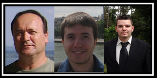
Biography:
Dorian Gorgan is Professor in Computer Science Department of the Technical University of Cluj-Napoca, PhD supervisor in Computers and Information Technology, and coordinator of the Computer Graphics and Interactive System Laboratory (http://users.utcluj.ro/~gorgan). The fields of interest involve parallel and distributed processing over HPC infrastructures such as Grid, Cloud, Multicore, and cluster, development of platforms and applications for spatial data processing and visualization, interdisciplinary research in the domains of Earth Sciences and Earth Observations. He has been involved as scientific coordinator and WP leader in national and international research projects such as BIGEARTH, PECSA, enviroGRIDS, IASON, SEE-GRID-SCI, GiSHEO, mEducator, iTRACE, MedioGrid, COMPLEXHPC, and KEYSTONE. He has been member of scientific and reviewing committees of many ISI journals and international conferences, and gave more than 300 papers and presentations in journals and prestigious conferences in the domains of Computer Science and Earth Observation.
Abstract:
The main issues of Big Data in Earth Observation (EO) domain are the volume and velocity of data acquired by an increasing number of aerial and space-borne sensors, but as well the complexity of data mining process. The sheer volume and acquisition rates may threaten to overwhelm many organizational storage capabilities, leading to situations in which data value is overtaken by storage costs, which will, in turn, lead to loss of data. Data can create value only when it is used, and the data protection has to be oriented toward allowing innovation that sometimes depends on creative people, which achieve unexpected valuable results through a flexible and adaptive manner. The users need to describe and experiment themselves different complex algorithms through analytics in order to valorize data. The analytics uses descriptive and predictive models to gain valuable knowledge and information from data analysis. This tutorial aims to exemplify some of the main features of WorDeL (Workflow Description Language), and demonstrate their usage in defining Earth Data processing tasks. The WorDeL language is based on the flexible description of processing tasks as workflows, composed of basic processing operators. With this approach, the language offers an intuitive way of representing processing tasks, without requiring programming expertise from its users. It also allows its users to employ and integrate existing functionality into their design, thereby reducing the complexity and development effort of newly defined processing workflows.
Hamisai Hamandawana
University of Fort Hare
South Africa
Title: Unveiling the first high resolution satellite mosaic coverage of Botswana’s Okavango Delta
Time : 17:30-17:50
Biography:
Hamisai Hamandawana is Associate Professor and head of the University of Fort Hare’s Department of GIS & Remote Sensing with research interests in the application of GIS and Remote Sensing to global climate change investigation. He taught GIS, Remote Sensing at the university of Botswana and North West University in South Africa and was GeoInformatics Programme manager for South Africa’s Agricultural Research Council. He has to date conducted several government consultancies, published more than 30 journal papers and reports, presented more than 25 papers at international conferences and served as expert reviewer of the Millennium Ecosystem Assessment Report.
Abstract:
In 2007 Hamandawana et.al, published a paper in Vol 10 Issue 1 of the International Journal of Remote Sensing which proposed a ground-breaking methodology on how to georeference and mosaic CORONA photographs. These high resolution (2m) panchromatic photographs were acquired by the US military during the Cold War between June 1959 and May 1972 in order to gain military intelligence by spying on the Soviet Union, China and the rest of the world in an undercover surveillance program code-named CORONA. Although CORONA photographs provide one of earliest photoreconnaissance datasets immensely useful for long-term change investigation by extending the temporal coverage of remotely sensed images into the historical past by nearly a decade prior to the launch of Landsat I in 1972, their utility has been constrained by difficulties in compiling large area coverages because they exhibit substantial geometric distortions and exponential brightness variations that are difficult to correct. This presentation will attempt to bridge this gap by sharing with those interested, the first and only available complete CORONA mosaic coverage of the Okavango Delta on 15 September 1967. It is hoped that the remote sensing community will tap on this dataset to provide useful insights on controversies surrounding the transient / non-transient nature of environmental change in this sub-region during the recent historical past.
Meryem Tahri
University Hassan II
Morocco
Title: The evaluation of solar farm locations applying Geographic Information System and Multi-Criteria Decision-Making methods: Case study in southern Morocco
Time : 18:00-18:20

Biography:
Meryem TAHRI was born on November 7, 1988 in Casablanca, actually, she is 3rd year PhD student from university Hassan II Casablanca in discipline of geoscience and environnement. She got the industrial engineering diploma specialized in supply chain and logistics at the age of 24 at ESITH engineering school in Casablanca. she has published a paper in reputed journal. Her speciality is geomatic, decision support system in the environmental ressources and multi-hazard and multi-risk studies supported by EO Data. She participates in a wide range of oral communication and poster presentation. She also started her musical studies at the age of 8, she is actually a professor of piano at the municipal Casablanca conservatory.
Abstract:
The extraction and burning fossil fuels such as coal or petroleum cause the release of carbon dioxide and other global warming pollutants in the atmosphere covering a coat in the planet and puts the earth in danger, several studies recognized the renewable energy resources are as clean sources, governments are already working hard to cut greenhouse gases. Environmental policies are currently largely devoted to fostering the development and implementation of renewable energy technologies in Morocco. This work studies the outcome of combining both Geographic Information System (GIS) tools and the Multi-Criteria Decision-Making (MCDM) method to assess the suitability of a certain set of locations to carry out a renewable energy project. For the sake of concreteness, we consider the case of the Ouarzazate photovoltaic solar energy project, which is located in the southern region of Morocco and aims to be connected to the national power grid of the country. Four criteria were used : location, orography, land use and climate and the Analytical Hierarchy Process (AHP) was used to calculate the corresponding criteria weights. These criteria can be subdivided into seven factors : land use, slope, slope orientation, distance to urban area, distance to road, potential solar radiation and land surface temperature. Climate turns out to be the most important criterion since it defines the potential electricity production of a certain photovoltaic field. Next comes orography, which reveals the steepness or gentleness of the slopes in a particular area. Finally, regarding the location criterion, the most suitable sites are those where the ground is flat and oriented towards the south. The features of a particular area were sorted into five classes:“unsuitable”, “marginally suitable”, “suitable”, “moderately suitable” and “highly suitable”. The outcomes of the study are shown in figure 5. According to our GIS model, a very large proportion of the area, more than 59%, corresponds to highly suitable land for photovoltaic field projects. It is worth mentioning, however, that other lands representing only about 26% were not considered in this assessment, as they are either cultivated or urbanized. As much as 23% of the land is the most suitable and lies in the region of Ghassate in the east whereas the least suitable areas represent 1% and are located in the south and west. In spite of the high potential solar radiation and the land surface temperature, these areas are found in mountainous zones. The overlay layer results obtained after applying spatial analysis showed that the majority of the land in Ouarzazate has a high suitability for photovoltaic farm installation. The high potential solar radiation, the land surface temperature and the orientation towards the south are unsurprisingly the key factors that increase the suitability of a land
Sunil C. Joshi
Nanyang Technological University
Singapore
Title: Changing Paradigm in Satellite Design, Development and Assembly with 3D Printing
Time : 18:20-18:40
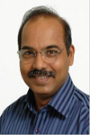
Biography:
Sunil C. Joshi obtained his M.Tech. Degree in Aeronautical Engineering with aircraft structures specialization. He received his Ph.D. degree from Monash University (Australia). Prior to that, he worked as a Scientist at National Aerospace laboratories, Bangalore, India, from 1988 to 1994. He has been an academic staff in School of Mechanical and Aerospace Engineering since 2000, presently as part of Aerospace Engineering cluster. His expertise lies in the domain of Aerospace Materials and Structures, and his teaching includes courses such as, Advanced Materials Engineering, and Structures and Materials. He has been the chairperson of the accreditation committee that works towards the accreditation of the BEng (AE) programme. He was the member of XSAT, Singapore’s first in-house designed and developed micro-satellite, team where he served as the team leader for thermal controls sub-system. Currently, his work involves nanosats and their thermal and mechanical design and behaviour.
Abstract:
3D printing has evolved with time into a matured process for being able to manufacture functional parts and structures gaining widespread attention in aerospace industry. It has started changing the satellite design philosophy. Designs can now be customized to ease assembly, optimize the space and reduce the overall weight. A design model of a plastic CubeSat structure fabricated employing Fused Deposition Modelling (FDM) process is presented. The CubeSat was designed to make assembly easier, possibly by hand, with minimum fasteners. This design ensured that there were no overhanging parts thereby eliminating use of any support material during printing, and it required no surface finishing. Closing or solar panels can be attached to this CubeSat frame without any screws. Essentially this design was easy-to-assemble using only 8 thumb screws in total. Prototypes of the designed CubeSat were printed in ABS to validate the tolerances. The entire sub-systems and payload layout was printed and put together to understand the usage of the available volume. This type of prototyping makes satellite design, development and assembly less complex and easy to visualise. Such designs can potentially be used to 3D print the structure in different environmental or print conditions such as off-world manufacturing.
Lotfy Kamal Azaz
Menofya University
Egypt
Title: Detecting coastline changes using gis and remote sensing, a case study from oman
Time : 18:40-19:00

Biography:
Lotfy Kamal Azaz is an Associate Professor in Geography department, Faculty of arts, Menofya University, Egypt. He has obatined his PhD in GIS and Urban Planning from School of Civil Engineering and Geosciences, and school of Architecture, Planning & Landscape, Newcastle University (UK). He has more than 20 Years total experience in teaching research, and Community service in the universities in Egypt, UK, and Oman. Moreover, He has more than 20 Years total experience in managing GIS and Remote sensing projects from conception to completion in Egypt, UK and Oman. He has published a number of books, articles in the fields of GIS and remote sensing applications. He acts as a reviewer for some international and regional journals.
Abstract:
Detecting changes are one of the most interesting applications of remote sensing and GIS. Change detection often involves comparing satellite imagery of the area taken at different times. Change detection has been widely used to assess deforestation, urban growth, impact of natural disasters and use/land cover changes. Coastal erosion can be detected as well by the same methods. Coastal erosion is a universal phenomenon because of sea level rise, which is considered a result of climate change. This paper aims to detect and measure coastline changes of Wedam_Alsahel area, Batinah, north of Oman using GIS and remote sensing. For this purpose, two satellite images were used. The first one is IRS image acquired in 1998, while the second one is IKONOS image acquired in 2008. The images were geometrically corrected. Spatial resolution of IKONOS image was modified to conform to spatial resolution of IRS image to perform comparison between images. Coastline was identified and digitized in both images, and then coastline changes were measured in many locations along the coast of the area of study. The size of coastline erosion ranged between 50.81 meter and 112.27 meter. The average coastline erosion is 8.78 meter annually. This size of change is very hazardous and it has great impacts on the population and environment. This critical issue needs to be managed. The study introduced some recommendations to deal with this phenomenon.

Biography:
Trevor Watkins is an assistant professor at Kent State University, where he serves as subject librarian for Chemistry, Computer Science, Liquid Crystals Institute, Mathematics, Physics, Engineering, Technology, and Military Science in University Libraries. He has over a decade of experience designing, integrating, migrating and deploying systems and networks. His research interests include developing systems using autonomous software agents and bio-inspired algorithms. He sits on the board of CTEST laboratories, where he often voluntarily contributes to the research and development of Epistemological and Hermeneutical systems based in software. He is a professional member of both IEEE, and ACM (SIGAI).
Abstract:
NASA’s Deep Space Network (DSN) is a network of satellites, antennas, and interplanetary probes. While effective, the current two-way communication link used for probe control and data collection, has some limitations. This paper dicusses how to scale and improve the current Deep Space Network by integrating a new peer-to-peer mesh satellite architecture based on Artificial Bee Colony Algorithm (ABCA) using autonomous cooperative agents. This paper is divided into three parts. First, the architecture is discussed. It is composed of a new central semantic routing algorithm between satellites, a data forwarding mechanism, and a winter cluster resiliency scheme. Second the interaction, responsibilities, and cooperation between autonomous software agents that govern each satellite is discussed. Finally the integration of this infrastructure with the existing DSN infrastructure is discussed.
Zhongping Lee
University of Massachusetts Boston
USA
Title: Secchi disk depth: evaluation of an algorithm based on new visibility theory

Biography:
ZhongPing Lee got his Ph.D in 1994 from the University of South Florida. Dr. Lee is currently a Professor at the School For the Environment of the University of Massachusetts Boston. Dr. Lee’s main research interests are in oceanic light field, algorithms for sub-surface properties from measurements of ocean color, as well as applications of ocean color products for the study of aquatic environments. He led the development of the quasi-analytical algorithm (QAA) and the Hyperspectral Optimization Processing Exemplar (HOPE) for processing of both optically deep- and shallow- waters.
Abstract:
Secchi disk depth (ZSD), a measurement of the maximum viewable depth of a white or black-and-white disk with a diameter about 30 cm when lowered into water, holds the longest (from at least 1880's) records of water transparency. This ZSD data record is found not only important for the study of climate change, but also useful for seagoers. However, there has been no standard ZSD product from all satellite ocean color missions. This may in part lie in that there was no robust algorithm to estimate ZSD of global oceans from ocean color measurements, although numerous empirical relationships were developed for various locations. In addition, the classical visibility theory suggests that ZSD is proportional to the inverse of (K+c), with K the diffuse attenuation coefficient and c the beam attenuation coefficient. Because c is significantly (2-5 or more) larger than K and that c could not be analytically retrieved from ocean color remote sensing, it has been perceived that there could be no analytical or semi-analytical algorithm for ZSD from ocean color measurements. A recent study found that this classical interpretation of ZSD is flawed, and a new theoretical relationship is developed for ZSD. With concurrent measurements of ZSD and remote-sensing reflectance (Rrs) of wide range of aquatic environments, the performance of the estimation of ZSD with Rrs as inputs by the classical and the new approaches is evaluated. The excellent results of the new relationship indicate a robust system to produce global ZSD from satellite ocean color measurements.
Miah Muhammad Adel
University of Arkansas at Pine Bluff
USA
Title: Spatial and temporal features of particle precipitation at low- and Mid-latitudes zones

Biography:
Miah Muhammad Adel after completing his M. Sc. degree in physics in 1974 at the age of 22, he started teaching in the same department at Rajshahi University, Bangladesh. On study leave abroad, he completed his Ph. D. degree in space physics and astronomy from the Louisiana State University (LSU)-Baton Rouge, USA, in 1988, and started working as an assistant professor of physics at the University of Arkansas at Pine Bluff (UAPB). He worked with the US Air Force S81-1 mission data at LSU and Japanese EXOS-C satellite data at UAPB. He is now working with the Belgium’s PROBA-V/EPT data. He developed expertise in surface water hydrology, and published six books on the Ganges basin. Also, he authored a book on lightning protection. In both disciplines, he published more than 50 articles.
Abstract:
EXOS-C observed precipitation of protons of energy 0.64 – 35 MeV and electrons of energy 0.19 -3.2 MeV parallel to the geomagnetic equator in the low-latitude region, mid-latitude region, and the auroral region in order of increasing intensities during the time interval (1984-86). The detector efficiency shows that the locally mirroring particles (pitch angle 90 degrees) outnumber those of other pitch angles. In the low-latitude region, the electron peak flux lies in the L- range of 2-2.2, and the proton peak flux between L=1.8 to 2.0. In the mid-latitude region, proton peaks lies between l = 2.2 to 2.4. The peak value of the particle population lies between 650 and 700 km. The particle population shows no longitude dependence within 140o to 360o. There is a shortage of data points in the other longitude range. In certain passes of the satellite, electron counting rates outnumber the proton counting rates and in some other passes the opposite effect occurs. Either altitude variation or a temporal variation or both may play a role for this opposing effect. No local time variation was found.
Aliakbar Rasuly
Macquarie University
Australia
Title: Real-time monitoring and synchronized processing of dust storms Western parts of Iran
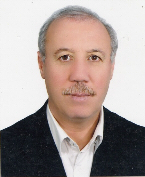
Biography:
Aliakbar Rasuly has completed his Ph.D. in Geosciences at Wollongong University, Australia in the year 1997 and MS in Geomorphology at University of Tabriz, IRAN in the year 1987. He is the Professor in Geosciences, Department of Environmental Sciences at Macquarie University, Sydney - Australia & RS & GIS Department, University of Tabriz, Iran.
Abstract:
The real-time monitoring of the weather and climate conditions by means of multi-spectral satellite images has become increasingly important during the past decades, in context of a modern geography. Subsequent synchronized image processing procedure is currently linked to discover all possible variations in environment and climate changes, mostly interleaving catastrophic impacts throughout of Iran. This study demonstrates how satellite images are being captured by a local satellite receiving station, mounted in the University of Tabriz. Associated Grabber software receives, archives, processes and displays data from NOAA Advanced Very High Resolution Radiometer (AVHRR) and MODIS/TERRA/Aqua images. Relevant images are being capturing by a land-based 1.8 m parabolic dish rotator and equipment rack with a receiver, ingest PC, a number of server host computers and distributed network switches. All allied hardwares and softwares provide fully automatic control of an advanced stabilization weather capturing system, intentionally the days with duststorm events. Purposely ingested data have been primary processed applying an automatic preprocessed setting and output images were subsequently taken into a non-popular image processing package; as a programming palette inside the iDAP & MacroPro softwares. Subsequently, a formula palette was defined with a complete range of functions in calculating of different duststorm indexes; such as: BTDI and AVI (adjusted for AVHRR images) and followed by BTA, NDDI, TDI and DP (adjusted for MODIS images) have been steadily applied. All processed images were exported to ArcGIS setting and ultimate dust maps have been lastly modeled.
David Hartshorn
Global VSAT Forum (GVF)
UK
Title: Satellite Communications: Global Technology, Market & Regulatory Trends

Biography:
David Hartshorn has more than 20 years of experience in the satellite communications industry. He serves as Secretary General of the Global VSAT Forum (GVF), the non-profit global association of the satellite communications industry. GVF includes more than 200 member organizations from every major region. Hartshorn leads the organization's regulatory and market-development programs to facilitate the provision of satellite communications.
Abstract:
Advances in satellite communications technology are now enabling service providers to provide fixed and mobile applications throughout global enterprise and consumer markets at an unprecedented level. In addition to millions of fixed VSATs, market demand is raising for "Satcom on the Move" and "Satcom on the Pause" systems that are bringing broadband to planes, trains, ships and other mobile platforms. Meanwhile, new variables are being added to an increasingly complex equation: Internet of Things, Big Data, High Throughput, and non-geostationary mega-constellations of small satellites to name a few. As satellite technology pushes the performance envelope, major challenges are being presented to government decision makers: Licensing, landing rights and other regulatory considerations are being revisited to ensure that the right balance is struck between market access and interference prevention. Spectrum pressure is rising from within the satellite industry as well as from external sources. For example, interests vying for satellite spectrum include the wireless sector, which is seeking access to satellite bands for delivery of WiMAX, LTE and 5G. Governments weighed in on regulatory and spectrum questions during last year's ITU World Radio communications Conference and, while key decisions were made, regulatory and spectrum matters are very much a work in progress. This presentation will provide an overview of today's trends from the perspective of the Global VSAT Forum, an international association of the satellite communications industry, which comprises the manufacturers, operators and service providers that are applying these innovations worldwide.
Ben Jarihani
University of the Sunshine Coast
Australia
Title: Studying hydrological processes in dry land landscapes: Can satellites help in data-poor regions?
Biography:
Ben Jarihani is a postdoctoral research fellow at Sustainability Research Centre, University of the Sunshine Coast working on erosion estimation and sediment transport modeling with collaboration with CSIRO. He received bachelor and master of engineering in irrigation, drainage and water resources management (1996-2001), followed by eight years industry work experience as a professional water engineer, hydrologist and project manager. He has done his PhD in hydrological sciences at University of Queensland, Australia with collaboration with CSIRO (2011-2015) entitled “developing remotely-sensed data approaches to studying hydrological processes in data-poor dry land landscapes”. Dr. Jarihani research interests include application of remote sensing and geographic Information system in water resources management and hydrological/hydrodynamic modelling. He has published several papers in reputed journals and has been serving as an active reviewer of repute. He received European Geosciences Union 2011Outstanding Student Poster awards in hydrological science, The University of Queensland Research Scholarship and The Integrated Natural Resource Management top-up scholarship from CSIRO.
Abstract:
Drylands occupy one third of the Earth’s surface and are home to around 400 million people, yet the water resources of these regions are often poorly understood because of a lack of fundamental hydrological data. Thus fundamental questions of (eco) hydrological function of these river systems cannot be understood at a detailed scale. Earth observation satellites have been proved to provide data and information on water cycle in multiple spatio-temporal scales. This research project aims to develop remotely-sensed data approaches in order to improve our understanding of hydrological processes in data-sparse dryland landscapes. Four objectives were investigated: (i) to evaluate the accuracy and effectiveness of satellite derived altimetry data for estimating flood water depths in low-gradient, multi-channel rivers; (ii) to detect and map flood extents and optimise the trade-off between image frequency and spatial resolution using Landsat and MODIS satellites imagery; (iii) to assess satellite-based Digital Elevation Models (DEMs) accuracy for hydrodynamic modelling; and (iv) to use a hydrodynamic model supported by satellite-derived data to investigate flood water transmission loss. This research concluded that it is now possible to realistically constrain water balances in data-sparse dryland rivers using hydrodynamic models in combination with satellite-derived data to address limitations in the availability of conventional hydrological datasets. This research has implications for the opportunities, limitations, and future directions of using remotely-sensed data to better understand water balance and hydrodynamics of data-sparse regions. This knowledge is imperative for improved management of the limited water resources in dryland, both in Australia and around the world.
Mikhail G Leonov
Russian Academy of Sciences
Russia
Title: Lateral protrusions (plate-flows) in the structure of the Earth׳s lithosphere
Biography:
Mikhail G Leonov has completed his PhD in 1980 at the Geological Institute of the Russian Academy of Sciences. From 2005 to 2010, he was the Head of this Institute. Currently, he is the Head of the Tectonics consolidated crust laboratory of the Geological Institute of the Russian Academy of Sciences. He is the member of the editorial boards of several journals. Through many years was the Head of the interlaboratory, interinstitute and international scientific programs. He has published 250 scientific works including 11 monographs and more than 100 articles published in scientific and popular journals. He has lectured in Russian universities, as well as in the University Marie and Pierre Curie (Paris). He participated in expeditions to the Caucasus, Pamir, Tien Shan, Kazakhstan, Karelia, Mongolia, Carpathians, and Balkans.
Abstract:
Within the Earth׳s lithosphere, there are specific structures, known as lateral protrusions or plate-flows. These structures are playing an important role in the continental and oceanic architecture of the Earth׳s crust. They are a fundamental and widespread phenomenon that controls many features of the tectonic and geodynamic evolution of platform and foldbelt basement. Geologically, the lateral protrusions or plate-flows provide spatially constrained, nearly horizontal rock bodies with attributes of 3D tectonic flow and lateral transport of rock masses. Similar structures have been found in various parts of the World both within the continental and oceanic lithosphere. Among them are the Baltic shield, Anatolia, Tian Shan, South Africa, East-European platform, the Scotia sea, Caribbean region, etc. The occurrence of flowing layers embodies the internal mobility of enormous volumes of rock masses and the possibility of their lateral redistribution at various depth levels of the continental lithosphere. This phenomenon is also reflected in the tectonic-physical and mathematical models. The existence of such structures was confirmed by interpretation of space images. The report, on the example of geodynamic polygon "Baikal", contains a methodology of the comprehensive cosmo-geological study of the lateral tectonic movement structures.
Anatoliy Toropov
Institute of Cosmophysical Research and Aeronomy
Russia
Title: Observation of neutron burst associated with cloud-to-ground lightning discharges
Biography:
Anatoliy Toropov was graduated from Yakutsk State University in 2005. Currently working as scientist at the Institute of Cosmophysical Research and Aeronomy in Ionosphere and Magnetosphere Radio emission laboratory. Currently, he is doing PhD at Institute of Cosmophysical Research and Aeronomy and his research is about electromagnetic fields of thunderstorms in the North-East Asia (Siberia). Research interest includes: atmosphere electric field, thunderstorm, neutrons generating in lightning discharge, bead lightning.
Abstract:
The made at the Institute for Cosmophysical Research and Aeronomy of an instrument system for the synchronous recording of variations in the neutron flux, the atmosphere electric field strength and the electromagnetic radio emission during lightning discharges is reported. Neutrons were detected at Yakutsk (altitude 94m, latitude 61°59.362′ N, longitude 129°41.874′ E) by a low-energy cosmic-ray SNM-15 lead- covered neutron counter and lead-free neutron counter with 10-μs resolution are obtained during short-range lightning events in the vicinity of Yakutsk. In the immediate vicinity of the neutron detectors the electric field-mill was installed to register the electric field and its variations during thunderstorms. The electric field-mill was calibrated in an artificial electric field and has a measurement range of +/-50 kV/m. A linear antenna is mounted in the vicinity of neuron detectors to sense the short-term electric field variations associated with a lightning discharge. It was found that the neutron bursts are observed in the negative lightning discharge only. It was established that all the neutron flux bursts were observed during the thunderstorms with the only type of electric structure of the thundercloud having a compact positive charge at the bottom. We discuss the possibility of generation of neutrons in the lower part (the point of impact into the ground) lightning discharge.
Rainer Sandau
International Academy of Astronautics
Germany
Title: Distributed Space Systems Basics, Status and Prospects
Biography:
Rainer Sandau is retired from the German Aerospace Center (DLR) and acts currently in numerous positions including Director Satellites and Space Applications of the International Academy of Astronautics (IAA) and adjunct Professor at Baylor University, Texas, USA. He has over 30 years of experience in airborne and space borne activities and has been involved in instrumentations of five space missions to Venus, Mars and Earth, and also in numerous concepts for instruments and small satellites for or with different countries and space agencies. He authored or co-authored over 250 publications, holds over 25 patents, and is co-author or -editor of 27 books or conference proceedings.
Abstract:
The advances in various fields of technology are the basis for miniaturized sensors and spacecraft subsystems which allow small satellite missions with performances often comparable or even better than those of former large satellite missions. The actual status of small satellites with associated payloads in terms of spatial, spectral and temporal resolution is provided. This recent trend of miniaturization accompanied with increased or even novel high performance features allows implementing affordable distributed space systems with different basic characteristics. After an introduction to the different concepts of distributed space systems like satellite formations, satellite constellations, spacecraft swarms and rendezvous and docking systems, the paper concentrates on constellations and formations. Their widespread possibilities are presented by means of example missions. Finally, an outlook is given in terms of technology development and application areas.
Dorian Gorgan
Technical University of Cluj-Napoca
Romania
Title: Flexible description of Earth observation data processing
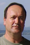
Biography:
Dorian Gorgan is Professor in Computer Science Department of the Technical University of Cluj-Napoca, PhD supervisor in Computers and Information Technology, and coordinator of the Computer Graphics and Interactive System Laboratory (http://users.utcluj.ro/~gorgan). The fields of interest involve parallel and distributed processing over HPC infrastructures such as Grid, Cloud, Multicore, and cluster, development of platforms and applications for spatial data processing and visualization, interdisciplinary research in the domains of Earth Sciences and Earth Observations. He has been involved as scientific coordinator and WP leader in national and international research projects such as BIGEARTH, PECSA, enviroGRIDS, IASON, SEE-GRID-SCI, GiSHEO, mEducator, iTRACE, MedioGrid, COMPLEXHPC, and KEYSTONE. He has been member of scientific and reviewing committees of many ISI journals and international conferences, and gave more than 300 papers and presentations in journals and prestigious conferences in the domains of Computer Science and Earth Observation.
Abstract:
Big Data is a challenge in many fields of research, one important domain being those dealing with Earth Observation (EO) data. The main issues, in this case, are the volume and velocity of data acquired by an increasing number of aerial and space-borne sensors, but as well the complexity of data mining process. Thus, the sheer volume and acquisition rates may threaten to overwhelm many organizational storage capabilities, leading to situations in which data value is overtaken by storage costs, which will, in turn, lead to loss of data. Data can create value only when it is used, and the data protection has to be oriented toward allowing innovation that sometimes depends on creative people, which achieve unexpected valuable results through a flexible and adaptive manner. The users need to describe and experiment themselves different complex algorithms through analytics in order to valorize data. The analytics uses descriptive and predictive models to gain valuable knowledge and information from data analysis. The BigEarth platform offers solutions for increasing the efficiency of the data processing efforts by combining two approaches. The first one experiments the high-performance, cloud-based computing solution in order to shorten the overall execution time. The second approach provides a highly flexible description of the data processing tasks in order to improve the modularity of the design and promote reusability. As a means of specifying the structure of the workflow, the BigEarth platform uses a specially designed description language called WorDeL (Workflow Description Language). This presentation aims to highlight and exemplify some of the main features of the language, and demonstrate their usage in defining Earth Data processing tasks. The WorDeL language is based on the flexible description of processing tasks as workflows, composed of basic processing operators. With this approach, the language offers an intuitive way of representing processing tasks, without requiring programming expertise from its users. It also allows its users to employ and integrate existing functionality into their design, thereby reducing the complexity and development effort of newly defined processing workflows. The WorDeL language supports the transparent adaptive parallelization of the processing tasks over high performance computation architectures, such as cloud based solutions.
Alexander V Bagrov
Institute of Astronomy of the Russian Academy of Science
Russia
Title: Conception of habitable rooms building on the Moon before manned mission there
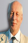
Biography:
Bagrov Alexander has completed his PhD at the age of 42 years from Odessa University (Russia) and got his Doctor of Science degree from Moscow State University. He is the Leading scientist of Institute of Astronomy of Russian Academy of Sciences and key specialist of Lavochkin Association, a premier space probes manufacturing organization. He has published more than 125 papers in reputed Russian journals and is author of 8 patents. He was awarded to title of "Honor Constructor of Space Technique".
Abstract:
We proposed extremely simple and low-cost conception of slow lunar apartment building using solar energy and lunar material - regolith and basalts. When solar radiation is focused into small patch, temperature inside the patch will be more than 3000K that is enough to melt any lunar material. Having concave film mirror 4-meters in diameter, we can melt about 10 g of stony material every second. If this material is in sands form, it may be poured into light patch to produce monolith construction. Such 3-D printer may be programmed for building any complex construction of walls, floors, studs, stairs, hatches and so on. One 3-D printer with 4-meter mirror can produce about 3,4... 4,0 m3 of monolith construction during one lunar day and 120-tonn building after 1 year work. During lunar night the printer will be at inoperative mode, but it will not be broken. After sunrise it will continue its work. Assuming that thickness of walls and studs would be 50-cm (to protect rooms from space radiation and micrometeorites), the 120-tonn building will have at least 21 m2 of gas proof room. Such light 3-D printer may be delivered to the landing point several years before manned mission, so when astronauts will install proper lids and life support system, they will have enough habitable room for long work.
Tatiana Vozmishcheva
Kalashnikov Izhevsk State Technical University
Russia
Title: From zero to infinity: the limit passage of space curvature in integrable problems of celestial mechanics

Biography:
Tatiana Vozmishcheva is an Associate Professor at Kalashnikov Izhevsk State Technical University and Faculty of Mechanics and Mathematics of Lomonosov Moscow State University. Tatiana Vozmishcheva has completed her PhD at Moscow Institute of Electronics and Mathematics (Technical University) in 1992 and postdoctoral studies at Department of Differential Geometry and Applications. She has published 49 papers and monographs in reputed journals and Publishing Houses.
Abstract:
What can we say about the three-dimensional space in which we are living? We draw the conclusions that it has the constant zero curvature on the base of experience and studying only surrounding space that is actually incorrect. Probably, we as the Clifford worm ascribe changes of curvature to some physical actions or to changes in our organism. Small parts of space are really similar to small hills on a surface which is flat on the average, and namely there the standard laws of geometry are not true. The property of a curvedness or deformation continuously passes from one part of space to another like a wave. Variation of space curvature just is what really occurs in the phenomenon which we call the matter motion. The connection between integrable problems of celestial mechanics, the Kepler problem and the two-center problem, in the Euclid space, in the Lobachevsky space and on a sphere is investigated. The limit passage in the two-center problem in the Lobachevsky space and on a sphere is carried out as ( is a curvature of the corresponding space). The potentials and metrics in spaces under study are written in gnomonic coordinates. It is shown that integrable problem of celestial mechanics: the Kepler problem and the two-center problem, pass one to another in spaces of constant curvature under changing two parameters: the space curvature and the distance between centers. It seems natural that integrable problems of celestial mechanics should pass each other at change of space curvature.
Douglas Santos Rodrigues Ferreira
Federal Institute of Rio de Janeiro
Brazil
Title: On the agreement between small-world-like OFC model and real earthquakes

Biography:
Douglas Santos Rodrigues Ferreira has completed his degree and Master's degree in Physics from Fluminense Federal University (Brazil) and his PhD in Geophysics from National Observatory (Brazil) with a sandwich period in Florida Institute of Technology (USA). He works in the Instrumentation Laboratory and Applied Scientific Computing at Federal Institute of Rio de Janeiro and has experience in Physics and Geophysics focusing on Applied Geophysics, Statistical Physics, Complex Networks and Self-organized Critical Systems.
Abstract:
Despite all the existing knowledge about the production of seismic waves through slips on faults, much remains to be discovered regarding the dynamics responsible for these slips. Aiming to contribute to the understanding of earthquake dynamics, in this paper we implemented simulations of the model developed by Olami, Feder and Christensen (OFC model), which incorporate characteristics of self-organized criticality (SOC) and has played an important role in the phenomenological study of earthquakes, because it displays a phenomenology similar to the one found in actual earthquakes. We applied the OFC model for two different topologies: Regular and “small-World”, where in the latter the links are randomly rewired with probability p. In both topologies, we have studied the distribution of time intervals between consecutive earthquakes and the border effects present in each one. In addition, we also have characterized the influence that the probability p produces in certain characteristics of the lattice and in the intensity of border effects. Furthermore, in order to contribute the understanding of long-distance relations between seismic activities, we have built complex networks of successive epicenters from synthetic catalogs produced with the OFC model, using both regular and small-World topologies. In our results, distributions arise belonging to a family of non-traditional distributions functions, which agrees with previous studies using data from actual earthquakes. Our results reinforce the idea that the Earth is in a critical self-organized state and furthermore point towards temporal and spatial correlations between earthquakes in different places.
Aleksey Malinka
National Academy of Sciences of Belarus
Belarus
Title: Retrieval of the sea ice optical properties from satellite optical measurements

Biography:
Aleksey Malinka has graduated from the Belarusian State University, the Department of Physics, in 1997. In 2005 he has completed his PhD at Physical and Mathematical Sciences, specialization – Optics. Up to now he works in the Institute of Physics of the National Academy of Sciences of Belarus as a Leading Researcher. He has published more than 20 papers in peer-reviewed journals and made more than 30 presentations at the international conferences. His studies are aimed at the better understanding of light scattering phenomena in various natural environments. The scope of his interests extends from the basic concepts of the light scattering theory to processing the data of lidar sounding and satellite remote sensing.
Abstract:
Satellite remote sensing is an important tool for monitoring the sea ice state, particularly in the difficult-to-access Polar Regions. The snow grain size, the soot contaminants concentration, the melt pond fraction (during the summer melt), and the surface albedo are the key characteristics for various problems regarding the climate changes, monitoring the ice melt process, particularly regarding the drastic changes in the Arctic environment, observed in the recent years. The common approach to retrieve the sea ice characteristics uses the a priori reflection spectra of the sea ice surface components: snow, white ice, blue ice, melt pond, and so on. Here another technique is presented based on models of the optical properties of sea ice. Algorithm MPD (Melt Pond Detector) considers the summer ice as consisting of white ice (high reflective) and melt ponds. The MPD input is the MERIS data. The algorithm retrieves the surface characteristics in an iterative procedure with the Newton-Raphson method. It uses the simple optical model of ice, take into account the bidirectional reflection, and include the atmospheric correction. It was verified with the in situ measurements. The output is maps of the melt pond fraction and the pixel spectral albedo. The produced maps allow monitoring the long-time global changes of the Arctic ice state. These retrievals provide the historical data on the process of Arctic ice melting, which is so important for understanding the climate changes in the Arctic. It is planned to implement it for processing the data of the OLCI on Sentinel-3. Parts of these studies have been supported by the 6th and 7th Framework Programmes of the EU (projects DAMOCLES and SIDARUS).
Foo Chee Hung
Construction Research Institute of Malaysia
Malaysia
Title: Human-nature interaction – How human wellbeing is affected by the degree of naturalness
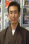
Biography:
Foo Chee Hung is a researcher from the Construction Research Institute of Malaysia (CREAM) – a research arm under the Construction Industry Development Board Malaysia (CIDB). He obtained both his first (Environmental Engineering) and master (SHE Engineering) degree in The University of Malaya. He then further pursuit his PhD (Urban Engineering) in The University of Tokyo. His research interest is in sustainability, affordable housing, green building, building quality assessment, Industrialized Building System (IBS), and urban ecosystem. He is a member of the Institution of Engineers Malaysia (IEM), GreenRE manager, and Qlassic assessor.
Abstract:
Past researches have reported positive correlation between environmental preferences and perceived naturalness, and the natural environments have been shown to have significant benefits for human wellbeing. Even a positive relationship is observed between natural settings and the likelihood of people undertaking outdoor activities (or recreation). This paper presents results of a study conducted in Klang Valley region, with the general goal to contribute to the empirical rationale for linking forest naturalness with human wellbeing. By applying a combination of research techniques and analysis, the present study successfully gives an observational support to the potential relation that links together naturalness, experiential connection to nature, and human wellbeing; where naturalness is an important dimension of environmental experience that may benefit to the human wellbeing (in terms of physical, mental, and social) through influencing the human-nature interaction. A more ‘natural’ forest tends to serve the public in a more diverse way than the less ‘natural’ forest. A more ‘human-controlled’ forest, on the other hand, tends to serve the public in a more specific way due to the instalment of certain facility which aims to facilitate the forest users for conducting certain activity. This paper is of useful in providing an understanding on how such relationship formed within a rapidly urbanized city, where urban natures are relatively more susceptible to the physical and economic changes brought by the ever growing development pressure. Apart from that, a deeper insight of the different meanings of urban natures – in the context of the developing country – is provided.
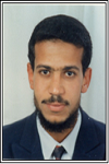
Biography:
Hamdy A. M. Aboulela has completed his PhD at the age of 37 years from Faculty of Science, Hamburg University, Germany, 2003. He is associate professor of Marine geology and applied geophysics in department of Marine Science, Faculty of Science, Suez Canal University 41522, Ismailia, Egypt. He has published more than 15 papers in reputed journals and has been serving as an editorial board member of repute.
Abstract:
Manipulation, combination, overlay, integration and reattribution GIS and remote sensing functions have been used to explore the possible new occurrences of geothermal resources in South Sinai. Moreover, surface observations and lineament analysis of satellite images are used to delineate the active geothermal areas. The distribution of recent earthquake epicentres over South Sinai shows three main active trends (N6oE, N40o-75oE and N50o-60oW) conformable with the long fault extensions extracted from ETM+7 and ASTER GDEM satellite images and comprise the well-known hot springs in South Sinai. The N6oE trend intersects both of N50o-60oW or N40o-75oE, the temperature of spring waters is remarkably increases. This feature attributed to the deep penetration of groundwater along the N6oE fault trend (Gulf of Aqaba trend). The seismicity patterns of well-known and newly predicted geothermal sites show that, the majority of earthquakes have focal depths range between 3 and 33 km and have micro to moderates magnitude (0.5 ≥ Mb ≤ 4.5). In addition, the maximum focal depth of events reached up to 50 km at Hammam Faroun area revealing the deep-seated thermal source. The main chemical type of the known thermal water of south Sinai is Cl-Na, indicating a long flow pathway of this water. The high calcium contents of thermal water of South Sinai are accompanied with remarkably low sulphates. The hydrochemistry of the newly predicted thermal sites exhibit similar pattern of the known thermal waters. Such observations are used as indicators to locate six predicted new occurrences of geothermal fields in South Sinai.
Abd-Alla GAD
National Authority of Remote Sensing and Space Sciences
Egypt
Title: Developing a digital land resources database of Egyptian Nile Valley, based on integrated GIS and satellite data
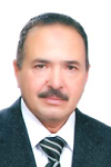
Biography:
Gad Graduated at the Faculty of Agriculture, Al-Azhar University, Cairo, Egypt, B.Sc., specialized in Soil Sciences, 1976 with degree of "Very good with honor degree". He continued studies at the Faculty of Sciences, State University of Ghent, Belgium, and obtained PhD in remote sensing applications, with greatest distinction degree in 1988. He is an expert in soil survey, land evaluation, land degradation and desertification. He was awarded the “State prize in advanced technical Studies, Agricultural Sciences”, Egypt, 2001; “Shield of Excellence”, Euro-Arab Organization of Water, Environment and Desert studies (2014); “Shield the University of Jordan” (2016). He coordinated the EU-FP7 funded project “Characterization and Sustainable Use of Egyptian Degraded Soils (SUDSOE), Jan 2012.
Abstract:
The National development plans aim to sustain and raise productivity of arable lands. Development of a digital land resources data base is important for realizing best land use. The current article focuses on the Nile Valley, which gifts the Egypt land, among the hyper arid desert area. Information and maps, including analogue data, were digitized, geo-referenced and imported to a GIS model. Networks of irrigation, drainage, roads, railways and utilities, were included. SRTM, recent ETM+ and SPOT satellite images were utilized to validate thematic maps and develop DEM. Intensive field investigation, equipped by a navigation GPS, was performed, to collect ground control points and representative soil samples. It was found that 2.63% of the mapped soils is exhibited by soil order “Arididsols”, dominated by “Petrogypsids” great group at Northwestern desert fringes of Nile Valley. The “Entisols” soil order dominates the studied soils (97.37%), where”Torrifluvents” great group is pronounced (52.3%). The elevation ranges from 0 to 40 meters ASL. It was found that 15.5% of Nile Valley are classified as highly capable, corresponding with “Vertic Torrifluvents” soils sub great group. The low capable soils, corresponding to sub-great groups “Typic Petrogypsids”, “Typic Haplosalids” and “Typic Petrogypsids”, represent 1.7 of the Nile Valley. The most striking findings noticed were the urban encroachment on the account of most fertile soils. It could be concluding that achieving such detailed digital land resources database is a great step towards the implementation of sustainable development and management programs.
Anatoliy Kulik
National Aerospace University "KhAI"
Ukraine
Title: Control of operability of redundant electrical flywheel actuator units under the destabilizing influences
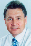
Biography:
Anatoliy Kulik graduated of the Kharkov Aviation Institute as a specialty Electromechanical Engineer in 1971 and he has worked there since then. He defended Candidate’s thesis in 1977 and Doctor's thesis in 1992. He worked as the Dean of the Flying Vehicles Control Systems faculty from 1998 to 2015. He is a Head of the Flying Vehicles Control Systems department since 1998. Three Doctoral and 15 Candidate theses have been prepared and defended under his leadership. Scientific results are reflected in 435 papers. He is a member of the editorial board of some specialized scientific magazines, Laureate of the Ukraine State Prize in Science and Techniques, and Member of International Academy of Navigation and Motion Control.
Abstract:
During the spaceflight, satellites are influenced by external perturbation actions of gravitational, magnetic, aerodynamic, electric, solar, and other forces and moments. To fend off these disturbances in order to maintain required orientation of the satellite, actuators are used, which create reactive moments for the conservation of angular momentum of the satellite. Electric-flywheels implemented as motor-flywheels are effectively used as actuators for satellites. These devices are combined to actuator units, which creates control vectors of reactive moments. The structure of three such actuators placed along the axes of the orthogonal coordinate system, allows fending off external disturbances. Units with redundant structure of flywheels actuators also allow parrying complex internal disturbances called as rejection. External and internal disturbances represent a lot of destabilizing influences. These actions violate the operation of electric flywheel actuator units. The units of actuators with redundant structure provide the ability to fend off a destabilizing effect. This problem is actually both in theory and in practice of satellite control. A new diagnosis-based control principle is used to solve this problem. By using that approach for operability control allows to provide a diagnosability and recoverability relative to a plurality of potential destabilizing effects of actuator unit during its designing. The new diagnostic models, which assign direct and indirect signs of destabilizing influences, were developed. The criteria of structural and signal diagnosability for these models were formed. The algorithms for diagnosing of a flywheels actuator unit with pyramidal structure were developed. The models and algorithms of operability recovery of such actuator units were formed. The breadboard model of electromechanical actuators with pyramidal structure in gimbals was made. The series of experimental research were carried, which confirmed the theoretical and practical applicability of proposed control approach of redundant electrical flywheels actuator unit operability.
Tarek Nada
National Authority for Remote Sensing and Space Sciences
Egypt
Title: Performance evaluation of Liquefied-Gas thruster

Biography:
Tarek Nada has completed his MSc and PhD in Aerospace Engineering from Cairo University and postdoctoral studies from Stuttgart University, Institute of Space Systems (Institut Für Raumfahrtsysteme, IRS). He is associate professor and head of space mission analysis department at National Authority for Remote Sensing and Space Sciences, Cairo, Egypt. He has published more than 15 papers in reputed journals and International conferences, and has been serving as reviewer for many International journals in Aerospace Engineering.
Abstract:
The performance of liquefied-gas thruster is evaluated for different design alternatives. Three heating concepts are assessed, namely; accumulator heating pipe, accumulator with inner copper discs and low-power resistojet. The performances of the three configurations are compared in terms of thrust, specific impulse, thrust-to-power ratio and impulse bit. This evaluation is essential in selecting the proper propulsion system for certain space mission. One-dimensional gas dynamics model is developed to predict the performance of the thruster for each concept employing butane as the propellant. Comparisons are made and conclusions for advantages and disadvantages of each design alternative are discussed. Moreover, a parametric study is conducted for each case to investigate the effects of nozzle geometry, initial tank pressure and input power on the performance of the thruster.
K Dergachov
National Aerospace University "KhAI"
Ukraine
Title: Tendencies of intellectualization in aerospace engineering

Biography:
K Dergachov graduated from the Kharkov Military University in Mathematics in 1995. He defended Candidate's thesis (PHD) in 2000. He worked as a teacher and researcher at the Kharkov Military University from 1996 to 2007. He works as Associate Professor in Flying Vehicles Control Systems department since 2007. His scientific results are reflected in 180 papers.
Abstract:
Progress of vehicles development is accompanied by number of negative impacts. Among them are an unacceptable level of human-being losses, the growth of energy consumption of non-renewable sources, the negative impact on the environment, passenger and freight flows delay, etc. So, there are a number of harmful effects on the environment along with the need to improve transport means. Obvious contradiction between these two problems gives rise to seeking of new ways of solving relevant scientific and technical problem providing for the vehicle safety. Currently, the solution of this problem can be found in intellectual vehicles implementation. Among the transport systems, aerospace systems occupy a significant place. Aerospace systems use and integrate an aircrafts or a space crafts (flight vehicles, FV) for the purpose of things and passengers transportation. Today, it is particularly important to improve exploitation efficiency of such systems. In aerospace systems, flight vehicle are used to perform functions of transportation which can bring us to new goals of FV functioning by taking into account various factors of environment and FV motion characteristics. Aircraft control is carried out by the use of control systems. In the past, they were building the FV control system using a prior knowledge about the environment. Intellectual support structure can be presented as the three types of automatic operations: Missions being performed without informing the person; missions being performed with the help of informing the person; recommended tasks which the system should carry out after information confirm. Aerospace technology intellectualization will result in: Effective solving navigation tasks without dispatchers and navigators assistance; e.g., the concept of 4-D navigation and free-plan flights (out of routes flights); carrying out profound diagnostics and workability recovery without ground services participation, during both flight and preflight; implementation of a number of other complex facilities requiring the intelligent support.
Abdel-Aziz Belal
National Authority for Remote Sensing and Space Sciences (NARSS)
Egypt
Title: Detecting urban growth using remote sensing and GIS techniques in Al gharbiya governorate, Egypt
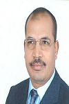
Biography:
Abdel-Aziz Belal is an Associate Professor at National Authority for Remote Sensing and Space Sciences (NARSS), Egypt. He has completed his Ph.D. in 2006 from Freiburg University (Germany). He has published more than 36 in reputed journals His main fields of interest on remote sensing and GIS techniques, Environmental Science, Soil Science, Climate Change.
Abstract:
Tanta and Quttour are the important districts in Al Gharbiya governorate, Middle of Nile Delta, Egypt. Urban sprawl is one of the main problems that reduce the limited highly fertile land in the Nile Delta of Egypt. Computational urban growth and computer hardware had made possible unprecedented increase in the availability and provide information inputs to planners. Remote sensing technology has shown its great capabilities to solve many earth resources issues. The aim of this study is to produce land use and cover map for the studied area at varied periods to monitor possible changes that may occurred, particularly in the urban areas and agriculture and subsequently predict likely changes. Two land sat images, Multispectral Scanner (MSS) in the 1972 and Enhanced Thematic Mapped (ETM) in the 2005 were used to assess the changes of agricultural lands, urban encroachment and water areas during this period with integration by GIS. The agricultural areas in Tanta and Quttour decreased by 7.17% and 5.84%, respectively from the year 1972 to 2005, while the urban areas increased by 7.17–5.84%, respectively. This urban expansion causes loss of productive agricultural lands. Finding data is useful for decision maker to investigate and monitoring illegal use of agricultural land in Nile Valley and Delta.

Biography:
Heba Abd El Hamid Abd Allah is an Architecture Engineering working as a teaching assistant at architecture Department, Faculty of Engineering, Aswan University, Egypt. Recently, she has registered as a master student at Aswan University in the field of urban planning. (Remote sensing, Photogrammetry, GIS, GPS and Plane surveying). In 2014, she has completed a comprehensive undergraduate degree in Architecture Engineering at Aswan University, Egypt. She is having a strong academic record and my overall bachelor grade was very good with honor rank with a percentage of 77.82%. She has ranked among the first in Architecture Department. She is interested in attending scientific conferences, seminars, workshops and associated with other different activities. She attended a workshop with DAAD about urban climate in El Gouna & anther one in Aswan. She spends most of my time in several activities related to her research.
Abstract:
As ecotourism becomes more and more popular, developing countries are now embracing it and including it in their economic development and conservation strategies. Egypt as one of these countries enjoys a rich cultural and environmental heritage and offers an exceptional environment for ecotourism development. Despite of this heritage of people, accents, history, flora and fauna all offer irresistible lures, Egypt has the Lowest fortune of ecotourism income. This was due to Lack knowledge of spatial success factors for ecotourism location Especial in Upper Egypt. So, the purpose of this study is to identify success factors that affect selecting ecotourism site prior to undertaking the development of an ecotourism operation, understanding these factors will mitigate the risk of failure of selecting process. To achieve these purpose, research divided into three main parts; the first part focused on the analysis of theoretical and conceptual knowledge in available literature especially on Egypt; and the second part deals with Detailed study of study area to figure out which spatial factors fits with it; and the third part Specializes questionnaire with specialists and planners to arrange the spatial success factors in terms of importance and determine the priority of each standard on the other
Biography:
Asmaa H. Ahmed is an Architecture Engineering working as a teaching assistant at architecture Department, Faculty of Engineering, Aswan University. Recently, she registered as a master student at Aswan University in the field of Surveying Engineering (Remote sensing, Photogrammetry, GIS, GPS, Plane Surveying and Advanced Geodesy). In 2011, she has completed a comprehensive undergraduate degree in Architecture Engineering at South Valley University, Egypt. She has a strong academic record and overall bachelor grade was very good with honor rank with a percentage of 81.4%. She has ranked among the first in Architecture Department. She is interested in attending scientific conferences, seminars and associated with other different activities. She spends most of my time in several activities related to my research.
Abstract:
Site selection for sitting of urban facilities is one of the crucial policy-related decisions taken by urban planners and policy makers. The combination of GIS with fuzzy set theory and deterministic models is known as GIS Fuzzy Modeling (GISFM). GISFM was adopted for support sustainable land use planning. This paper considers the specific problem of creating a well-sustainable distributed of hospitals. We develop a Multi-Criteria Decision Analysis process that combines Geographical Information System (GIS) analysis with the Fuzzy Analytical Hierarchy Process (FAHP), and use this process to determine the optimum site for a new hospital in Aswan City. Based on actual conditions of the study area, we built a hierarchy model for selecting optimum health care services sites in Aswan city, Egypt. We considered two main factors, and 5 sub-factors. An application adopting the AHP idea was developed to calculate weights of the criteria of the site. The GIS was used to overlay and generate criteria maps and suitability map. The (GIS) was used to manipulate and present spatial data. All maps are graded from 1 (lowest suitability) to 5 (highest suitability) using spatial information technologies. The candidate sites were determined by aggregation based on the criteria weights. The candidate sites are divided by ‘best’, ‘good’ and ‘unsuitable’ landfill areas. Best health care site represent optimal sites; good health care site can be used as back-up candidate sites. Our work offers a siting methodology and provides essential support for decision-makers in the assessment of health care site management problems in Aswan City and other rapidly developing cities in developing countries.
Rajkumar Hajra
University of Orléans
France
Title: High-Intensity Long-Duration continuous AE activity (HILDCAA) events and “Killer Electrons†in Earth’s outer radiation belt

Biography:
Rajkumar Hajra has completed his PhD at the age of 28 years from University of Calcutta, India, and postdoctoral studies from Instituto Nacional de Pesquisas Espaciais (INPE), Brazil. He is currently working as a researcher in CNRS, Orleans, France. His research interest includes various ionospheric and magnetospheric topics related to ionospheric total electron content, scintillation, solar wind high-speed stream effects etc. Presently he is working in an ESA funded project related to the Rosetta mission to study the ionized environment of a comet called 67P/Churyumov-Gerasimenko (67P/C-G). He has published more than 20 papers in reputed journals.
Abstract:
High-intensity long-duration continuous AE activity (HILDCAA) events have been shown to be associated mostly with high-speed solar wind streams (HSSs) [Hajra et al., JGR, 118, 5626, 2013]. These geoeffective events, by definition [Tsurutani and Gonzalez, PSS, 35, 405, 1987], have peak AE intensities > 1,000 nT and continue for more than 2 days when AE values do not drop below 200 nT for more than 2 h at a time. The events are caused by the southward component of interplanetary Alfvén waves embedded within the HSSs. Recent studies show that HILDCAA events are associated with generation of relativistic (MeV) electron acceleration in the Earth’s outer radiation belt [e.g., Hajra et al., GRL, 41, 1876, 2014]. The relativistic electrons are known as “killer electrons” for their hazardous effects to orbiting spacecraft. In the present talk, we will present a detailed study on the geomagnetic characteristics and interplanetary causes of the HILDCAA events as well as the solar cycle and seasonal dependences of the events. It will be shown that the ground-based AE observations during HILDCAAs may potentially be used to predict by > 1 day advance the acceleration of radiation belt relativistic electrons at geosynchronous orbit. Relativistic electron acceleration and decay timescales will be provided for wave-particle investigators to attempt to match their models to empirically derived values.
Jindong Xu
Yantai University School of Computer and Control Engineering
China
Title: Multi-scale sparse decomposition of image and its application in Remote Sensing image fusion

Biography:
Jindong Xu has completed his PhD at the age of 34 years from Beijing Normal University and postdoctoral studies from Institute of Automation Chinese Academy of Sciences. He is the assistant professor of Yantai University, a famous university of China. He has published more than 10 papers in reputed journals.
Abstract:
Morphological component analysis (MCA) is a successful example of a sparse image decomposition algorithm. Building on MCA, a multi-scale sparse image decomposition method, called m-MCA, is presented in this paper. M-MCA combines Curvelet Transform bases and Local Discrete Cosine Transform bases to form the decomposition dictionary and controls the entries of the dictionary to decompose the image into texture component and cartoon component. From the aspect of the amount of information, a remote sensing image (RSI) fusion method based on multi-scale sparse decomposition is proposed. Via sparse decomposition, the effective scale texture component of high resolution RSI and cartoon component of multi-spectral RSI are selected to be fused together. Compared to the classical fusion method, the proposed fusion method gets higher spatial resolution and lower spectral distortion with a little computation load. Compared to sparse reconstruction fusion method, it achieves a higher algorithm speed and a better fusion result.
Zhuokun Pan
Zhejiang University
China
Title: An IDL-based program for constructing time-series remote sensing data: towards high spatiotemporal applications
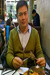
Biography:
Pan Zhuokun is currently a doctoral student in Zhejiang University. His research interests are mainly focused on remote sensing and geoinformation sciences in agriculture. Specifically, he has great interest in integrating remote sensing data and physical model to perform regional application, for the evaluation of agriculture suitability, risk, and yield improvement.
Abstract:
Research in time-series of remote sensing data is receiving increasing attentions. Research using relatively high spatiotemporal resolution satellite imagery was unprecedented. For the purpose of utilizing such high repeat cycle with relatively high spatial resolution satellite materials, in this paper, an IDL-based program was developed. The China’s HJ-1 A/B satellite data were employed for time-series construction. To construct a complete spatial time-series data with IDL, processing methodologies included Savitzky-Golay filter for smoothing, and linear-interpolation for daily NDVI imagery interpolation. Methodologies employed in this program are quite capable in maintaining essential shape of NDVI trajectory temporally. By analogy to commonly used multi-temporal remote sensing data (e.g., vegetation-index product derived from MODIS, AVHRR), application cases in utilizing HJ-1 A/B NDVI time-series were presented. It was also tested applicable for most multi-temporal remote sensing data for time-series construction. With the availability of relatively high spatiotemporal satellite data, the authors are having a positive expectation at utilizing such data to advance the time-series analysis in remote sensing community.
Amin Beiranvand Pour
Universiti Teknologi Malaysia
Malaysia
Title: PALSAR-2 remote sensing data for geo-hazard mapping in Kelantan river basin, Malaysia
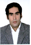
Biography:
Amin Beiranvand Pour has completed his PhD from University Technology Malaysia. He is the Senior Lecturer in University Technology Malaysia. He has published more than 25 papers in Geology and Remote Sensing journals.
Abstract:
Natural hazards of geological origin are one of major problems during heavy monsoons rainfall in Kelantan state, peninsular Malaysia. Several landslides happened in this region were obviously connected to geological and topographical features. Satellite synthetic aperture radar (SAR) data are particularly applicable for detection of geological structural and topographical features in tropical conditions. In this study, Phased Array type L-band Synthetic Aperture Radar (PALSAR-2) data were used to identify high potential risk and susceptible zones for landslide in the Kelantan river basin. Adaptive Local Sigma filter was selected and applied to accomplish speckle reduction and preserving both edges and features in PALSAR-2 fine mode observation images. Different polarization images were integrated to enhance geological structures. Additionally, directional filters were applied to the PALSAR-2 Local Sigma resultant image for edge enhancement and detailed identification of linear features. Several faults, drainage patterns and lithological contact layers were identified at regional scale. In order to assess the results, fieldwork and GPS survey were conducted in the landsliding zones in the Kelantan river basin. Results demonstrate the most of the landslides were associated with N-S, NNW-SSE and NE-SW trending faults, angulate drainage pattern and metamorphic and Quaternary units. Consequently, landslide risk map were produced for Kelantan river basin using recent PALSAR-2 data, which could be broadly applicable for landslide hazard assessment and delineation of high potential risk and susceptible areas. Landslide mitigation programmes could be conducted in the landslide recurrence regions for reducing catastrophes leading to economic losses and death.
Lucie Novakova
Academy of Sciences
of the Czech Republic
Czech Republic
Title: Relation of fault orientation data in mezzo- and macro-scale as provided by field survey and ASTER GDEM lineament analysis in context of paleostress analysis
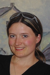
Biography:
Lucie Novakova finished her Ph.D. in 2013 at Faculty of Sciences, Charles University, Prague. She has been working at the Institute of Rock Structure and Mechanics, Academy of Sciences of the Czech Republic since 2005. Her work is dealing with brittle tectonics from macro to micro scale, reconstruction of tectonic history of complex fault zones, and intraplate seismicity within the Bohemian Massif. She has published more than 15 papers in international journals and has been Editor in Chief and Editorial Board Member of reputed journals.
Abstract:
Brittle tectonics paleostress analysis utilizes information recorded on faults mostly in mezzo-scale to determine stress regime in macro-scale. Data coverage as well as relationship between mezzo- and macro-scale faults in a studied area (typically tens to hundreds square kilometres) are essential to obtain reliable results. In addition analysis of fault’s orientation data in different scales might not only unearth possible segmentation of a studied area but also help to delimitate it. Several methods can be deployed to learn orientation data of macro-faults. Geological or tectonic maps and remote sensing data are the most obvious sources. Geology and tectonics in particular provide a framework in which natural terrain tends to be formed. While maps usually describe faults from certain dimension as supposed by the geologist, digital elevation model provides subjectively unbiased dataset with macro-faults demonstrated as lineaments. Geological map and lineament orientation analysis of the area provides necessary structural information for following brittle tectonics features field survey to cover the area evenly. In our paleostress project we applied image tracing techniques on the ASTER GDEM to determine main orientation of terrain lineaments. Subsequently, according to orientation of the terrain lineaments we defined five different areas. As compared with the geology map, high degree of correspondence was found. In addition, also field mapped orientation of the mezzo faults has been found rather consistent suggesting the mapped mezzo-faults are related to the macro-faults as expected. The finding also suggests local stress regimes recorded over the studied area represent stress regimes in the macro-scale.

Biography:
Jium-Ming Lin was born in Taiwan 1952 and graduated from the Department of Electronic Engineering, National Chiao-Tung University at Taiwan in 1974. He achieved the Master and Ph. D Degrees from the same school of Institute of Electronics in 1976 and 1985, respectively. He was an adjunct professor and full professor since 1992 and 1996 at the Dept. of Mechanical Engineering, Chung-Hua University, Taiwan. Now he is at Dept. of Electronic Engineering and majors in the fields of RFID, accelerometer, rate gyro; multi-variable, optimal, stochastic and fuzzy-neural control; avionics, and MEMS. He also has several patents in the related areas.
Abstract:
This research applied both the traditional, Ziegler-Nichols-based and Ziegler-Nichols-based fuzzy control methods for the design of mobile satellite antenna tracking system. Firstly, the antenna tracking and the stabilization loops were roughly designed according to the traditional bandwidth and phase margin requirements. However, the tracking performances would be degraded if the tacking loop gain is reduced due to parameter variations. On the other hand, both Ziegler-Nichols-based PID-type and Ziegler-Nichols-based fuzzy controllers were also applied in the tracking loop to improve the performance. But only the performances obtained by the fuzzy controllers were better for both the antenna tracking loop with low and high gains, and to reduce the effect of tracking loop gain parameter variations. In addition, the backlash hysteresis effect of gimbals are also taken into consideration for both cases; one can see that the systems obtained by using Ziegler-Nichols-based P, PI, PD and PID type fuzzy controllers are more robust to parameter variations even with the hysteresis effect. Key-Words: - Mobile Satellite Antenna, PD-type Fuzzy Controller, PI Compensator, Stabilization
Salwa Belaqziz
Chouaïb Doukkali University
Morocco
Title: Remote sensing-based irrigation index to improve water efficiency in agriculture

Biography:
Salwa Belaqziz is an Assistant Professor of Computer Science at the Chouaïb Doukkali University (El Jadida, Morocco). She received her PhD degree in Computer Science in 2014 from the Cadi Ayyad University (Marrakech, Morocco). After graduating, she spent a year at the French National Institute for Agricultural Research in Toulouse as a postdoctoral researcher. Her main research interests are: software engineering, multi-agent systems, water resources management and remote sensing.
Abstract:
With the increasing pressure on water resources accentuated by climate change, irrigation scheduling has become an important tool that significantly influences growth, development and production of crops and which allow avoiding both excessive irrigation and crop water stress. For this purpose, using remote sensing-based vegetation indices derived from optical data, can be considered as a suitable tool for monitoring crop phenology, water stress and therefore, the crop water requirement. In this context, we present and evaluate a new irrigation priority index (the IPI) based on remote sensing, which measures the irrigation priority of a plot in parts concerned by the irrigation round. This normalized indicator takes into account the water stress coefï¬cient and the time of irrigation with regard to the duration of an irrigation round. The IPI ranges between -1 and 1 and decreases with irrigation priority. The IPI was used to evaluate the actual irrigation scheduling in an irrigated perimeter of 2800 ha of Tensift Al Haouz plain close to Marrakech in Morocco during the 2002–2003 winter wheat season. The obtained results showed that about 32% of the plots receive late irrigation, when the stress was maximum. The sensitivity of grain yield to the IPI values was also evaluated on a data set of wheat yields acquired on the 2008–2009 season. The spatial yield was simply calculated using a linear relationship between wheat yields and the spatial accumulated NDVI (Normalized Difference Vegetation Index). The result showed a clear relationship between grain yield and IPI.
Oleksiy Dudnik
Institute of Radio Astronomy
Ukraine
Title: Three-belt structure of electron fluxes in the Earth’s magnetosphere as seen by the STEP-F instrument during deep minimum of solar activity
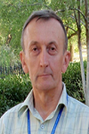
Biography:
Oleksiy Dudnik received PhD and Doctor of Science degrees in Physics and Mathematics from the Kharkiv State University, Ukraine, in 1990, and in 2015, respectively. He was Head of the Space Research Sector at Kharkiv University; Chief designer of the STEP-F satellite instrument flown aboard CORONAS-Photon satellite. He was PI of international and domestic research projects aimed for developing of compact satellite devices on measurements of energetic charge particles. His research interests are: dynamics of magnetospheric particles and radiation belts; HF sporadic radio emission of the near Earth space, space weather. He published more than 50 papers in journals on listed areas.
Abstract:
The analysis of sub relativistic02 electron fluxes at height ~550 km was performed on the base of experimental data obtained in 2009 from the STEP-F instrument installed on board the LEO spacecraft CORONAS Photon. Throughout processed data from selected months of 2009 three belts’ structure of electron fluxes was recorded in the Earth’s magnetosphere due to large geometric factor (~20 cm2*sr) and high sensitivity of the STEP-F instrument. The slot between Van Allen inner and outer radiation belts had not being filled in by particles as it frequently was recorded during strong geomagnetic storms. Instead of it additional steady belt was recorder at L shell ~1.6 distantly not far from the well-known Van Allen inner belt (at L~2.3 for the energy range ∆Ee=0.18 0.51 MeV). The intensity of particles in both: additional and inner belts depended on the level of geomagnetic activity though the latter one in average was very low in 2009, the year of minimum of 11-year’s cycle of solar activity. The Van Allen and new recorded belt at L~1.6 had been registered on the geographic longitudes, which are not coincided with those ones of South Atlantic Anomaly zone location. The energy spectra of electrons populating both innermost belts differ strongly: a harder spectrum was found in the Van Allen inner belt in comparison with the newly detected third one. For the third “additional†radiation belt electrons with energies Ee≥0.4 MeV had not been registered.
Manviienko Serhii
Privat Joint Stock Company “Research and Production Complex “Kursâ€
Ukraine
Title: Results of experimental working off relativistic gravimeter
Biography:
Manviienko Serhii has completed his PhD at the age of 30 years from SDO “Yuzhnoye” in the year 2012. He is the director of business development “RPC “Kurs” in 2015.He has published more than 32 papers in reputed journals and one of the first has suggested to use relativistic effect of gravitational displacement of frequency of electromagnetic radiation at creation of new type relativistic gravimeter.
Abstract:
According to the contract on cooperation and the organization of mutual relations between SO «Ukrmetrteststandart» and “RPC “Kurs” in December, 2015 tests of one of types relativistic gravimeter - differential radiophysical gravimeter have been conducted. Technical realisation of such type gravimeter is having the name a program-technical complex (PTK) «Gravika». Tests have been spent in SO «Ukrmetrteststandart» Acknowledgement of technical characteristics PTK «Gravika». On the basis of navigating receivers of new generation and the modernized scheme of measurement was the test purpose; Acknowledgement of technical characteristics PTK «Gravika». Is receptions of a difference of frequencies between signals of 10 MHz of two GPS receivers at the expense of their rating on distance of 2,85 m on height. Results of measurements received by means of CNT-90 are duplicated by internal comparators BC21 and ВС23 hydrogen standards of frequency VCH-1005. Sessions of measurements with working off of the optimum scheme of connections have been for this purpose spent from November, 15th, till December, 21st, 2015. The size of change of a difference of frequencies between a signal of 10 MHz of two GPS the-receivers carried on height on distance of 2,85 m., makes 9.8Ñ…10-15
Biography:
R. K. Sharma completed his PhD in Space Dynamics at the age of 28 years from University of Delhi, India. He is professor of Aerospace Engineering at Karunya University, Coimbatore, India since August 2011. Prior to that, he worked as scientist in Indian Space Research Organization for 38 years. He has published 57 papers in reputed journals including 4 in Proceedings of Royal Society of London. He has published 25 papers in the proceedings of reputed conferences. He has reviewed a number of manuscripts for different Journals. He has examined about 40 theses for the degree of Ph.D in Space Dynamics and Celestial Mechanics.
Abstract:
Precise orbit computation of artificial Earth Satellite is a basic necessity for accurate mission planning, satellite geodesy, re-entry and orbital lifetime estimates. Though the numerical integration methods can generate more accurate ephemeris of a satellite with respect to a complex force model, the analytical solutions represent a manifold of solutions for a large domain of initial conditions and parameters and find indispensable application to mission planning and qualitative analysis. The method of the KS total-energy equations [1] in terms of the KS regular elements and uniformly regular KS canonical elements has been found to be very powerful for obtaining numerical as well as analytical solutions with respect to different perturbing forces. Utilizing the KS and the uniformly regular KS canonical elements, we have developed a number of non-singular analytical theories for short-term orbit predictions with Earth’s oblateness and luni-solar perturbations in closed form in eccentricity and inclination, and for long-term orbit predictions of near-Earth satellite orbits for low as well as for high eccentricity orbits with the air drag effect utilizing different analytical drag models including oblate diurnally varying atmosphere with density scale height variation with altitude [2, 3, 4]. In the present lecture, we systematically highlight our above studies for a wide range of orbits.
Salah Er-Raki
Cadi Ayyad University
Morocco
Title: Using satellite remote sensing data for mapping crop water requirement in semi-arid region
Biography:
Salah Er-Raki holds a PhD in agricultural water management from the Cadi Ayyad University. He was actually Professor at the Faculty of Sciences and Techniques, Cadi Ayyad University. His main research interests include the application of remotely sensed data in land-surface atmosphere models especially in arid semi-arid regions. He worked in several Funded European research projects (SUDMED, WATERMED, IRRIMED, PLEIADES, REC). He is an author and co-author of more than 40 per review publications and more than 100 papers in conferences and workshops. He serves also as an editorial board member and reviewer of several international scientific journals.
Abstract:
Estimates of crop water requirements using remote sensing data are essential in effective planning of irrigation water use in arid and semiarid regions. The Haouz plain that surrounds the city of Marrakech (Center of Morocco) is classified among regions in the country facing strong water shortages. This is mainly due the combined effect of persistent drought and the increase of water demands related to increase in irrigated surfaces, urbanization and tourism recreational projects. There is thus a crucial need to develop tools for better management of irrigation water use through accurate estimates of crop water requirement at a regional scale. Remote sensing can provide fundamental, new scientific information, where data can be obtained systematically over large geographic areas rather than just single-point observations. This work, which is part of the activities of the SudMed program and the International Joint Laboratory TREMA (http://trema.ucam.ac.ma), aims to derive crop water requirements maps from remote sensing data (SPOT, LANDSAT, MODIS,..) through the use of the relationships between the Normalized Difference Vegetation Index (NDVI) and crop biophysical variables such as crop coefficient, cover fraction.
Habitamu Taddese
Hawassa University
Ethiopia
Title: Application of geographic information systems in identifying potential sites for jatropha curcas production in Ethiopia
Biography:
Habitamu has completed his MSc degree in Geoinformation in June 2010. He studied forestry during his BSc degree education. He is currently working as an assistant professor and researcher in Wondo Genet College of Forestry and Natural Resources, Hawassa University, Ethiopia. He strives to increase his visibility as a young scientist in the fields of environment and renewable energy. He applies remote sensing and Geographic Information Science (GISc) in solving environmental problems and assessing natural resources including renewable energy reources. He has published 3 scientific papers in reputed journals and has additional two papers that are under review process.
Abstract:
Jatropha curcas L. is an oil bearing plant growing in tropical and subtropical regions of the world. This plant is considered to be a potential solution to the prevailing shortage of fossil fuel and the resulting environmental impacts. Cognizant of this, governments have given considerable attention to develop biodiesel technologies including that of jatropha. Development of biodiesel technologies has also attracted interest of national and international investors in Ethiopia. However, there is gap of information with regard to how much potential land can be allocated for biodiesel development. In this study, Geographic Information System (GIS) was used to identify those potential areas. Data of relevant environment factors influencing growth and productivity of jatropha such as climate, soils and topography were used for this purpose. Generally, results of overlay analysis for biophysical suitability evaluation using GIS identified 15.07%, 76.57% and 8.36% of the land as highly suitable, moderately suitable and not suitable for jatropha production, respectively. The main limiting factors identified in this study are elevation, climate and water logging condition of soils. Sensitivity analysis based on land use / cover criterion indicates that there is great variation in the area of land suitable for jatropha investment with a few changes in land use types that go not suitable due to theie ecological significance. In general, adequate land is available for jatropha investment in the country. However, allocation of land for jatropha production should be done based on the identified suitable sites. Keywords: GIS, land suitability, Jatropha curcas L., spatial modelling, Ethiopia.
Zhuokun Pan
Zhejiang University
China
Title: An IDL-based program for constructing time-series remote sensing data: towards high spatiotemporal applications
Biography:
Pan Zhuokun is currently a doctoral student in Zhejiang University. His research interests are mainly focused on remote sensing and geoinformation sciences in agriculture. Specifically, he has great interest in integrating remote sensing data and physical model to perform regional application, for the evaluation of agriculture suitability, risk, and yield improvement.
Abstract:
Research in time-series of remote sensing data is receiving increasing attentions. Research using relatively high spatiotemporal resolution satellite imagery was unprecedented. For the purpose of utilizing such high repeat cycle with relatively high spatial resolution satellite materials, in this paper, an IDL-based program was developed. The China’s HJ-1 A/B satellite data were employed for time-series construction. To construct a complete spatial time-series data with IDL, processing methodologies included Savitzky-Golay filter for smoothing, and linear-interpolation for daily NDVI imagery interpolation. Methodologies employed in this program are quite capable in maintaining essential shape of NDVI trajectory temporally. By analogy to commonly used multi-temporal remote sensing data (e.g., vegetation-index product derived from MODIS, AVHRR), application cases in utilizing HJ-1 A/B NDVI time-series were presented. It was also tested applicable for most multi-temporal remote sensing data for time-series construction. With the availability of relatively high spatiotemporal satellite data, the authors are having a positive expectation at utilizing such data to advance the time-series analysis in remote sensing community.
- Dear Satellite 2016 attendees!
We would like to inform you that 3rd Day of the conference i.e., (July 23rd, 2016) is scheduled for Business to Business Meeting, Networking with Keynotes, speakers, moderator and lunch will be provided from 12:30 -13:30.
We are very much glad to anticipate your presentation at networking and lunch session on 3rd day of the conference.
Thanks and regards,
Valentina Esther
Satellite 2016
Session Introduction
Giovanni Laneve
Sapienza University of Rome
Italy
Title: Satellite images applications made by using automated procedures
Biography:
Giovanni Laneve received the laurea degree in aeronautic engineering from the Università di Napoli, Naples, Italy, in 1985, and the laurea degree in aerospace engineering from the Università di Roma “La Sapienza,†Rome, Italy, in 1988. Presently he is an Associate Professor of the Aerospace Engineering School of the Università di Roma “La Sapienza.†He has produced more than 130 scientific papers. Since 1988, he has been teaching the course of 'Aerospace systems for Remote Sensing'. Currently, his main research interest concerns new algorithms for the exploitation of satellite images, satellite remote sensing applications for fire management, applications of satellite data for the African regions, and studies on environmental and disaster monitoring.
Abstract:
The effective exploitation of the increasing number of Earth Observation (EO) satellite images presently available requests the development of automatic processing procedures. The present paper is devote to illustrate some 'real-time' monitoring applications of remote sensing satellite images. The applications have been developed at the Earth Observation Satellite Images Applications Lab (EOSIAL). The EOSIAL Lab of the University of Rome 'La Sapienza' is dedicated to develop innovative application through the use of optical remote sensing data (multi- and hyper-spectral) and SAR, integrated with GIS analysis. The areas of interest include: the monitoring of fires, monitoring of volcanic eruptions, the study of oil spills, monitoring of agricultural areas and precision agriculture, the development of applications related to safety issues (borders permeability, monitoring of refugee camps) and disaster management (dust storm, damage assessment, early warning, etc.). The automated procedures developed at the Lab involves the use of geostationary and polar orbit satellites sensor at low, medium and high spatial resolution. In particular, some applications concerning: - The early detection and monitoring of forest fires based on geostationary satellite (MSG/SEVIRI); - The generation of fire hazard maps based on polar orbit satellites; - The continuous monitoring of areas impacted by dust storm; - The periodic update of agricultural area maps for developing countries.
Yu V Tokarev
Radiophysical Research Institute
Russia
Title: Power Losses of HF Emission at the Earth - Remote Spacecraft Path

Biography:
Yuri V. Tokarev was born in 1941. After education in State University he was sent to Radiophysical Research institute (Gorky, Russia) where he works so far. In 1972 Yu.Tokarev has completed his PhD thesis on synchrotron mechanism of nonthermal radio emission of the Galaxy. In 1974-1979 years he was appointed the head of the RRI laboratory at Vasil’sursk, Gorky region where at this time a powerful HF transmitting system named later the SURA facility was created. The main mission of the SURA facility is studying of the nonlinear phenomena of a powerful radio wave in ionosphere plasma. At the same time its 144-element antenna with the size 300 m x 300 m can work in reception mode too. Since 1980 Yu.Tokarev headed works at the facility on using of its antenna as radio astronomical tool in a poorly studied range at frequencies lower than 10 MHz and also as radar for investigation of near space objects (plasmasphere, Earth bow shock, Moon, solar wind) by radio sounding technique. He has published more than 30 papers in these areas in reviewed journals.
Abstract:
Attenuation of the HF emission during crossing the Earth ionosphere is of interest as for a problem of their transport to near-earth space, and for the ground-based long-wave radio astronomy. Experiments on reception of radiation of the Russian SURA facility in the working range of 4.3-9.5 MHz onboard of the ESA-NASA WIND spacecraft give favorable opportunity to promote in this direction. Some results of these experiments in 1996…2001 years when the sp/c moved on the elliptic orbits extended in the solar direction with apogee up to one million kilometers are discussed in the report. The technique of absolute calibration of the SURA signals based on using of the cosmic background spectrum as a secondary standard is presented. The most studied mechanism of transionospheric attenuation of short waves is their absorption due to ohmic losses. At the same time, the preliminary analysis shows that the observed picture of weakening of the SURA radiation doesn't fit into the ionosphere absorption model. Evidently, the wave scattering by the ionosphere inhomogeneities as well as some phenomena of nonlinear interaction of powerful HF emission with ionosphere plasma (the SURA effective power was of 15 MW) also take part here. Noted mechanisms have various impacts to the passing radiation at frequencies above the ionosphere critical frequencies and have to be shown differently in observed signal characteristics. For solution of the question the analysis of observed features of the received signals, including transition curve, scintillation spectrum, polarization parameters and power distribution function is considered in the report.

Biography:
Sipho Mkhabela has completed Foundation degree Aeronautical Engineering from Farnborough College of Technology (Degree awarded by Surrey University) United Kingdom, best student in Mathematics, Worked as an engineer at Cennox Plc. Also a member of the Royal Aeronautical Society, London UK.
Abstract:
This research and presentation is about Aerospace Engineering and Technology, Aerospace Engineering is the primary field of engineering concerned with the development of aircraft and spacecraft. It is divided into two major and overlapping branches: aeronautical engineering and astronautical engineering. A Spacecraft is a vehicle or machine designed to fly in outer space. They are used for a variety of purposes, including communication, Earth Observation, Meteorology, navigation, space colonization, Planetary exploration and transportation of humans and cargo. Aerospace Engineering and technology focuses on communication between earth communication stations and space based communication satellites. In this presentation I will be covering lots of topics, all in relation or under the topic: Aerospace Engineering and Technology, for example: Material science, Aircraft Structures, Orbital maneuver, Fluid mechanics, Space Propulsion, etc
Shengcheng Cui
Chinese Academy of Sciences
China
Title: A new land surface albedo model for better characterizing surface reflective properties

Biography:
Shengcheng Cui has completed his PhD in June, 2011 from the Graduate School of Chinese Academy of Sciences (and now is University of Chinese Academy of Sciences). His major research interests include the study of the surface reflective properties (SRP) model and retrieval algorithm, global statistical analysis and applications of satellite measured SRP data. At present, he is the Principal Investigators (PIs) of the AHNSF (Anhui Provincial Natural Science Foundation) and NSFC (National Natural Science Foundation of China) projects. He has published more than 20 papers in reputed journals
Abstract:
Land surface albedo (LSA) provides a unique interface for the coupled surface-atmosphere system (CSAS). It serves as an essential analysis tool for the surface energy balance and plays an important role in various aspects involving the state and evolution of CSAS. A new LSA model was constructed to improve the characterization of the surface reflectivity properties. This model took the real angular distribution of diffuse sky irradiance field and the multiple-reflecting effect between the surface and the atmosphere into account. The model has advantage in accuracy when the sun is located higher than 50 degrees. Satellite observed surface reflectance anisotropy and albedo is strongly affected by solar illumination angles and atmospheric conditions. A parameterization of LSA was conducted and tabulated into lookup tables (LUT) with respect to two variables – solar zenith angle (SZA) and aerosol optical depth (AOD). With the developed LSA model and the parameterized LSA LUTs, it is expected that users can easily make a fast yet accurate albedo calculations after successfully inverting surface bidirectional reflectance distribution function (BRDF) model. It is promising for in-situ truth validation against satellite-derived land surface parameters products and also useful for any radiative transfer problems in the CSAS.
Yao Yao
Sun Yat-sen University
China
Title: Extracting urban impervious surface from GF-1 imagery based on one-class classifiers

Biography:
Yao Yao is a PhD candidate at the age of 28 years from Sun Yat-sen University and He has worked for China Academy of Space Technology (CAST) from 2012 to 2014. His area of interests includes Remote Sensing, Geoinformatics, Geodesy and Surveying. He published various artlicles in national and international journals.
Abstract:
Impervious surface area is a direct consequence of the urbanization, which also plays an important role in urban planning and environmental management. With rapid technique development of remote sensing, Monitoring urban impervious surface via high spatial resolution (HSR) images has attracted unprecedented attention recently. Traditional multi-classes models are inefficient for impervious surface extraction because it requires labeling all known and unknown classes that occur in the image exhaustively, so we need to find a reliable one-class model to classify one specific land cover type without labeling other classes. In this study, we investigate several one-class classifiers, such as Presence and Background Learning (PBL), Positive Unlabeled Learning (PUL), OCSVM, BSVM and MAXENT, to extract urban impervious surface area using high spatial resolution imagery of GF-1, China’s new generation of high spatial remote sensing satellite, and evaluate the classification accuracy based on artificial interpretation results. Compared to traditional multi-classes classifiers (ANN and SVM), the experimental results indicate that PBL and PUL provide highest classification accuracy, which is similar to the accuracy provided by ANN model. More surprisingly, it outperforms OCSVM, BSVM, MAXENT and SVM models. Hence, the one-class classifiers only need a small set of specific samples to train models without losing predictive accuracy.
Ayobami T Salami
Obafemi Awolowo University
Nigeria
Title: Updating Land use map of Obafemi Awolowo University campus using Low-Cost unmanned aerial vehicle image
Biography:
Ayobami T Salami is the Head, Space Applications & Environmental Science Laboratory at the Obafemi Awolowo University (OAU), Nigeria where he is currently the Deputy Vice-Chancellor (Academic). He is also the Centre Leader, World Bank sponsored African Centre of Excellence on ICT-Driven Knowledge Park. He has coordinated many multi-disciplinary and multi-country projects for several national, regional and international organizations. He has also had teaching and research experience in the University of the Gambia; University of Dar es Salaam, Tanzania and International Institute for Geo-information Science and Earth Observation (ITC), The Netherlands. He has been an Eisenhower Fellow (USA) since 2009.
Abstract:
This study uses a high resolution digital orthophoto derived from an Unmanned Aerial Vehicle (UAV) aerial photograph to update the land use map of the Obafemi Awolowo University Campus while focusing on the built up environment. An aerial survey was conducted in the study area using commercially available low-cost Phantom II Vision Quad copter. Sets of overlapping aerial photographs captured with optical camera on-board the UAV were used to produce 8 cm orthophoto. A digital copy of 1987 land use paper map of the campus was obtained by heads-up digitizing, the digital map was then overlaid on the orthophoto from which new buildings and features were extracted and populated with relevant attributes. These features were used to compose an up-to-date map. An updated land use map of the Obafemi Awolowo University campus produced shows an addition of 187 building structures, with sizes ranging from small service centers to large administrative blocks. The major changes which took place in the study area included the removal of the old bukateria, and the construction of new market and the swimming pool (which is at the sport complex of the campus). Most of the buildings are created around the existing ones with some gradual build-up of structures at the eastern part of the campus. This may cause congestion on some facilities such as roads network. The study was able to show that the use of micro UAV is a cost effective way to derive high resolution spatial datasets which could be used for monitoring land use changes in the developing countries.
Reuben Jikeme Umunna
National Space Research & Development Agency (NASRDA)
Nigeria
Title: Design of a 25watts Resist-o-jet cold gas thruster
Biography:
Reuben Jikeme is currently a PhD candidate at Kyushu Institute of Technology, Kitakyushu, Japan. He completed a Masters in Aerospace Engineering at University of Salford, Manchester, England. He joined National Space Research and Development Agency, Abuja, Nigeria, 2007 and was part of the team that successfully assembled and tested Nigeriasat-2 and Nigeriasat-X Earth Observation satellites. Reuben’s areas of research include: Spacecraft propulsion; aerodynamics; guidance and control of Unmanned Aerial Vehicles – fixed and rotary.
Abstract:
A resist-o-jet is an electrically heated thruster wherein electric energy is converted to thermal energy by Joule-heating for the purpose of raising propellant temperature. Resist-o-jet thrusters have been extensively studied since the 1960’s as a cheap and reliable performance enhancement for spacecraft translations. This work aimed to design a low power heat exchange to be used in a cold gas or liquefied gas satellite propulsion system. The design ensures complete vaporization of the propellant (if liquid) within the thruster chamber and improves the specific impulse of the thruster. To maximize heat transfer, various heat exchanger configurations were studied in detail. These studies revealed that two different heating methods exist - indirect and direct heating. The indirect heating method requires a heater and an exchanger thus, making it difficult to isolate the propellant from having direct contact with the heater. The direct method on the other hand combines both functions in a single element where the propellant makes direct contact with the heater, allowing for a relatively simple and more reliable design. This work outlines the design process of a 50watts direct contact heating resist-o-jet thruster.

Biography:
Pradeep K Rawat is a renowned hydrologist from the department of Geography, Kumaun University, Nainital, India. Beside that he has been a visiting consultant scientist in International Centre for Integrated Mountain Development (ICIMOD) Kathmandu, Nepal. He published more than 25 research papers in reputed peer reviewing international journals. His primary area of research and teaching interest is applications and development of new geo techniques (remote sensing data, GIS, mathematical modeling etc.) in environmental geomorphology, hydrology and natural hazards in view of climate change. Consequently at present time he particularly engaged to examine the impacts of climate change and environmental degradation on geohydrology to evolve a geotechnical integrated management plan (GIMP). Beside that he has established himself as an active reviewer for several international journals published by Springer and Elsevier.
Abstract:
Himalaya foothill geo-environment is highly vulnerable for flood disaster due to dynamic upstream hydrological process and its associated reshaped downstream geomorphology. Rapid urbanization resultant to high rate of land use change and natural resource degradation which has been accumulating the vulnerability and socioeconomic risks of flood disaster in the region. The Ramnagar Himalayan Foothill area (RHFA) in district Nainital, Uttarakhand (India) has been selected for the case illustration. Key objective of the study was to investigate emerging flood disaster risk in the region through development and integration of multiple GIS modules. Results advocates that the fast urbanization and development of new colonies has caused increase in built up area (with 1.25% annually) and population density (with 87 persons/km2 annually) under different flood hazard zones during last two decades period (1995-2015). Consequently 29% area of very low flood disaster risk zone converted into moderate (6 %), high (8 %) and very high flood disaster risk zone (15 %) with 0.31 %, 0.40 %, and 0.77 % annual rates respectively. This emerging spatial variability of flood disaster risk shows increasing rates in very low to very high hazard zones. Unfortuenelly, the densely populated (2610-9440 persons/km2) hazard areas still have been growing with their rich socioeconomic and infrastural development which needs to be stopped now without being too late and to implement an effective disaster risks reduction (DRR) plan to manage such hydrological events.
Sisir Kanti Nag
Jadavpur University
India
Title: Assessment of potential zones for groundwater in Kashipur block, Purulia district, West Bengal, India

Biography:
S K Nag has completed his PhD from Jadavpur University. He joined the department as faculty in the year 1990. He became the Head of the Department in 2007 and continued till 2009. A laboratory for Remote Sensing and GIS studies has been set up in the Department and the class-rooms and laboratories were upgraded into smart category with modern equipment and technologies for teaching facilities. He has published more than 40 papers in reputed journals and has been serving as an Editorial Board Member of repute.
Abstract:
The rapidly increasing need for water has put tremendous pressure on groundwater resources in areas where it is the prime source of water. The objective of this study is to delineate groundwater potential zone in Kashipur Block, Purulia district, West Bengal, India with dry climate and hard rock terrain. In the present study, groundwater potential zones for the assessment of groundwater availability in Kashipur Block of Purilia District, West Bengal, has been delineated using remote sensing and GIS techniques. Survey of India toposheets and IRS-1C—LISS III satellite imagery. The raster maps of these factors are allocated to a fixed score and weight computed from multi-influencing factor technique. Each weighted layer is statistically computed to get the groundwater potential zones. Weighted Index Overlay modeling technique was used to develop a groundwater potential zone map with three weighted and scored parameters. Although the area is characterized by hard rock, it has groundwater prospective zones due to fracturing, weathering and the presence of valley fills overlying a planation surface. The results reveal that the modeling assessment method proposed in this study is an effective tool for deciphering groundwater potential zones for proper planning and management of groundwater resources in diverse hydrogeological terrains.
Mariappan Ramasamy
Jawharlal Nehru Technological University
India
Title: LTE based Satellite networks using IP-Over-WDM optical links

Biography:
Mariappan Ramasamy is Dean of Research & Development in Sri Venkateswara College of Eng., Tirupati, affiliated to Jawaharlal Nehru Technological University, Andhra Pradesh, INDIA. He is Masters in Electronics & Communication Eng. with specialization in Optical Communication and Doctorate in Information & Communication Engineering with specialized in Wireless & Optical Communication Networks. His field of interests includes - Wireless networks, Cognitive networks, sensor networks, Optical networks, Satellite Networks and Network security. He has more than 22 years of Experience in Academic & Research & Development Projects. He has published about 48 research papers in reputed Journals and Conference Proceedings. e has been serving as an editorial board member of reputed Journals including IEEE/OSA Journal of Light wave Technology. He is the Fellow of IE and UWAI. He is also an active member of the Professional Societies: IEEE, CSI, ISTE, ACEEE and IAENG. His current nature of work includes Project development, researching the new technology development to implement in various research projects in linked with the Industry and Society. He has received ISTE National award for the Best National Projects, Innovation for Entrepreneurship Development Centre (IEDC) Project award, Accenture innovation award, Techknow award, etc. Also he has received research grants from DST, DRDO, CSIR, TNSCST, etc for Research Projects and allied activities.
Abstract:
Optical Communication plays a vital role in many applications which require high data rate links with low latency and wide channel capacity. IP-over-WDM is the future Optical Internet technology which replaces the bottleneck of electronic routers and switches available in the current generation Internets. One such challenging technology is the LTE based Satellite networks using IP-over-WDM Optical links from satellite to ground stations ie for Satellite downlinks. Due to the inherent properties of Optical domain, it reduces the downlink latency to a great extent while increasing more number of satellite users with its enormous bandwidth. As the channel space per user will be wide enough, the becoming probability of the downlink will be almost zero. In addition, the Optical links have no electromagnetic interference or noise like RF links in the traditional RF based satellite networks. Also, the RF links need complex design of ground station receiver, while the proposed optical domain receiver will have simpler design by using an efficient photo detector without any external noise or EM interference. This new technology may have few challenging problems due to bad weather and environmental conditions, which can be solved by re-routing satellite links through cross optical links where good optical beams are received perfectly. The most important aspect of this next generation LTE based Optical domain satellite link is reconfigurability, the logical link topology will be reconfigured and optimized based on the traffic load, link cost, etc and hence the ultimate QoS parameters for the Optical domain satellite link network will be enhanced much.
Vinay Vishwanath Godse
Manipal Institute of Technology
India
Title: Identifying ground station locations to receive data optimally
Biography:
Vinay Vishwanath Godse has completed his B. tech at the age of 21 years from B.A.T.U University, Mangaon, India. He has worked in Accusonic controls Pvt. Ltd. For 2 years as executive engineer. Now, He is pursuing M.tech in Manipal University, Karnataka, India and doing his M.tech project in DSST (Department of space science technology), Research Center Imarat (RCI), Hyderabad, India.
Abstract:
Earth observation satellites play significant role for global situation awareness. The earth observation satellites use imaging payloads in RF and IR bands, which carry huge amount of data, needs to be transfer during visibility of satellite over the ground station. Location of ground station plays very important role in communication with LEO satellites, as orbital speed of LEO satellite is much higher than earth rotation speed. It will be accessible for particular ground station for very short duration. In this project we want to develop an effective way of data transfer by situating ground stations to collect the data from maximum passes per day. Our approach is to compute and simulate sub satellite points (SSP) for ground stations to receive data for given earth observation LEO satellite with low free space loss (FSL) and accordingly situating ground stations over Indian terrain for real time data transfer. Cartosat-2B LEO earth observation satellite is taken for the case study. Cartosat-2B will complete around 14 passes over equator in a day. In those 14 passes only 4 to 5 times it will pass Indian Terrain. Our aim is to receive data at multiple ground stations and increase number of accessible passes criteria of low free space loss (FSL) has been set while selecting ground stations.
- Track 02: Orbital Mechanics | Track 05: Satellite Remote Sensing and GIS | Track 06: Satellite Subsystems | Track 08: Satellite Communication | Track 09: Satellite Navigation | Track 15: LTE-based ground network and satellite networks

Chair
Barbara Koch
Albert-Ludwigs University of Freiburg
Germany

Co-Chair
Nicolas H Younan
Mississippi State University
USA
- Track 02: Orbital Mechanics | Track 05: Satellite Remote Sensing and GIS | Track 06: Satellite Subsystems | Track 08: Satellite Communication | Track 09: Satellite Navigation | Track 15: LTE-based ground network and satellite networks

Chair
Barbara Koch
Albert-Ludwigs University of Freiburg
Germany

Co-Chair
Nicolas H Younan
Mississippi State University
USA
